Hurricane safety for hikers, campers and paddlers: the coast, inland floods and after the storm
On Sunday, August 23, 2009, Hurricane Bill passed far out to sea off the coast of Maine on its way to Newfoundland. It never came ashore in the United States, but it sent big swells onto the rocky shore of Acadia National Park, and park officials estimated that about 10,000 people came out to watch the surf. Many gathered on the rocks at Thunder Hole, a narrow inlet where waves boom into a cave. A wave larger than the rest came over the rocks, knocked down the crowd and swept several people into the sea. A seven-year-old girl died, and others were hurt, several with broken bones.
A hurricane gives more warning than almost any other weather hazard: days, not minutes. For campers, hikers and paddlers, the usual right answer is simple: change the plan and stay away. The people who get hurt are often somewhere they did not expect the storm to reach, such as a beach in sunshine hundreds of miles from it, a mountain creek far inland, or a trail in the weeks afterwards. This guide covers where and when hurricanes happen, what actually kills people, how to read the forecast, and what to do on the coast, inland and after the storm has passed.
In season, check the outlook before you go
From August through October, check the National Hurricane Center’s seven-day Tropical Weather Outlook before any trip to the Gulf or Atlantic coast, the southern Appalachians or Atlantic Canada, and again the day before you leave. If a storm is forecast to reach the area while you are there, move the trip. If a park or local authority orders visitors out, leave at once.
Where and when hurricanes happen
The Atlantic season runs from June 1 to November 30. Most storms form between the middle of August and the middle of October, and the National Hurricane Center puts the peak at September 10. Storms that reach land can come ashore anywhere from Texas to Maine, but the Gulf Coast, Florida and the Carolinas are hit most often. The parks on that coast include Everglades, Biscayne, Dry Tortugas and Congaree.
Inland, the southern Appalachians take the rain from storms that come ashore on the Gulf or the Atlantic and move north. The mountains force the moist air upward, where it cools and drops its rain, so the heaviest rain can fall a long way from the coast. That takes in Great Smoky Mountains, Mount Mitchell, Gorges and Shenandoah.
Atlantic Canada sees two to four tropical storms or their remnants enter its forecast zone in a typical year, according to the Canadian Hurricane Centre. By the time they arrive many have become post-tropical: they lose their tight, tropical structure and spread out, so their wind and rain cover a much larger area. As they make that change, the heaviest rain tends to fall to the left of the storm’s track and the strongest wind to the right. Post-tropical Fiona in September 2022 was the most damaging storm of any kind in Atlantic Canada’s history. It closed sections of the Cabot Trail in Cape Breton Highlands National Park and the park’s campgrounds, and the erosion it caused permanently closed lookouts and parking along the shore of Prince Edward Island National Park. Other parks in its reach include Kejimkujik, Kouchibouguac, Fundy, Terra Nova and Gros Morne.
The eastern Pacific season runs from May 15 to November 30, with most storms between late June and early October. Few come ashore in the United States, but their remnants carry moisture into the desert Southwest. In August 2023, Tropical Storm Hilary dropped 2.2 inches (56 mm) of rain on Death Valley in a single day, about what the park normally gets in a year. Every road in the park was damaged, and it closed for about two months, the longest closure in its history. Joshua Tree and Anza-Borrego are in the same path.
What kills people in a hurricane
Water, far more than wind. The National Hurricane Center has studied the causes of death in Atlantic hurricanes in the United States over several decades. From 1963 to 2012, storm surge (sea water pushed ashore by the storm) caused about half of the direct deaths, and freshwater flooding from rain caused about a quarter. In the decade from 2013 to 2022 the mix shifted: freshwater flooding caused about 57 percent of direct deaths, surf and rip currents about 15 percent, wind about 12 percent and storm surge about 11 percent.
Two of those causes matter most for people outdoors, because they reach well beyond the coast where the storm comes ashore:
- Rain and flooding inland. A weakening storm moving over land can still drop more rain than the ground and the rivers can take, hundreds of miles from the coast. In the mountains, steep slopes and narrow valleys concentrate it.
- Surf and rip currents on the coast. Swells from a hurricane hundreds of miles offshore reach beaches in sunshine, days before or after it passes, and sometimes when it never comes ashore at all, as at Thunder Hole.
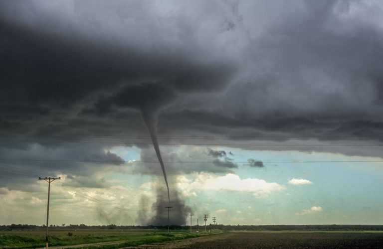
Hurricanes also produce tornadoes, mostly in the rain bands on the right side of the storm as it comes ashore. They are often brief and hidden in rain, so they can be hard to see coming.
Reading the forecast and the warnings
The outlook. The National Hurricane Center’s Tropical Weather Outlook shows areas where storms may form over the next two and seven days, with the chance of each. In season, it is the first thing to check.
The park’s own forecast. Every park and national monument guide on this site has its own current forecast, and it leads with the weather alerts in force there, from the National Weather Service in the United States or Environment and Climate Change Canada, including tropical storm and hurricane watches and warnings and flood watches. Open the guide for the park you are heading to and choose “See the current forecast”.
Advisories and the cone. Once a storm forms, the center issues advisories every six hours with a track forecast. The familiar cone on the map shows where the center of the storm is likely to go, not how far its effects reach. Rain, surge, surf and wind regularly extend far outside the cone, so being outside it does not mean you are out of the storm.
Categories. Advisories rate a storm by its strongest sustained wind, averaged over one minute. Below 39 mph (63 km/h) it is a tropical depression, and from 39 to 73 mph (63 to 118 km/h) a tropical storm, which is when it gets a name. From 74 mph (119 km/h) it is a hurricane, rated on the Saffir-Simpson Hurricane Wind Scale, which the Canadian Hurricane Centre uses as well:
- Category 1: 74 to 95 mph (119 to 153 km/h). Large branches break and shallow-rooted trees can topple.
- Category 2: 96 to 110 mph (154 to 177 km/h). Many shallow-rooted trees snap or are uprooted and block roads.
- Category 3: 111 to 129 mph (178 to 208 km/h). Many trees come down, roads are blocked, and power and water can be out for days to weeks.
- Category 4: 130 to 156 mph (209 to 251 km/h). Most trees snap or are uprooted, and the area can be cut off for weeks or months.
- Category 5: 157 mph (252 km/h) or more. Most wood-frame homes are destroyed, and fallen trees and power lines cut off whole areas for weeks or months.
Categories 3 to 5 are called major hurricanes. The category measures wind alone. It says nothing about rain, storm surge or surf, which kill far more people, so a tropical storm or a Category 1 hurricane can be the deadlier of two storms.
Watches and warnings. In the United States:
- A tropical storm watch or hurricane watch means those conditions are possible in the area named, usually about 48 hours before tropical-storm-force winds are expected.
- A tropical storm warning or hurricane warning means those conditions are expected, usually about 36 hours before tropical-storm-force winds arrive. By then, outdoor plans in the area should already be cancelled.
- A storm surge warning means a life-threatening rise of sea water moving inland is expected, generally within 36 hours.
- Flood watches and flash flood warnings from the local weather service office cover the inland rain. These matter most in the mountains, where a storm that is no longer a hurricane can still cause deadly flooding.
In Canada, the Canadian Hurricane Centre in Dartmouth, Nova Scotia, issues bulletins for storms approaching Canadian waters, and Environment and Climate Change Canada issues the watches and warnings for each region, including rainfall and wind warnings for post-tropical storms.
Evacuation orders and closures. Local governments order evacuations, and parks close campgrounds, roads and trails ahead of a storm. Follow them. They are often issued while the weather is still fine, because the time to leave a barrier island or a remote park is before the roads and ferries stop.
Planning a trip in hurricane season
Book with the season in mind. From mid-August to mid-October, choose campsites, boat trips and rentals you can cancel or change, so the decision to stay home costs little.
Know the way out. Barrier islands and coastal parks often have one road, one bridge or one ferry. Island parks such as Dry Tortugas are reached only by boat or seaplane, and those stop well before a storm arrives. If you will not be able to leave quickly, leave early.
Plan for the forecast to change on a long trip. A storm can form and reach the coast in less than a week. On a multi-day paddle or a long section of the Appalachian Trail in season, carry a way to get an updated forecast where there is no signal, such as the Garmin inReach Mini 2, and check it every day.
Leave a trip plan. After a storm, washed-out roads and bridges can cut people off for days, and the people at home need to know where to tell searchers to look. A plan left with someone at home says where you were going, with whom and when you were due out. Leave Word is our tool for that.
On the coast when a storm is offshore
The surf from a distant hurricane is a spectacle, and people go to the edge to see it. The waves arrive in sets, and every so often one is far larger than the ones before it and reaches higher up the rocks or the beach than anyone watching has seen it go.
- Watch from well back. Stay off rocks that are wet, dark or covered in weed: the sea has reached them recently. On a rocky shore such as Acadia’s, stand well above the highest wet line, and on a beach, well above the highest line of foam and debris.
- Keep your back to the land, not the sea. Turning away to take a photograph or to walk back is when people are caught. The same risk on Pacific shores is covered in photographing alone at dawn and dusk.
- Stay out of the water, however inviting the beach looks. Lifeguards may close beaches to swimming when a hurricane is offshore, even in sunshine.
- If you are caught in a rip current, do not swim against it toward shore. Swim parallel to the beach until you are out of the current, or float and wave for help, and then swim in at an angle.
- Paddlers, stay off open coastal water once the swell arrives. Waves breaking on shoals, river mouths and harbour entrances can be far bigger than the forecast height offshore. Check the marine forecast, and see canoe and kayak safety.
Inland: rain, rivers and landslides
In late September 2024, Hurricane Helene came ashore in Florida’s Big Bend and moved north into the southern Appalachians. A weather station at Busick, North Carolina, near Mount Mitchell, recorded 30.78 inches (782 mm) of rain over four days. Rivers across western North Carolina rose to record levels, and slopes gave way. According to the National Hurricane Center’s report, Helene killed at least 248 people in the United States, the most of any hurricane to strike the US mainland since Katrina in 2005; 105 of the deaths were in North Carolina, and flooding caused 77 of them. Sections of the Appalachian Trail in the Pisgah, Nantahala and Chattahoochee-Oconee national forests were closed because of fallen trees, washed-out trail and landslides, and one section was still closed a year later.
It is not only a mountain problem, and it is not new. On October 15, 1954, the remnants of Hurricane Hazel reached Toronto, about 600 miles (1,000 km) from where the storm had come ashore in the Carolinas. The Humber River rose and swept away a large part of a single street, Raymore Drive, killing more than 30 of its residents; 81 people died in the Toronto area. The land where those houses stood is now a park, and new homes were banned there.
In the mountains or along a river when a tropical storm or its remnants are forecast:
- Change the trip. A forecast of several inches of rain in steep country is the time to stay out, whatever the storm is called.
- If you are already out, head for the trailhead early, before the creeks you crossed on the way in rise. Creeks peak after the heaviest rain, when the slopes above finish draining.
- Do not camp beside a creek or river, or in a narrow valley floor. Camp on a bench well above the water, away from the foot of steep slopes. In saturated soil, whole trees can come down in wind they would normally withstand.
- Do not cross a flooded creek. Wait it out on the near side; how to cross a river or stream safely covers how to judge one, and most fall within a day once the rain stops.
- Watch for landslides: new cracks in the trail or the slope, tilting trees, sudden muddy water in a stream that was clearing, or a rumble from above. Move away across the slope, not down it.
- Never drive or walk through floodwater on a road. The weather service warns that 6 inches (15 cm) of moving water can knock an adult down and 12 inches (30 cm) can float many cars, and the road beneath may be gone.
In the desert Southwest the same rain arrives as flash floods in washes and canyons; flash floods covers what to do.
If the storm reaches you outdoors
With days of warning, being outdoors when a hurricane arrives is avoidable, and the aim of everything above is to be somewhere else. If it happens anyway:
- Get to a sturdy building if you can reach one before the wind rises. A tent, a trailer or a car offers little protection from falling trees, and a hurricane is not a passing storm: the wind and rain can last for many hours.
- Stay put once it arrives. Travelling through a hurricane on foot, by car or by boat is more dangerous than staying in the best shelter you have.
- Choose the spot for falling trees and rising water. Away from the tallest trees and any dead ones, above any ground that could flood or take storm surge, and not at the foot of a steep slope.
- Beware the eye. If the wind drops suddenly and the sky clears, the eye may be passing over. After a lull that can last from minutes to an hour or more, the wind returns from the opposite direction. Stay where you are.
- Treat a tornado warning in a rain band as you would any other, and get to the lowest, most interior shelter available. Tornado safety for campers and hikers covers what to do in a tent, a car or on the trail.
After the storm
The storm moves on in a day or two; its damage to trails, roads and slopes can last for months or years.
- Respect closures. Closed trails and roads after a hurricane are usually closed because they are dangerous, not only because they are untidy: undercut slopes, washed-out bridges, hanging limbs and trees ready to fall. Check the park’s alerts before you go back.
- Expect the route to have changed. Trails can be buried under fallen trees, bridges and footbridges gone, and creek crossings moved or deepened. Allow far more time, and carry a paper map and compass, since the trail on the ground may no longer match the one on your phone.
- Treat all water. Floodwater carries sewage, fuel and chemicals into streams and lakes. Filter and disinfect everything you drink, as described in how to purify water in the backcountry, and carry water from home where you can.
- Keep clear of downed power lines, on trailhead roads and in campgrounds, and treat every one as live.
- Watch the slopes. Ground soaked by a hurricane can keep moving for days afterwards, especially after more rain.
Common mistakes
- Going to the shore to watch the surf. A larger wave than the rest reaches higher than anyone expects, and people on wet rocks are swept in. Watch from well above the highest wet line, or from a lookout set back from the shore.
- Deciding you are safe because you are outside the cone. The cone shows where the centre of the storm may go, and rain, surf and wind reach far beyond it. Read the watches and warnings for where you are, and the local forecast discussion.
- Treating a weakened storm as finished. A tropical storm or its remnants inland can bring more rain than the hurricane did on the coast, as Helene and Hazel showed. Act on the rainfall forecast and flood watches, not on the storm’s category.
- Waiting for an evacuation order to leave an island or a remote park. Roads, bridges and ferries close, and traffic builds, once the order comes. Leave when a storm is forecast to reach the area, before it is ordered.
- Camping by the creek in a forecast of heavy rain. Creeks in steep country rise fast and peak after the rain eases, often at night. Camp on a bench well above the water.
- Going back too soon. Trails are generally reopened once crews have checked them, and a route that looks clear at the trailhead can be blocked or undercut a mile in. Check the park’s alerts, and turn back at the first sign that the trail has changed.
What to carry
- A way to get the forecast without signal on long trips in season, such as the Garmin inReach Mini 2, which can also call for help, or the ACR ResQLink beacon for calling for help alone.
- A weather radio for car camping and coastal trips, set to sound an alarm for warnings in your area.
- A phone with emergency alerts turned on, and a power bank such as the Nitecore NB10000, since the power may be out for days afterwards.
- A water purifier, such as the Grayl GeoPress, for the water after a storm. Floodwater carries sewage, and most hiking filters do not remove viruses; a purifier does.
- A paper map and compass for trails that may have changed, with the map on your phone as a backup, not the other way round.
- A first-aid kit, such as the My Medic MYFAK Large, sized for the time it may take help to arrive when roads are closed.
Key takeaways
Hurricane season runs from June through November in the Atlantic and from mid-May through November in the eastern Pacific, with the Atlantic peak from mid-August to mid-October. A hurricane gives days of warning, and the right response is usually to change the trip: check the outlook before you go, book what you can cancel, and leave a coast or an island early rather than waiting for an order.
Most people who die in hurricanes are killed by water, and much of that water is far from where the storm comes ashore. On the coast, watch the surf from well back, even in sunshine. Inland, act on the rainfall forecast and the flood watches whatever the storm is now called, stay out of steep country and away from creeks, and never cross floodwater. Afterwards, respect closures, expect the trail to have changed, and treat all water.
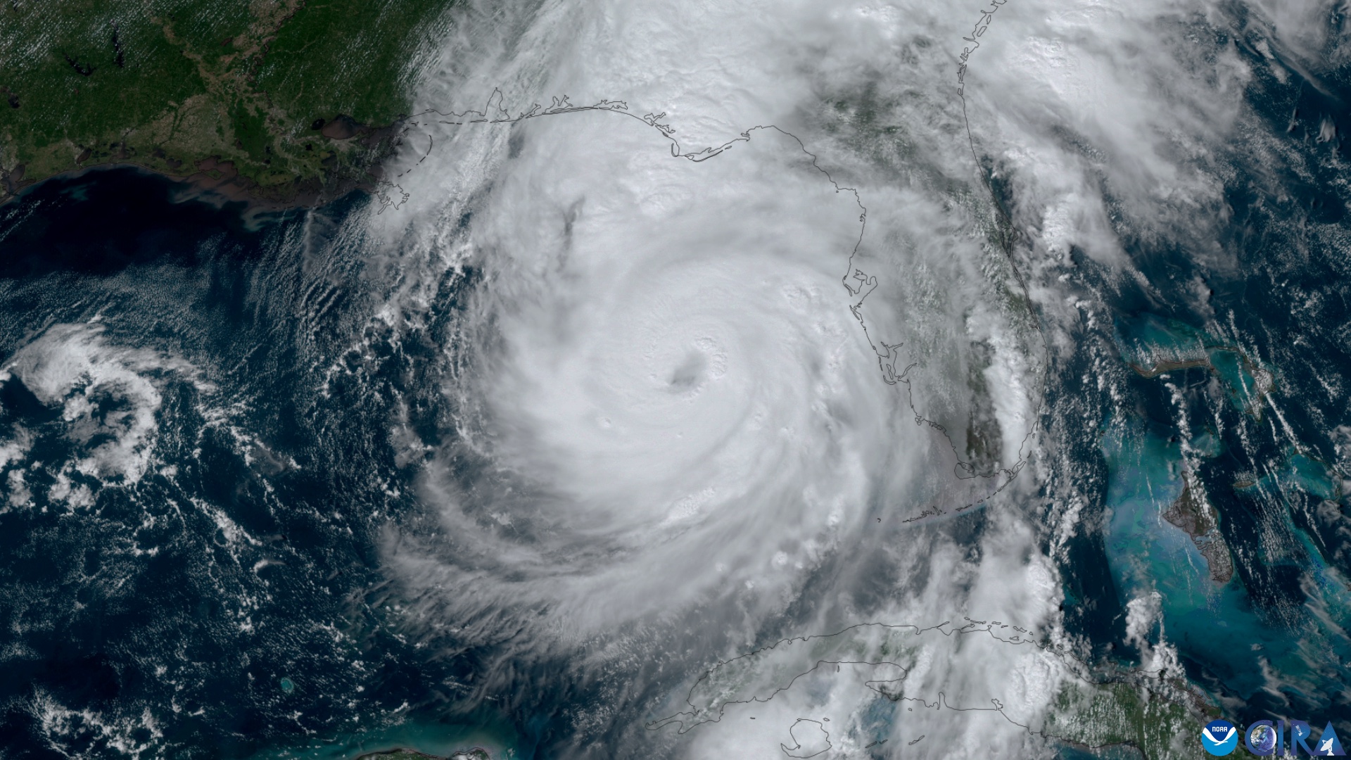
Season dates, the peak, and the definitions of watches, warnings and storm surge follow the National Hurricane Center; the causes of death follow its studies of US tropical cyclone deaths for 1963 to 2012 and 2013 to 2022. Atlantic Canada figures and the description of post-tropical storms follow the Canadian Hurricane Centre, and Fiona’s effects on the parks follow Parks Canada. The account of the August 23, 2009 Thunder Hole accident follows ABC News and National Parks Traveler reporting; Helene’s rainfall and death toll follow the National Hurricane Center’s report on the storm as reported by WBTV, and the Appalachian Trail closures follow the US Forest Service and the Appalachian Trail Conservancy; the account of Hurricane Hazel in Toronto follows The Canadian Encyclopedia and The Weather Network; Hilary’s effects on Death Valley follow the National Park Service. The rip current and floodwater advice follows the National Weather Service. Header image: Hurricane Helene on September 26, 2024, GOES imagery by CSU/CIRA and NOAA, public domain. This is general education and not a substitute for official forecasts, evacuation orders and park closures.
Wilderness Experts is reader-supported. As an Amazon Associate we earn from qualifying purchases; when you buy through links on our site we may earn a commission at no extra cost to you. It never changes what we recommend.