

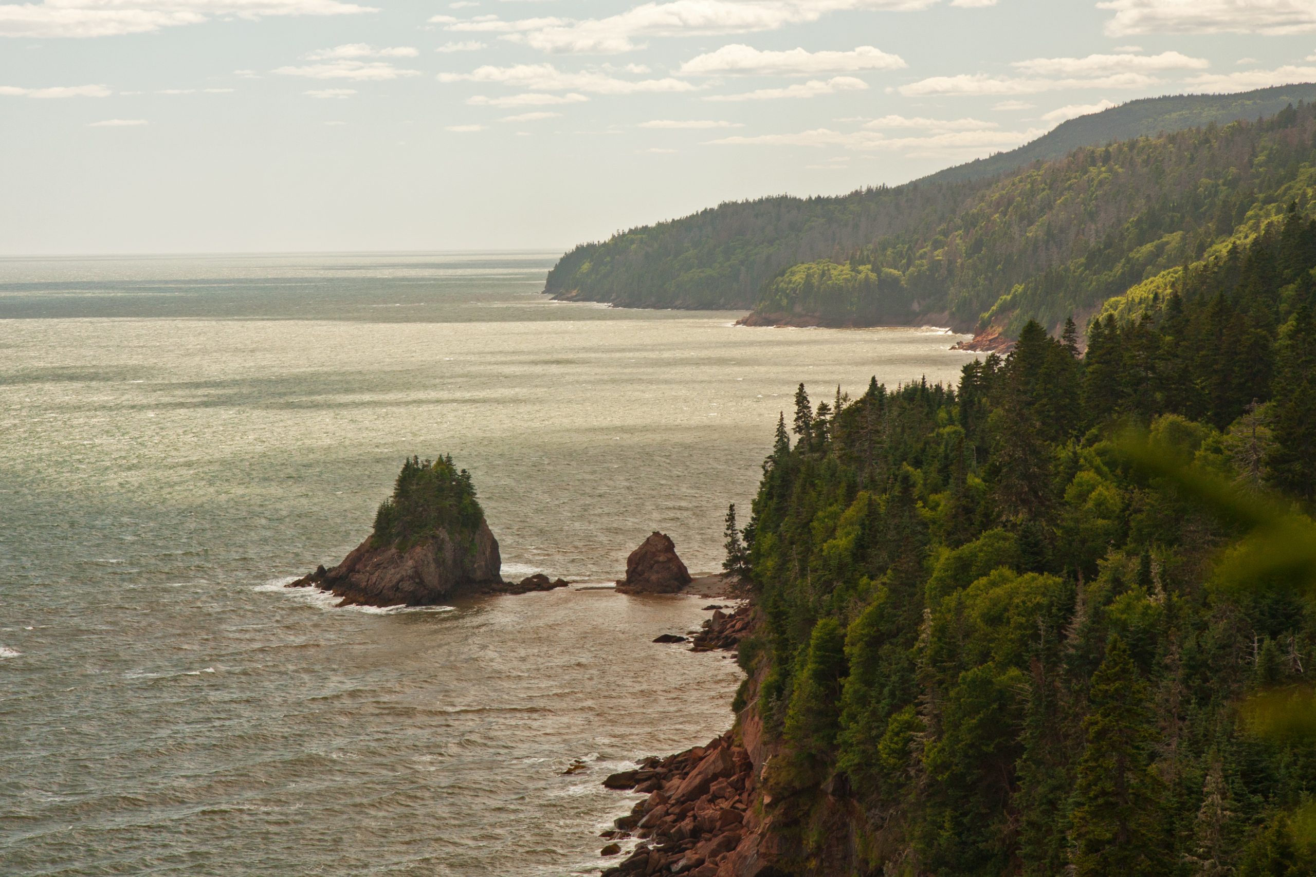
Fundy National Park
Twice a day the Bay of Fundy moves more water than every river on earth combined, and the shoreline at Fundy National Park rises and falls by up to 39 feet (12 m) with it. You can walk on the ocean floor in the morning and watch boats float over the same ground by afternoon. Inland, the Caledonia Highlands are cut by steep forested valleys holding more than twenty named waterfalls.
Fast facts
- Established: 1948
- Size: about 80 square miles (206 km²) on the New Brunswick coast
- Tidal range: up to roughly 39 feet (12 m), among the highest in the world
- Waterfalls: more than 20, including Dickson Falls and Third Vault Falls
- Gateway: Alma, New Brunswick
- Managed by: Parks Canada
The landscape
The park climbs from the shore onto a forested plateau, and the rivers running off it have cut sharp valleys on their way back down. Point Wolfe and the Upper Salmon carve through covered-bridge country into tidal estuaries. At low tide the sea withdraws far enough to expose acres of red mud and rock; at high tide the same ground is under several storeys of cold Atlantic water.
Best time to go
June through October is the main season. Early summer brings persistent sea fog along the coast, which can sit thick on the shoreline while the highlands above are clear. September and October give the best combination of settled weather, fewer crowds and hardwood colour in the valleys.
Getting there and around
Highway 114 passes through the park and links Moncton with Alma, so most visitors arrive by car and stay in or near the village. The road inside the park serves the campgrounds, the main trailheads and the viewpoints along the coast. Tide tables are posted at the visitor centre and in Alma, and you should read them before planning anything on the shoreline.
Things to do
Dickson Falls is the short, accessible classic. Third Vault Falls is the park’s tallest and takes a proper hike. Matthews Head gives cliff-top views over the bay. At low tide you can walk out onto the ocean floor near Alma and Herring Cove. Experienced sea kayakers paddle the coast, and the Fundy Footpath continues southwest along the shore as a serious multi-day route.
Staying safe
The tide is the hazard that defines this park. It comes in faster than people expect and can cut off a beach or a stretch of ocean floor while you are still on it, so always know the time of the next high tide and your escape route. The water is cold enough to sap strength quickly. Exposed rock and mud are slick. Ticks are established here and Lyme disease is a real risk, so cover up and check thoroughly afterwards. Watch for moose and deer on Highway 114 at dawn and dusk.
Know before you go
You need a park pass, and campgrounds and backcountry sites should be reserved ahead in summer. Cell coverage is unreliable across much of the park. Check the bulletins page for fire bans and trail closures, and carry a printed tide table rather than relying on a signal to look one up.
- Coordinates
- 45.6172, -65.0433
- Magnetic declination
- 16.1° W (2026)
Set this declination on your compass, then align it to the map's north lines; it is the angle between true north and magnetic north, refreshed each year.
A spread of the park’s main places shows straight away, and the rest appear as you zoom in. You can also search above, or pick any place from the lists below, and the map will go to it.
Getting there 1
Park entrance
On the trail 14
Trailhead
Campgrounds
Sights 12
Viewpoints
Waterfalls
Beach
Peaks
Map data comes from third-party sources and may be incomplete or out of date, so carry a current official map (terms).
- Best seasons
- Summer, Fall
- Difficulty
- Easy to strenuous
- Access / trailheads
- Highway 114 runs through the park, about 75 minutes from Moncton and reached from Sussex to the west. The village of Alma sits at the eastern entrance with fuel, food and tide tables.
- Water
- Treated water at campgrounds and the visitor centre. Assume all surface water needs boiling for 10 minutes or adequate filtering.
- Cell / satellite coverage
- Cell coverage is not available everywhere in the park. Pay phones are located at the visitor information centre.
- Nearest ranger / SAR / emergency
- Call 911. In remote areas be prepared to wait for help to arrive. Park information: 506-887-6000.
- Permits & regulations
- Park entry fee or a Parks Canada Discovery Pass. Backcountry and wilderness sites require a permit and reservation. Fire bans are posted seasonally.
- Leave No Trace
- Stay on marked trails, leave the shoreline as you found it, pack out all waste, and check yourself for ticks after every walk.
January
- Below freezing all day
February
- Below freezing all day
March
- Below-freezing nights
April
- Below-freezing nights
May
June
July
August
September This month
October
November
- Below-freezing nights
December
- Below-freezing nights
What to bring depends on your trip: how long you’re out, where you sleep, and how far you go from the road. The planner builds the list for yours.
Plan a trip here →Averages for 1981–2010 from Environment Canada climate normals, measured at the Alma station, 6 miles (9 km) away at 140 feet (43 m).