

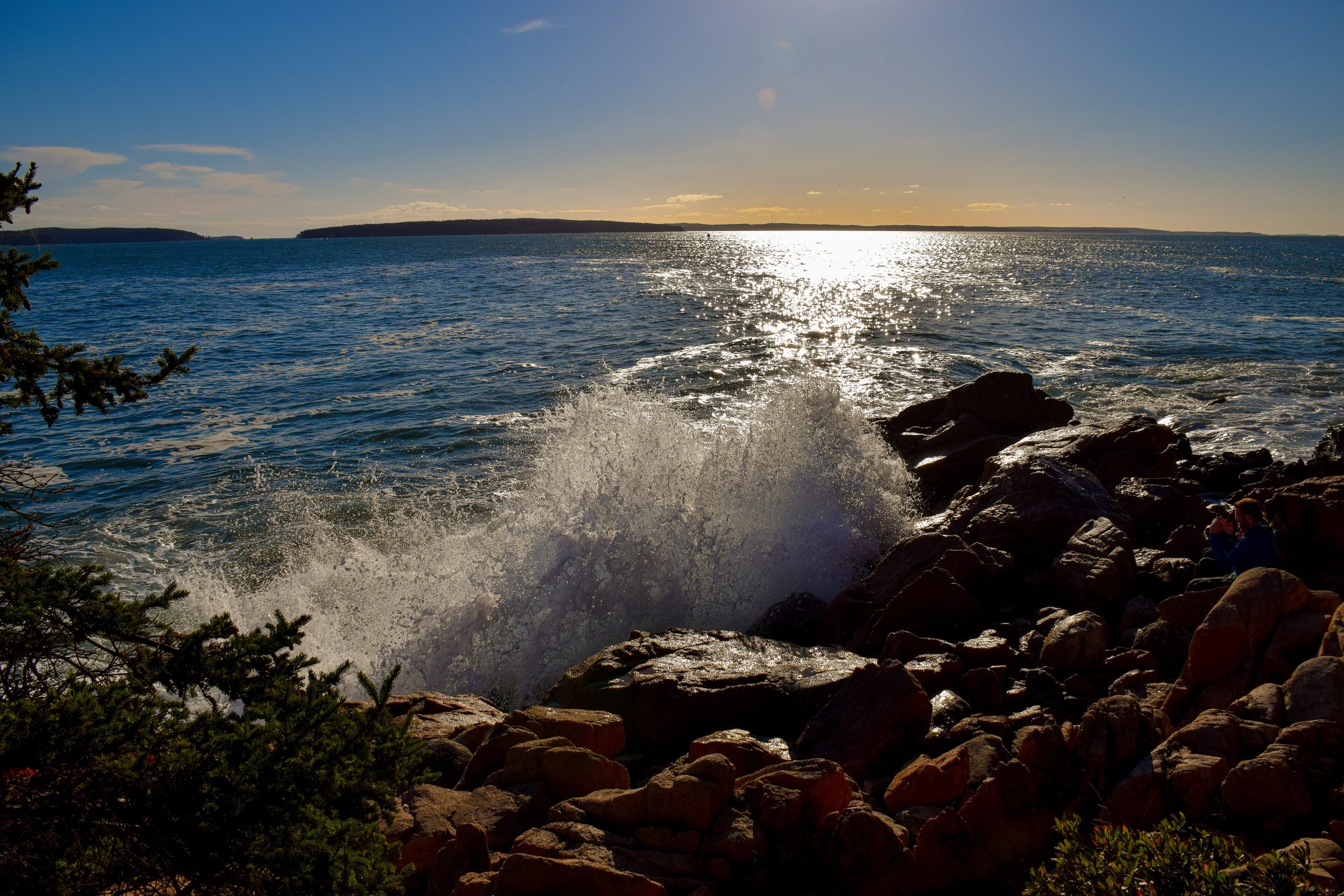
Acadia National Park
Acadia is where the mountains meet the sea on the rugged coast of Maine, a park of pink-granite peaks, surf-battered headlands, spruce forest and quiet ponds, crowned by Cadillac Mountain, the highest point on the U.S. Atlantic coast. Compact but astonishingly varied, and laced with historic carriage roads, it is New England’s beloved coastal wilderness.
Fast facts
- Established: 1916 (as Sieur de Monts; became Acadia in 1929)
- Size: about 49,000 acres (200 km²), mostly on Mount Desert Island
- High point: Cadillac Mountain, 1,530 feet (466 m)
- Carriage roads: 45 miles (72 km) of historic gravel roads for walking, cycling and horses
- Gateway: Bar Harbor, Maine
- Managed by: National Park Service
The landscape
Glaciers rounded Acadia’s granite domes and carved the only fjord on the U.S. East Coast, Somes Sound. Bare pink-granite summits rise above spruce-fir forest and glacial ponds, and the coastline alternates rocky headlands, cobble coves and the famous Thunder Hole, where surf booms into a chasm. It is rich in wildlife, peregrine falcons on the cliffs, seabirds and seals offshore, and deer and foxes in the woods.
Best time to go
Summer is peak season, with warm days, full services and long hours, and crowds. Fall is spectacular, when the hardwoods blaze and the air turns crisp, drawing foliage seekers. Spring is quieter and muddy, and winter is cold and largely unplowed, offering solitude, snowshoeing and cross-country skiing on the carriage roads for the hardy.
Getting there and around
The main part of the park is on Mount Desert Island, reached via ME-3 through Bar Harbor, with the Schoodic Peninsula and remote Isle au Haut as separate units. In season, the free Island Explorer shuttle links trailheads, beaches and town, easing the notorious parking crunch; a timed-entry reservation is required to drive up Cadillac Mountain.
Things to do
Drive or ride the Park Loop Road past Sand Beach, Thunder Hole and Jordan Pond, and hike everything from gentle pond loops to the exposed, iron-runged Precipice and Beehive trails. Cycle the carriage roads, catch sunrise from Cadillac Mountain, sea kayak the island’s coves, and finish with popovers at the historic Jordan Pond House.
Staying safe
The ocean is cold and the shoreline rocks are slick and swept by big tides and rogue waves, so keep back from the surf and mind the tide when exploring coves. The famous ladder trails involve real exposure and iron rungs on cliff faces. Know your limits and avoid them when wet. Fog rolls in fast, ticks are common, and coastal weather can change quickly, so pack layers.
Know before you go
A park pass is required, a timed-entry reservation is needed to drive Cadillac Summit Road in season, and campgrounds should be reserved well ahead for summer and fall. This page is a general overview, not a live conditions report; always confirm current conditions, reservations and closures with the National Park Service before your trip.
- Coordinates
- 44.2164, -68.3455
- Magnetic declination
- 15.1° W (2026)
Set this declination on your compass, then align it to the map's north lines; it is the angle between true north and magnetic north, refreshed each year.
A spread of the park’s main places shows straight away, and the rest appear as you zoom in. You can also search above, or pick any place from the lists below, and the map will go to it.
Getting there 8
Park entrances
Visitor centre
Ranger stations
On the trail 8
Trailheads
Campgrounds
Picnic sites
Sights 69
Viewpoints
Waterfalls
Beachs
Heritage site
Point of interests
Islands
Peaks 30
Map data comes from third-party sources and may be incomplete or out of date, so carry a current official map (terms).
- Best seasons
- Summer, Fall (foliage)
- Difficulty
- Easy to strenuous
- Access / trailheads
- Mostly on Mount Desert Island in Maine, reached via ME-3 through Bar Harbor; the Schoodic Peninsula and Isle au Haut are separate units. A seasonal Island Explorer shuttle serves the park.
- Water
- Drinking water at developed areas; carry water on trails and treat any backcountry sources.
- Cell / satellite coverage
- Decent coverage near Bar Harbor; patchier on trails and outer units.
- Nearest ranger / SAR / emergency
- Contact park rangers; marine emergencies: U.S. Coast Guard (VHF 16); life-threatening emergencies: 911.
- Permits & regulations
- Per-vehicle entry fee (America the Beautiful pass accepted); a timed-entry reservation is required to drive Cadillac Summit Road in season, and campgrounds are reservable.
- Leave No Trace
- Stay on trails to protect fragile summit plants, keep off closed areas, pack out all waste, and follow Leave No Trace.
January
- Below-freezing nights
February
- Below-freezing nights
March
- Below-freezing nights
April
May
June
July
August
September This month
October
November
December
- Below-freezing nights
What to bring depends on your trip: how long you’re out, where you sleep, and how far you go from the road. The planner builds the list for yours.
Plan a trip here →Averages for 1991–2020 from NOAA U.S. Climate Normals, measured at the Acadia National Park station, 4 miles (7 km) away at 470 feet (143 m). Conditions change with elevation: expect it colder higher up.