

Cape Breton Highlands National Park
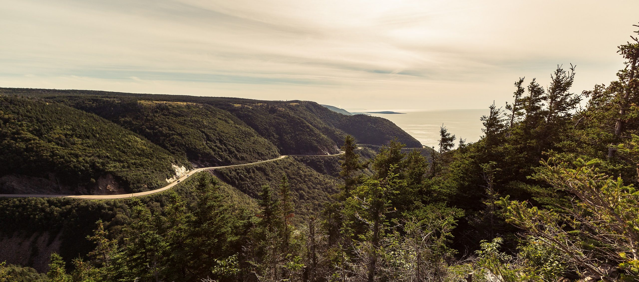
Cape Breton Highlands is where the mountains meet the sea in Atlantic Canada, a wild plateau of forested canyons and windswept barrens that plunges to the surf along the world-famous Cabot Trail. One of the most scenic drives on the continent threads its coast and highlands, linking ocean lookouts, hiking trails and the living Acadian and Gaelic culture of the surrounding communities.
Fast facts
- Established: 1936, the first national park in Atlantic Canada
- Size: about 366 square miles (949 km²) on northern Cape Breton Island
- Signature route: the Cabot Trail runs through the park
- Landscape: a highland plateau meeting the Atlantic and the Gulf of St. Lawrence
- Gateways: Chéticamp and Ingonish, Nova Scotia
- Managed by: Parks Canada
The landscape
A high, rolling plateau of boreal forest and taiga barrens forms the park’s heart, cut by deep river canyons and edged by dramatic coastal cliffs on both the Gulf and Atlantic sides. The mix of Acadian forest, highland bog and rugged shore supports moose, black bears, bald eagles and, offshore, whales, a rich blend of mountain and maritime worlds.
Best time to go
Summer is warm and full of services, ideal for hiking, the beaches and the Cabot Trail. Fall is the showstopper, when the hardwoods blaze red and gold and the driving is spectacular. Spring is quiet and muddy, and winter brings snow, solitude and closed facilities, with the highlands given over to cross-country skiing.
Getting there and around
The park occupies the northern tip of Cape Breton Island, entered near Chéticamp on the west or Ingonish on the east, both on the Cabot Trail. A vehicle is essential to drive the loop and reach the many trailheads and lookouts that line it; the towns at either gateway supply lodging and services.
Things to do
Drive the Cabot Trail for its ocean panoramas, and hike its trails, the cliff-top Skyline at sunset is the signature walk, with the Franey and Middle Head trails close behind. Swim or paddle the coast, watch for moose on the barrens and whales offshore, and soak up the Celtic and Acadian music of the gateway communities.
Staying safe
The Atlantic is cold and its currents strong, so respect the surf and cold-water risk at the beaches. Cliff-top trails have real exposure, fog can roll in fast, and moose, especially in fall rut, deserve a wide berth. Black bears are present, and ticks are common, so store food properly and check yourself after hiking.
Know before you go
A Parks Canada pass is required and camping should be reserved, especially for the fall foliage season. This page is a general overview, not a live conditions report; always confirm current conditions, reservations and closures with Parks Canada before your trip.
- Coordinates
- 46.7301, -60.6408
- Magnetic declination
- 16.8° W (2026)
Set this declination on your compass, then align it to the map's north lines; it is the angle between true north and magnetic north, refreshed each year.
A spread of the park’s main places shows straight away, and the rest appear as you zoom in. You can also search above, or pick any place from the lists below, and the map will go to it.
On the trail 11
Trailheads
Campgrounds
Hut or shelter
Picnic site
Sights 30
Viewpoints
Waterfalls
Beachs
Island
Peaks 14
Map data comes from third-party sources and may be incomplete or out of date, so carry a current official map (terms).
- Best seasons
- Summer, Fall (foliage)
- Difficulty
- Easy to strenuous
- Access / trailheads
- On northern Cape Breton Island, Nova Scotia; the famous Cabot Trail loops through the park, entered near Chéticamp (west) or Ingonish (east).
- Water
- Potable water at campgrounds; carry water and treat backcountry sources.
- Cell / satellite coverage
- Patchy cell service in the highlands. Carry a map.
- Nearest ranger / SAR / emergency
- Parks Canada dispatch: 1-877-852-3100; life-threatening emergencies: 911.
- Permits & regulations
- A Parks Canada pass is required; camping requires a reservation, and some winter facilities close seasonally.
- Leave No Trace
- Keep well back from moose, stay on trails and cliff paths, pack out all waste, and follow Leave No Trace.
January
- Below freezing all day
February
- Below freezing all day
March
- Below-freezing nights
April
- Below-freezing nights
May
June
July
August
September This month
October
November
- Below-freezing nights
December
- Below-freezing nights
What to bring depends on your trip: how long you’re out, where you sleep, and how far you go from the road. The planner builds the list for yours.
Plan a trip here →Averages for 1981–2010 from Environment Canada climate normals, measured at the Wreck Cove Brook station, 20 miles (31 km) away at 250 feet (76 m). Conditions change with elevation: expect it colder higher up.