

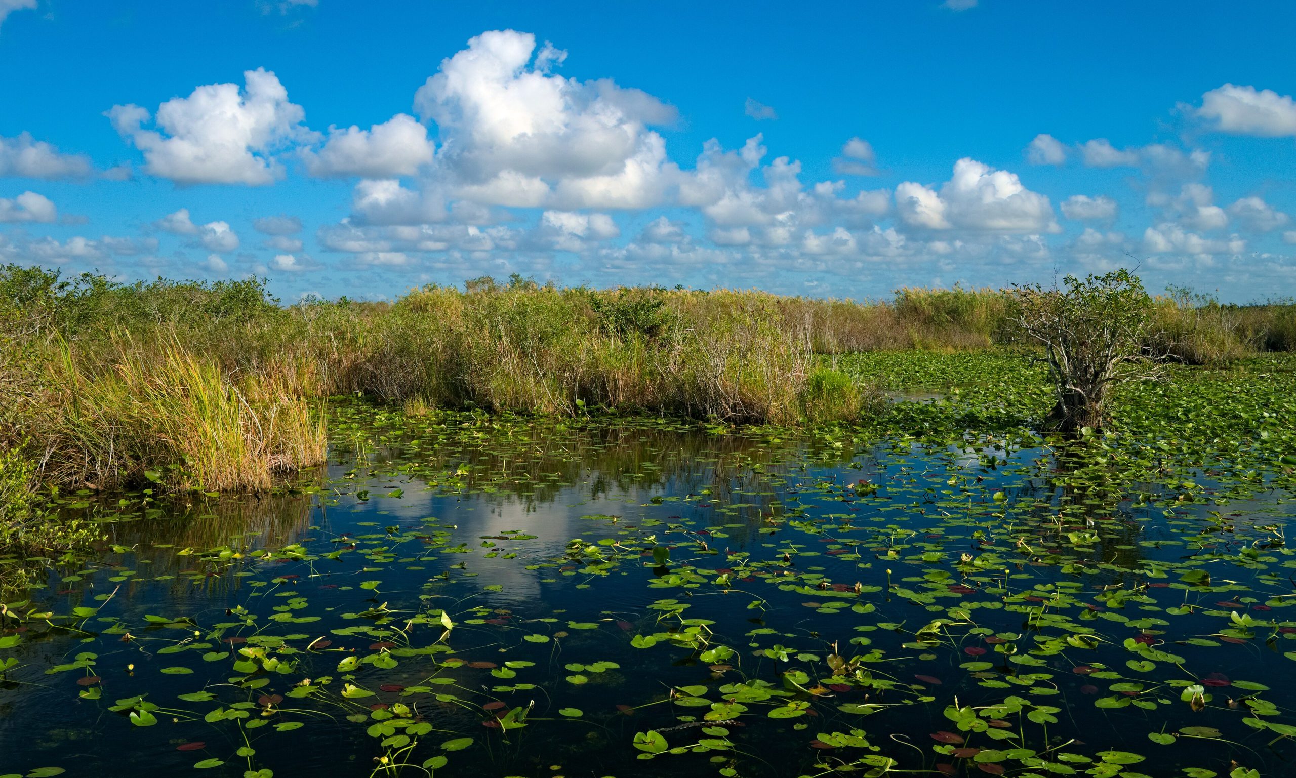
Everglades National Park
The Everglades is like nowhere else, a vast, slow-moving “River of Grass” that spreads across the southern tip of Florida in a shallow sheet, blending sawgrass marsh, mangrove coast, cypress swamp and pine rockland into a single subtropical wilderness. It is the only place on Earth where alligators and crocodiles coexist, and a haven for wading birds, manatees and the elusive Florida panther.
Fast facts
- Established: 1947
- Size: about 1.5 million acres (6,000 km²), the largest subtropical wilderness in the U.S.
- Recognition: a UNESCO World Heritage Site, Biosphere Reserve and Wetland of International Importance
- Wildlife: alligators, crocodiles, manatees, wading birds and the Florida panther
- Gateways: Homestead, Miami and Everglades City, Florida
- Managed by: National Park Service
The landscape
The Everglades is defined by water moving imperceptibly south, a broad, grassy sheet dotted with tree islands, giving way to cypress domes, mangrove estuaries along the coast, and dry pine and hardwood hammocks on slightly higher ground. This mosaic of wetland and swamp supports an extraordinary richness of birds, reptiles and fish, and shelters endangered species found nowhere else.
Best time to go
The dry season, roughly December through April, is by far the best time, pleasant temperatures, far fewer mosquitoes, and wildlife concentrated around shrinking water holes for superb viewing. The wet season (May through November) brings heat, humidity, ferocious mosquitoes, daily thunderstorms and the risk of hurricanes, making travel far more demanding.
Getting there and around
No single road crosses the Everglades, so the park has three separate access points: the main road from Homestead down to Flamingo, Shark Valley off the Tamiami Trail (US-41), and the Gulf Coast at Everglades City for the Ten Thousand Islands. Choose your area before you go, a vehicle reaches each entrance, and the wetland interior is explored by boat, canoe or on boardwalk trails.
Things to do
Walk the famous Anhinga Trail boardwalk for close alligator and bird viewing, bike or tram the Shark Valley loop to its observation tower, and paddle the mangrove creeks and the long Wilderness Waterway. Ranger programs, boat tours from the Gulf Coast, and world-class birding round out a visit to this birder’s and paddler’s paradise.
Staying safe
Give alligators and crocodiles a wide berth and never feed them, watch for venomous snakes, and remember that the flat, watery wilderness makes it easy to lose your bearings. Carry a map, charts and a compass or GPS on any backcountry route. In the wet season, mosquitoes can be overwhelming, so bring strong repellent and protective clothing, and always guard against heat, sun and sudden storms.
Know before you go
A park pass is required, and backcountry and wilderness-waterway camping need permits, which should be arranged ahead. Carry all your drinking water and plan around the dramatic seasonal difference. This page is a general overview, not a live conditions report; always confirm current conditions, mosquito and water levels, and permits with the National Park Service before your trip.
- Coordinates
- 25.3713, -80.9548
- Magnetic declination
- 6.9° W (2026)
Set this declination on your compass, then align it to the map's north lines; it is the angle between true north and magnetic north, refreshed each year.
A spread of the park’s main places shows straight away, and the rest appear as you zoom in. You can also search above, or pick any place from the lists below, and the map will go to it.
Getting there 6
Park entrances
Ranger stations
On the trail 55
Trailheads
Campgrounds
Picnic sites
Sights 49
Viewpoints
Beachs
Heritage sites
Point of interests
Islands
Peaks
Map data comes from third-party sources and may be incomplete or out of date, so carry a current official map (terms).
- Best seasons
- Winter, Early spring (dry season)
- Difficulty
- Easy to moderate
- Access / trailheads
- Three separate entrances: the main/Flamingo road from Homestead, Shark Valley off US-41 (Tamiami Trail), and Gulf Coast at Everglades City. No single road crosses the park.
- Water
- Carry all your drinking water; the surface water here is not a reliable source and much is brackish.
- Cell / satellite coverage
- Little to no cell service in the backcountry and on the water. Carry a map, charts and a satellite messenger.
- Nearest ranger / SAR / emergency
- Contact park rangers; marine emergencies: U.S. Coast Guard (VHF 16); life-threatening emergencies: 911.
- Permits & regulations
- Per-vehicle entry fee (America the Beautiful pass accepted); wilderness and backcountry camping (including the Wilderness Waterway) require a permit.
- Leave No Trace
- Stay on trails and marked routes, keep well back from wildlife, pack out all waste, and follow Leave No Trace.
January
February
March
April
May
June
- Hot days
July
- Hot days
August
- Hot days
September This month
- Hot days
October
November
December
What to bring depends on your trip: how long you’re out, where you sleep, and how far you go from the road. The planner builds the list for yours.
Plan a trip here →Averages for 1991–2020 from NOAA U.S. Climate Normals, measured at the Royal Palm Ranger Station, 21 miles (35 km) away at 7 feet (2 m).