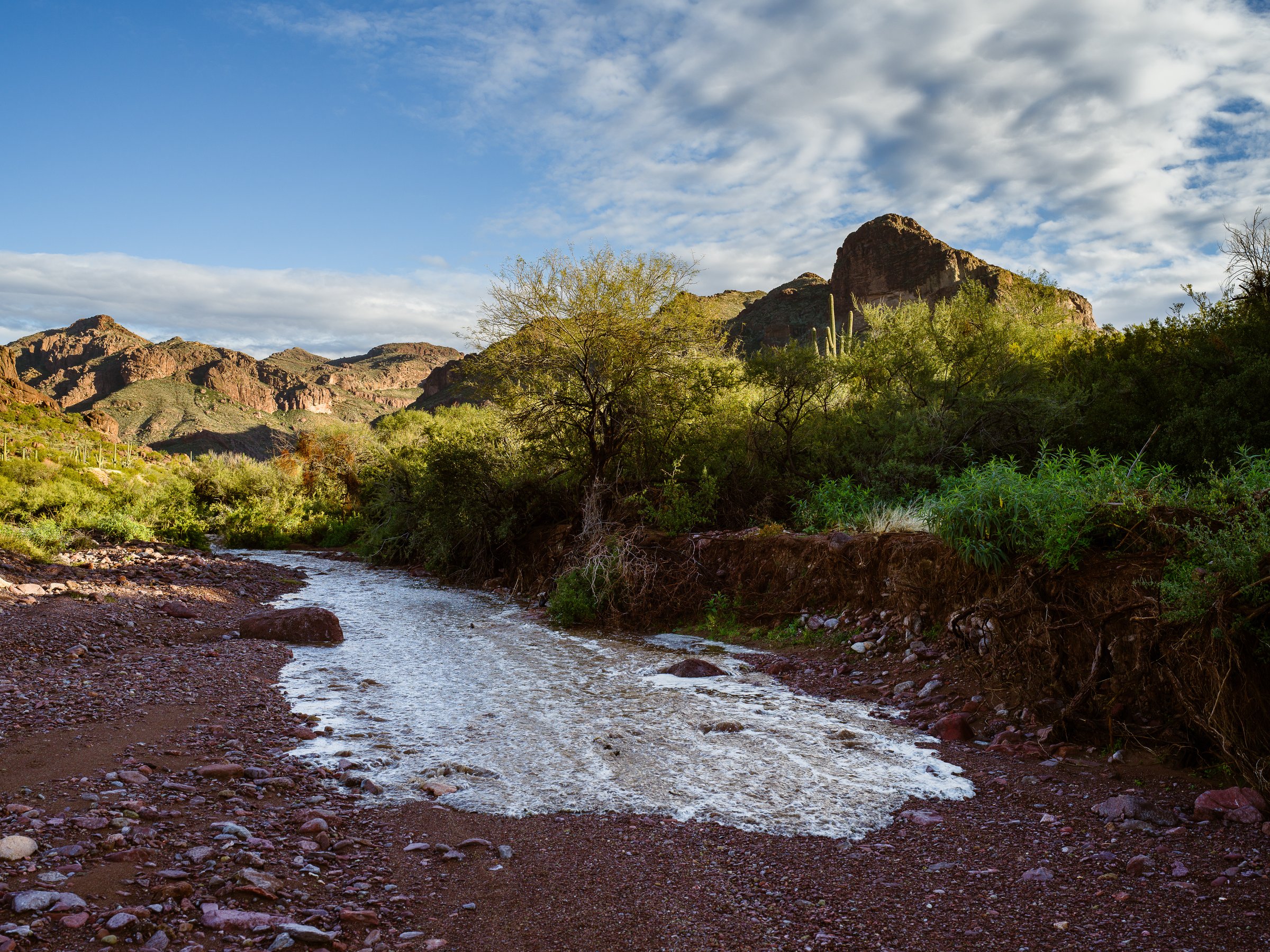
Flash floods: slot canyons, washes and the storm you cannot see
In August 1997, eleven people were touring Lower Antelope Canyon in northern Arizona under a sky that was mostly clear. A thunderstorm about 15 miles (24 km) away had dropped heavy rain on ground none of them could see, and the runoff arrived in the slot as a wall of water. Only the guide came out alive. Eighteen years later, seven canyoneers died in Keyhole Canyon in Zion in almost the same way. A flash flood is the one backcountry hazard that routinely kills people standing in sunshine, because the storm that causes it is somewhere else.
That is also what makes it manageable. A flash flood cannot reach you on high ground, it follows the same drainages every time, and the weather that feeds it is forecast days ahead in the places it matters most. This guide covers how flash floods work, where and when they happen, how to read the forecast and the canyon, where to walk and camp, what to do in the minute after you hear the roar, and the drive to the trailhead, which is where most flood deaths actually happen. General storm planning is covered in reading backcountry weather; this article covers the flood that potentially comes afterwards.
The sky above you tells you almost nothing
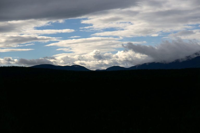
The rain that floods a slot canyon or a desert wash can fall 15 to 20 miles (24 to 32 km) upstream, out of sight behind the rim. Clear sky overhead is not evidence of safety. The forecast for the whole drainage is.
How a flash flood works
A flash flood is a rapid rise of water in a normally dry or low channel, following intense rain over a short period. What separates it from an ordinary flood is speed. A river rising over days gives you days. A flash flood gives you minutes, sometimes seconds, and it arrives from upstream as a surge rather than a gradual climb.
Three things turn a thunderstorm into a flash flood. The first is intensity: convective storms can drop more rain in an hour than the ground can absorb in a day. The second is surface. Bare rock, baked desert soil, compacted clay and ground stripped by a recent wildfire all shed water almost as fast as it lands, so nearly all of it becomes runoff. The third is shape. A drainage basin collects that runoff from many square miles and funnels it into one channel. The Virgin River that runs through the Zion Narrows drains 288 square miles (746 km²), and the park notes that a storm in that basin can raise the flow by more than a hundred times.
In a narrow canyon the water has nowhere to spread, so it rises instead. The front of a flash flood is often described as a wall, and in a slot it can be one: the National Park Service describes surges of water and debris 12 feet (3.7 m) high or more. That front carries whatever the channel held, including logs, boulders and the mud that makes the water opaque. This matters because drowning is not the only way a flash flood kills. The park service notes that death in slot-canyon floods most often comes from blunt force trauma, from rock and debris carried in the water.
The key idea to take into the field is that the flood is created where the rain falls and delivered where the canyon narrows. Those can be hours apart and in different weather.
Where they happen
Flash floods can happen almost anywhere that heavy rain meets a channel, but a few kinds of terrain account for most backcountry danger.
- Slot canyons. The Colorado Plateau of Utah, Arizona, Colorado and New Mexico holds most of the famous ones. Some are wide enough to walk two abreast and some are shoulder width, and many have long sections where the walls rise sheer on both sides with no way up. In a slot the question is not whether you could survive the water but whether you could leave the channel at all.
- Dry washes and arroyos. Across the desert Southwest, washes serve as trails, roads and campsites for most of the year. They are also the drainage system for storms you will never see. Sand floors, flat ground and shade from the banks make them inviting, and every one of those features comes from the water that periodically fills them.
- Mountain creeks below thunderstorms. A steep creek fed by a thunderstorm on the peaks above can rise several feet in minutes, in the Rockies, the Sierra, the Appalachians and the Canadian mountain parks alike. Camps pitched on gravel bars and trails that follow the creek bed are the potential danger areas.
- Hill country rivers. Fast-rising rivers in limestone and granite country, such as the Texas Hill Country, flood from rain that runs off thin soil. The Guadalupe River flood of July 2025 rose through riverside camps in the dark, and it is a reminder that a flash flood does not need a canyon.
- Burn scars. For several years after a wildfire, burned slopes shed rain like pavement and send debris flows of mud, ash and rock down drainages that previously handled the same storm without trouble. Treat any drainage below a recent burn as higher risk than its history suggests.
- Badlands, coulees and prairie draws. Clay soils in places like the Dakota badlands and southern Alberta and Saskatchewan barely absorb rain at all. Draws that are dust in the morning can run with water an hour after a storm.
When they happen
In the American Southwest, the peak season is the summer monsoon. The weather service defines it as mid-June through September, and most of the storms come between early July and mid-September. Moist air from the south fuels afternoon thunderstorms over the plateaus and mountains almost every day in an active pattern, and they tend to build from late morning and peak in the afternoon and evening. Storms can form, rain out and dissipate before you have seen them, and the flood they produce can arrive hours later.
Outside the monsoon, the risks shift rather than disappear. Spring snowmelt can combine with rain to raise mountain creeks. Late-season tropical moisture can bring heavy, widespread rain to the Southwest in September and October. East of the Rockies, flash floods follow slow-moving thunderstorms through the warm months, and they are often at their worst at night, when new cells keep forming and passing over the same ground one after another (forecasters call it training) and people are asleep beside the water.
The practical takeaway is to plan canyon and wash travel for the early part of the day in monsoon season, to be out of any narrow section by early afternoon, and to treat a forecast of thunderstorms anywhere in the drainage as a reason to choose a different route rather than a reason to hurry.
Reading the forecast before you go
Check the forecast for the whole drainage you are entering, not just the trailhead. That means looking at the weather for the high ground upstream, which may sit in a different forecast zone, a different town’s listing, or on a different side of a mountain range.
In the United States, the National Weather Service issues three levels of flash flood, and they mean different things.
- Flash Flood Watch. Conditions are favourable for flash flooding. It is neither certain nor imminent, and watches are often issued hours to days ahead. For a slot canyon or a wash trip, a watch is a no-go. The whole point of a watch is that nobody can tell you where the storm will form.
- Flash Flood Warning. Flash flooding is occurring, imminent or highly likely in the warned area. If you are in the backcountry and learn of a warning that covers your drainage, go to high ground now.
- Flash Flood Emergency. A rare escalation for a severe threat to life and catastrophic flooding that is under way or about to be.
Several parks publish their own daily rating. Zion, for example, rates flash flood potential as Not Expected, Possible, Probable or Expected, and closes some canyons when the rating is high enough. Read “Not Expected” for what it says: the park adds that safety remains your responsibility, because a single storm cell can still build over the drainage.
In Canada, Environment and Climate Change Canada issues severe thunderstorm warnings for short, intense storms that can cause flash flooding, and rainfall warnings for longer events. Flood warnings and advisories for rivers come from the provincial forecast centres rather than the federal service. For a creek trip in the mountain parks, the thunderstorm forecast is the one to watch.
Wherever you are, ask at the ranger station or visitor centre on the morning you go. They see the forecast in the context of that week’s rain, soil and recent flooding, and they will know which canyons are closed.
Warning signs in the canyon
Once you are in a canyon, your senses are the forecast. The park service lists the signs to watch for, and each of them means the same thing: move to high ground now, and investigate later.
- Any deterioration in the weather, including clouds building over the high ground upstream or thunder you can hear, but lightning you may not see.
- A change in water clarity from clear to muddy, even if the level has not changed yet.
- Floating debris: twigs, leaves, foam or pine needles arriving on water that was clean.
- Rising water or a stronger current, however slight.
- A growing roar from upstream, which is often compared to a train or a jet and can be the last warning you get.
Do not wait for two signs. Muddy water on its own is enough, because the dirt had to come from somewhere, and the only place it can come from is rain on the ground upstream. A sudden gust of wind down the canyon, or a drop in temperature, can also be the air being pushed ahead of the water.
Choosing where to walk and where to camp
The best time to plan your escape is before you need it, while you are walking in. Canyons are not uniformly dangerous. They have sections where you can climb out easily and sections where you cannot, and your job is to know which is which and how long you will spend in the second kind.
Read the high-water marks. Look for driftwood jammed in cracks or wedged in trees, a line of debris or mud staining on the walls, and polished rock high above the floor. These show where the water has been. Your escape needs to be above them, not merely above today’s creek.
Learn the escape points as you pass them. Note side benches, ramps, talus slopes and ledges you could scramble onto in a minute. If a section of canyon runs for a long stretch between them, that stretch is where you should not linger, and where you should be on the least uncertain day of the trip.
Know how long you will be committed. A narrow section that takes twenty minutes to pass is a different decision from one that takes five hours. The longer the commitment, the better the forecast has to be.
Never camp in a wash or on a low bench. Camp well above the high-water marks, on ground that the drainage would have to rise far beyond its record to reach. A flat sand floor, a shaded bench beside a creek and a gravel bar are all made by floods. Our guide to choosing and setting up a safe backcountry campsite covers the rest of site selection, but this rule overrides any convenience: in flash flood country, you camp where the water cannot go, even if it means a longer walk to it.
Park out of the channel too. Trailhead parking in a wash, or on a dirt road that crosses one, can be cut off or carried away while you are gone.
If the water starts to rise
When any of the warning signs appears, the sequence is short, and every step is about time.
- Climb immediately. Head for the nearest point that gets you above the high-water marks, even if it is only a ledge. Do not stop to pack up camp, gather gear or take a photograph. The park service is blunt about this: do not waste time picking up gear.
- Go up, not along. Running downstream is a race against water that moves faster than you can, over ground that gets worse as it gets wet. Moving upstream toward the flood is worse still. Only move along the canyon if there is no way up where you are and you know a way up is close.
- Keep climbing until you are well clear. A flood front is often followed by a larger surge, and the first rise is rarely the peak. Get higher than you think you need to.
- Do not try to cross. The National Weather Service figure is that 6 inches (15 cm) of fast-moving water can knock an adult off their feet, and floodwater is opaque, full of debris and moving over a bed you cannot see. Crossing a normal-flow river is its own skill, covered in how to cross a river or stream safely; crossing a flash flood is not a skill, it is a gamble.
- Wait it out. Flash floods rise quickly and usually fall within hours. You may spend a cold, uncomfortable afternoon or night on a ledge. That is the successful outcome.
If you are swept off your feet despite all of this, the self-rescue techniques in caught in whitewater: how to survive being swept downstream apply, above all getting your feet downstream and working toward the edge rather than standing up in the current. But in a slot full of debris, the odds are poor, which is why every piece of advice above is about never being in the water at all.
The drive in and out
Most people who die in floods in the United States are not hiking. They are driving. The National Weather Service, citing CDC data, reports that more than half of all flood drownings happen when a vehicle is driven into floodwater, and walking into or near floodwater is the second largest cause.
The numbers are unforgiving: 12 inches (30 cm) of rushing water can carry away most cars, and 2 feet (60 cm) can carry away SUVs and trucks. High clearance and four-wheel drive do not change this, because what floats a vehicle is buoyancy, not traction.
Desert trailheads are often reached by dirt roads that dip through washes, and those dips flood from storms you cannot see, exactly like the canyons. A road that was dry on the drive in can be running on the drive out. The rule the weather service gives drivers is the right one for trail users too: turn around, don’t drown. If water is flowing across the road, wait. Road crossings of washes usually drain within hours, and a night in a car on the right side of a wash is better than any outcome of driving into it.
After the flood passes
When the water drops, the canyon will be a different place. Expect new pools, deep mud, freshly moved boulders and logjams that may block the way you came. Floods often come in pulses, so give the channel time before you trust it again, and watch the weather upstream as closely as you did before.
Mud and fresh sediment can behave like quicksand. If you have to cross it, the techniques in how to escape quicksand, bogs and mud apply. Floodwater and the pools it leaves behind are heavily contaminated with sediment and runoff, so filter and treat any water you collect, following how to purify water in the backcountry, and let silt settle first to spare the filter.
If you are cut off, stay put. A group on high ground with a way to call for help is in a far better position than a group trying to force a route through a flooded canyon. The signalling methods in how to signal for rescue in the backcountry work from a ledge as well as from anywhere else.
Common mistakes
- Judging the risk by the sky overhead. Hikers look up, see blue, and enter a slot while a storm is building over the watershed out of sight, which is how the 1997 Antelope Canyon victims were caught. Read the forecast for the whole drainage and for the high ground upstream, and skip narrow canyons on any day with thunderstorms forecast in the area.
- Treating a Flash Flood Watch as a maybe. A watch means nobody can say where the storm will form, so parties go in hoping it forms somewhere else. On a watch day, choose a route on open ridges or benches and save the canyon for a clear forecast.
- Camping on the sand floor of a wash. The flattest, softest, shadiest ground in the desert is flat because floods made it, and a storm miles away can fill it at night. Pitch camp above the highest driftwood and debris lines, even if it means a longer walk to water.
- Going back for gear. A pack or a tent feels too valuable to leave, and the minutes spent collecting it are the minutes that close the escape. Leave everything, climb, and deal with the loss later from a ledge. Your camp shouldn’t be in a hazard area in the first place, so this shouldn’t be a consideration if you’ve chosen well.
- Racing the water down the canyon. Running for the exit seems faster than climbing, but a flood front outpaces a person over broken ground. Climb out at the first escape point instead, and note those points on the way in so you know where they are.
- Driving through a flooded road crossing. A few inches of water look manageable, and a foot is enough to float most cars. Stop at the edge, turn around or wait for it to drain, and plan the trip with an extra night of food in the car in monsoon season.
- Going back in too soon. The water drops, the canyon looks passable, and a second pulse arrives from another part of the watershed. Wait until the water is clear again and the upstream weather has settled before re-entering a narrow section.
What to carry
The most important flash flood tool is information, and most of it is gathered before you leave. In the canyon itself, a few items change your options.
- A way to get a forecast and call for help. Slot canyons have no cell service. A two-way satellite messenger such as the Garmin inReach Mini 2 or the SPOT X can pull a weather update and send a message from a ledge, and an ACR ResQLink PLB can summon rescue if someone is hurt.
- A headlamp. A wait on high ground can run into the night, and a narrow canyon gets dark early. The Black Diamond Spot 400 is our pick for most trips.
- An extra warm layer. Desert nights are cold, and you may be wet. Our guide to what to wear in the bush covers building a layer system that handles both.
- A map with the escape points marked. Mark the side exits, benches and ramps before you go, both on paper or on your phone as described in your phone as a backcountry GPS.
- A way to treat water. Floodwater is heavily contaminated, and a long wait can make it the only source you have.
Key takeaways
A flash flood is created where the rain falls and delivered where the channel narrows, often far from the storm and under a clear sky. That makes the forecast for the whole drainage, not the weather overhead, the thing that decides whether you go in. In the US, treat a Flash Flood Watch as a reason to pick a different route, and a warning as a reason to get to high ground at once; in Canada, watch the severe thunderstorm forecast for the terrain upstream. Ask at the ranger station the morning you go.
In the canyon, watch for muddy water, floating debris, a rising level and a roar from upstream, and act on the first sign rather than waiting for a second. Learn the escape points as you walk in, know how long you will be committed between them, and camp well above the high-water marks. If the water rises, drop everything and climb, go up rather than along, keep climbing past where you think you need to be, and wait until the water drops and clears. On the drive, never enter water flowing across the road: most flood deaths happen in vehicles, and the wash crossing will drain if you give it time.
Flood behaviour, warning signs and the Zion flash flood potential ratings follow National Park Service guidance for Zion National Park. The depths that knock a person down and carry away vehicles, the share of flood deaths in vehicles, and the definitions of Flash Flood Watch, Warning and Emergency follow the National Weather Service. Canadian alerting follows Environment and Climate Change Canada. Accounts of the 1997 Antelope Canyon and 2015 Keyhole Canyon floods follow contemporary news reporting. This is general education and not a substitute for local forecasts and ranger advice.
Wilderness Experts is reader-supported. As an Amazon Associate we earn from qualifying purchases; when you buy through links on our site we may earn a commission at no extra cost to you. It never changes what we recommend.