

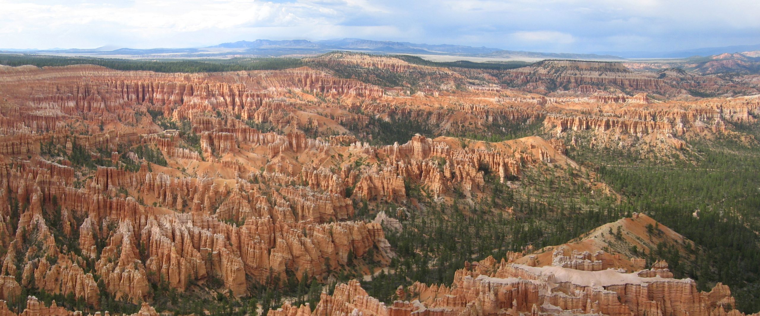
Bryce Canyon National Park
Bryce Canyon isn’t really a canyon at all but a series of natural amphitheaters filled with hoodoos, thousands of slender, glowing orange-and-white rock spires that stand like a stone forest. Perched high on the edge of the Paunsaugunt Plateau in southern Utah, it pairs this otherworldly rockscape with cool pine forest and some of the darkest, most star-filled skies in the country.
Fast facts
- Established: national monument 1923; national park in 1928
- Size: about 35,800 acres (145 km²) on the Paunsaugunt Plateau
- Signature feature: the world’s largest concentration of hoodoos
- Elevation: roughly 8,000 to 9,100 feet (2,400 to 2,800 m) along the rim
- Dark sky: a certified International Dark Sky Park
- Managed by: National Park Service
The landscape
Frost and rain have carved the plateau’s soft limestone into ranks of hoodoos, fins and windows that fill the amphitheaters below the rim and blaze at sunrise. Because it sits high, the park is cloaked in ponderosa, fir and bristlecone pine, cool and often snowy in a region of desert, a striking contrast that makes Bryce feel like a world apart.
Best time to go
Late spring through fall is the main season for hiking below the rim, with summer pleasantly cool at this altitude but bringing afternoon thunderstorms. Fall is crisp and clear. Winter is cold and snowy, and the sight of red hoodoos capped with snow is unforgettable, though trails turn icy.
Getting there and around
The park is reached via Highway 63 off scenic Highway 12 in southern Utah, and a scenic road runs along the rim to a string of overlooks. A seasonal shuttle helps with the limited parking at the busy amphitheater viewpoints; a vehicle is otherwise needed to reach the more distant southern overlooks.
Things to do
Walk the rim between Sunrise and Sunset points, then drop among the hoodoos on the Navajo Loop and Queen’s Garden trails, the classic combination, or take the longer Peekaboo and Fairyland loops. Drive to the higher southern viewpoints, watch sunrise light the spires, and stay for ranger-led astronomy under the exceptional dark sky.
Staying safe
The elevation surprises people. Pace yourself, hydrate, and remember every trail below the rim means a steep climb back up in thin air. Watch for afternoon lightning on the exposed rim, carry sun protection, and expect snow and ice on the trails from fall into spring, when traction devices help.
Know before you go
A park pass is required, backcountry camping needs a permit, and the campgrounds and shuttle fill in summer, so plan ahead. This page is a general overview, not a live conditions report; always confirm current conditions and closures with the National Park Service before your trip.
- Coordinates
- 37.5707, -112.1786
- Magnetic declination
- 10.3° E (2026)
Set this declination on your compass, then align it to the map's north lines; it is the angle between true north and magnetic north, refreshed each year.
A spread of the park’s main places shows straight away, and the rest appear as you zoom in. You can also search above, or pick any place from the lists below, and the map will go to it.
Getting there 1
Park entrance
On the trail 38
Trailheads
Campgrounds
Picnic sites
Sights 35
Viewpoints
Waterfall
Point of interests
Peaks 14
Map data comes from third-party sources and may be incomplete or out of date, so carry a current official map (terms).
- Best seasons
- Late spring, Summer, Fall
- Difficulty
- Easy to strenuous
- Access / trailheads
- In southern Utah via Highway 63 off Highway 12; the scenic road runs to a series of amphitheater viewpoints. Nearest hub is Bryce Canyon City.
- Water
- Water at the visitor center and developed areas; carry water on trails.
- Cell / satellite coverage
- Limited cell service. Download maps and share your plans.
- Nearest ranger / SAR / emergency
- Contact park rangers; life-threatening emergencies: 911.
- Permits & regulations
- Per-vehicle entry fee (America the Beautiful pass accepted); backcountry camping requires a permit. A seasonal shuttle helps with limited parking.
- Leave No Trace
- Stay on trails among the hoodoos, pack out all waste, and follow Leave No Trace.
January
- Below-freezing nights
February
- Below-freezing nights
March
- Below-freezing nights
April
- Below-freezing nights
May
June
- Day-to-night swing of 30°F (17°C)
July
August
September This month
October
- Below-freezing nights
November
- Below-freezing nights
December
- Below-freezing nights
What to bring depends on your trip: how long you’re out, where you sleep, and how far you go from the road. The planner builds the list for yours.
Plan a trip here →Averages for 1991–2020 from NOAA U.S. Climate Normals, measured at the Bryce Canyon National Park HQ station, 5 miles (8 km) away at 7,890 feet (2,405 m). Conditions change with elevation: expect it colder higher up.