

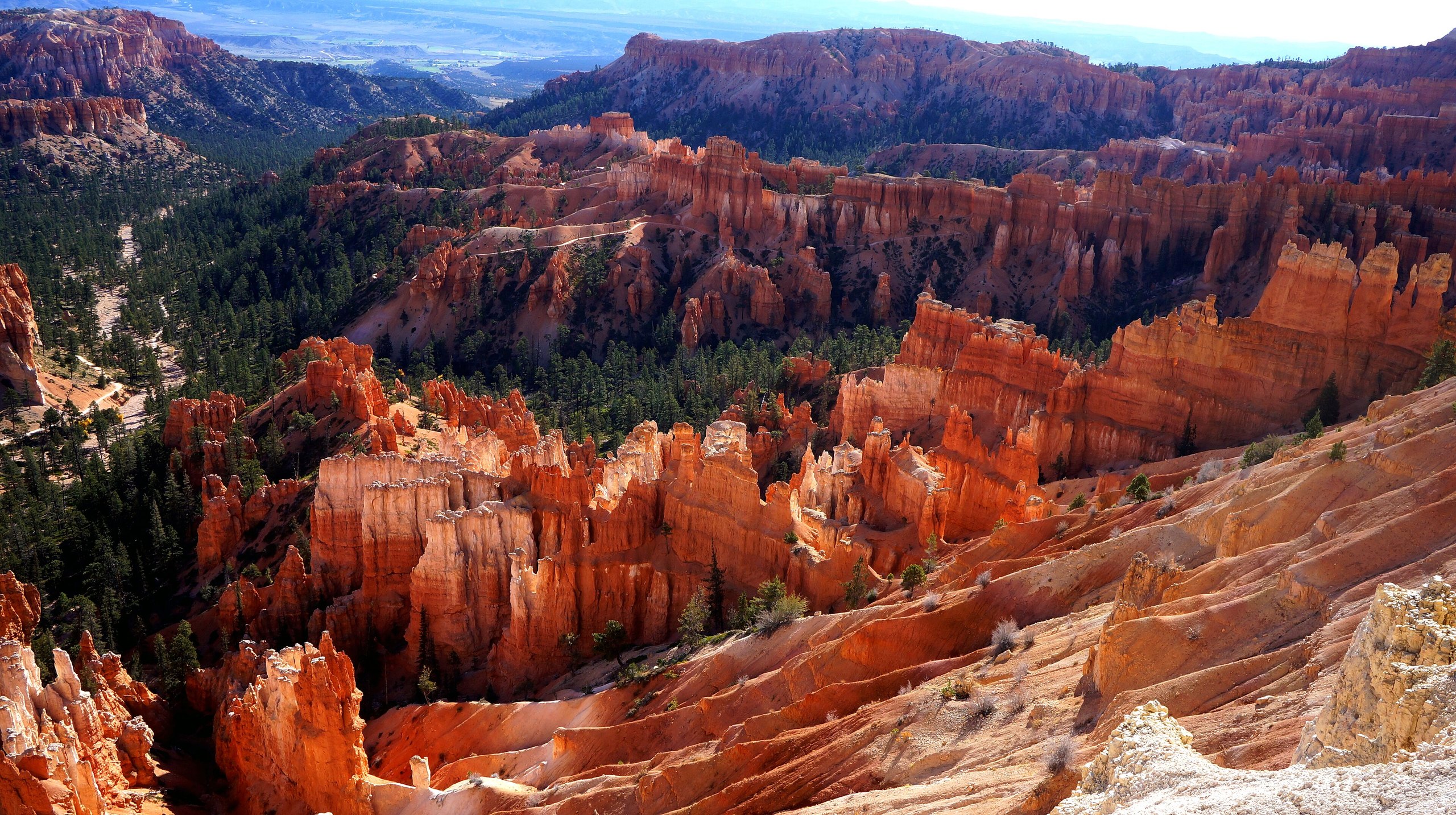
Top 9 things to do in Bryce Canyon National Park
Bryce Canyon is not a canyon. It is the eroded edge of a high plateau in southern Utah, cut into bowls full of rock spires called hoodoos, and the largest bowl, the Bryce Amphitheater, holds most of what people come to see within a couple of miles of the entrance. The park is small enough to do well in a day or two. These are the nine outings we would put first. The order starts with what the park is known for, then goes by what an outing gives back for the time and effort it takes. Distances and heights are National Park Service figures; times are our estimates and do not include stops.
The rim is at 8,000 to 9,100 feet (2,440 to 2,780 m). The air is thin, the sun is strong, and every trail into the amphitheater goes down first and climbs on the way back, so the hard part comes last. Thunderstorms are common on summer afternoons, and the rim is the wrong place to be when lightning is near.
1. Watch sunrise over the Bryce Amphitheater
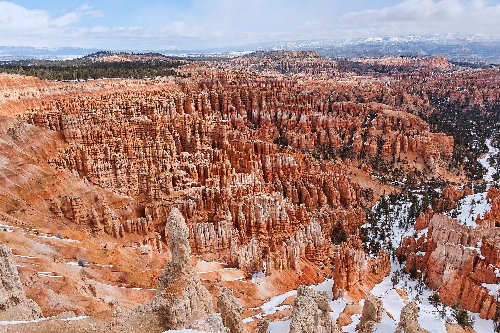
The amphitheater faces east, so the first light of the day comes straight in and the hoodoos turn from grey to orange to pale gold in a few minutes. It is the one thing nearly every visitor does. Sunrise Point and Sunset Point are the closest viewpoints to the lodge and campgrounds. Bryce Point, the highest of the four, looks down the whole length of the bowl and is the usual choice of photographers. Inspiration Point stands above the Silent City, the densest cluster of spires in the park.
It is cold at dawn at this height in any month, often below freezing from October to May. Bring a warm layer and gloves.
- Distance: a short paved walk from each parking area
- Allow: 1 hour, arriving 30 minutes before sunrise
- Start: Sunrise, Sunset, Inspiration or Bryce Point, all within 4 miles (6.4 km) of the entrance
- When: all year
- Suits: everyone. The viewpoints at Sunrise and Sunset points take wheelchairs.
2. Hike Queen’s Garden and the Navajo Loop
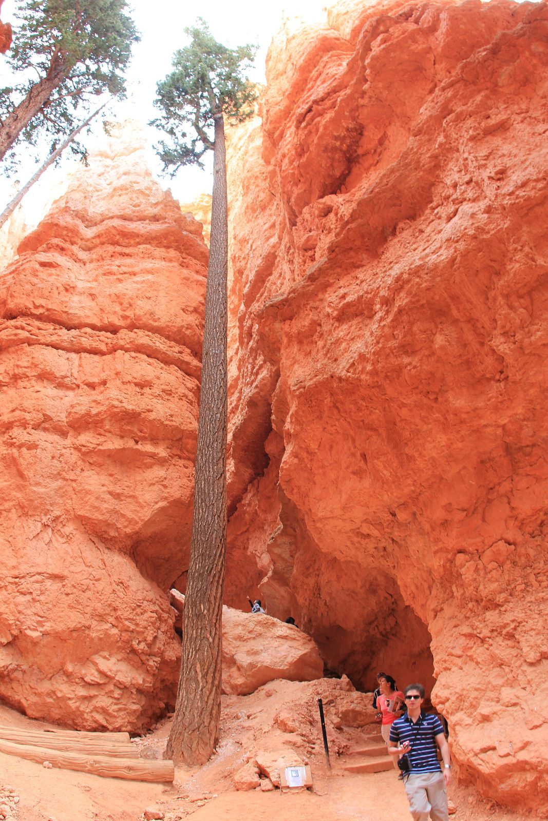
From the rim the hoodoos are a view. This hike puts you among them, and it is the one to do if you do only one. Go down from Sunrise Point on the Queen’s Garden Trail, the gentlest way into the amphitheater, past a spire said to look like Queen Victoria, then cross the floor through pines and climb out on the Navajo Loop to Sunset Point. One branch of the Navajo Loop climbs through Wall Street, a slot between walls about 100 feet (30 m) high with tall Douglas firs growing in it; the other passes Thor’s Hammer. A level half-mile (0.8 km) along the rim brings you back to the start.
Wall Street is closed in winter because of falling rock and ice, and the other branch stays open. Wear shoes with tread: the trail surface is loose grit over hard clay.
- Distance: a loop of 2.9 miles (4.6 km)
- Climb: about 600 feet (183 m)
- Allow: 2 to 3 hours
- Start: Sunrise Point
- When: April to October on dry trail; in winter with traction devices
- Suits: most walkers, including children, who take the climb out slowly
3. Walk the Rim Trail
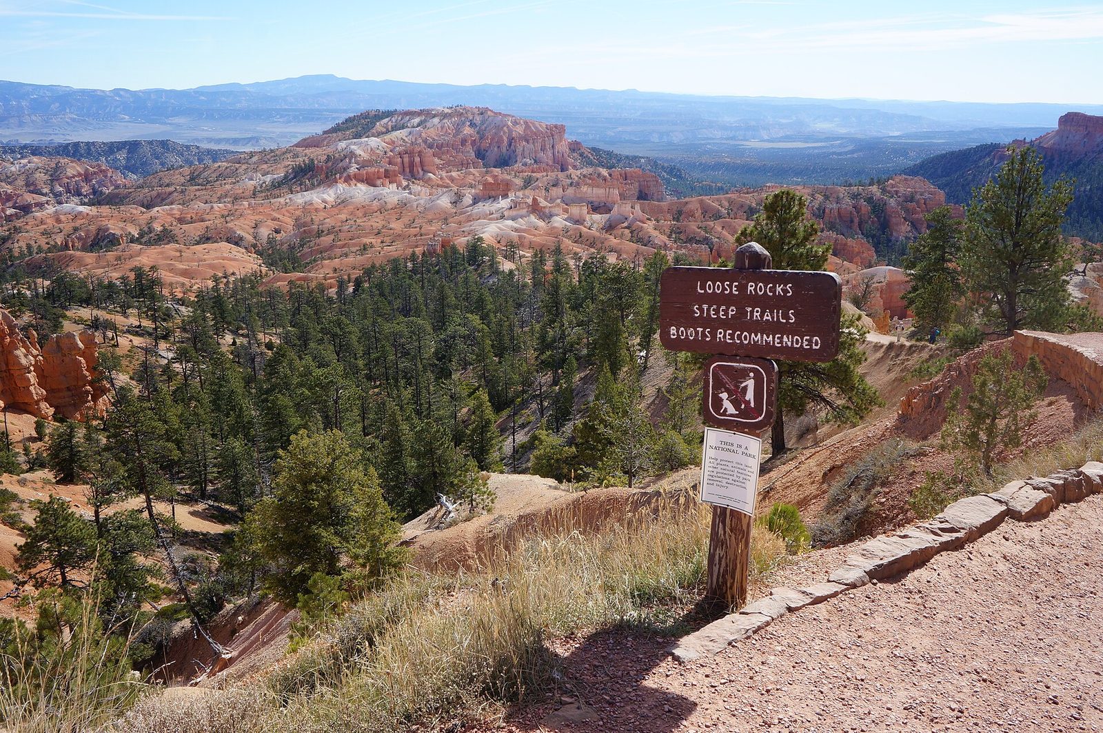
The Rim Trail follows the edge of the amphitheater for its whole length, and the half-mile between Sunrise and Sunset points is paved and level, with benches. That stretch is the easiest good walk in the park and suits wheelchairs and strollers. Carry on south and the path turns to dirt and climbs to the three levels of Inspiration Point and then to Bryce Point, with the view changing at every bend. The park shuttle stops at each viewpoint, so you can walk one way and ride back.
- Distance: 0.5 miles (0.8 km) one way between Sunrise and Sunset points; 5.5 miles (8.9 km) one way from Fairyland Point to Bryce Point
- Allow: 30 minutes to half a day
- Start: any of the amphitheater viewpoints
- When: all year; the shuttle runs from about April to October
- Suits: everyone on the paved section
4. Drive the scenic road to Rainbow Point
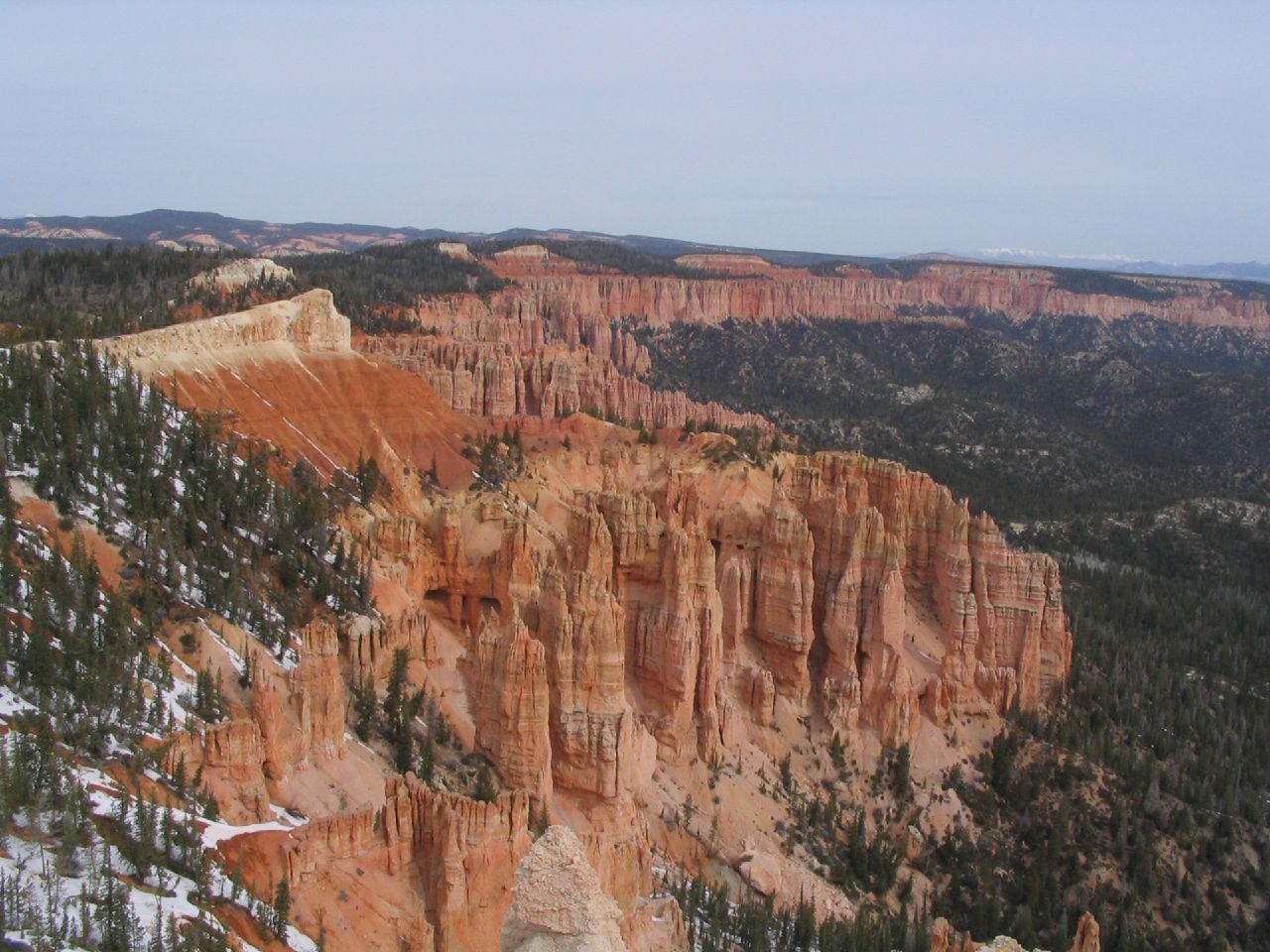
Most visitors never leave the amphitheater. The park road runs on for 18 miles (29 km) along the plateau, climbing through fir and spruce to Rainbow Point at 9,115 feet (2,778 m), where the view takes in the whole staircase of cliffs falling away to the south. Drive to the end first and stop on the way back, when all the pullouts are on your side of the road. Natural Bridge, an 85-foot (26 m) arch of red rock, is the best of them. At Rainbow Point the short Bristlecone Loop passes pines well over a thousand years old.
- Distance: 18 miles (29 km) each way; the Bristlecone Loop is 1 mile (1.6 km)
- Allow: 3 hours with stops
- Start: the park entrance on Highway 63
- When: all year, though the road closes for a day or two after heavy snow
- Suits: everyone
5. Hike the Fairyland Loop
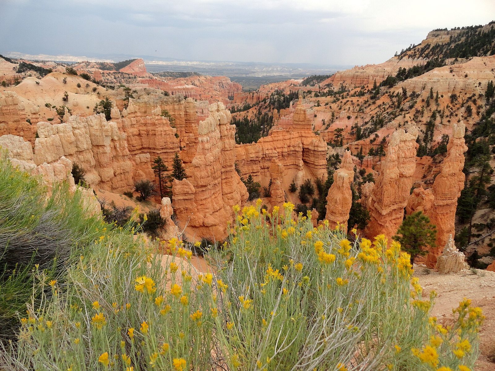
Fairyland Canyon is the next bowl north of the main amphitheater, and far fewer people go there. The loop drops from Fairyland Point through hoodoos as fine as any in the park, passes a side trail to Tower Bridge, a double arch between two spires, and climbs out near Sunrise Point. The last leg follows the rim back. It is a long, dry trail with several climbs and almost no shade, so carry at least 3 quarts (3 litres) of water each in summer and start early.
- Distance: a loop of 8 miles (13 km)
- Climb: about 1,600 feet (490 m)
- Allow: 4 to 5 hours
- Start: Fairyland Point, on a spur road just inside the park boundary, before the entrance station
- When: May to October
- Suits: fit walkers who want the hoodoos without the crowd
6. Walk the Peekaboo Loop
The Peekaboo Loop circles through the heart of the amphitheater below Bryce Point, among the tallest and most crowded hoodoos, with windows in the rock walls and a view known as the Wall of Windows. It is steeper than the Queen’s Garden and Navajo trails and climbs and drops the whole way round. It is also the horse trail: guided rides on horses and mules use it from spring to fall, and walkers step aside for them. Riding it is a good way into the canyon for anyone who cannot manage the climb on foot.
- Distance: a loop of 5.5 miles (8.9 km) from Bryce Point
- Climb: about 1,560 feet (475 m)
- Allow: 3 to 4 hours
- Start: Bryce Point
- When: May to October
- Suits: fit walkers; riders of any experience on a guided trip
7. Stay up for the stars
Bryce Canyon is high, dry and a long way from any city, and its night sky is among the darkest in the lower 48 states. On a moonless night the Milky Way stretches from one horizon to the other and thousands of stars are visible to the naked eye. Rangers run astronomy programs with telescopes through the summer and an astronomy festival each June, and on nights around the full moon they lead hikes among the hoodoos, with places given out by lottery the same day.
- Allow: an evening
- Start: any rim viewpoint; ask at the visitor center about that week’s programs
- When: all year; around the new moon for stars, the full moon for a ranger hike
- Suits: everyone. Nights are cold even in July.
8. Walk to Mossy Cave
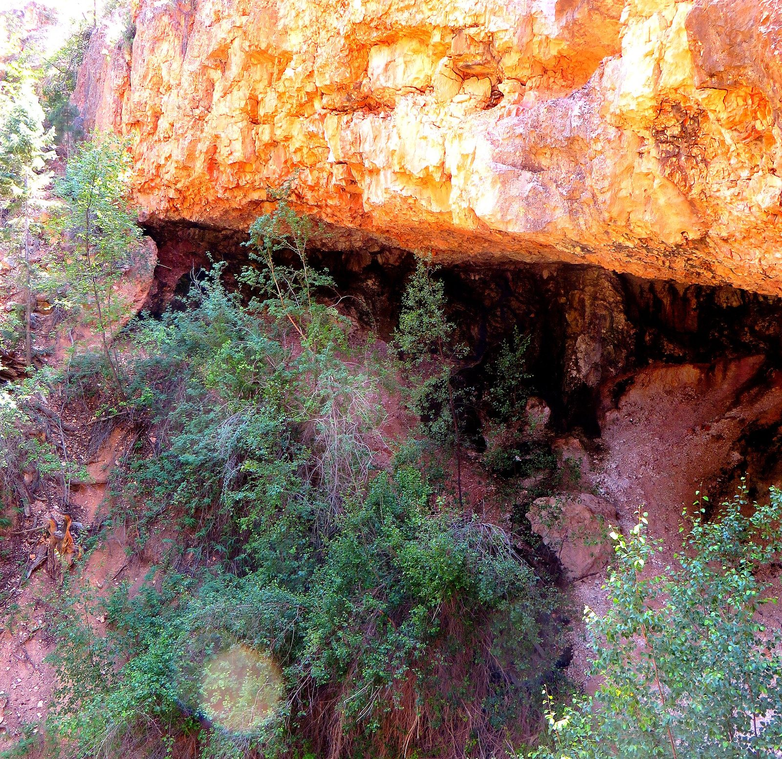
This short walk is outside the main part of the park, on Highway 12, and it is the one place where you walk up into the hoodoos instead of down. The trail follows a stream to a fork. One way leads to a small waterfall, the other to a shaded alcove where moss grows in summer and ice hangs in winter. The stream is in fact a canal, the Tropic Ditch, dug by Mormon settlers between 1890 and 1892 to carry water to their fields. Parking is very limited, and the trail is crowded at midday.
- Distance: 0.8 miles (1.3 km) round trip
- Allow: 45 minutes
- Start: Mossy Cave Trailhead, on Highway 12 about 4 miles (6.4 km) east of the Highway 63 junction
- When: all year; the waterfall runs from about May to October
- Suits: families
9. Come for snow on the hoodoos
The plateau gets real winter: snow lies on the rim from about December to March, and the red spires carry it against a blue sky. The park stays open, with the road ploughed to the main viewpoints. On snowshoes or cross-country skis you can follow the Rim Trail or the unploughed roads to Fairyland and Paria points, and rangers lead snowshoe walks when there is enough snow. Trails below the rim are icy and need traction devices.
- Allow: a day
- Start: the visitor center, for conditions and the ranger programs
- When: December to March
- Suits: anyone dressed for temperatures well below 32°F (0°C)
Before you go
This list covers what stays the same from year to year. Shuttle dates, trail closures, program schedules and road conditions change, and the National Park Service posts them on its own site. The link is on our Bryce Canyon National Park guide, with the map, passes and how to get there.