

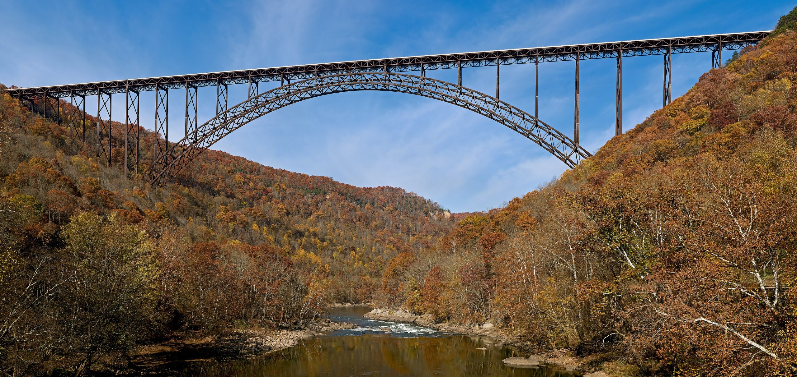
New River Gorge National Park
The New River Gorge is a rugged canyon of ancient river and Appalachian forest in southern West Virginia, and, paradoxically, one of the oldest rivers on the continent. Famous for world-class whitewater, sandstone cliffs beloved by climbers, and the soaring arch of the New River Gorge Bridge, it became a national park in 2020, protecting a deep, wild gorge threaded with history.
Fast facts
- Established: national river 1978; national park and preserve in 2020
- Size: about 7,000 acres (28 km²) of park (within a larger protected corridor)
- The bridge: the New River Gorge Bridge, one of the longest steel-arch spans in the hemisphere
- Whitewater: some of the best rafting in the eastern U.S.
- Gateway: Fayetteville, West Virginia
- Managed by: National Park Service
The landscape
The New River has cut a gorge up to 1,000 feet (300 m) deep through the Appalachian Plateau, its whitewater tumbling past sandstone cliffs and dense hardwood forest. The rim and slopes are laced with climbing crags, trails and the remnants of old coal towns and railroads, while the bridge leaps the canyon in a single dramatic span high above the river.
Best time to go
Spring through fall is the active season, with rafting running high in spring and settling through summer, and fall painting the gorge in color, the busiest and most beautiful time, capped by the famous Bridge Day. Winter is quiet and cold, with bare trees opening long views and climbers and hikers having the trails to themselves.
Getting there and around
The park lies in southern West Virginia off US-19 and I-64 near Fayetteville, with the Canyon Rim visitor center by the bridge as the main hub. A vehicle is the practical way to reach the scattered overlooks, trailheads, climbing areas and river put-ins along both rims of the gorge.
Things to do
Raft the New River’s rapids with an outfitter, climb the sandstone crags that draw climbers from around the world, and hike or bike trails to overlooks like Long Point and Endless Wall. Take in the bridge from the Canyon Rim boardwalk, explore historic mining towns, and fish or paddle the quieter stretches.
Staying safe
The whitewater is powerful and the water cold, so raft with a reputable outfitter and respect the river. Climbing and cliff-edge trails carry real fall risk, rock gets slick when wet, and the terrain is steep and rugged. Know your limits, watch for ticks and snakes, and carry water and a map.
Know before you go
There is no entrance fee; rafting is booked through outfitters, and camping is largely first-come. This page is a general overview, not a live conditions report; always confirm current conditions, river levels and closures with the National Park Service before your trip.
- Coordinates
- 37.9369, -81.0169
- Magnetic declination
- 8.3° W (2026)
Set this declination on your compass, then align it to the map's north lines; it is the angle between true north and magnetic north, refreshed each year.
A spread of the park’s main places shows straight away, and the rest appear as you zoom in. You can also search above, or pick any place from the lists below, and the map will go to it.
Getting there 2
Visitor centre
Ranger station
On the trail 12
Trailheads
Hut or shelter
Sights 9
Viewpoints
Waterfalls
Heritage site
Peak
Map data comes from third-party sources and may be incomplete or out of date, so carry a current official map (terms).
- Best seasons
- Spring, Summer, Fall
- Difficulty
- Easy to strenuous
- Access / trailheads
- In southern West Virginia off US-19 and I-64, near Fayetteville; the Canyon Rim visitor center and the New River Gorge Bridge are the main landmarks.
- Water
- Potable water at visitor centers; carry water on trails and treat river water.
- Cell / satellite coverage
- Patchy cell service in the gorge. Carry a map.
- Nearest ranger / SAR / emergency
- Contact park rangers; life-threatening emergencies: 911.
- Permits & regulations
- No entrance fee; commercial rafting is run by outfitters, and backcountry camping is first-come with some designated sites. Climbing is self-managed.
- Leave No Trace
- Stay on trails and established climbing areas, pack out all waste, and follow Leave No Trace.
January
- Below-freezing nights
February
- Below-freezing nights
March
- Below-freezing nights
April
May
June
July
August
September This month
October
November
December
- Below-freezing nights
What to bring depends on your trip: how long you’re out, where you sleep, and how far you go from the road. The planner builds the list for yours.
Plan a trip here →Averages for 1991–2020 from NOAA U.S. Climate Normals, measured at the Oak Hill station, 6 miles (9 km) away at 2,040 feet (622 m). Conditions change with elevation: expect it colder higher up.