

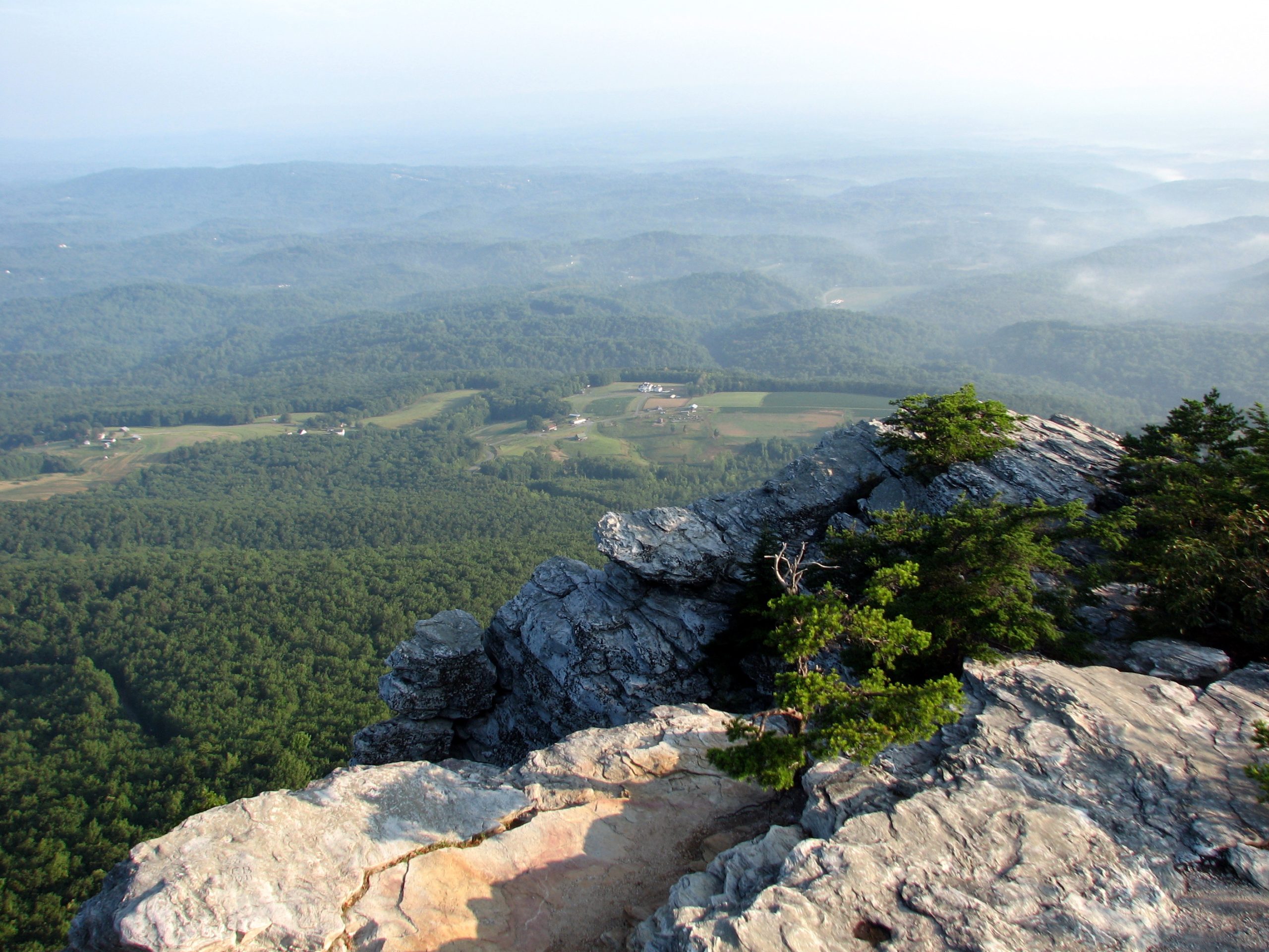
Hanging Rock State Park
Fast facts
- Size: about 9,000 acres (36 km²)
- High point: Moore’s Knob, with an observation tower at 2,497 feet (761 m)
- Trails: 48 miles (77 km) of hiking trail, 15 miles (24 km) of bike trail and 6 miles (10 km) of bridle trail
- Camping: 73 tent and trailer sites without hookups, group sites and 10 cabins; no backcountry camping
- Established: 1936
- Gateway: Danbury and Winston-Salem
- Managed by: North Carolina State Parks
The landscape
The Sauratown Mountains are called the mountains away from the mountains: a short, isolated range that rises as much as 1,700 feet (520 m) above the rolling Piedmont, well east of the Blue Ridge. Their tops are capped with hard white quartzite, which has outlasted the softer rock around it and now stands as cliffs, knobs and ledges. Hanging Rock itself is a prow of that quartzite jutting out over the forest, and Moore’s Wall, Cook’s Wall and Wolf Rock are others.
Streams fall off the high ground in a series of waterfalls, the Upper and Lower Cascades, Window Falls, Hidden Falls and Tory’s Falls. The forest is oak and hickory with pine on the dry ridges and hemlock, rhododendron and mountain laurel in the ravines, plants more typical of mountains far to the west. The Civilian Conservation Corps built the lake, the stone bathhouse and many of the trails between 1935 and 1942.
Best time to go
Spring and fall are best. Rhododendron and mountain laurel flower in May and June, and fall colour peaks from mid-October to early November, when the main parking lots fill on weekends. Summer is warm and humid, with swimming and boat rentals at the lake from late May to early September and thunderstorms on many afternoons. Winter is quiet and gives the longest views through bare trees, but ice forms on the rock and the stone steps. The park is open all year, and gate hours change with the season.
Getting there and around
From Winston-Salem, drive north through Danbury and follow the signs to the main gate on Hanging Rock Park Road. The Visitor Center parking lot at the top of the road is the start for Hanging Rock, the Upper Cascades, Window Falls and the Indian Creek Trail. The lake parking lot, a little farther on, serves Moore’s Wall and the campground. Lower Cascades, Tory’s Den, the climbing area, the mountain bike trails and the Dan River access are each reached by car from separate parking areas outside the main gate.
Things to do
The Hanging Rock Trail is the classic: a steady climb on pavement, gravel and then wood and stone steps to the top of the rock, which takes most people about an hour, with views over the park to the Blue Ridge. The Moore’s Wall Loop is a strenuous 4.7 miles (7.6 km) to the observation tower on the park’s highest point, with a 360-degree view, returning down 684 stone steps. Cook’s Wall and Wolf Rock are quieter clifftop walks from the same network.
The waterfalls are short walks. The Upper Cascades are 0.2 miles (0.3 km) from the Visitor Center on an easy trail, Hidden Falls and Window Falls are 0.4 and 0.6 miles (0.6 and 1 km) down the Indian Creek Trail, and the Lower Cascades, a 35-foot (11 m) fall into a large pool, are 0.4 miles (0.6 km) from their own parking lot down steep stairs. The Indian Creek Trail continues 3.6 miles (5.8 km) to the Dan River, which paddlers run from the park’s access. There is also rock climbing on Cook’s Wall and Moore’s Wall, 15 miles (24 km) of mountain bike trail, and the Mountains-to-Sea State Trail crosses the park in 7.4 miles (11.9 km).
Staying safe
The summits end in sheer drops with no railings. The park’s rule is to stay a body length back from any cliff edge and not to step onto the rocks at the lip, which can be loose. Keep children and dogs close. Quartzite is slick when wet and icy in winter. Around the waterfalls, stay on the trail and the viewing decks: wet rock above and beside the falls is where people slip.
Copperheads and timber rattlesnakes both live in the park, so watch where you put your hands and feet on rocky ground and leave any snake alone. The summits are exposed; get off them if a thunderstorm is building. The Indian Creek and Moore’s Wall trails cross creeks without bridges, which can be impassable after heavy rain. Check for ticks after hiking.
Know before you go
Pets are welcome on a leash of 6 feet (1.8 m) or less but not on the swim beach or in buildings and cabins. Dogs are not allowed on the Sauratown Trail beyond the park boundary. The campground has no water or electric hookups. This page is a general overview, not a live conditions report, so check gate hours, trail closures and the swim season with North Carolina State Parks before you go.
- Coordinates
- 36.3992, -80.2882
- Magnetic declination
- 8.5° W (2026)
Set this declination on your compass, then align it to the map's north lines; it is the angle between true north and magnetic north, refreshed each year.
How declination works, and how to navigate with a map and compass
A spread of the park’s main places shows straight away, and the rest appear as you zoom in. You can also search above, or pick any place from the lists below, and the map will go to it. Places in bold, marked , have a short description.
Getting there 1
Park entrance
On the trail 5
Routes
Campgrounds
Sights 18
Viewpoints
Waterfalls
Lake
Heritage sites
Point of interest
Peaks
Map data comes from third-party sources and may be incomplete or out of date, so carry a current official map (terms).
Looking for one of these closer to home?Destinations near me by trip type →
- Best seasons
- Spring (rhododendron and laurel), Fall (colour), Summer, Winter
- Difficulty
- Easy to strenuous
- Access / trailheads
- About 30 miles (48 km) north of Winston-Salem and 2 miles (3 km) from Danbury. The main entrance on Hanging Rock Park Road leads to the Visitor Center, lake and campground. Lower Cascades, Tory's Den, the Dan River access and the bike trails have their own parking areas on nearby roads.
- Water
- Drinking water at the Visitor Center, campground and lake bathhouse. None on the trails; treat any creek water.
- Cell / satellite coverage
- Fair on the summits and near the Visitor Center, weak in the hollows and along the Dan River.
- Nearest ranger / SAR / emergency
- Emergencies: 911. Park office: 336-593-8480.
- Permits & regulations
- No fee for day use. Fees apply for camping, cabins, swim passes and boat rentals. Rock climbers must register. Campsites and cabins are reserved through North Carolina State Parks.
- Leave No Trace
- Stay on the trails, keep pets on a leash of 6 feet (1.8 m) or less, leave plants and wildlife alone, and pack out all trash.
January
- Below-freezing nights
February
- Below-freezing nights
March
April
May
June
July
August
September
October This month
November
December
- Below-freezing nights
What to bring depends on your trip: how long you’re out, where you sleep, and how far you go from the road. The planner builds the list for yours.
Plan a trip here →Averages for 1991–2020 from NOAA U.S. Climate Normals, measured at the Danbury station, 6 miles (10 km)10 km (6 miles) away at 1,019 feet (311 m)311 m (1,019 feet). Higher trails run colder, by about 3.5°F for every 1,000 ft (2°C per 300 m)2°C for every 300 m (3.5°F per 1,000 ft) of climb. Daylight runs from sunrise to sunset on the 15th, on the park’s own clock, for a level horizon. Valleys and slopes facing away from the sun are in shade earlier.
Nearby parks
-
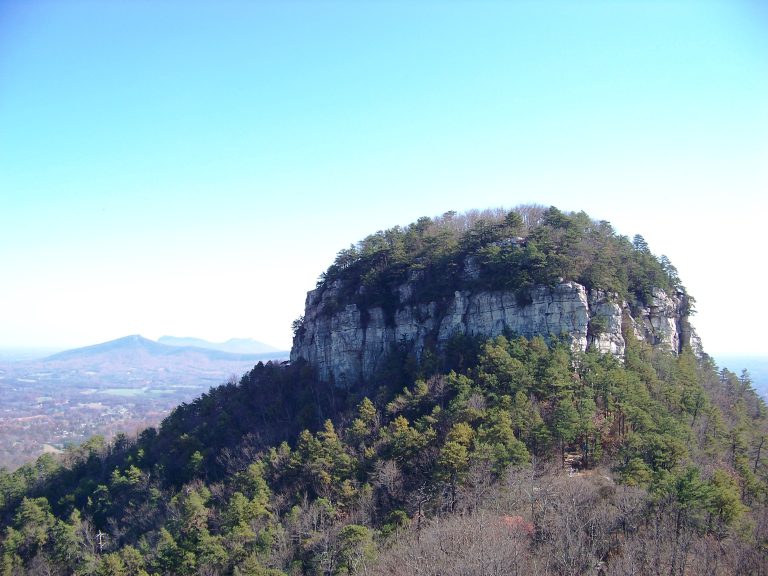 Pilot Mountain State Park
A quartzite knob visible for miles across the North Carolina Piedmont, with summit overlooks, cliff-foot trails and a quiet stretch of the Yadkin River.
-
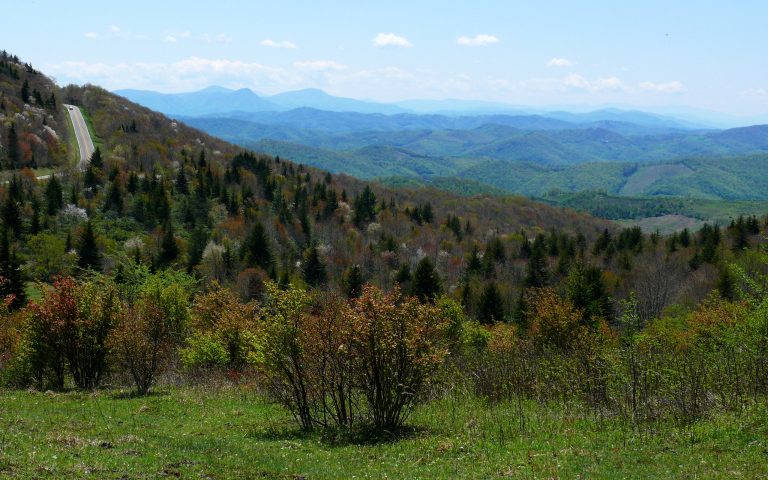 Grayson Highlands State Park
Wild ponies on open balds above 5,000 feet (1,520 m), next to Mount Rogers, Virginia's highest peak, on the AT.
-
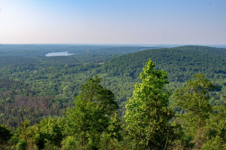 Morrow Mountain State Park
Worn-down summits of the ancient Uwharrie Mountains above Lake Tillery, with a drive-up overlook, quiet forest trails and backpack campsites.
-
 South Mountains State Park
A backcountry park in the foothills east of Asheville, with an 80-foot (24 m) waterfall and 50 miles (80 km) of trail.
Straight-line distance between park centres. Road distance is usually longer.
Looking for somewhere closer to home?
See every park and monument within a day’s drive of where you are.