

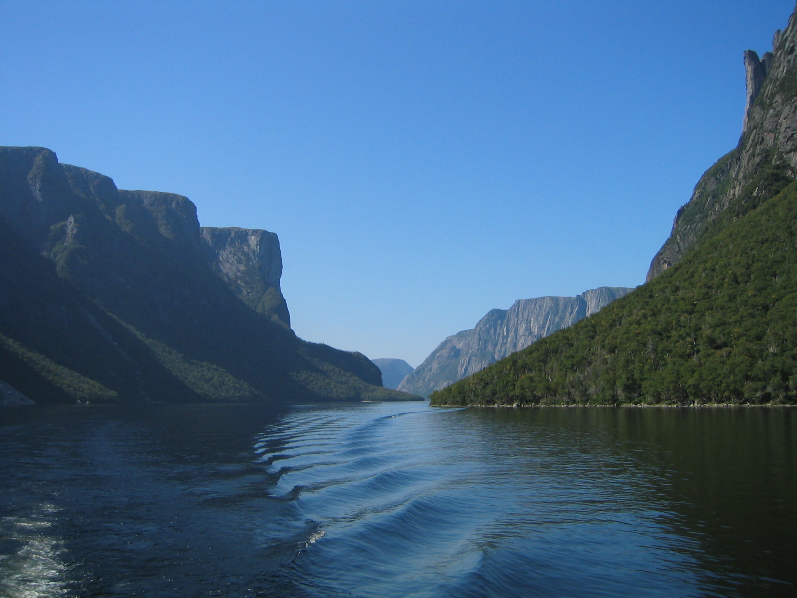
Gros Morne National Park
Gros Morne is Newfoundland’s crown jewel, a UNESCO World Heritage Site where the very guts of the Earth lie exposed. Glacier-carved fjords, flat-topped mountains, and the barren, rust-colored Tablelands, a slab of the planet’s mantle pushed to the surface, tell a story of continental collision that helped prove plate tectonics, all set against a wild Atlantic coast.
Fast facts
- Established: 1973 (national park 2005); UNESCO World Heritage Site 1987
- Size: about 697 square miles (1,805 km²) on Newfoundland’s west coast
- Namesake: Gros Morne mountain, 2,640 feet (806 m), second-highest in Newfoundland
- Geology: the Tablelands, exposed Earth’s mantle
- Gateway: Rocky Harbour, Newfoundland and Labrador
- Managed by: Parks Canada
The landscape
The park pairs the ancient Long Range Mountains, a northern extension of the Appalachians, with dramatic fjords like Western Brook Pond, where sheer cliffs rise from freshwater once trapped by rising land. The otherworldly Tablelands glow orange with mantle rock too harsh for most plants, while boreal forest, bog, coastal barrens and beaches fill out a landscape of astonishing geological variety.
Best time to go
Summer and early fall are the prime season, with the boat tours running, trails clear, and the weather at its (still changeable) best; fall adds color and fewer crowds. The season is short and coastal weather is famously fickle, with fog and cold possible any time, so pack layers whenever you visit.
Getting there and around
The park lies on Newfoundland’s west coast, reached via Highway 430 from Deer Lake, with Rocky Harbour as the hub. A vehicle is essential to travel between the widely spaced trailheads, fjord boat launch and coastal communities; the famous Western Brook Pond requires a walk in to the boat dock plus a ticketed tour.
Things to do
Cruise the landlocked fjord of Western Brook Pond beneath towering cliffs, hike the harsh, beautiful Tablelands, and, for the fit, tackle the strenuous Gros Morne Mountain climb for sweeping views. Walk the coastal and boardwalk trails, watch for moose and seabirds, sea kayak the coast, and take in the fishing-village culture of the region.
Staying safe
Coastal weather turns cold, wet and foggy fast, so carry layers and rain gear year-round. The Gros Morne Mountain and Tablelands routes are steep, exposed and rocky, cold water demands care when paddling, and moose, abundant here, deserve a wide berth, especially in fall. Ticks are increasingly present, so check yourself.
Know before you go
A Parks Canada pass is required, camping should be reserved, and the Western Brook Pond boat tour is ticketed and popular. Book ahead. This page is a general overview, not a live conditions report; always confirm current conditions, tour schedules and reservations with Parks Canada before your trip.
- Coordinates
- 49.6365, -57.7779
- Magnetic declination
- 17.6° W (2026)
Set this declination on your compass, then align it to the map's north lines; it is the angle between true north and magnetic north, refreshed each year.
A spread of the park’s main places shows straight away, and the rest appear as you zoom in. You can also search above, or pick any place from the lists below, and the map will go to it.
Getting there 1
Park entrance
On the trail 17
Campgrounds
Hut or shelter
Sights 46
Viewpoints
Waterfalls
Point of interests
Islands
Peaks 30
Map data comes from third-party sources and may be incomplete or out of date, so carry a current official map (terms).
- Best seasons
- Summer, Early fall
- Difficulty
- Easy to strenuous
- Access / trailheads
- On the west coast of Newfoundland via Highway 430 (the Viking Trail) from Deer Lake; Rocky Harbour is the main service town.
- Water
- Abundant streams; filter or treat backcountry water.
- Cell / satellite coverage
- Patchy cell service. Carry a map.
- Nearest ranger / SAR / emergency
- Parks Canada dispatch: 1-877-852-3100; life-threatening emergencies: 911.
- Permits & regulations
- A Parks Canada pass is required; camping needs a reservation, and the popular Western Brook Pond boat tour is ticketed and books up.
- Leave No Trace
- Stay on trails to protect fragile terrain, keep back from moose, pack out all waste, and follow Leave No Trace.
January
- Below freezing all day
February
- Below freezing all day
March
- Below freezing all day
April
- Below-freezing nights
May
June
July
August
September This month
October
November
- Below-freezing nights
December
- Below freezing all day
What to bring depends on your trip: how long you’re out, where you sleep, and how far you go from the road. The planner builds the list for yours.
Plan a trip here →Averages for 1981–2010 from Environment Canada climate normals, measured at the Cow Head station, 17 miles (28 km) away at 50 feet (15 m). Conditions change with elevation: expect it colder higher up.