

Mingan Archipelago National Park Reserve
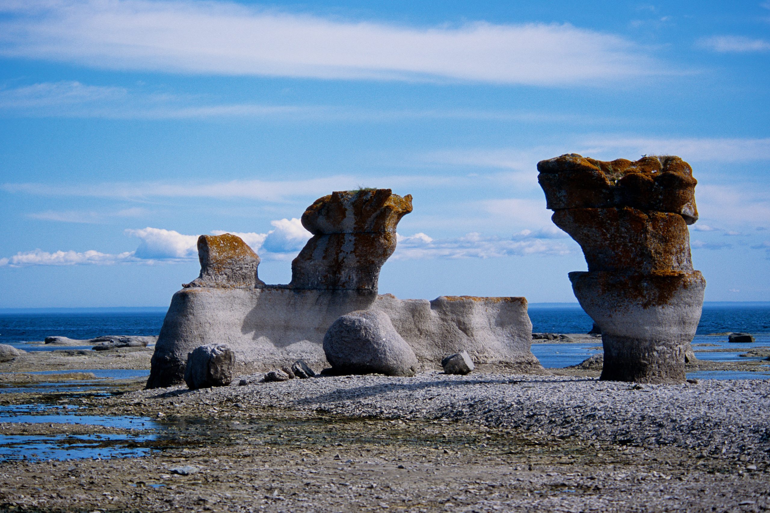
The Mingan Archipelago is a string of more than a thousand islands and islets along Quebec’s remote north shore, famous for its surreal limestone monoliths, giant flowerpot-shaped sea stacks sculpted by the waves of the Gulf of St. Lawrence. Rich in seabirds, seals and even whales offshore, and carpeted with rare arctic-alpine plants, it is a paddler’s and naturalist’s dream.
Fast facts
- Established: 1984
- Size: about 58 square miles (151 km²) across roughly 1,000 islands and islets
- Signature feature: eroded limestone monoliths (“flowerpots”)
- Wildlife: puffins and seabird colonies, seals, and whales offshore
- Gateways: Havre-Saint-Pierre and Longue-Pointe-de-Mingan, Quebec
- Managed by: Parks Canada
The landscape
The islands are built of ancient sea-floor limestone, which the elements have carved into cliffs, arches and the park’s iconic monoliths standing offshore like stone sentinels. Cloaked in boreal forest, bog and rare coastal plant communities, and ringed by tide pools and beaches, they host puffins and other seabirds, seals hauled out on the rocks, and whales feeding in the gulf.
Best time to go
The season is essentially summer, June through September, when the tour boats run and the weather is at its (changeable) best. July and August are warmest and busiest. The far-north-shore location makes for cool, foggy, unpredictable conditions even in summer, so pack layers whenever you come.
Getting there and around
The archipelago lies along Highway 138 on Quebec’s north shore, a long drive east of the populated south, with boats departing from Havre-Saint-Pierre and Longue-Pointe-de-Mingan. Access to the islands is by tour boat, sea kayak or private vessel; once ashore, you explore on foot along shoreline and forest trails.
Things to do
Take a boat tour or paddle among the monoliths, land on islands like Quarry and Niapiskau to walk the interpretive trails past the flowerpots, and watch for puffins, seals and whales. Boat-in camping lets you overnight in the archipelago, and the tide pools and rare flora reward slow, close exploration.
Staying safe
The gulf is cold, tidal water where fog and storms can arrive fast, so paddlers need real sea-kayak skills, cold-water gear and a float plan, and everyone should heed the marine forecast. Shoreline rock is slippery, tides shift quickly, and the monoliths are fragile, admire them without climbing on them.
Know before you go
A Parks Canada pass is required, and because access is by boat, plan your crossing and reserve any camping ahead. This page is a general overview, not a live conditions report; always confirm current boat schedules, marine conditions and reservations with Parks Canada before your trip.
- Coordinates
- 50.2444, -63.5981
- Magnetic declination
- 17.6° W (2026)
Set this declination on your compass, then align it to the map's north lines; it is the angle between true north and magnetic north, refreshed each year.
A spread of the park’s main places shows straight away, and the rest appear as you zoom in. You can also search above, or pick any place from the lists below, and the map will go to it.
Getting there 2
Airstrips
On the trail 3
Campgrounds
Sights 34
Viewpoint
Point of interest
Islands
Peaks
Map data comes from third-party sources and may be incomplete or out of date, so carry a current official map (terms).
- Best seasons
- Summer (June to September)
- Difficulty
- Easy to moderate
- Access / trailheads
- Along the north shore of the Gulf of St. Lawrence in eastern Quebec, off Highway 138; boats depart from Havre-Saint-Pierre and Longue-Pointe-de-Mingan.
- Water
- Carry fresh water to the islands.
- Cell / satellite coverage
- Patchy to no cell service on the water and islands.
- Nearest ranger / SAR / emergency
- Marine emergencies via the Canadian Coast Guard; life-threatening emergencies: 911.
- Permits & regulations
- A Parks Canada pass is required; the islands are reached by tour boat or private vessel, and boat-in camping needs a reservation.
- Leave No Trace
- Do not climb on the fragile monoliths, camp only at designated sites, pack out everything, and follow Leave No Trace.
January
- Below freezing all day
February
- Below freezing all day
March
- Below freezing all day
April
- Below-freezing nights
May
June
July
August
September This month
October
November
- Below-freezing nights
December
- Below freezing all day
What to bring depends on your trip: how long you’re out, where you sleep, and how far you go from the road. The planner builds the list for yours.
Plan a trip here →Averages for 1981–2010 from Environment Canada climate normals, measured at the Riviere au Tonnerre station, 29 miles (46 km) away at 50 feet (15 m).