

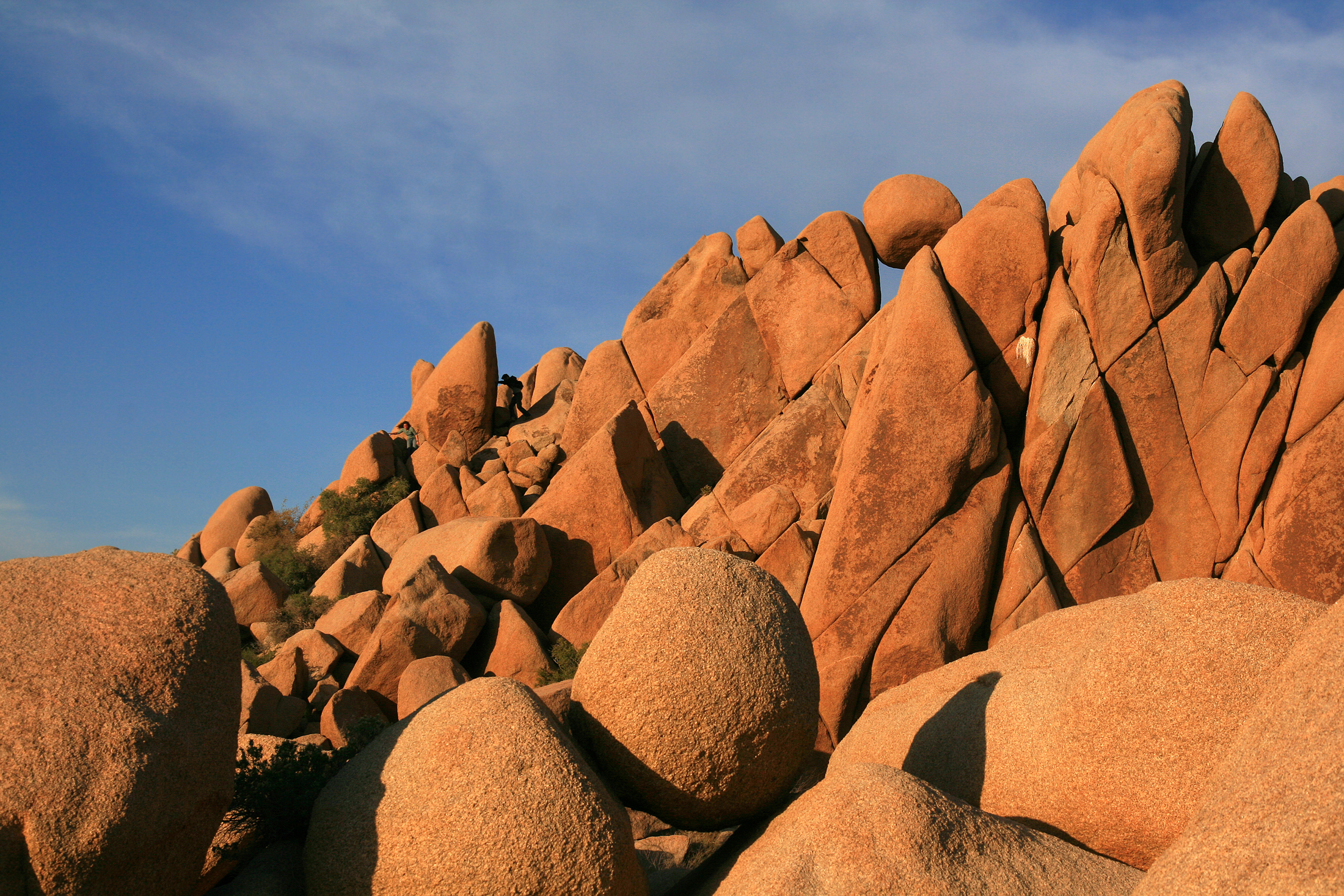
Joshua Tree National Park
Joshua Tree is where two deserts meet, the higher, cooler Mojave with its namesake spiky trees, and the lower, hotter Colorado Desert of creosote and cholla. Add jumbled fields of golden monzogranite boulders, some of the darkest skies in Southern California, and world-class rock climbing, and you have one of the most distinctive and beloved parks in the West, an easy drive from Los Angeles.
Fast facts
- Established: national monument 1936; national park in 1994
- Size: about 795,000 acres (3,220 km²) straddling two deserts
- Signature species: the Joshua tree (a giant yucca)
- Draw: thousands of rock-climbing routes and boulder problems
- Gateways: Twentynine Palms and the town of Joshua Tree, California
- Managed by: National Park Service
The landscape
The western, higher park is classic Mojave, forests of Joshua trees among piles of rounded granite that look sculpted for climbing. Drop east and south and the land falls into the Colorado Desert, hotter and sparser, with ocotillo, cholla cactus gardens and open creosote flats. Fan-palm oases mark hidden water, and the wildlife runs to bighorn sheep, coyotes, jackrabbits, roadrunners and rattlesnakes.
Best time to go
Fall through spring is the season, comfortable days, cold desert nights, and, in a good year, a spring wildflower bloom. Summer is dangerously hot, with daytime highs well over 100°F (38°C) that make anything but dawn outings risky. Winter can bring frost and even a dusting of snow on the boulders, and the clear, dark nights make stargazing spectacular year-round.
Getting there and around
Three entrances serve the park, the west and north near the town of Joshua Tree and Twentynine Palms, and the south off Interstate 10. A paved road connects the major sights and trailheads across the park, but there is no shuttle and no gas inside, so come with a full tank and a vehicle.
Things to do
Short hikes lead to Hidden Valley, Barker Dam and the Cholla Cactus Garden; longer routes climb to Ryan Mountain or wind through the Lost Palms Oasis. Rock climbing and bouldering are the park’s calling card, with routes for every level. Scenic drives, the Keys View overlook, and some of the best stargazing in Southern California round out a visit.
Staying safe
Heat and lack of water are the real dangers. Carry far more water than you expect to need, hike early, and avoid strenuous outings in summer heat. Watch washes for flash floods during storms, scramble and climb within your ability on rock that punishes mistakes, and give rattlesnakes room. Cell service is minimal, so tell someone your plans and carry a map.
Know before you go
A park pass is required, backcountry camping needs free self-registration, and the popular campgrounds fill fast in the cool season. Reserve ahead. Fill water and fuel before entering, since there is essentially none inside. This page is a general overview, not a live conditions report; always confirm current conditions and closures with the National Park Service before your trip.
- Coordinates
- 33.8998, -115.8601
- Magnetic declination
- 10.8° E (2026)
Set this declination on your compass, then align it to the map's north lines; it is the angle between true north and magnetic north, refreshed each year.
A spread of the park’s main places shows straight away, and the rest appear as you zoom in. You can also search above, or pick any place from the lists below, and the map will go to it.
Getting there 7
Park entrances
Ranger stations
On the trail 45
Trailheads
Campgrounds
Picnic sites
Sights 43
Viewpoints
Heritage sites
Peaks 30
Map data comes from third-party sources and may be incomplete or out of date, so carry a current official map (terms).
- Best seasons
- Fall, Winter, Spring
- Difficulty
- Easy to strenuous
- Access / trailheads
- Three entrances near Twentynine Palms, Joshua Tree and the south at I-10; a paved park road links the main sights. There is no shuttle, so a vehicle is essential.
- Water
- Carry all your water. There is almost none in the park; fill up at the visitor centers before entering.
- Cell / satellite coverage
- Little to no cell service in the park. Download maps and share your plans.
- Nearest ranger / SAR / emergency
- Contact park rangers or San Bernardino County dispatch; life-threatening emergencies: 911.
- Permits & regulations
- Per-vehicle entry fee (America the Beautiful pass accepted); backcountry camping requires free self-registration, and climbing has some seasonal wildlife closures.
- Leave No Trace
- Stay on trails and durable rock, do not climb on or damage Joshua trees, pack out all waste, and follow Leave No Trace.
January
February
March
April
- Day-to-night swing of 30°F (17°C)
May
- Day-to-night swing of 32°F (18°C)
June
- Hot days
- Day-to-night swing of 34°F (19°C)
July
- Extreme daytime heat
- Day-to-night swing of 32°F (18°C)
August
- Extreme daytime heat
- Day-to-night swing of 30°F (17°C)
September This month
- Hot days
October
- Day-to-night swing of 30°F (17°C)
November
December
What to bring depends on your trip: how long you’re out, where you sleep, and how far you go from the road. The planner builds the list for yours.
Plan a trip here →Averages for 1991–2020 from NOAA U.S. Climate Normals, measured at the Joshua Tree station, 10 miles (16 km) away at 2,563 feet (781 m). Conditions change with elevation: expect it colder higher up.