

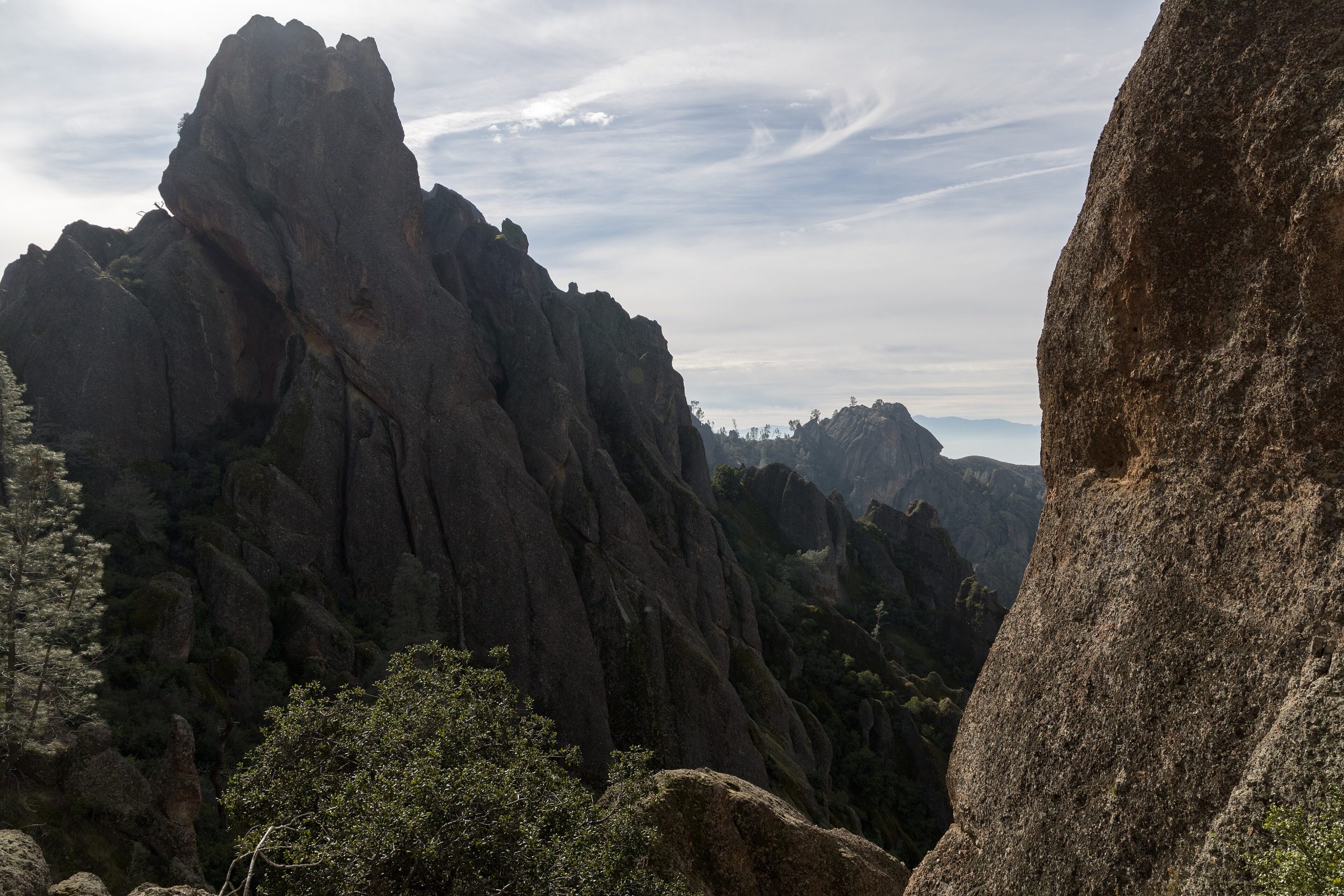
Pinnacles National Park
Pinnacles protects the eroded remains of an ancient volcano, a maze of towering rock spires, sheer crags and dark talus caves rising from the chaparral hills of central California. Small, uncrowded and split by a ridge into two unconnected halves, it is a favourite of rock climbers, cave scramblers and anyone hoping to watch endangered California condors ride the thermals overhead.
Fast facts
- Established: national monument 1908; national park in 2013 (the newest in the lower 48 at the time)
- Size: about 26,600 acres (108 km²) of the Gabilan Range
- Origin: a volcano rifted and carried ~200 miles (320 km) north along the San Andreas Fault
- Wildlife star: the endangered California condor
- Gateways: Hollister (east) and Soledad (west), California
- Managed by: National Park Service
The landscape
The park’s heart is the High Peaks, jagged rhyolite spires and pinnacles left where erosion carved a volcanic field. Below them, boulders have tumbled into narrow gorges to form the Bear Gulch and Balconies talus caves, dark passages you scramble through by headlamp. Oak woodland and chaparral cover the slopes, home to condors, prairie falcons, bobcats, and a famous diversity of bees.
Best time to go
Spring and fall are ideal, wildflowers and mild temperatures in spring, comfortable clear days in fall. Summer is punishingly hot, often over 100°F (38°C), and best avoided beyond early morning. Winter is cool and green, though rain can flood the caves and force closures. Cave and condor activity vary seasonally, so it pays to check ahead.
Getting there and around
Pinnacles has two entrances that do not connect by road through the park, the east side off Highway 25 (with the campground and visitor center) and the west side off Highway 146, so choose your side before you go, or hike between them over the High Peaks. A vehicle reaches each entrance; from the trailheads, everything is on foot.
Things to do
Hike the spectacular High Peaks trail among the spires, scramble through the Bear Gulch and Balconies talus caves (bring a headlamp), and watch for soaring condors from the ridgelines. Rock climbers come for the crags’ distinctive volcanic routes, and the reservoir and shaded gulches make gentler outings for families.
Staying safe
Heat and dehydration are the main risks. Carry plenty of water, hike early, and skip strenuous routes on hot days. The caves are dark, low and can flood, so bring a light, watch your head, and heed closures. The High Peaks trail has steep drop-offs and narrow steps carved in rock, and ticks and rattlesnakes are present, so watch your footing and your hands.
Know before you go
A park pass is required, the campground is on the east side only, and the talus caves close seasonally for bat protection or after rain. Check current cave and condor status before you come. This page is a general overview, not a live conditions report; always confirm current conditions, cave access and closures with the National Park Service before your trip.
- Coordinates
- 36.4863, -121.1734
- Magnetic declination
- 12.4° E (2026)
Set this declination on your compass, then align it to the map's north lines; it is the angle between true north and magnetic north, refreshed each year.
A spread of the park’s main places shows straight away, and the rest appear as you zoom in. You can also search above, or pick any place from the lists below, and the map will go to it.
Getting there 4
Park entrances
Ranger stations
On the trail 10
Trailheads
Campground
Picnic sites
Sights 18
Viewpoints
Point of interests
Peaks 10
Map data comes from third-party sources and may be incomplete or out of date, so carry a current official map (terms).
- Best seasons
- Spring, Fall
- Difficulty
- Easy to strenuous
- Access / trailheads
- Two separate entrances that do NOT connect through the park: the east (Hwy 25) near Hollister with the campground, and the west (Hwy 146) near Soledad. Reach the High Peaks on foot.
- Water
- Carry ample water; fill up at the visitor center or campground, as trail water is scarce, especially in heat.
- Cell / satellite coverage
- Little to no cell service. Carry a map and a headlamp for the caves.
- Nearest ranger / SAR / emergency
- Contact park rangers or San Benito County dispatch; life-threatening emergencies: 911.
- Permits & regulations
- Per-vehicle entry fee (America the Beautiful pass accepted); talus caves close seasonally to protect bats or after rain, so check current cave status.
- Leave No Trace
- Stay on trails, protect roosting bats in the caves, pack out all waste, and follow Leave No Trace.
January
February
March
- Day-to-night swing of 30°F (17°C)
April
- Day-to-night swing of 33°F (18°C)
May
- Day-to-night swing of 37°F (21°C)
June
- Day-to-night swing of 42°F (23°C)
July
- Hot days
- Day-to-night swing of 46°F (26°C)
August
- Hot days
- Day-to-night swing of 46°F (26°C)
September This month
- Hot days
- Day-to-night swing of 44°F (24°C)
October
- Day-to-night swing of 40°F (22°C)
November
- Day-to-night swing of 33°F (18°C)
December
What to bring depends on your trip: how long you’re out, where you sleep, and how far you go from the road. The planner builds the list for yours.
Plan a trip here →Averages for 1991–2020 from NOAA U.S. Climate Normals, measured at the Pinnacles National Park station, 1 miles (1 km) away at 1,307 feet (398 m). Conditions change with elevation: expect it colder higher up.