

Sirmilik National Park
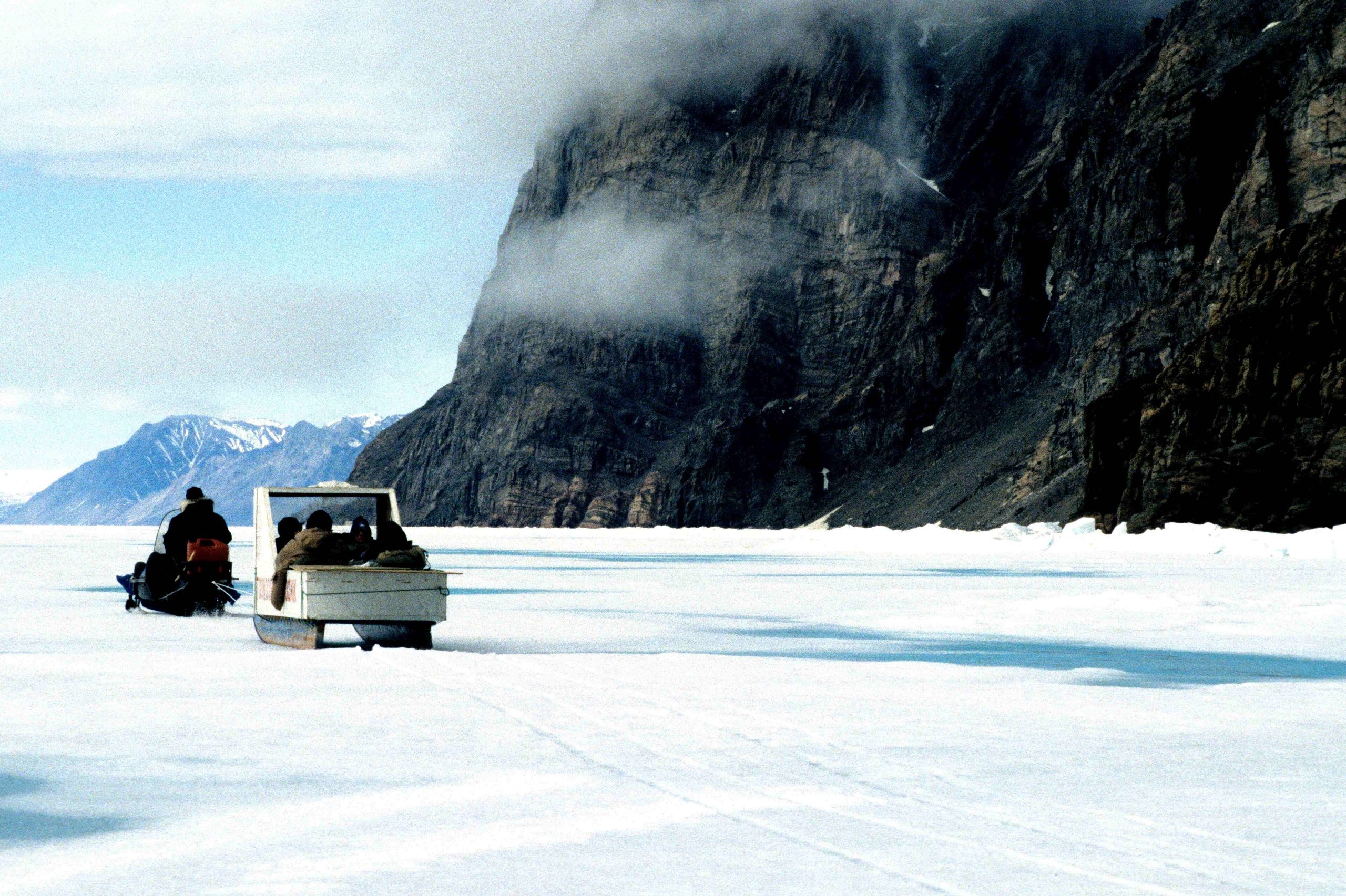
Sirmilik, “place of glaciers”, is a breathtaking High Arctic park spanning northern Baffin Island and Bylot Island in Nunavut. A landscape of glaciers, jagged red-and-black peaks, and sea-ice-fringed fjords, it hosts spectacular seabird colonies and abundant marine mammals, offering some of the most dramatic Arctic scenery and wildlife in Canada to those who reach it with Inuit guides.
Fast facts
- Established: 2001
- Size: about 8,570 square miles (22,200 km²) on Baffin and Bylot islands, Nunavut
- Wildlife: vast seabird colonies, narwhals, seals, polar bears and muskoxen
- Scenery: glaciers, hoodoos and dramatic mountain fjords
- Gateways: Pond Inlet and Arctic Bay, Nunavut
- Managed by: Parks Canada, with the Qikiqtani Inuit
The landscape
The park’s three areas encompass the icefields and peaks of Bylot Island, the striking hoodoos of the Borden Peninsula, and the glacier-hung fjords of the Baffin coast. The floe edge, where sea ice meets open water, is a wildlife spectacle, drawing narwhals, seals, whales and polar bears, while Bylot hosts one of the largest greater snow goose and seabird colonies in the Arctic.
Best time to go
Late spring is prime for floe-edge trips and ski touring over sea ice by snowmobile-supported travel, while summer opens boat access and hiking as the ice breaks up. Both are cold, and weather is always changeable in the High Arctic. There is no warm-weather off-season. Trips are timed to ice and wildlife, and arranged through Inuit outfitters.
Getting there and around
Access is from the Inuit communities of Pond Inlet or Arctic Bay, themselves reached by air, and then into the park by boat in summer or snowmobile over the sea ice in spring. There are no roads or facilities inside, and virtually all visitors travel with licensed Inuit outfitters who provide the guiding, safety and logistics.
Things to do
Floe-edge excursions to watch narwhals, seals and polar bears are the signature experience, along with ski touring and snowmobile-supported travel in spring, sea kayaking and boating in summer, and hiking amid glaciers and hoodoos. Birding at Bylot’s colonies and immersion in Inuit culture make it unforgettable.
Staying safe
This is polar-bear country on shifting sea ice in a remote Arctic. Conditions demand experienced Inuit guides, whose knowledge of ice, weather and wildlife is your primary safety margin. Extreme cold, glaciers and total remoteness mean self-sufficiency and satellite communication are essential, and you should follow your outfitter’s guidance closely.
Know before you go
A Parks Canada pass and registration/orientation are required, and nearly all visits are through licensed Inuit outfitters. Book well ahead. This page is a general overview, not a live conditions report; always confirm current access, ice conditions and options with Parks Canada before your trip.
- Coordinates
- 72.7660, -80.4114
- Magnetic declination
- 28.0° W (2026)
Set this declination on your compass, then align it to the map's north lines; it is the angle between true north and magnetic north, refreshed each year.
A spread of the park’s main places shows straight away, and the rest appear as you zoom in. You can also search above, or pick any place from the lists below, and the map will go to it.
Sights 54
Point of interests
Islands
Peaks 30
Map data comes from third-party sources and may be incomplete or out of date, so carry a current official map (terms).
- Best seasons
- Late spring to summer (guided)
- Difficulty
- Strenuous (remote Arctic, guided)
- Access / trailheads
- On northern Baffin Island and Bylot Island, Nunavut, near Pond Inlet and Arctic Bay. Access is by boat or snowmobile from those communities (reached by air).
- Water
- Glacial streams and melt; filter or treat all water.
- Cell / satellite coverage
- No cell service. Carry a satellite communicator and file a plan.
- Nearest ranger / SAR / emergency
- Coordinate through Parks Canada in Pond Inlet; response is limited.
- Permits & regulations
- A Parks Canada pass and registration/orientation are required; access is from Inuit communities by boat or snowmobile, and most trips are outfitter-guided.
- Leave No Trace
- Pack out everything, respect Inuit heritage and wildlife, and follow strict Leave No Trace.
January
- Below freezing all day
February
- Below freezing all day
March
- Below freezing all day
April
- Below freezing all day
May
- Below freezing all day
June
- Below-freezing nights
July
August
September This month
- Below-freezing nights
October
- Below freezing all day
November
- Below freezing all day
December
- Below freezing all day
What to bring depends on your trip: how long you’re out, where you sleep, and how far you go from the road. The planner builds the list for yours.
Plan a trip here →Averages for 1981–2010 from Environment Canada climate normals, measured at the Pond Inlet Airport station, 50 miles (81 km) away at 202 feet (62 m). Conditions change with elevation: expect it colder higher up.