

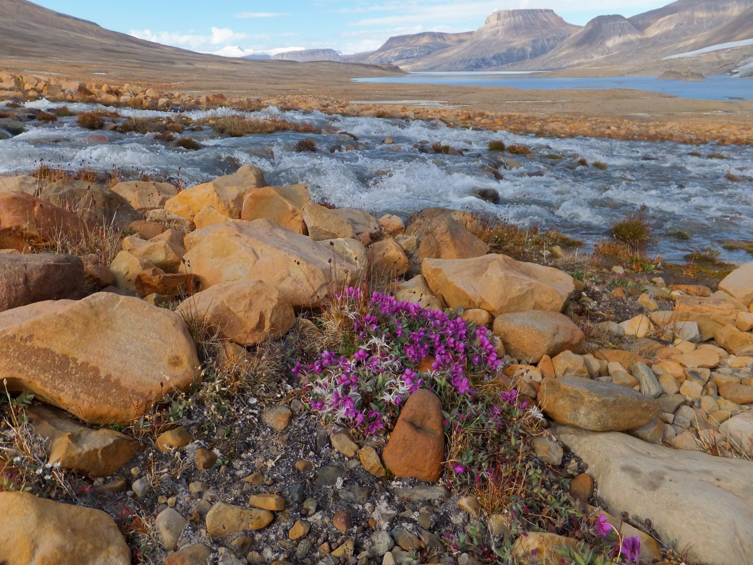
Quttinirpaaq National Park
Quttinirpaaq, “top of the world” in Inuktitut, sits at the far northern tip of Ellesmere Island, one of the most remote and northerly places on the planet. A polar wilderness of ice caps, jagged mountains and glacier-carved fjords, it is the second-most-northerly park on Earth, a realm of 24-hour summer sun, surprising oases of life, and utter, humbling isolation.
Fast facts
- Established: 1988 (as Ellesmere Island National Park Reserve); renamed 2001
- Size: about 14,585 square miles (37,775 km²) on northern Ellesmere Island, Nunavut
- Superlative: among the most northerly protected lands on Earth
- Features: vast ice caps, the Grant Land Mountains, and fjords
- Access point: Resolute, Nunavut (long-range charter only)
- Managed by: Parks Canada
The landscape
The park is a High Arctic world of extremes, enormous ice caps and glaciers, the rugged Grant Land Mountains (including Barbeau Peak, the highest in eastern North America), and deep fjords reaching the frozen Arctic Ocean. Amid the ice lie surprising thermal oases like Lake Hazen, a relatively lush pocket that supports muskoxen, Arctic hares, wolves and nesting birds in the endless summer light.
Best time to go
Only the brief High Arctic summer allows access, under 24-hour daylight but still bitter cold, windy and unpredictable, with snow possible any day. There is no other season for visiting, the rest of the year is polar darkness and extreme cold, and even summer trips are rare, costly and demanding.
Getting there and around
Reaching Quttinirpaaq requires long-range chartered aircraft, typically staging through Resolute, at considerable expense; there are no roads, communities or services within reach. Travel inside is on foot or ski, and every visit is a major, fully self-supported expedition undertaken by highly experienced parties or specialized outfitters.
Things to do
This is a park for serious expeditions, trekking between Lake Hazen and Tanquary Fiord, mountaineering in the Grant Land Mountains, and experiencing a polar wilderness almost no one ever sees. Wildlife viewing at the oases, glacier travel and the sheer experience of standing near the top of the world are the rewards.
Staying safe
Few places on Earth are less forgiving: extreme cold, glaciated and crevassed terrain, river crossings, polar bears, and a remoteness so total that rescue may be days away. Only expert, fully equipped and self-sufficient parties should attempt it, with satellite communication, meticulous planning, and Parks Canada’s mandatory orientation.
Know before you go
A Parks Canada pass, registration and orientation are required, and access is by costly long-range charter for experienced expeditions only. This page is a general overview, not a live conditions report; always confirm current access, conditions and requirements with Parks Canada before your trip.
- Coordinates
- 82.1594, -70.7785
- Magnetic declination
- 42.2° W (2026)
Set this declination on your compass, then align it to the map's north lines; it is the angle between true north and magnetic north, refreshed each year.
A spread of the park’s main places shows straight away, and the rest appear as you zoom in. You can also search above, or pick any place from the lists below, and the map will go to it.
Getting there 2
Airstrips
Sights 72
Point of interests
Islands
Peaks 30
Map data comes from third-party sources and may be incomplete or out of date, so carry a current official map (terms).
- Best seasons
- Summer (fly-in, guided)
- Difficulty
- Strenuous (extreme remote Arctic)
- Access / trailheads
- At the far northern tip of Ellesmere Island, Nunavut, among the most northerly lands on Earth. Access is by long-range charter aircraft, typically via Resolute; there are no roads or services.
- Water
- Glacial streams and melt; filter or treat all water.
- Cell / satellite coverage
- No cell service. Carry a satellite communicator and file a detailed plan.
- Nearest ranger / SAR / emergency
- Coordinate through Parks Canada; rescue is extremely limited and may be days away.
- Permits & regulations
- A Parks Canada pass, registration and orientation are required; access is by expensive charter aircraft, and trips are for highly experienced, self-sufficient parties.
- Leave No Trace
- Pack out everything, protect the fragile polar landscape, and follow strict Leave No Trace.
January
- Below freezing all day
February
- Below freezing all day
March
- Below freezing all day
April
- Below freezing all day
May
- Below freezing all day
June
July
August
September This month
- Below freezing all day
October
- Below freezing all day
November
- Below freezing all day
December
- Below freezing all day
What to bring depends on your trip: how long you’re out, where you sleep, and how far you go from the road. The planner builds the list for yours.
Plan a trip here →Averages for 1981–2010 from Environment Canada climate normals, measured at the Eureka Airport station, 220 miles (354 km) away at 34 feet (10 m). That is the nearest station with long-term records, so treat these as a regional guide. Conditions change with elevation: expect it colder higher up.