

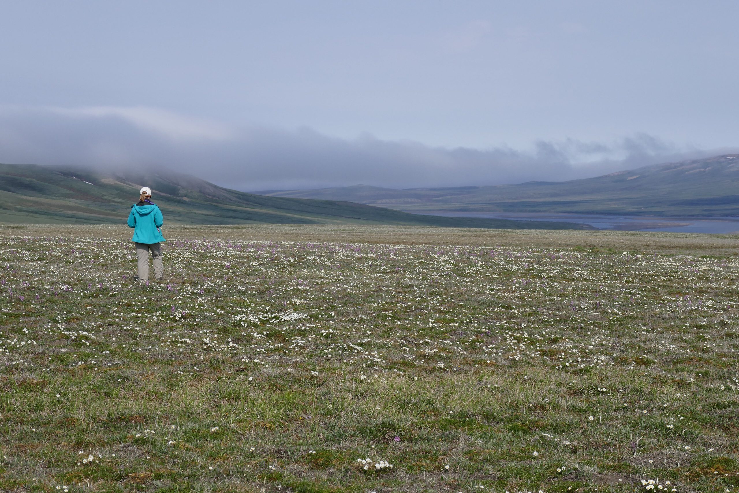
Aulavik National Park
Aulavik, “place where people travel” in Inuvialuktun, protects a remote Arctic wilderness on the north end of Banks Island, home to the highest density of muskoxen on Earth. Threaded by the gentle Thomsen River, one of the northernmost navigable rivers on the planet, it is a park of open tundra, big skies and profound solitude, reached only by charter aircraft.
Fast facts
- Established: 1992
- Size: about 4,739 square miles (12,275 km²) of Arctic lowland and tundra
- Wildlife: the world’s densest muskox population, plus Peary caribou and Arctic wildlife
- River: the Thomsen, among the northernmost canoeable rivers on Earth
- Access point: Inuvik, Northwest Territories (charter only)
- Managed by: Parks Canada
The landscape
Aulavik is a rolling Arctic landscape of tundra, badlands and river valley, drained by the meandering Thomsen and rimmed by the Beaufort Sea coast. Treeless and shaped by permafrost, it turns briefly green and flower-strewn in summer, when muskoxen graze the flats and migratory birds crowd the wetlands, with archaeological traces of thousands of years of human presence.
Best time to go
The only realistic window is the brief Arctic summer, roughly June through August, when the Thomsen is runnable and temperatures are survivable, though still cold, windy and prone to snow. Outside summer, the park is locked in Arctic cold and darkness and is effectively inaccessible.
Getting there and around
Access is by chartered aircraft only, usually flying from Inuvik to a tundra airstrip within the park; there are no roads, no scheduled flights and no services. Once on the ground, travel is by canoe on the Thomsen or on foot across the tundra, and every trip is a fully self-supported or outfitted expedition.
Things to do
Canoeing the Thomsen River is the classic Aulavik journey, gliding past muskoxen and archaeological sites under the midnight sun. Backpacking the tundra, watching wildlife, and photographing this rarely seen Arctic world round out a visit, all of it self-directed, with no marked trails or facilities.
Staying safe
This is one of the most remote parks in Canada, so self-reliance is everything: carry a satellite communicator, file a detailed plan, and be equipped for extreme cold and wind any time of year. Cold water, wildlife including coastal polar bears, and the sheer distance from help all demand serious Arctic experience or a licensed outfitter.
Know before you go
A Parks Canada pass and registration are required, and you must arrange charter flights and be fully self-sufficient or travel with an outfitter. This page is a general overview, not a live conditions report; always confirm current access, conditions and requirements with Parks Canada before your trip.
- Coordinates
- 73.7148, -119.6096
- Magnetic declination
- 15.3° E (2026)
Set this declination on your compass, then align it to the map's north lines; it is the angle between true north and magnetic north, refreshed each year.
A spread of the park’s main places shows straight away, and the rest appear as you zoom in. You can also search above, or pick any place from the lists below, and the map will go to it.
On the trail 1
Hut or shelter
Sights 13
Islands
Peak
Map data comes from third-party sources and may be incomplete or out of date, so carry a current official map (terms).
- Best seasons
- Summer (June to August, guided/charter)
- Difficulty
- Strenuous (remote Arctic, charter access)
- Access / trailheads
- On northern Banks Island in the Northwest Territories. Access is by chartered aircraft only, typically from Inuvik; there are no roads or scheduled service.
- Water
- Rivers and streams; filter or treat all water.
- Cell / satellite coverage
- No cell service. Carry a satellite communicator and file a trip plan.
- Nearest ranger / SAR / emergency
- Coordinate through Parks Canada in Inuvik; response is very limited given the remoteness.
- Permits & regulations
- A Parks Canada pass and registration are required; there is no infrastructure, so all trips are self-sufficient or outfitter-supported by charter flight.
- Leave No Trace
- Pack out everything, protect fragile tundra, respect Inuvialuit heritage, and follow strict Leave No Trace.
January
- Below freezing all day
February
- Below freezing all day
March
- Below freezing all day
April
- Below freezing all day
May
- Below freezing all day
June
July
August
September This month
- Below-freezing nights
October
- Below freezing all day
November
- Below freezing all day
December
- Below freezing all day
What to bring depends on your trip: how long you’re out, where you sleep, and how far you go from the road. The planner builds the list for yours.
Plan a trip here →Averages for 1981–2010 from Environment Canada climate normals, measured at the Ulukhaktok Airport station, 207 miles (334 km) away at 118 feet (36 m). That is the nearest station with long-term records, so treat these as a regional guide.