

Ukkusiksalik National Park
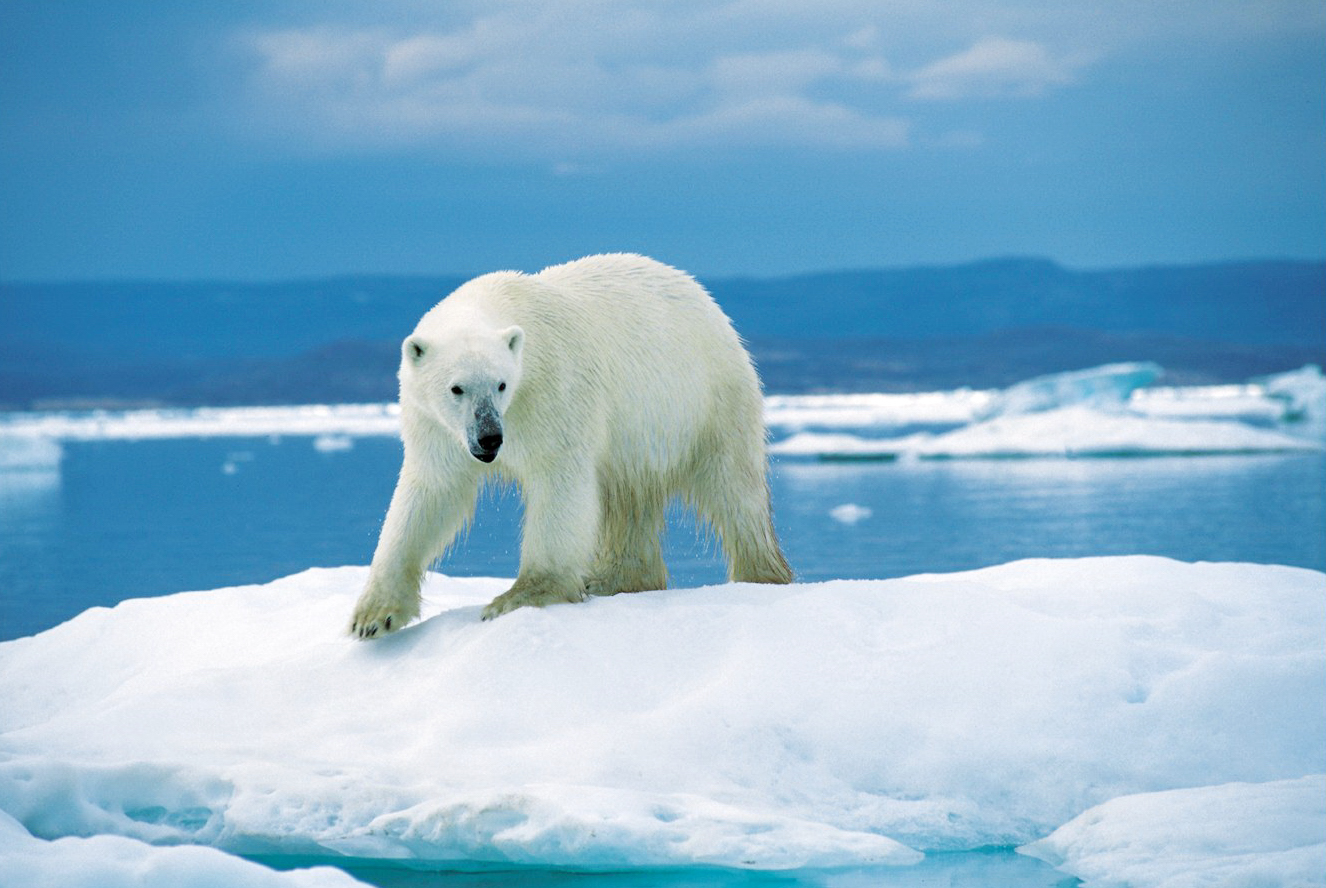
Ukkusiksalik surrounds Wager Bay, a great saltwater inlet reaching deep into the tundra of the Kivalliq region of Nunavut. A remote Arctic wilderness rich in wildlife, especially a high density of polar bears, and dotted with more than 500 archaeological sites recording centuries of Inuit life, it offers a rare, guided window into a living Arctic homeland.
Fast facts
- Established: 2003
- Size: about 8,062 square miles (20,880 km²) around Wager Bay, Nunavut
- Wildlife: a notable density of polar bears, plus caribou, muskoxen and grizzlies
- Heritage: more than 500 Inuit archaeological sites
- Gateway: Naujaat, Nunavut (fly-in/boat)
- Managed by: Parks Canada, with the Kivalliq Inuit
The landscape
The park centers on Wager Bay, a long tidal inlet whose narrow mouth creates powerful reversing rapids as the tide surges in and out. Around it spread rolling tundra, rivers, cliffs and coastal flats, shaped by permafrost and the cold sea. It is exceptional wildlife country, polar bears den and roam here, alongside caribou, muskoxen, grizzlies, seals and nesting birds.
Best time to go
The brief Arctic summer is the only practical window, when the bay is navigable and the tundra accessible under long daylight, though cold, wind and insects persist and weather is unpredictable. There is no other season for visiting, and trips are timed and arranged through Inuit outfitters.
Getting there and around
Access is by chartered aircraft or boat, typically from the community of Naujaat; there are no roads or facilities. Travel within is by boat and on foot, and nearly all visitors come with licensed Inuit outfitters, whose knowledge of the bay, the tides, the wildlife and the weather is essential for safety.
Things to do
Guided wildlife viewing, above all polar bears, but also caribou, muskoxen and marine mammals, is the heart of a visit, along with witnessing the reversing rapids at the bay’s mouth, exploring archaeological sites, and learning Inuit history and land skills from local guides. Photography and immersion in a wild homeland are the rewards.
Staying safe
This is high-density polar-bear country, so guided travel with experienced Inuit outfitters is the norm and your key safety margin. Extreme cold, powerful tidal currents, and total remoteness with no quick rescue mean self-sufficiency, satellite communication and strict adherence to your guide’s protocols are essential.
Know before you go
A Parks Canada pass and registration are required, and visits are through licensed Inuit outfitters. Plan well ahead. This page is a general overview, not a live conditions report; always confirm current access, conditions and options with Parks Canada before your trip.
- Coordinates
- 65.7639, -89.8290
- Magnetic declination
- 9.8° W (2026)
Set this declination on your compass, then align it to the map's north lines; it is the angle between true north and magnetic north, refreshed each year.
A spread of the park’s main places shows straight away, and the rest appear as you zoom in. You can also search above, or pick any place from the lists below, and the map will go to it.
Sights 4
Islands
Peaks
Map data comes from third-party sources and may be incomplete or out of date, so carry a current official map (terms).
- Best seasons
- Summer (fly-in/boat, guided)
- Difficulty
- Strenuous (remote Arctic, guided)
- Access / trailheads
- Around Wager Bay in the Kivalliq region of Nunavut, just below the Arctic Circle. Access is by chartered aircraft or boat, typically from Naujaat; there are no roads.
- Water
- Streams and rivers; filter or treat all water. Coastal water is tidal and salty.
- Cell / satellite coverage
- No cell service. Carry a satellite communicator and file a plan.
- Nearest ranger / SAR / emergency
- Coordinate through Parks Canada and Naujaat; response is very limited.
- Permits & regulations
- A Parks Canada pass and registration are required; access is by charter aircraft or boat, and visits are outfitter-guided from Naujaat.
- Leave No Trace
- Keep strict distance from polar bears, pack out everything, respect Inuit heritage, and follow strict Leave No Trace.
January
- Below freezing all day
February
- Below freezing all day
March
- Below freezing all day
April
- Below freezing all day
May
- Below freezing all day
June
- Below-freezing nights
July
August
September This month
- Below-freezing nights
October
- Below freezing all day
November
- Below freezing all day
December
- Below freezing all day
What to bring depends on your trip: how long you’re out, where you sleep, and how far you go from the road. The planner builds the list for yours.
Plan a trip here →Averages for 1981–2010 from Environment Canada climate normals, measured at the Kugaaruk Airport station, 192 miles (309 km) away at 51 feet (16 m). That is the nearest station with long-term records, so treat these as a regional guide.