

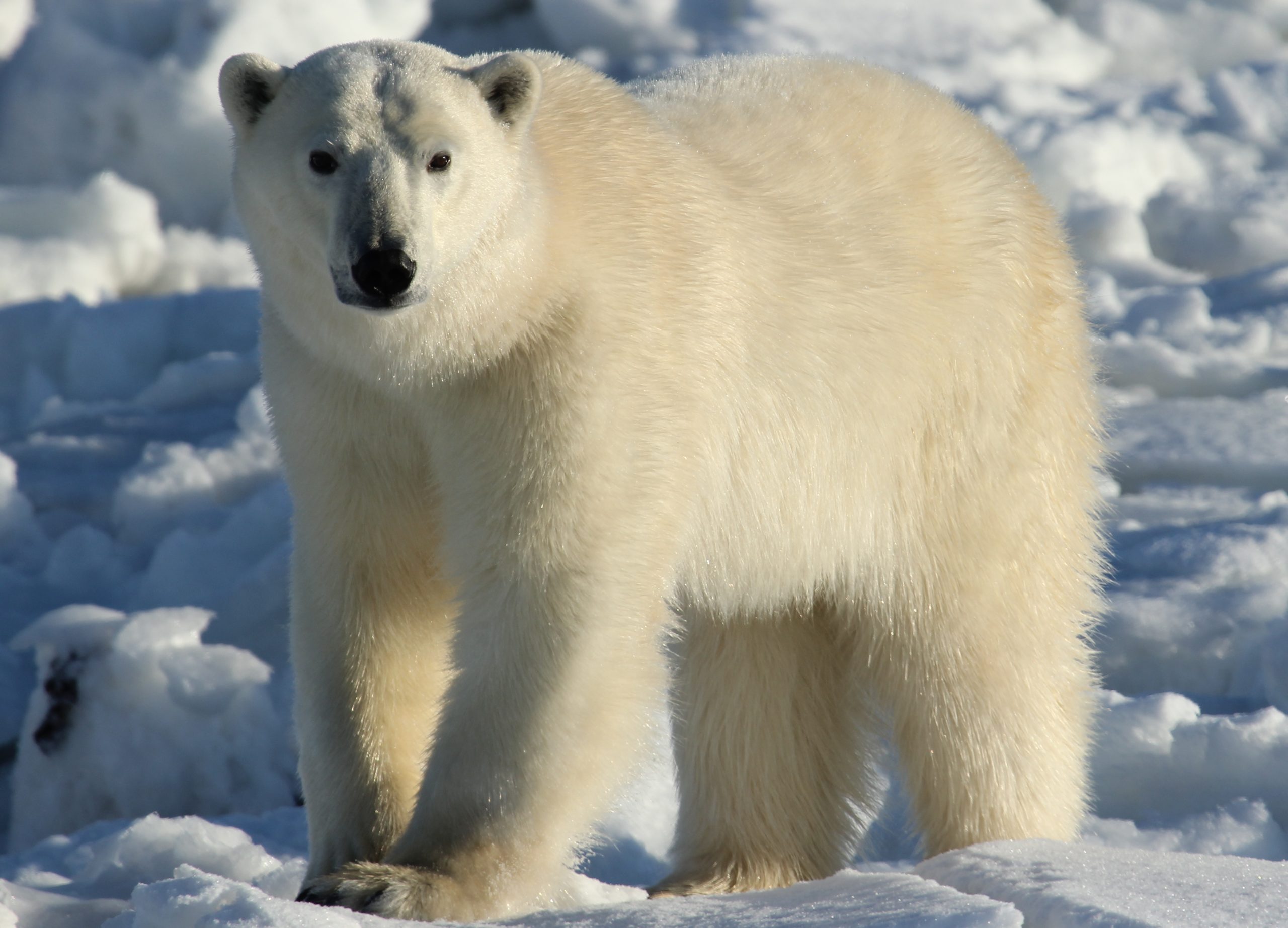
Wapusk National Park
Wapusk, Cree for “white bear”, protects one of the largest known polar-bear denning areas on Earth, a vast, roadless wilderness of subarctic tundra and taiga on the Hudson Bay coast near Churchill, Manitoba. This is one of Canada’s most remote and least-visited national parks, reachable only on a guided expedition, where the reward is a genuine encounter with the wild edge of the Arctic.
Fast facts
- Established: 1996
- Size: about 4,431 square miles (11,475 km²) on the Hudson Bay Lowlands
- Signature wildlife: one of the world’s largest polar-bear maternity denning areas
- Also home to: caribou, Arctic fox, wolves and huge summer bird populations
- Access point: Churchill, Manitoba (guided trips only)
- Managed by: Parks Canada
The landscape
Wapusk sits where the boreal forest frays into open tundra along the Hudson Bay coast, a low, wet mosaic of peat bogs, permafrost, spruce taiga, winding rivers and coastal flats. Underlain by permafrost and shaped by the cold bay, it is a critical habitat: polar bears den here, caribou range across it, and in summer the wetlands host vast numbers of nesting and migrating birds.
Best time to go
Timing depends entirely on what you hope to see and is dictated by guided operators. Summer offers tundra wildflowers, birdlife and long daylight; late fall is the famous polar-bear season around Churchill as the bears gather to await the sea ice. Winter is brutally cold and dark. There is no casual visiting season. Every trip is a planned, guided expedition.
Getting there and around
There are no roads into Wapusk. Access is only by licensed guided trips, typically by helicopter or specialized tundra vehicle, operating out of Churchill, itself reachable only by air or rail. Independent travel is not permitted, both for safety in polar-bear country and to protect the fragile land, so a visit means booking through an authorized operator.
Things to do
The experience is guided wildlife viewing and immersion in a rare subarctic ecosystem, watching for polar bears, caribou and Arctic foxes, taking in the sweep of tundra and coast, and, in summer, the extraordinary birdlife of the Hudson Bay Lowlands. Photography and learning from expert guides about this threatened landscape are central to any trip.
Staying safe
Wapusk is polar-bear country, and polar bears are among the most dangerous animals on Earth. This is precisely why access is guided only, and your safety depends on following your guide’s protocols exactly. The subarctic cold is extreme and the remoteness total, with no services and no quick rescue, while summer brings clouds of insects. Every logistical and safety detail is managed by the operator.
Know before you go
You cannot visit Wapusk independently. Book through Parks Canada’s authorized operators in Churchill, who handle passes, permits, gear, food and safety. Plan and reserve far in advance, as trips are limited and specialized. This page is a general overview, not a live conditions report; always confirm current trip options and conditions with Parks Canada and licensed operators before your trip.
- Coordinates
- 57.9524, -93.1245
- Magnetic declination
- 2.1° W (2026)
Set this declination on your compass, then align it to the map's north lines; it is the angle between true north and magnetic north, refreshed each year.
A spread of the park’s main places shows straight away, and the rest appear as you zoom in. You can also search above, or pick any place from the lists below, and the map will go to it.
On the trail 2
Campgrounds
Map data comes from third-party sources and may be incomplete or out of date, so carry a current official map (terms).
- Best seasons
- Summer (guided); polar bear season is fall
- Difficulty
- Strenuous (guided access only)
- Access / trailheads
- On the Hudson Bay coast southeast of Churchill, Manitoba. No roads reach the park; access is by helicopter or Tundra-vehicle trips with licensed operators out of Churchill.
- Water
- No potable water. All water and supplies are handled by the guided operator.
- Cell / satellite coverage
- No cell service, guided groups carry satellite communication.
- Nearest ranger / SAR / emergency
- Coordinated through Parks Canada and operators in Churchill; life-threatening emergencies: 911 where reachable.
- Permits & regulations
- Access is by licensed guided trip only, arranged through Parks Canada and authorized operators. There is no independent public access. A pass and permits are handled through the operator.
- Leave No Trace
- Follow your guide’s protocols exactly, keep strict distance from wildlife, pack out everything, and follow Leave No Trace.
January
- Below freezing all day
February
- Below freezing all day
March
- Below freezing all day
April
- Below freezing all day
May
- Below-freezing nights
June
July
August
September This month
October
- Below-freezing nights
November
- Below freezing all day
December
- Below freezing all day
What to bring depends on your trip: how long you’re out, where you sleep, and how far you go from the road. The planner builds the list for yours.
Plan a trip here →Averages for 1981–2010 from Environment Canada climate normals, measured at the Churchill Airport station, 64 miles (103 km) away at 96 feet (29 m). That is the nearest station with long-term records, so treat these as a regional guide.