

Mount Rainier National Park
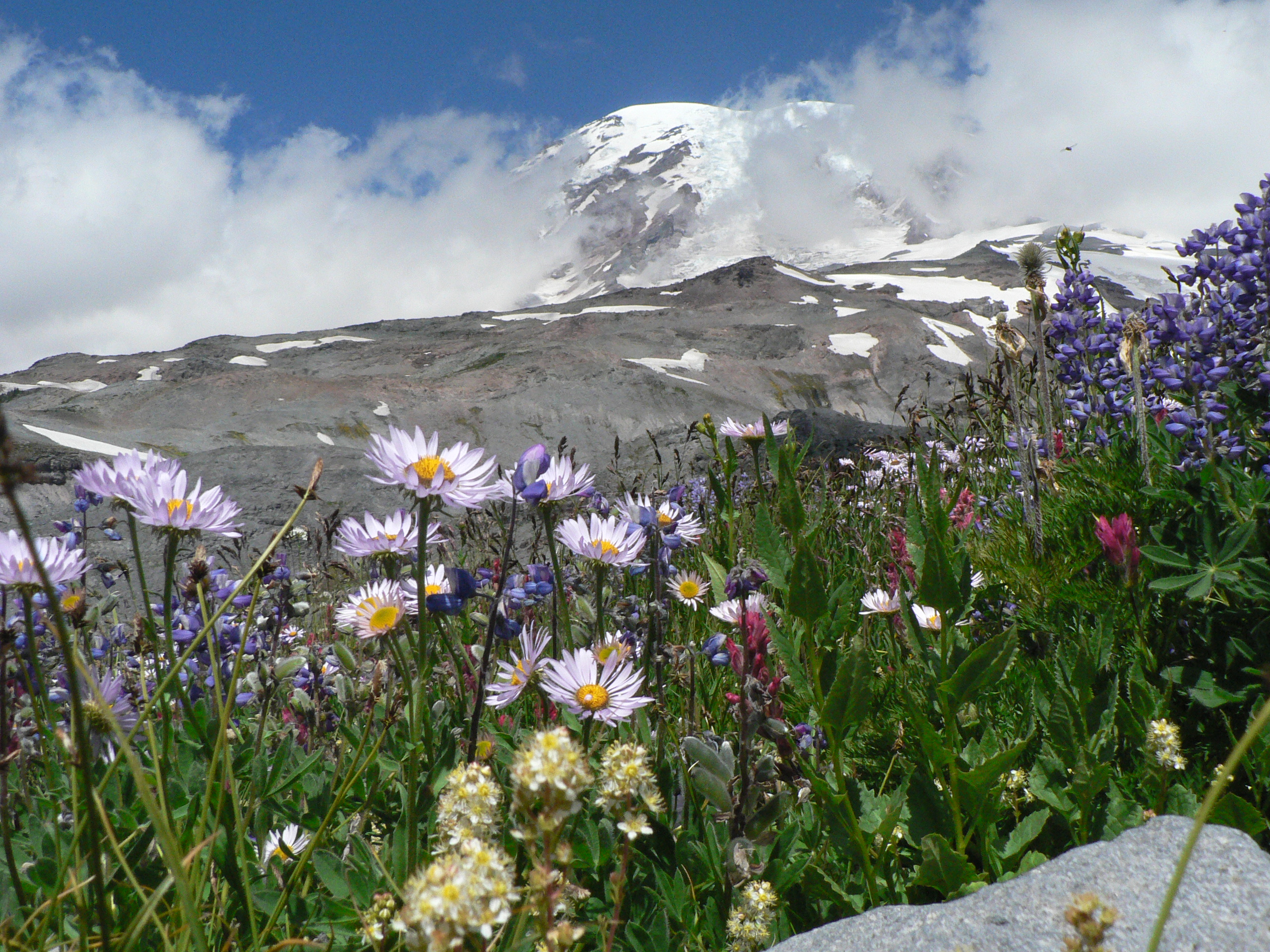
Mount Rainier stands alone on the Washington skyline, a 14,410-foot (4,392 m) ice-clad volcano so massive it makes its own weather, ringed by wildflower meadows, ancient forests and cascading rivers fed by 25 glaciers. The most heavily glaciated peak in the contiguous United States, it is a magnet for hikers drawn to its subalpine parklands and for mountaineers testing themselves on its icy flanks.
Fast facts
- Established: 1899, the fifth U.S. national park
- Size: about 236,000 acres (955 km²) in west-central Washington
- The peak: Mount Rainier, 14,410 feet (4,392 m), an active volcano
- Glaciers: 25 major glaciers, the most on any U.S. peak outside Alaska
- Gateways: Seattle and Tacoma, Washington
- Managed by: National Park Service
The landscape
The volcano’s glaciers feed rushing rivers that carve valleys through old-growth forests of towering Douglas fir and western red cedar. Higher up, the trees give way to the famous subalpine “parklands”, meadows that erupt with wildflowers in the short summer, and then to rock, snow and ice. Black bears, elk, marmots and mountain goats range the slopes below the summit.
Best time to go
Summer through early fall is the prime window, when the roads are open, the meadows bloom (peaking late July into August), and the high trails clear of snow. Rainier holds enormous snowpack, so many areas open late and close early. Winter is deep and snowy, with Paradise a hub for snowshoeing and skiing when roads permit.
Getting there and around
The park is reached from the Seattle–Tacoma area, with the Nisqually entrance (SR-706) open year-round to Paradise and other entrances seasonal. Timed-entry reservations apply in the busy season, so check the current system; a vehicle is needed to reach Paradise, Sunrise and the trailheads, and parking fills early.
Things to do
Hike the meadow trails at Paradise and Sunrise, walk beneath old growth on the Grove of the Patriarchs, and chase waterfalls and glacier views. Backpackers circle the mountain on the 93-mile (150 km) Wonderland Trail, and climbers attempt the glaciated summit via Camp Muir, a serious mountaineering objective requiring skill and a permit.
Staying safe
The upper mountain is glaciated, crevassed terrain for trained, equipped climbers only. Even lower down, weather turns fast and cold, snow lingers into summer, rivers run cold and swift with rockfall danger, and afternoon storms build quickly. Carry layers, start early, stay on trails to protect the meadows, and store food from bears.
Know before you go
A park pass and, in the busy season, a timed-entry reservation are required. Check the current system. Wilderness and climbing permits are needed for those trips. This page is a general overview, not a live conditions report; always confirm current road status, reservations and permits with the National Park Service before your trip.
- Coordinates
- 46.8543, -121.7113
- Magnetic declination
- 14.6° E (2026)
Set this declination on your compass, then align it to the map's north lines; it is the angle between true north and magnetic north, refreshed each year.
A spread of the park’s main places shows straight away, and the rest appear as you zoom in. You can also search above, or pick any place from the lists below, and the map will go to it.
Getting there 18
Park entrances
Ranger stations
On the trail 95
Trailheads
Campgrounds
Hut or shelters
Picnic sites
Sights 110
Viewpoints
Waterfalls
Point of interests
Peaks 30
Map data comes from third-party sources and may be incomplete or out of date, so carry a current official map (terms).
- Best seasons
- Summer, Early fall
- Difficulty
- Easy to strenuous
- Access / trailheads
- In west-central Washington via SR-706 to Nisqually (year-round) and other seasonal entrances; Paradise and Sunrise are the main hubs. Nearest cities are Seattle and Tacoma.
- Water
- Abundant rivers and streams; filter or treat all backcountry water.
- Cell / satellite coverage
- Little to no cell service. Carry a map and a satellite messenger.
- Nearest ranger / SAR / emergency
- Contact park rangers; life-threatening emergencies: 911.
- Permits & regulations
- Per-vehicle entry fee (America the Beautiful pass accepted); timed-entry reservations apply in the busy season, wilderness camping needs a permit, and summit climbs require a climbing permit.
- Leave No Trace
- Stay on trails to protect fragile meadows, use bear-proof storage, pack out all waste, and follow Leave No Trace.
January
- Below-freezing nights
February
- Below-freezing nights
March
- Below-freezing nights
April
- Below-freezing nights
May
June
July
August
September This month
October
November
- Below-freezing nights
December
- Below-freezing nights
What to bring depends on your trip: how long you’re out, where you sleep, and how far you go from the road. The planner builds the list for yours.
Plan a trip here →Averages for 1991–2020 from NOAA U.S. Climate Normals, measured at the Rainier Paradise Ranger Station, 4 miles (6 km) away at 5,415 feet (1,650 m). Conditions change with elevation: expect it colder higher up.