

Ivvavik National Park
Ivvavik, “a place for giving birth” in Inuvialuktun, for the caribou that calve here, protects a stunning stretch of the northern Yukon, from the jagged British Mountains to the Beaufort Sea. Created through the Inuvialuit land claim, it is a roadless Arctic wilderness famed for rafting the wild Firth River and for the great migrations of the Porcupine caribou herd.
Fast facts
- Established: 1984, the first Canadian park created through an Indigenous land claim
- Size: about 3,760 square miles (9,750 km²) in the northern Yukon
- River: the wild Firth, a classic Arctic whitewater run
- Wildlife: calving grounds of the Porcupine caribou herd, grizzlies and muskoxen
- Access point: Inuvik, Northwest Territories (charter only)
- Managed by: Parks Canada
The landscape
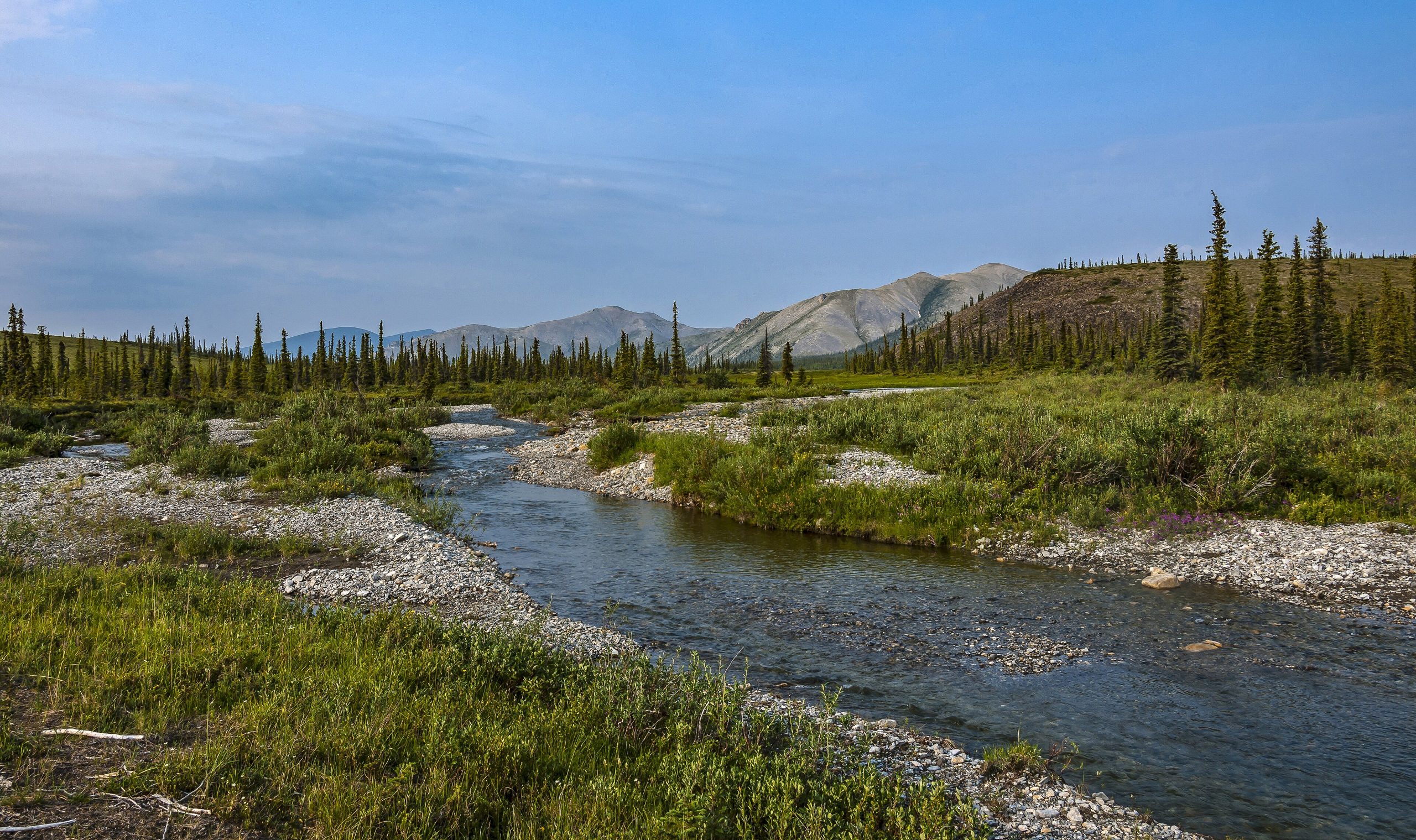
Unglaciated during the last ice age, Ivvavik has a distinctive, rounded look, the ancient British Mountains, broad tundra valleys, and the Firth River cutting through canyons toward the Arctic coast. Treeless and shaped by permafrost, it bursts briefly into wildflowers and birdsong each summer, when caribou move across the land and grizzlies range the slopes.
Best time to go
The short Arctic summer, June through August, is the only practical window, when the Firth is runnable and the tundra is (relatively) mild, though cold, wind and snow are always possible and insects peak at midsummer. Outside summer the park is locked in Arctic cold and darkness.
Getting there and around
Access is by charter aircraft from Inuvik to a landing strip within the park; there are no roads or scheduled flights. Once in, travel is by raft on the Firth or on foot across the tundra, and most visitors come through Parks Canada’s guided base-camp program or a licensed outfitter, as full self-support demands serious Arctic experience.
Things to do
Rafting the Firth River through the British Mountains is the classic Ivvavik expedition, past canyons, tundra and archaeological sites. The guided base camp at Sheep Creek offers hiking, wildlife and bird watching, and cultural learning with Inuvialuit hosts, a rare, supported way to experience one of the wildest corners of Canada.
Staying safe
This is deep Arctic wilderness: carry a satellite communicator, be equipped for cold and storms any time, and respect grizzlies and swift, cold rivers. River rapids demand skill, the remoteness is total, and rescue is far off, travel with an outfitter or as a highly experienced, self-reliant party.
Know before you go
A Parks Canada pass and registration are required, and you must arrange charter flights; most people join the guided base-camp program or an outfitter. This page is a general overview, not a live conditions report; always confirm current access, conditions and options with Parks Canada before your trip.
- Coordinates
- 69.1042, -139.5673
- Magnetic declination
- 17.2° E (2026)
Set this declination on your compass, then align it to the map's north lines; it is the angle between true north and magnetic north, refreshed each year.
A spread of the park’s main places shows straight away, and the rest appear as you zoom in. You can also search above, or pick any place from the lists below, and the map will go to it.
Getting there 4
Airstrips
On the trail 2
Campgrounds
Sights 3
Peaks
Map data comes from third-party sources and may be incomplete or out of date, so carry a current official map (terms).
- Best seasons
- Summer (June to August, fly-in/guided)
- Difficulty
- Strenuous (remote Arctic, fly-in)
- Access / trailheads
- In the northern Yukon on the Beaufort Sea coast. Access is by chartered aircraft from Inuvik, NWT; there are no roads.
- Water
- Rivers and streams; filter or treat all water.
- Cell / satellite coverage
- No cell service. Carry a satellite communicator and file a trip plan.
- Nearest ranger / SAR / emergency
- Coordinate through Parks Canada in Inuvik; response is very limited.
- Permits & regulations
- A Parks Canada pass and registration are required; access is by charter aircraft, and most visitors travel with the park’s guided base-camp program or an outfitter.
- Leave No Trace
- Pack out everything, protect fragile tundra, respect Inuvialuit heritage, and follow strict Leave No Trace.
January
- Below freezing all day
February
- Below freezing all day
March
- Below freezing all day
April
- Below freezing all day
May
- Below-freezing nights
June
July
August
September This month
- Below-freezing nights
October
- Below freezing all day
November
- Below freezing all day
December
- Below freezing all day
What to bring depends on your trip: how long you’re out, where you sleep, and how far you go from the road. The planner builds the list for yours.
Plan a trip here →Averages for 1981–2010 from Environment Canada climate normals, measured at the Old Crow Airport station, 106 miles (171 km) away at 821 feet (250 m). That is the nearest station with long-term records, so treat these as a regional guide. Conditions change with elevation: expect it colder higher up.