

Grand Teton National Park
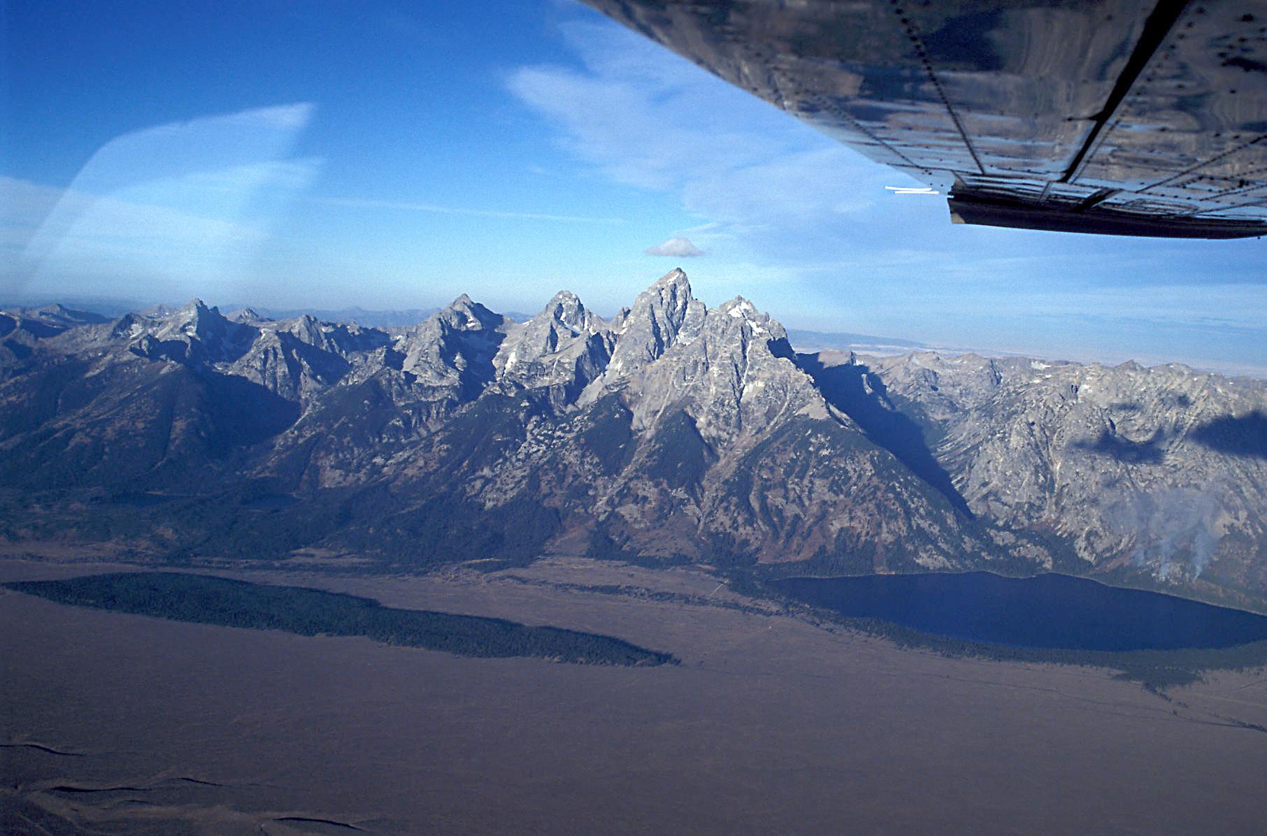
Few mountain views on Earth rival the Tetons, a young, jagged range that rockets straight up more than a mile from the flat floor of Jackson Hole, with no foothills to soften the drama. Mirror-still lakes at their base, the Snake River winding through sage flats, and abundant wildlife make Grand Teton a photographer’s dream and a mountaineer’s proving ground in northwest Wyoming.
Fast facts
- Established: 1929 (expanded 1950)
- Size: about 310,000 acres (1,300 km²) in northwest Wyoming
- High point: the Grand Teton, 13,775 feet (4,199 m)
- Setting: the Teton Range rising above Jackson Hole and the Snake River
- Gateway: Jackson, Wyoming (just south of Yellowstone)
- Managed by: National Park Service
The landscape
The fault-block Teton Range rises abruptly above the valley, its peaks cradling small glaciers and its base strung with jewel-like lakes, Jenny, Jackson, Leigh and more. Below spread the sage flats and cottonwood bottoms of Jackson Hole, threaded by the Snake River. The mix of alpine, forest, lake and valley supports grizzly and black bears, moose, elk, bison, pronghorn and beavers.
Best time to go
Summer through early fall is prime, with the high trails clear, warm days and long light; September adds golden aspens and the elk rut. Snow lingers on the peaks into summer and returns in fall. Winter is deep and cold, with the interior road closed but superb cross-country skiing, snowshoeing and wildlife watching.
Getting there and around
The park lies just south of Yellowstone, reached via US-26/89/191, with Jackson as the main gateway and Jackson Hole Airport actually inside the park. A vehicle is the practical way to travel the park road and reach trailheads, lakes and overlooks; the two parks are easily combined into one trip.
Things to do
Hike to Inspiration Point and Hidden Falls at Jenny Lake, into Cascade and Paintbrush canyons, or up to alpine lakes; the Grand itself is a classic guided climb. Paddle or cruise the lakes, float the Snake River for wildlife and reflections, drive Mormon Row and the wildlife-rich valley, and watch for moose and bears at dawn and dusk.
Staying safe
This is grizzly and black bear country. Carry bear spray, make noise and store food properly. Mountain weather turns fast with cold and lightning, snow lingers high into summer, rivers run cold and swift, and the peaks are serious mountaineering terrain, so match objectives to your skills and start early.
Know before you go
A park pass is required, and backcountry, climbing and boating permits are needed for those activities. Some are competitive, so plan ahead. Campgrounds fill fast in summer. This page is a general overview, not a live conditions report; always confirm current conditions, closures and permits with the National Park Service before your trip.
- Coordinates
- 43.8110, -110.6856
- Magnetic declination
- 10.7° E (2026)
Set this declination on your compass, then align it to the map's north lines; it is the angle between true north and magnetic north, refreshed each year.
A spread of the park’s main places shows straight away, and the rest appear as you zoom in. You can also search above, or pick any place from the lists below, and the map will go to it.
Getting there 7
Park entrances
Airstrip
Ranger stations
On the trail 42
Trailheads
Campgrounds
Picnic sites
Sights 82
Viewpoints
Waterfalls
Beach
Point of interests
Islands
Peaks 30
Map data comes from third-party sources and may be incomplete or out of date, so carry a current official map (terms).
- Best seasons
- Summer, Early fall
- Difficulty
- Easy to strenuous
- Access / trailheads
- In northwest Wyoming just south of Yellowstone, via US-26/89/191; Jackson is the main gateway, with Jackson Hole Airport inside the park boundary.
- Water
- Abundant lakes, rivers and streams; filter or treat all backcountry water.
- Cell / satellite coverage
- Limited cell service away from developed areas. Carry a map and a satellite messenger.
- Nearest ranger / SAR / emergency
- Contact park rangers; life-threatening emergencies: 911.
- Permits & regulations
- Per-vehicle entry fee (America the Beautiful pass accepted); backcountry camping and climbing bivouacs need permits, and boats require a permit.
- Leave No Trace
- Use bear-proof storage, stay on trails, pack out all waste, and follow Leave No Trace.
January
- Below freezing all day
February
- Below freezing all day
March
- Below-freezing nights
April
- Below-freezing nights
May
June
- Day-to-night swing of 32°F (18°C)
July
- Day-to-night swing of 38°F (21°C)
August
- Day-to-night swing of 39°F (22°C)
September This month
- Day-to-night swing of 37°F (21°C)
October
- Below-freezing nights
- Day-to-night swing of 31°F (17°C)
November
- Below-freezing nights
December
- Below freezing all day
What to bring depends on your trip: how long you’re out, where you sleep, and how far you go from the road. The planner builds the list for yours.
Plan a trip here →Averages for 1991–2020 from NOAA U.S. Climate Normals, measured at the Moose station, 7 miles (11 km) away at 6,444 feet (1,964 m). Conditions change with elevation: expect it colder higher up.