

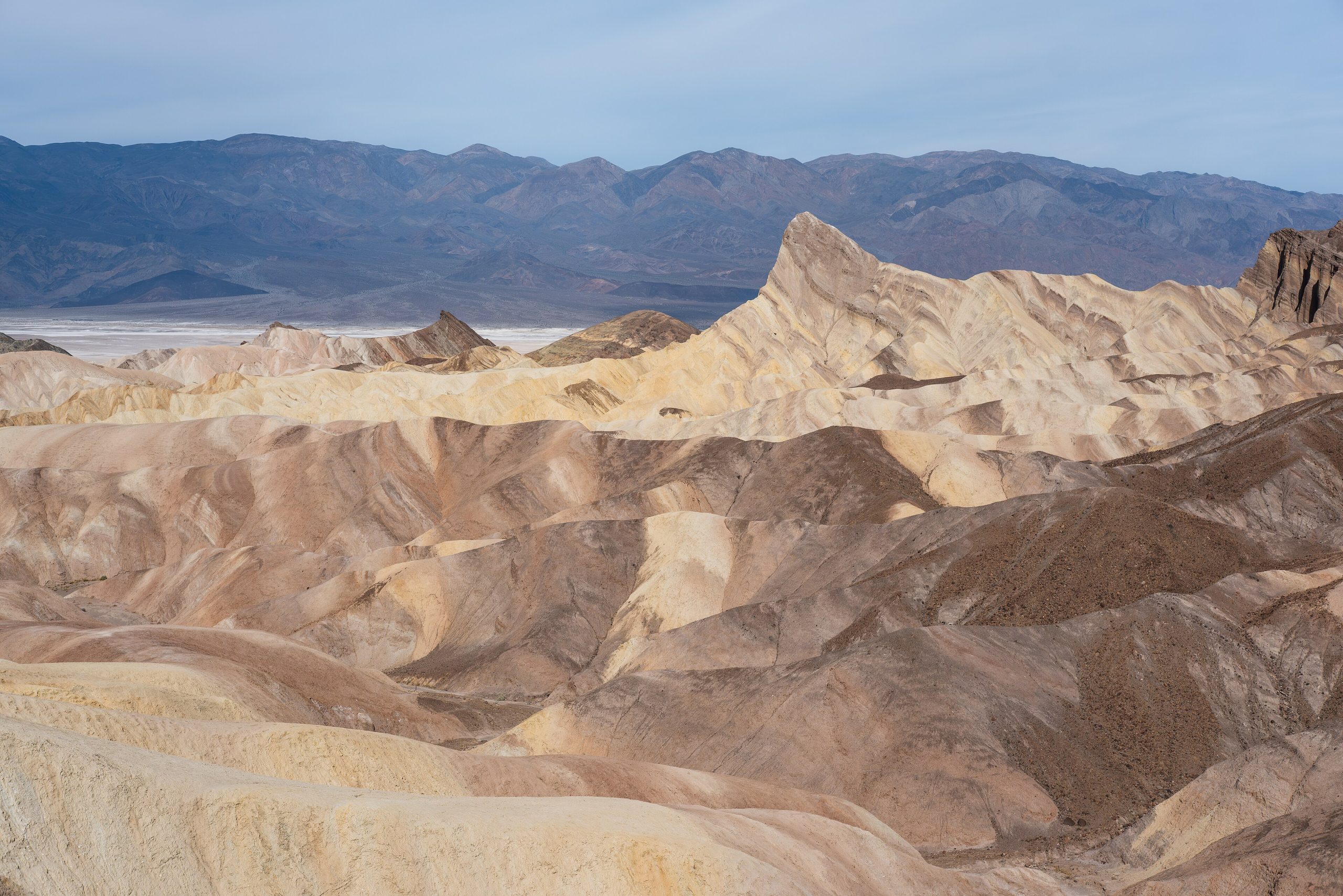
Death Valley National Park
Death Valley is a land of superlatives, the hottest, driest and lowest place in North America, where summer air temperatures have topped 130°F (54°C) and the salt flats of Badwater Basin sink to 282 feet (86 m) below sea level. Yet this vast desert is also achingly beautiful: sculpted badlands, rolling dunes, wildflower spring blooms and some of the darkest, starriest skies in the country.
Fast facts
- Established: national monument 1933; national park in 1994
- Size: about 3.4 million acres (14,000 km²), the largest national park in the lower 48
- Extremes: lowest point in North America (Badwater, −282 ft / −86 m) and record heat
- Dark sky: a certified International Dark Sky Park
- Gateways: Lone Pine, California and Las Vegas, Nevada
- Managed by: National Park Service
The landscape
Death Valley is a deep basin walled by high desert ranges. The Panamint Mountains climb to over 11,000 feet (3,400 m) just west of the sub-sea-level valley floor. Salt flats, eroded badlands at Zabriskie Point, the Mesquite Flat sand dunes, colourful mineral hills and hidden canyons fill the basin, while the surrounding mountains catch snow in winter. Bighorn sheep, coyotes, and hardy desert plants and pupfish survive here.
Best time to go
Late fall through early spring is the only sensible time to explore actively, with pleasant days and cool nights, and, in rare wet years, a spectacular spring wildflower bloom. Summer is genuinely dangerous, with heat that can kill, so any summer visit means staying in a vehicle, near services, and out of the backcountry. Winter can bring snow to the high peaks above the warm valley floor.
Getting there and around
The park is enormous and spread out, reached mainly via CA-190 from the Lone Pine area or from Las Vegas. Furnace Creek and Stovepipe Wells are the service hubs with fuel, water and lodging. Distances between sights are long, many roads are remote, and some backcountry routes require high-clearance or 4WD, so plan fuel, water and time carefully.
Things to do
Drive to Badwater Basin’s salt flats, catch sunrise at Zabriskie Point, wind through Artists Palette, and walk the Mesquite Flat dunes. Hikes lead into Golden Canyon and Mosaic Canyon and up to Dante’s View, higher routes climb Telescope Peak in the cool season, and after dark the park is one of the finest stargazing destinations in the country.
Staying safe
Heat is the overriding danger: in the warm months, do not hike in the low country after morning, carry and drink far more water than seems necessary, and never rely on finding water in the park. Watch for flash floods in canyons during storms, fuel up before long drives, and prepare for vast distances with no cell service. Carry extra water, a paper map and a satellite messenger.
Know before you go
A park pass is required, backcountry camping is by free self-registration, and services are concentrated at Furnace Creek and Stovepipe Wells, so plan fuel and water around the distances. This page is a general overview, not a live conditions report; always confirm current conditions, road status and heat warnings with the National Park Service before your trip.
- Coordinates
- 36.4704, -117.1388
- Magnetic declination
- 11.6° E (2026)
Set this declination on your compass, then align it to the map's north lines; it is the angle between true north and magnetic north, refreshed each year.
A spread of the park’s main places shows straight away, and the rest appear as you zoom in. You can also search above, or pick any place from the lists below, and the map will go to it.
Getting there 7
Park entrance
Airstrips
Ranger stations
On the trail 33
Trailheads
Campgrounds
Picnic site
Sights 97
Viewpoints
Waterfalls
Heritage sites
Point of interests
Peaks 30
Map data comes from third-party sources and may be incomplete or out of date, so carry a current official map (terms).
- Best seasons
- Late fall, Winter, Early spring
- Difficulty
- Easy to strenuous
- Access / trailheads
- Vast park east of the Sierra straddling the California–Nevada line; main access via CA-190 from Lone Pine or Death Valley Junction, and from Las Vegas via NV-160/CA-190.
- Water
- Carry far more water than you think. There is little to none in most of the park; fill up at Furnace Creek or Stovepipe Wells.
- Cell / satellite coverage
- Little to no cell service across most of the park. Carry a paper map, extra water and a satellite messenger.
- Nearest ranger / SAR / emergency
- Contact park rangers at Furnace Creek; life-threatening emergencies: 911 (help can be far away).
- Permits & regulations
- Per-vehicle entry fee (America the Beautiful pass accepted); backcountry camping is by free self-registration, and some backcountry roads require high-clearance or 4WD.
- Leave No Trace
- Stay on established roads and trails, pack out all waste, protect fragile desert crust and springs, and follow Leave No Trace.
January
February
March
April
- Hot days
May
- Extreme daytime heat
June
- Extreme daytime heat
July
- Extreme daytime heat
August
- Extreme daytime heat
September This month
- Extreme daytime heat
October
- Hot days
November
December
What to bring depends on your trip: how long you’re out, where you sleep, and how far you go from the road. The planner builds the list for yours.
Plan a trip here →Averages for 1991–2020 from NOAA U.S. Climate Normals, measured at the Death Valley National Park station, 12 miles (20 km) away at −194 feet (−59 m). Conditions change with elevation: expect it colder higher up.