

Hot Springs National Park
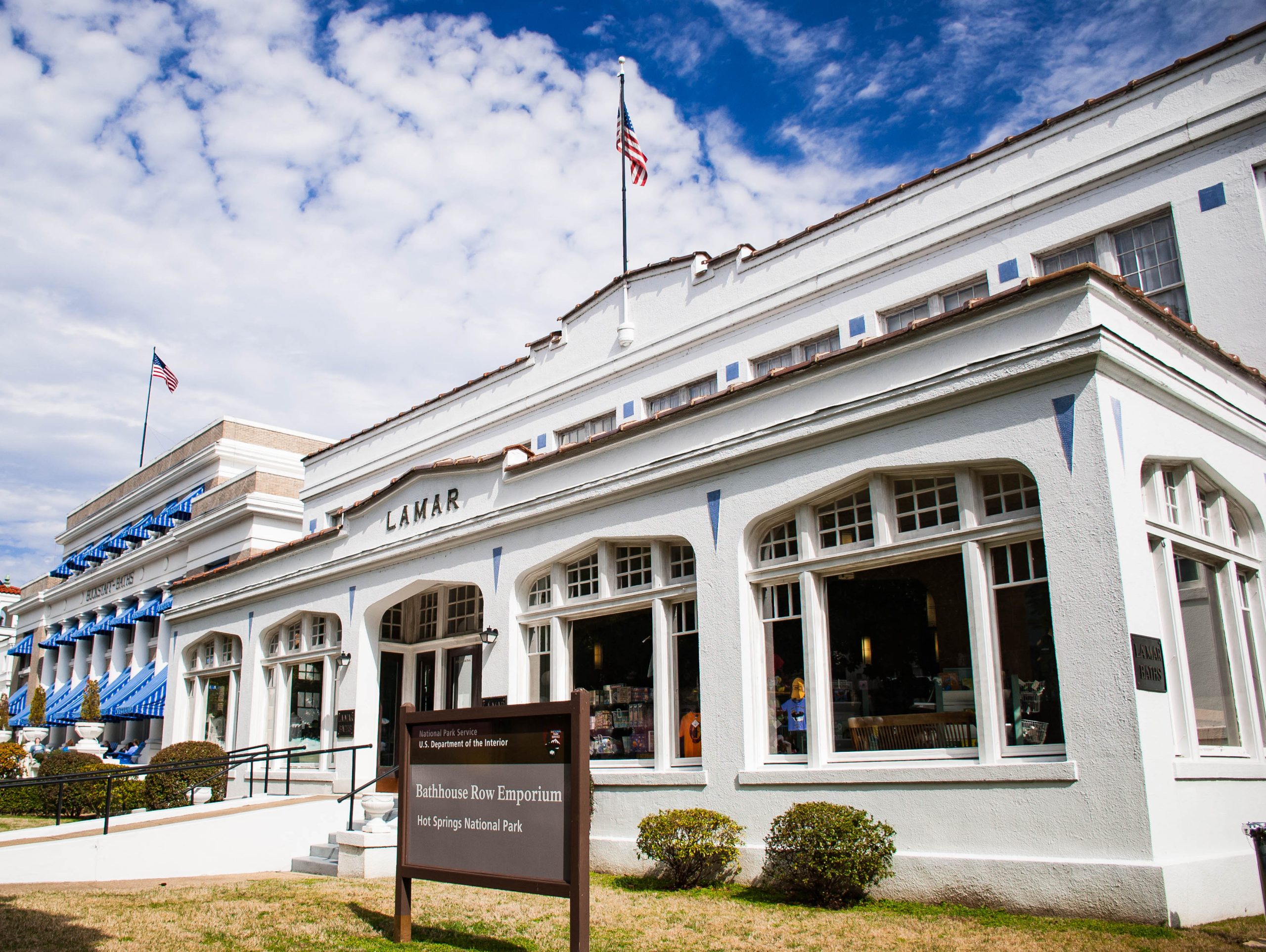
Hot Springs is the national park system’s most unusual member, a park woven into a working town, built around the 143°F (62°C) thermal waters that have drawn people to bathe here for centuries. Its centerpiece is the elegant Bathhouse Row, backed by forested hills laced with quiet trails, making it a rare place where a soak, a stroll and a mountain hike all sit within a few blocks of each other.
Fast facts
- Established: federal reservation 1832; national park in 1921
- Size: about 5,550 acres (22 km²), one of the smallest national parks
- Signature feature: 47 hot springs and historic Bathhouse Row
- Water temperature: the springs emerge near 143°F (62°C)
- Setting: within the city of Hot Springs, Arkansas
- Managed by: National Park Service
The landscape
The park drapes over the low, forested ridges of the Ouachita Mountains, where rainwater sinks deep, is geothermally heated, and rises again through the springs at the base of Hot Springs Mountain. Oak-hickory-pine woodland covers the slopes, turning gold and russet in autumn, and more than 26 miles (42 km) of trail thread the hills above the historic downtown corridor.
Best time to go
Spring and fall are the most pleasant, with mild temperatures, wildflowers or fall color, and comfortable hiking. Summer is hot and humid, though the shaded trails and cool bathhouses help; winter is mild by national-park standards and quiet, with the steaming springs at their most atmospheric.
Getting there and around
The park sits right in the city, easily reached off US-70 and AR-7, and its heart, Bathhouse Row, the visitor center in the Fordyce Bathhouse, and the thermal fountains, is walkable. A scenic drive climbs Hot Springs and West Mountains to overlooks and the observation tower, and trailheads branch off along the way.
Things to do
Tour the restored Fordyce Bathhouse museum, then take the waters at one of the two operating historic bathhouses, or fill a jug at the free public fountains. Walk the Grand Promenade behind Bathhouse Row, hike the wooded trails on Hot Springs and Sugarloaf Mountains, drive to the mountain-top tower for a view over the Ouachitas, and camp at Gulpha Gorge on the park’s edge.
Staying safe
The thermal water is genuinely scalding at the source, look but don’t touch the open springs, and let bathhouse staff manage soaking temperatures. In summer, guard against heat and humidity and carry water on the trails, which can be slick after rain. Ticks and chiggers are common in the warm months, so use repellent and check yourself afterward.
Know before you go
There is no entrance fee, and the bathhouses are run by private concessioners, so book spa services directly and ahead in busy seasons. The town supplies all lodging, dining and services. This page is a general overview, not a live conditions report; always confirm current hours, bathhouse operations and conditions with the National Park Service before your trip.
- Coordinates
- 34.5292, -93.0662
- Magnetic declination
- 0.2° E (2026)
Set this declination on your compass, then align it to the map's north lines; it is the angle between true north and magnetic north, refreshed each year.
A spread of the park’s main places shows straight away, and the rest appear as you zoom in. You can also search above, or pick any place from the lists below, and the map will go to it.
On the trail 1
Campground
Sights 6
Viewpoint
Point of interest
Peaks
Map data comes from third-party sources and may be incomplete or out of date, so carry a current official map (terms).
- Best seasons
- Spring, Fall
- Difficulty
- Easy to moderate
- Access / trailheads
- In the city of Hot Springs, Arkansas, off US-70/AR-7; the historic Bathhouse Row and visitor center are walkable, with a scenic drive up Hot Springs and West Mountains.
- Water
- Fill jugs free at the public thermal and cold-spring fountains; trail water is limited, so carry your own.
- Cell / satellite coverage
- Good cell coverage given the urban setting; patchier on the mountain trails.
- Nearest ranger / SAR / emergency
- Contact park rangers or city dispatch; life-threatening emergencies: 911.
- Permits & regulations
- No entrance fee. Gulpha Gorge Campground is first-come or reservable; bathhouse services are run by private concessioners.
- Leave No Trace
- Stay on trails, do not disturb the springs, pack out all waste, and follow Leave No Trace.
January
- Below-freezing nights
February
March
April
May
June
July
- Hot days
August
- Hot days
September This month
October
November
December
What to bring depends on your trip: how long you’re out, where you sleep, and how far you go from the road. The planner builds the list for yours.
Plan a trip here →Averages for 1991–2020 from NOAA U.S. Climate Normals, measured at the Hot Springs station, 1 miles (2 km) away at 626 feet (191 m). Conditions change with elevation: expect it colder higher up.