

Yosemite National Park
Yosemite is the crown jewel of the Sierra Nevada, ancient granite monoliths rising from meadow floors, some of the tallest waterfalls in North America thundering off the cliffs, and groves of giant sequoias standing where they have stood for millennia. A UNESCO World Heritage Site and biosphere reserve, it is also one of America’s busiest parks, which is exactly why a little planning pays off: the same access that makes Yosemite Valley easy also fills its parking lots before dawn.
Fast facts
- Established: 1890 (first protected as a state reservation in 1864)
- Size: about 759,000 acres (1,187 square miles / 3,070 km²)
- Elevation: roughly 2,000 ft (600 m) in the foothills to 13,114 ft (3,997 m) at Mount Lyell
- Visitors: around 3.5–4 million a year
- Landmarks: El Capitan, Half Dome, Yosemite Falls, Glacier Point, Mariposa Grove
- Managed by: National Park Service
The landscape
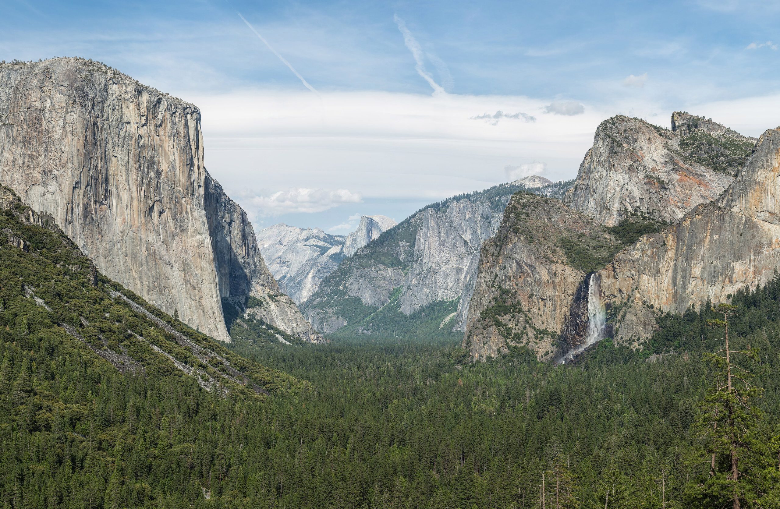
Yosemite is a landscape carved by glaciers, rivers and time. Massive granite formations, the sheer face of El Capitan, the rounded crown of Half Dome, frame the U-shaped Yosemite Valley, where the Merced River winds through meadow and forest. Waterfalls plunge from high cliffs, giant sequoias stand in three groves, and beyond the valley the park climbs into high alpine terrain of clear lakes, rugged peaks and open wilderness.
Best time to go
Spring is the waterfall season, when snowmelt drives Yosemite Falls and Bridalveil Fall to their peak, though high trails may still be snowbound. Summer opens every road and trail, and brings the biggest crowds and afternoon high-country thunderstorms. Fall thins the crowds and turns the aspens gold, and winter blankets the valley in snow for snowshoeing and cross-country skiing while high-elevation areas close.
Getting there and around
Four highway entrances serve the park: CA-140 and CA-41 stay open year-round, while CA-120 (Tioga Road) and CA-120W close seasonally for snow. The nearest airports, Fresno, Sacramento and Oakland, are a 2–4 hour drive. Inside, the free Yosemite Valley shuttle links trailheads, lodges and visitor centers; outside the valley you need a vehicle, and peak-season parking or entry reservations may be required, so check the NPS site first.
Things to do
Hiking spans everything from flat valley strolls to the strenuous Mist Trail and the permit-only Half Dome cables. El Capitan and Half Dome are world-famous rock-climbing objectives with guiding and rentals in the valley. Photographers chase sunrise at Taft Point and sunset at Glacier Point, wildlife watchers look for mule deer, black bears and peregrine falcons, and rangers run free walks, talks and stargazing programs.
Staying safe
Black bears are common, so never leave food or scented items unattended and always use the bear-proof lockers. Conditions change fast, carry layers, sun protection and plenty of water, and many trails involve steep drop-offs, so stay on marked paths near cliffs and waterfalls. River currents are strong and cold year-round, and drowning is a leading cause of park fatalities, so never swim in waterfalls or cross swollen streams. At elevation, hydrate and watch for altitude sickness, and download offline maps since cell service is minimal.
Know before you go
Popular activities, the Half Dome cables, wilderness camping, certain lodges, require advance permits or reservations, and the park may run peak-season parking or entry reservations, so always verify current requirements with the National Park Service. Valley campgrounds fill months ahead. This page is a general overview, not a live conditions report; confirm current closures, reservations and permits with the NPS before your trip.
- Coordinates
- 37.8392, -119.5428
- Magnetic declination
- 12.3° E (2026)
Set this declination on your compass, then align it to the map's north lines; it is the angle between true north and magnetic north, refreshed each year.
A spread of the park’s main places shows straight away, and the rest appear as you zoom in. You can also search above, or pick any place from the lists below, and the map will go to it.
Getting there 22
Park entrances
Visitor centre
Ranger stations
On the trail 100
Trailheads
Campgrounds
Hut or shelters
Picnic sites
Sights 108
Viewpoints
Waterfalls
Beach
Heritage sites
Point of interests
Peaks 30
Map data comes from third-party sources and may be incomplete or out of date, so carry a current official map (terms).
- Best seasons
- Spring (waterfalls), Summer, Fall
- Difficulty
- Easy to strenuous
- Access / trailheads
- Four highway entrances (CA-140, CA-41, CA-120 and CA-120W); Tioga Road (CA-120) closes in winter. The free Yosemite Valley shuttle links major trailheads and lodges.
- Water
- Abundant rivers, lakes and streams; filter or treat all backcountry water.
- Cell / satellite coverage
- Cell coverage is extremely limited or absent in most of the park. Download offline maps and share your itinerary.
- Nearest ranger / SAR / emergency
- Yosemite dispatch via visitor centers; life-threatening emergencies: 911.
- Permits & regulations
- Per-vehicle entry fee (America the Beautiful pass accepted); Half Dome cables and wilderness camping require permits, and peak-season parking or entry reservations may apply.
- Leave No Trace
- Use bear-proof lockers, pack out all trash, stay on marked trails, and follow Leave No Trace to protect fragile high-country terrain.
January
- Below-freezing nights
February
- Below-freezing nights
March
April
May
June
- Day-to-night swing of 30°F (17°C)
July
- Day-to-night swing of 32°F (18°C)
August
- Day-to-night swing of 32°F (18°C)
September This month
- Day-to-night swing of 32°F (18°C)
October
- Day-to-night swing of 30°F (17°C)
November
December
- Below-freezing nights
What to bring depends on your trip: how long you’re out, where you sleep, and how far you go from the road. The planner builds the list for yours.
Plan a trip here →Averages for 1991–2020 from NOAA U.S. Climate Normals, measured at the Yosemite Park HQ station at 4,018 feet (1,225 m). Conditions change with elevation: expect it colder higher up.