

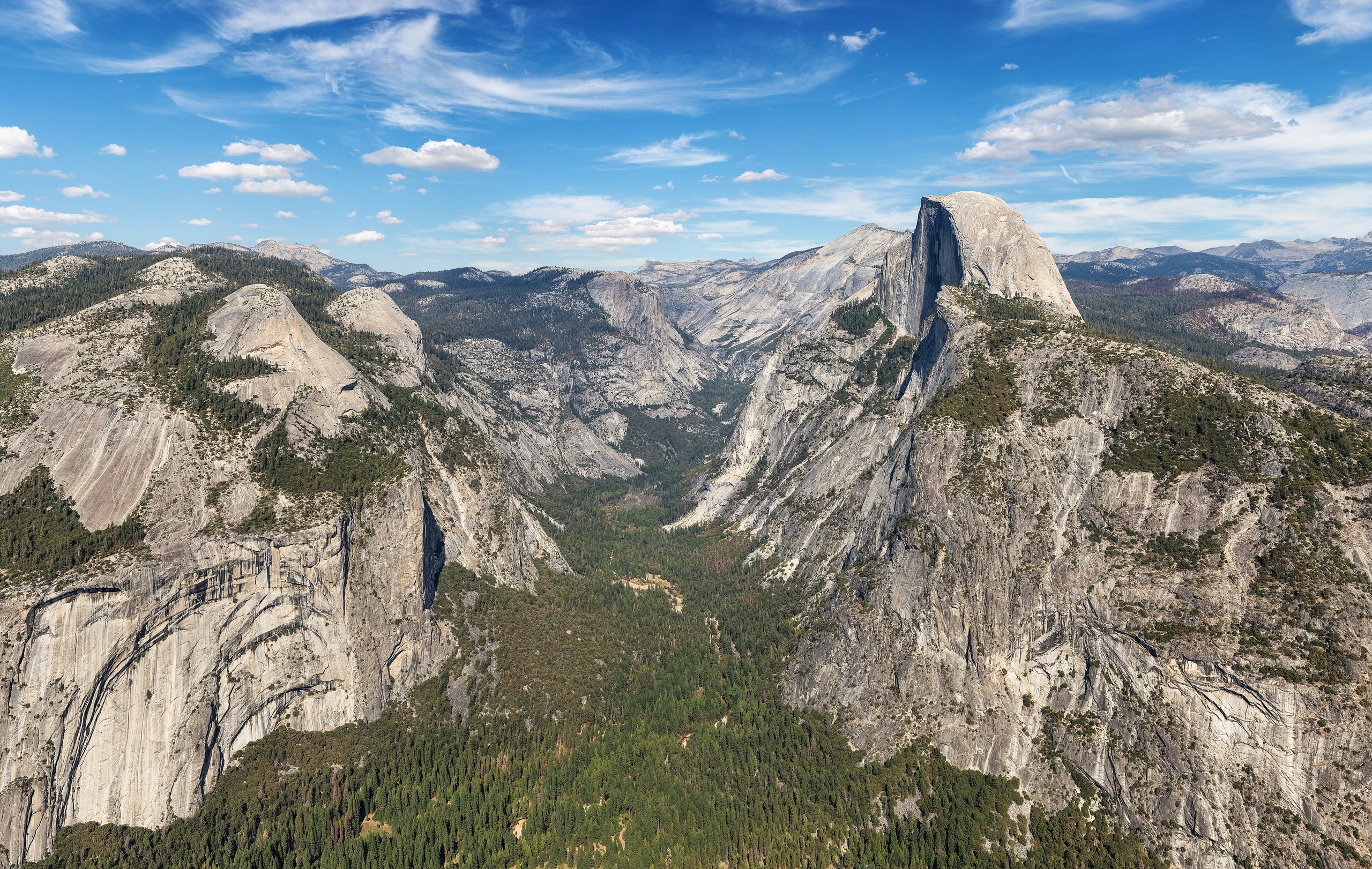
Top 12 things to do in Yosemite National Park
Most visitors to Yosemite spend their time in Yosemite Valley, a glacier-cut trough 7 miles (11 km) long that holds the waterfalls and cliffs the park is known for. The valley is under one percent of the park. The rest is high country, sequoia groves and a second, quieter valley. These are the twelve outings we would put first. The order starts with what the park is known for, then goes by what an outing gives back for the time and effort it takes. Distances and climbs are National Park Service figures; times are estimates and do not include stops.
Waterfalls here run on snowmelt. They peak in May and June, and several, Yosemite Falls among them, are dry or nearly so by late August. In some years the park requires a reservation to drive in at busy times, and the roads to Glacier Point and Tuolumne Meadows are closed by snow from about November to late May or June.
1. Stop at Tunnel View
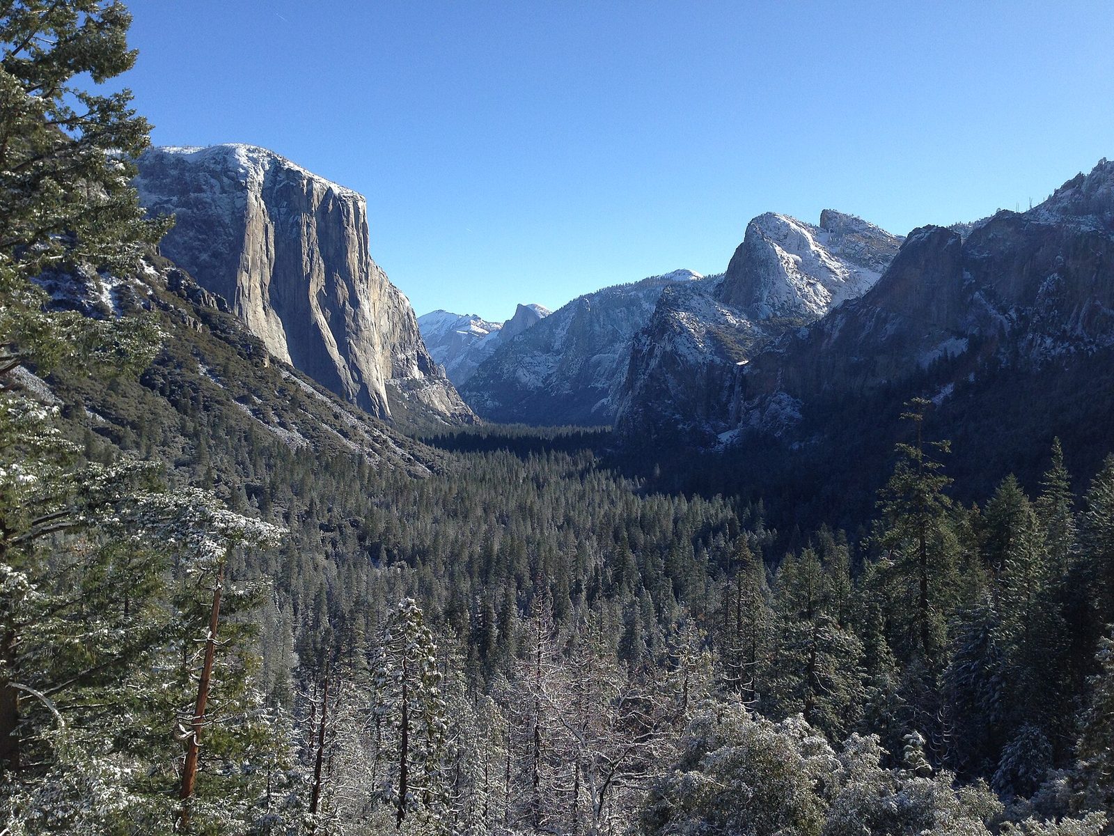
This is the first sight of the valley for anyone arriving from the south, and the most photographed view in the park: El Capitan on the left, Bridalveil Fall on the right, and Half Dome at the far end. It takes two minutes from the car. Then drive down to the Bridalveil Fall parking area for the short paved walk to the base of the 620-foot (189 m) fall, which runs all year and throws spray across the path in spring.
- Distance: at the roadside; about half a mile (800 m) round trip to Bridalveil Fall
- Allow: 15 minutes for the view; 45 minutes with the fall
- Start: the east end of the Wawona Tunnel on Wawona Road (Highway 41)
- When: all year. Late afternoon puts the light on El Capitan and Half Dome.
- Suits: everyone
2. Climb the Mist Trail to Vernal and Nevada falls
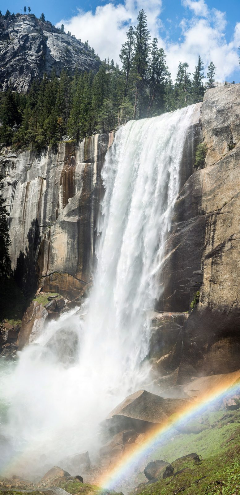
If you take one hike in Yosemite, take this one. The trail follows the Merced River up from the valley floor to a footbridge with the first view of Vernal Fall, then climbs beside the fall on more than 600 granite steps. In spring the spray soaks everyone on them, so bring a rain shell and expect slick rock. The top of Vernal Fall is a broad granite shelf at the lip of the 317-foot (97 m) drop. Strong hikers carry on to the top of Nevada Fall, 594 feet (181 m) high, and come down by the John Muir Trail for a different view of both.
The river above each fall looks calm and is not. People who waded or swam at Emerald Pool and near the brinks have been swept over the falls. Stay out of the water.
- Distance: 1.6 miles (2.6 km) round trip to the footbridge; 2.4 miles (3.9 km) to the top of Vernal Fall; 5.4 miles (8.7 km) to the top of Nevada Fall
- Climb: 400 feet (120 m) to the footbridge; 1,000 feet (300 m) to Vernal Fall; 2,000 feet (610 m) to Nevada Fall
- Allow: 1.5 hours, 3 hours, or 5 to 6 hours
- Start: Happy Isles, shuttle stop 16
- When: April to October; May and June for the most water. Part of the trail closes in winter for ice.
- Suits: most walkers to the footbridge; fit hikers beyond it
3. Walk to the base of Yosemite Falls
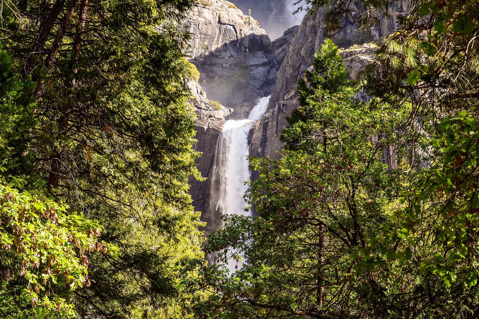
Yosemite Falls drops 2,425 feet (739 m) in three tiers, the highest waterfall in the park and one of the tallest in North America. A paved loop leads through the trees to a bridge at the foot of the lower fall, close enough in May to feel the wind and spray it makes. The eastern half of the loop is level and suits wheelchairs. By late summer the fall is usually a dark stain on the rock, so make this a spring stop.
- Distance: a loop of 1 mile (1.6 km)
- Allow: 30 to 45 minutes
- Start: Lower Yosemite Fall, shuttle stop 6
- When: March to June for water; frozen spray builds a cone of ice at the base in winter
- Suits: everyone
4. Look down from Glacier Point
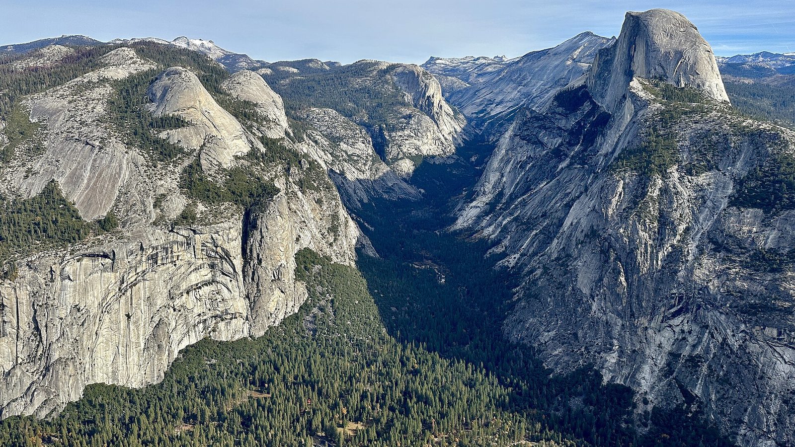
Glacier Point sits on the valley’s south rim at about 7,200 feet (2,195 m), some 3,200 feet (975 m) straight above the valley floor. Half Dome is level with you across the gap, Vernal and Nevada falls step down to the right, and the high Sierra runs along the horizon. The viewpoint is a short paved walk from the parking area.
Two short trails start from the same road a little way back. Sentinel Dome is a walk up bare granite to a view in every direction, and Taft Point ends at a railing on the edge of a sheer wall, beside fissures that split the rim. Each is 2.2 miles (3.5 km) round trip. Stay for sunset, when Half Dome turns orange.
- Distance: a few hundred yards to the viewpoint; 2.2 miles (3.5 km) round trip each for Sentinel Dome and Taft Point
- Allow: 1 hour at the point, plus an hour’s drive each way from the valley; half a day with a trail
- Start: the end of Glacier Point Road
- When: about late May to November, while the road is open
- Suits: everyone at the viewpoint. Keep children in hand at Taft Point, which has one short railing and long unfenced edges.
5. Climb Half Dome
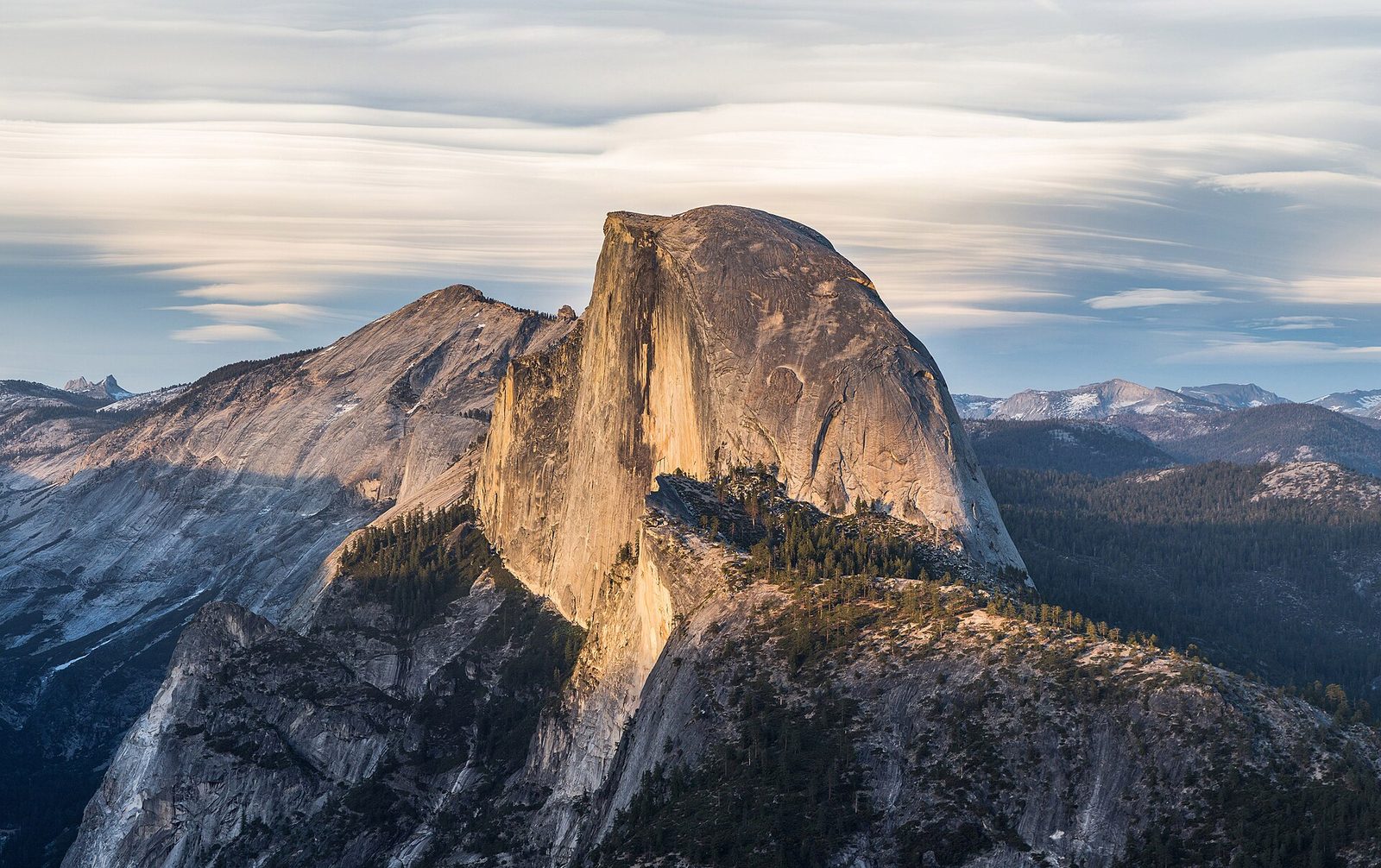
Half Dome is the park’s signature summit, nearly 5,000 feet (1,500 m) above the valley floor, and the hike to it is a very long, hard day. The route goes up the Mist Trail past both falls, through Little Yosemite Valley, and up a steep shoulder of granite steps. The last 400 feet (120 m) climb the bare dome between two steel cables, pulling yourself up with your arms. The view from the broad summit runs from the valley to the Sierra crest.
A permit is required to go up the cables, issued by lottery in March with a small daily lottery two days ahead. Start before dawn, carry at least a gallon (4 litres) of water each, and wear gloves with grip. Turn around if clouds build: the dome is struck by lightning often, and the granite is slick when wet. People have died in both ways.
- Distance: 14 to 16 miles (22.5 to 26 km) round trip, depending on the route
- Climb: 4,800 feet (1,460 m)
- Allow: 10 to 12 hours
- Start: Happy Isles, shuttle stop 16
- When: about late May to early October, while the cables are up
- Needs: a Half Dome permit for every hiker
- Suits: very fit hikers with no fear of heights
6. Walk among the giant sequoias in Mariposa Grove
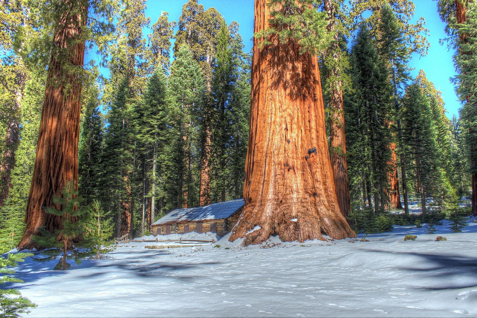
Mariposa Grove holds several hundred mature giant sequoias, the largest trees on Earth by volume. A short accessible loop near the arrival area gives a first look. The Grizzly Giant Loop goes farther, to the Grizzly Giant, which is about 3,000 years old and has one limb nearly 7 feet (2 m) thick, and to the California Tunnel Tree, cut in 1895 so that stagecoaches could drive through it. In 1864 Abraham Lincoln signed the act that protected this grove and Yosemite Valley, the first time the United States set land aside for the public in this way.
- Distance: 2 miles (3.2 km) for the Grizzly Giant Loop
- Climb: 300 feet (90 m)
- Allow: 1.5 to 2 hours, plus the shuttle
- Start: Mariposa Grove Welcome Plaza near the South Entrance. A free shuttle runs the last 2 miles (3.2 km) from spring to fall; at other times you walk the road.
- When: April to November for the shuttle; open to walkers, skiers and snowshoers in winter
- Suits: everyone
7. Drive the Tioga Road to Tuolumne Meadows
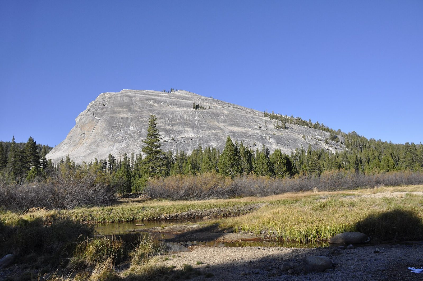
The Tioga Road crosses the park’s high country, climbing from forest to bare granite and ending at Tioga Pass, 9,943 feet (3,031 m). Olmsted Point looks back down Tenaya Canyon at the far side of Half Dome. Tenaya Lake, ringed by granite at 8,150 feet (2,484 m), has sandy beaches and cold, clear water. Tuolumne Meadows, at 8,619 feet (2,627 m), is a wide sub-alpine meadow along the river with domes on every side.
For a short hike there, Lembert Dome is a steep climb to bare granite above the meadows. The air is thin, the days are cooler than the valley by 15 to 20°F (8 to 11°C), and thunderstorms build on summer afternoons.
- Distance: about 55 miles (89 km) from Yosemite Valley to Tuolumne Meadows; 2.8 miles (4.5 km) round trip up Lembert Dome, with 850 feet (260 m) of climbing
- Allow: a full day from the valley
- Start: Crane Flat, where the Tioga Road leaves the Big Oak Flat Road
- When: about June to October. Wildflowers peak in July.
- Suits: everyone by car; the hikes start high, so take the first day easily
8. Cycle the valley floor and watch climbers on El Capitan
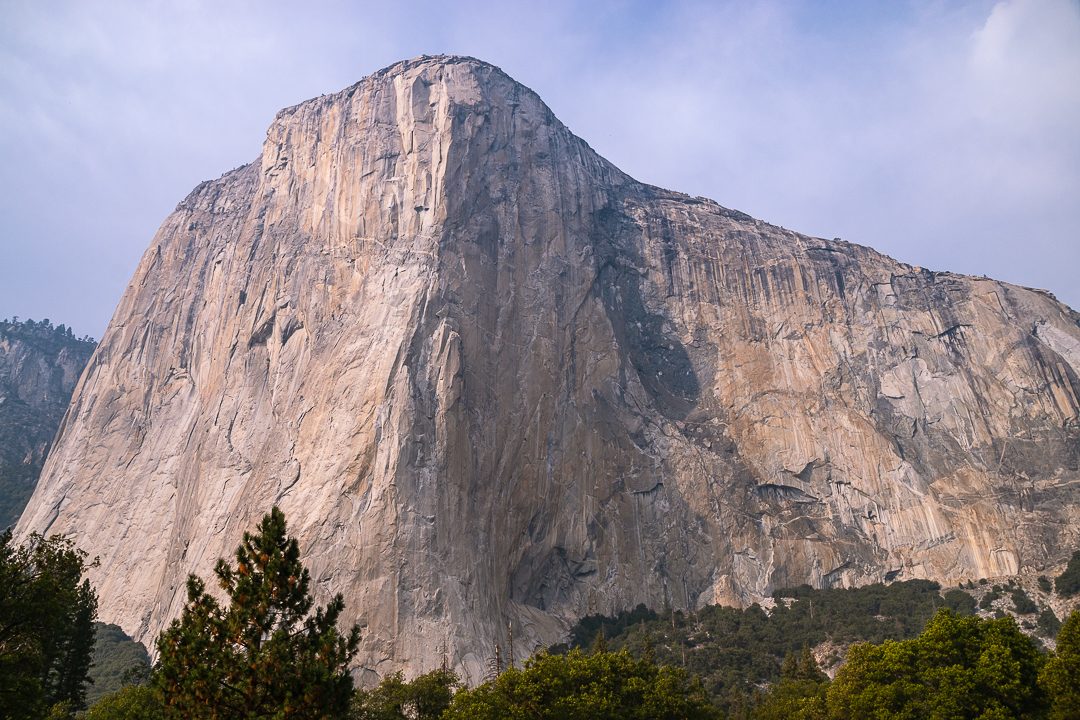
The valley has more than 12 miles (19 km) of paved, nearly level bike paths, and riding them is the best way to see it in summer, when the roads are slow and the parking is full. Bikes are rented in the valley. Ride west to El Capitan Meadow and look up: the wall is about 3,000 feet (914 m) high, and with binoculars you can pick out climbers on it, and at night their headlamps. Most parties take several days and sleep on the wall. Camp 4, where modern big-wall climbing began in the 1950s and 1960s, is on the way back.
- Distance: about 12 miles (19 km) of bike path in loops
- Allow: 2 to 4 hours
- Start: Yosemite Village or Curry Village
- When: April to October; May and September are the main climbing seasons
- Suits: families and anyone who can ride a bike
9. Hike to the top of Yosemite Falls
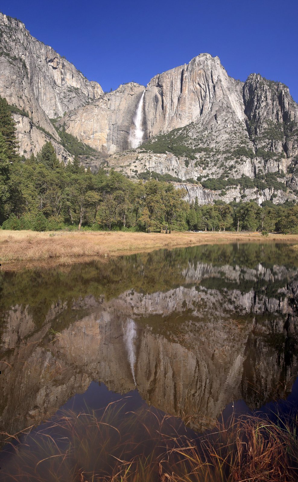
One of the oldest trails in the park, built in the 1870s, climbs the valley’s north wall in dozens of switchbacks to the brink of the upper fall, 1,430 feet (436 m) above its base. Columbia Rock, a mile up, is a worthwhile goal on its own, with a view along the valley to Half Dome. Above it the trail comes close under the fall, then climbs a steep, sunny gully to the rim. It is a harder day than its length suggests: the climb is unbroken, and the upper half has no shade. Start early and carry plenty of water.
- Distance: 2 miles (3.2 km) round trip to Columbia Rock; 7.2 miles (11.6 km) round trip to the top
- Climb: 1,000 feet (300 m) to Columbia Rock; 2,700 feet (820 m) to the top
- Allow: 2 to 3 hours, or 6 to 8 hours
- Start: Camp 4, shuttle stop 7
- When: April to June for water; passable most of the year, with ice in winter
- Suits: fit hikers; Columbia Rock suits most walkers used to hills
10. Walk to Mirror Lake
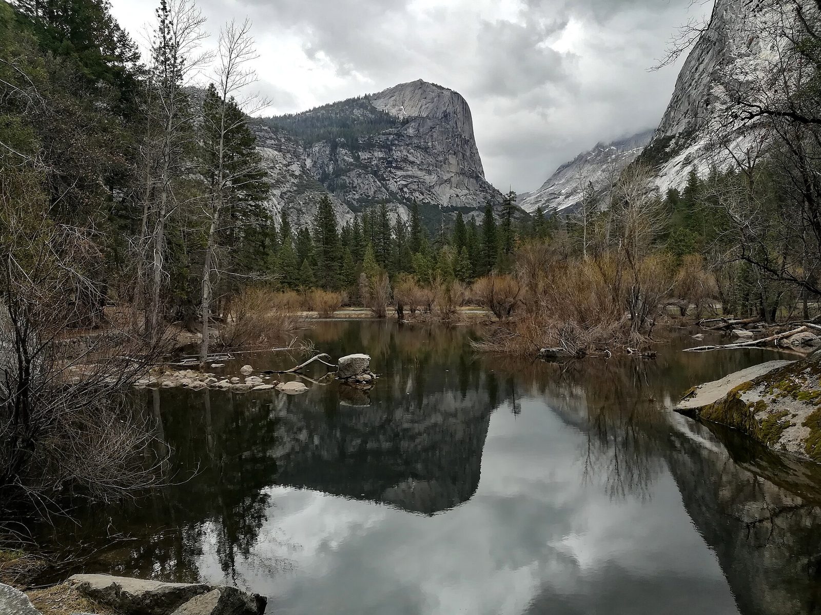
An old paved road leads up Tenaya Creek to a shallow pool at the foot of Half Dome, where the cliff rises almost a mile overhead. In spring, on a still morning, the pool reflects Half Dome and Mount Watkins. By late summer it has dried to a sandy meadow, the last stage of a lake that is slowly filling in. A longer loop continues up the canyon and back on the far side of the creek.
- Distance: 2 miles (3.2 km) round trip to the lake; 5 miles (8 km) for the loop
- Allow: 1 hour, or 2 to 3 hours for the loop
- Start: Mirror Lake Trailhead, shuttle stop 17
- When: April to June for water and reflections; a pleasant level walk in any season
- Suits: families; the road to the lake takes strollers and bikes part of the way
11. See Hetch Hetchy and Wapama Falls
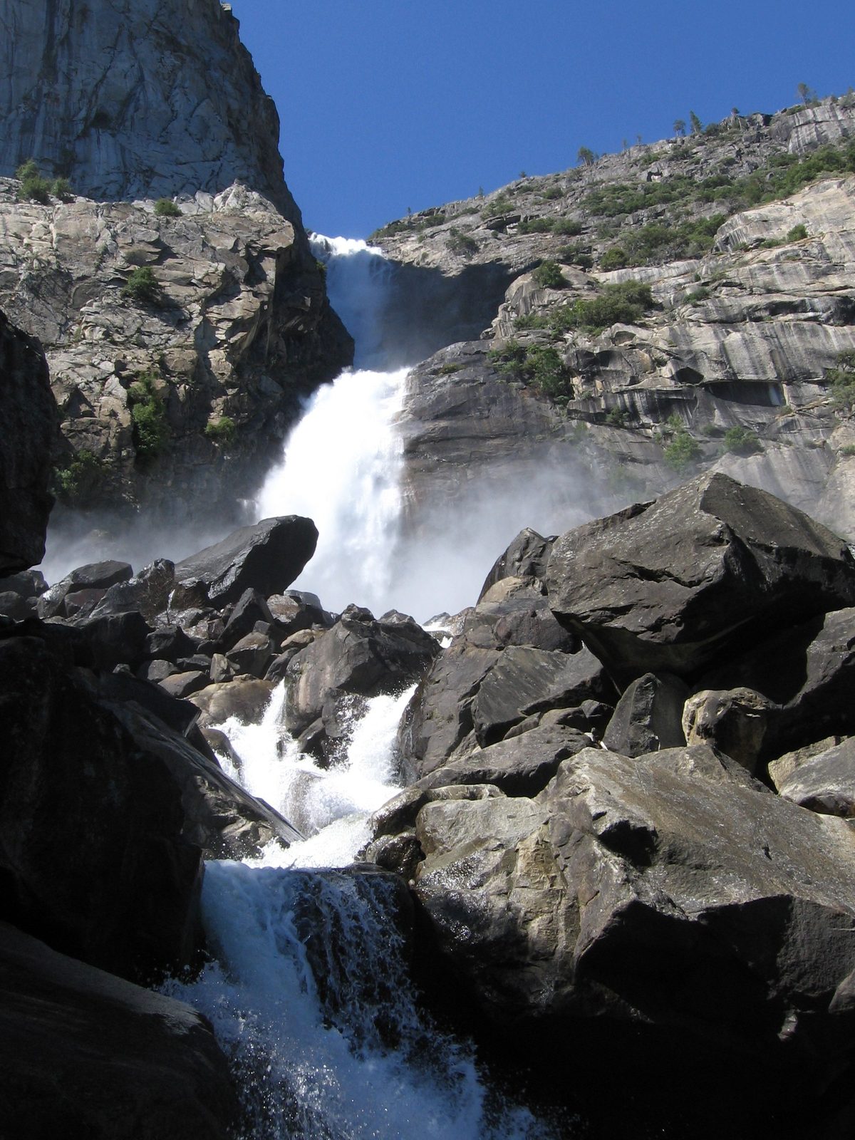
Hetch Hetchy was a second Yosemite Valley until O’Shaughnessy Dam flooded it in 1923 for San Francisco’s water, after a fight that John Muir led and lost. What is left is a reservoir between granite walls, with waterfalls coming down them and a small share of the valley’s visitors. The trail crosses the dam, passes through a tunnel, and follows the shore to the footbridges at the base of Wapama Falls. In a heavy snowmelt, water pours over the bridges and the Park Service closes them.
This corner of the park is lower and hotter than the valley, which makes it good in spring and fall and hard going on a summer afternoon. Rattlesnakes and poison oak are common along the trail.
- Distance: 5 miles (8 km) round trip
- Allow: 2.5 to 3.5 hours
- Start: O’Shaughnessy Dam, at the end of Hetch Hetchy Road. The road is open in daylight hours only.
- When: March to June, and October and November
- Suits: most walkers who want a waterfall without the valley’s crowds
12. Watch Horsetail Fall light up in February
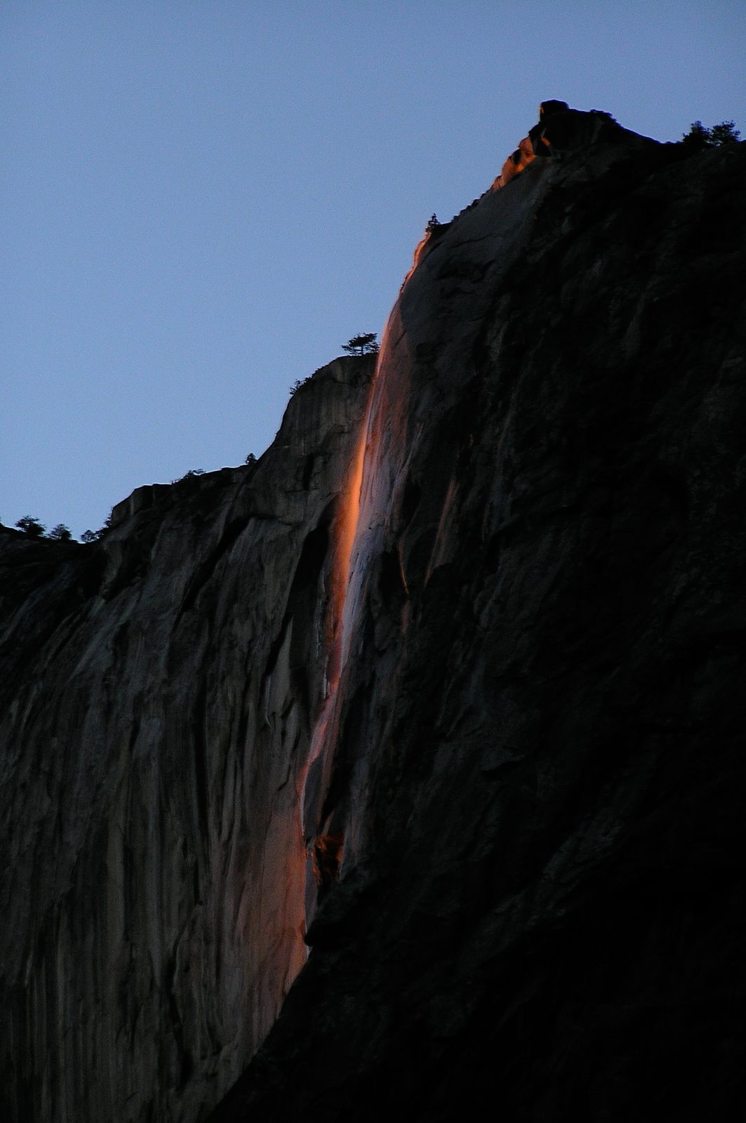
Horsetail Fall is a thin, seasonal waterfall on the east face of El Capitan. For about two weeks in mid to late February, if the fall is flowing and the western sky is clear, the setting sun strikes it at an angle that turns the water orange for the last ten minutes of the day, as though the cliff were pouring fire. It takes snow on top of El Capitan, a mild afternoon to melt it and a cloudless horizon, so many evenings show nothing.
The event now draws thousands. The Park Service closes some roadside parking and, in some years, requires a reservation to enter the park on February weekends. Expect to walk a mile or more each way to the viewing area, and dress for standing still in the cold.
- Distance: about 3 miles (5 km) round trip on foot from the nearest parking
- Allow: an afternoon; be in place an hour before sunset
- Start: Yosemite Falls parking area, then west along Northside Drive to the El Capitan picnic area
- When: about the second half of February
- Suits: photographers and anyone patient enough to risk seeing nothing
Before you go
This list covers what stays the same from year to year. Entry reservations, road opening dates, permit lotteries and trail closures change, and the National Park Service posts them on its own site. The link is on our Yosemite National Park guide, with the map, permits and how to get there.