

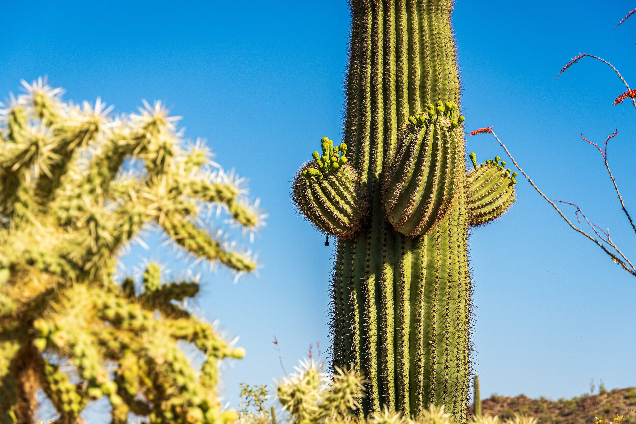
Saguaro National Park
Saguaro National Park guards the giant cactus that has become the emblem of the American West, the towering, many-armed saguaro that grows only in the Sonoran Desert. Split into two districts on either side of Tucson, the park pairs easy cactus-forest drives and walks with a surprisingly rugged high country that climbs from desert floor to pine-clad mountain, all within reach of the city.
Fast facts
- Established: national monument 1933; national park in 1994
- Size: about 92,000 acres (370 km²) in two districts
- Signature species: the saguaro cactus, which can live 150–200 years and top 40 feet (12 m)
- Elevation: roughly 2,700 feet (800 m) on the desert floor to 8,666 feet (2,641 m) on Mica Mountain
- Gateway: Tucson, Arizona, the park frames the city east and west
- Managed by: National Park Service
The landscape
The lower park is classic Sonoran Desert, dense stands of saguaro alongside prickly pear, cholla, ocotillo and palo verde. Climb into the Rincon Mountains in the east district, though, and the desert gives way through grassland and oak to pine and fir forest above 8,000 feet (2,400 m), a cool sky-island world above the cactus. Washes cut the flats, and wildlife ranges from javelina, coyotes and desert tortoises to black bears in the high country.
Best time to go
Fall through spring is prime, with warm days and cool nights ideal for hiking; saguaro blossoms appear in late spring. Summer is dangerously hot on the desert floor and best limited to dawn outings or the cooler high country, with afternoon monsoon storms rolling in from July. Winter is mild and pleasant, occasionally dusting the peaks with snow.
Getting there and around
The two districts sit about a 45-minute drive apart across Tucson, each with its own visitor center and a paved or graded scenic loop, Cactus Forest Drive in the east, Bajada Loop Drive in the west. A vehicle is needed to reach and move between them; from the loops, trailheads branch off for walks of every length.
Things to do
The scenic loop drives and short trails like the Desert Ecology and Valley View paths showcase the cactus forest with little effort. Ambitious hikers tackle the long climb to Wasson Peak in the west or the multi-day route up Mica Mountain in the east, where backcountry campgrounds allow overnight trips. Sunrise and sunset light on the saguaro is the reason many photographers come.
Staying safe
Heat and dehydration are the real dangers. Carry ample water, hike early, and turn back before you are spent. Keep your distance from cactus (cholla spines are notorious) and from rattlesnakes and Gila monsters, watch your footing on rocky trails, and avoid washes when storms threaten flash flooding. Sun protection is essential year-round.
Know before you go
A park pass covers both districts, and Rincon backcountry camping requires a wilderness permit booked ahead. There is no lodging or campground on the desert-floor loops, but Tucson has every service minutes away. This page is a general overview, not a live conditions report; always confirm current conditions and permits with the National Park Service before your trip.
- Coordinates
- 32.2281, -110.8712
- Magnetic declination
- 9.1° E (2026)
Set this declination on your compass, then align it to the map's north lines; it is the angle between true north and magnetic north, refreshed each year.
A spread of the park’s main places shows straight away, and the rest appear as you zoom in. You can also search above, or pick any place from the lists below, and the map will go to it.
Getting there 2
Park entrance
Ranger station
On the trail 25
Trailheads
Campgrounds
Picnic sites
Sights 26
Viewpoints
Waterfalls
Heritage site
Peaks 19
Map data comes from third-party sources and may be incomplete or out of date, so carry a current official map (terms).
- Best seasons
- Fall, Winter, Spring
- Difficulty
- Easy to strenuous
- Access / trailheads
- Two districts flank Tucson: the Rincon Mountain District (east) and the Tucson Mountain District (west), each with a visitor center and a scenic loop drive.
- Water
- Carry all your water; reliable water is scarce, and higher backcountry sources are seasonal.
- Cell / satellite coverage
- Cell service is decent near Tucson but drops off in the mountains. Carry a map and share your plans.
- Nearest ranger / SAR / emergency
- Contact park rangers or Pima County dispatch; life-threatening emergencies: 911.
- Permits & regulations
- Per-vehicle entry fee (America the Beautiful pass accepted); backcountry camping in the Rincon Mountain District requires a wilderness permit.
- Leave No Trace
- Stay on trails, give cactus and wildlife space, pack out all waste, and follow Leave No Trace.
January
February
March
April
May
- Hot days
June
- Extreme daytime heat
July
- Extreme daytime heat
August
- Hot days
September This month
- Hot days
October
November
December
What to bring depends on your trip: how long you’re out, where you sleep, and how far you go from the road. The planner builds the list for yours.
Plan a trip here →Averages for 1991–2020 from NOAA U.S. Climate Normals, measured at the Saguaro National Park station, 4 miles (6 km) away at 3,080 feet (939 m). Conditions change with elevation: expect it colder higher up.