

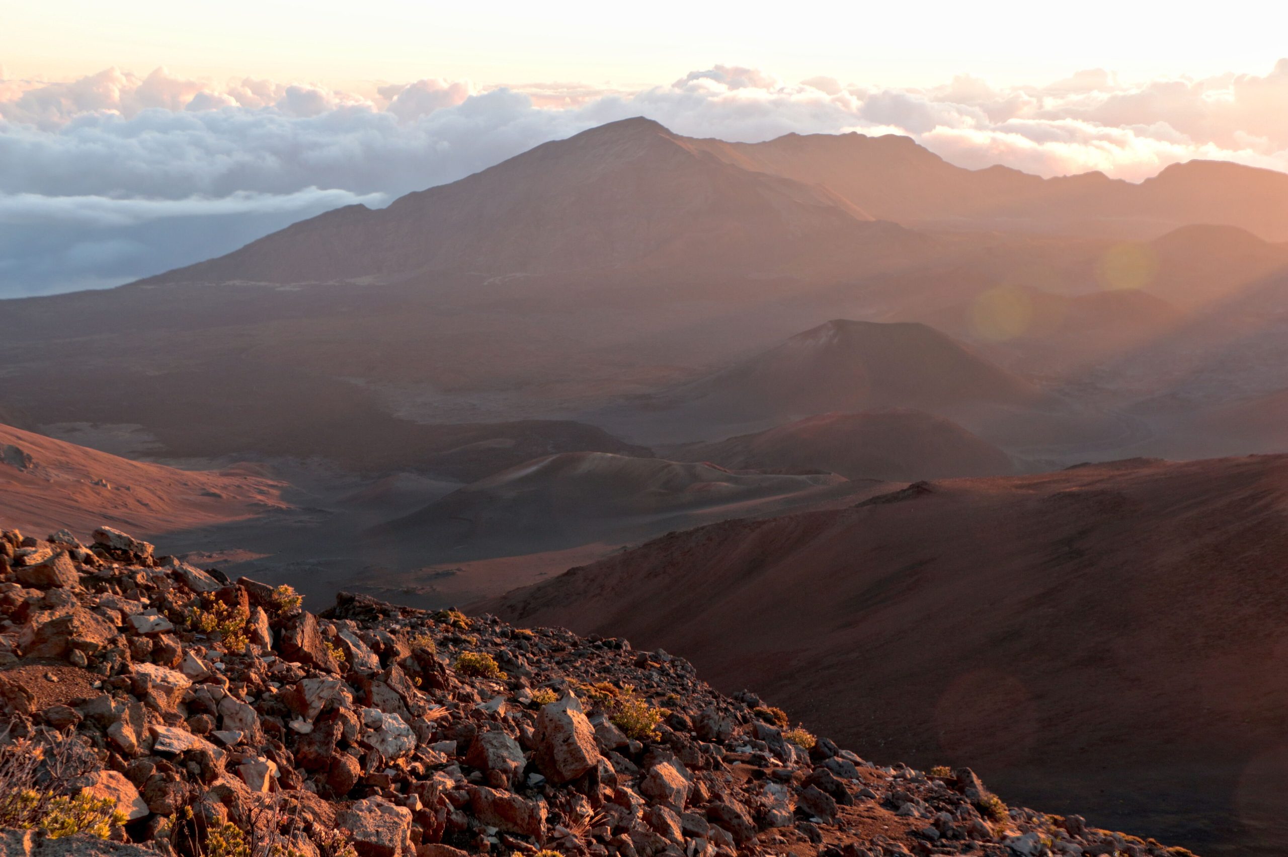
Haleakala National Park
Haleakalā, “house of the sun”, rises more than 10,000 feet (3,000 m) above Maui, a dormant volcano whose vast, cinder-strewn summit basin looks more like Mars than a tropical island. From a world-famous sunrise above the clouds to the lush waterfalls and bamboo forest of the coastal Kīpahulu district, the park spans an astonishing range of climates and holds deep significance in Hawaiian culture.
Fast facts
- Established: 1916 (as part of Hawaii National Park; separate park in 1961)
- Size: about 33,000 acres (130 km²) on the island of Maui
- Summit: Pu’u’ula’ula, 10,023 feet (3,055 m)
- Biosphere Reserve: home to rare species like the silversword and nēnē goose
- Districts: the high Summit District and the coastal Kīpahulu District
- Managed by: National Park Service
The landscape
The summit district is a high-altitude world of a huge erosional basin, cinder cones, lava and thin, cold air, where the endemic silversword blooms and the endangered nēnē walks the slopes. Far below and around the coast, the Kīpahulu district is its opposite, tropical rainforest, bamboo groves, and the tiered pools and waterfalls of the Pīpīwai stream flowing to the sea.
Best time to go
The park is open year-round, with drier weather generally from spring into fall. The summit is cold and can freeze any time, while Kīpahulu is warm, wet and prone to sudden downpours. Sunrise at the summit is the iconic experience, and requires a reservation, but sunset and the dark, clear nights for stargazing are just as rewarding and less regulated.
Getting there and around
The two districts are not connected within the park. The Summit District is reached by the winding Haleakalā Highway from central Maui, a drive that climbs from sea level to 10,000 feet (3,000 m) in about two hours. The coastal Kīpahulu District lies near Hāna on the far southeast coast, at the end of the long, scenic Road to Hāna. A vehicle is essential for both.
Things to do
Watch the reserved sunrise or a quieter sunset from the summit, then hike into the basin on the otherworldly Sliding Sands trail. In Kīpahulu, walk the Pīpīwai Trail past waterfalls and through a bamboo forest to Waimoku Falls, and cool off at the tiered pools along the coast. Backpackers overnight at wilderness campsites and cabins in the summit crater, and the dark skies make for superb stargazing.
Staying safe
The summit is genuinely cold, windy and thin-aired. Dress for near-freezing temperatures even coming from the beach, and watch for altitude sickness, especially before diving. High-altitude sun is intense, so cover up. In Kīpahulu, never enter streams or pools when rain threatens, as flash floods can arrive without warning, and stay back from wet, slippery cliff edges.
Know before you go
A park pass is required, and summit sunrise entry needs a separate timed reservation booked in advance. Check the current system. Crater camping and cabins require permits or bookings. This page is a general overview, not a live conditions report; always confirm current conditions, reservations and permits with the National Park Service before your trip.
- Coordinates
- 20.6993, -156.1486
- Magnetic declination
- 9.3° E (2026)
Set this declination on your compass, then align it to the map's north lines; it is the angle between true north and magnetic north, refreshed each year.
A spread of the park’s main places shows straight away, and the rest appear as you zoom in. You can also search above, or pick any place from the lists below, and the map will go to it.
Getting there 3
Park entrances
Visitor centre
On the trail 9
Trailheads
Campgrounds
Hut or shelters
Sights 41
Viewpoints
Waterfalls
Heritage site
Point of interest
Island
Peaks 30
Map data comes from third-party sources and may be incomplete or out of date, so carry a current official map (terms).
- Best seasons
- Year-round (drier roughly Apr–Oct)
- Difficulty
- Easy to strenuous
- Access / trailheads
- Two districts, not connected: the Summit District via Haleakalā Highway from central Maui, and the coastal Kīpahulu District near Hāna on the far southeast coast.
- Water
- Carry water at the summit; treat stream water in Kīpahulu. Water is limited in the wilderness.
- Cell / satellite coverage
- Little to no cell service in the park. Carry a map and share your plans.
- Nearest ranger / SAR / emergency
- Contact park rangers; life-threatening emergencies: 911.
- Permits & regulations
- Per-vehicle entry fee (America the Beautiful pass accepted); sunrise at the summit requires a separate reservation, and wilderness camping/cabins in the crater require permits or bookings.
- Leave No Trace
- Stay on trails to protect rare species, respect Hawaiian cultural sites, pack out all waste, and follow Leave No Trace.
January
February
March
April
May
June
July
August
September This month
October
November
December
What to bring depends on your trip: how long you’re out, where you sleep, and how far you go from the road. The planner builds the list for yours.
Plan a trip here →Averages for 1991–2020 from NOAA U.S. Climate Normals, measured at the Haleakala Ranger Station, 3 miles (5 km) away at 6,962 feet (2,122 m). Conditions change with elevation: expect it colder higher up.