

Grasslands National Park
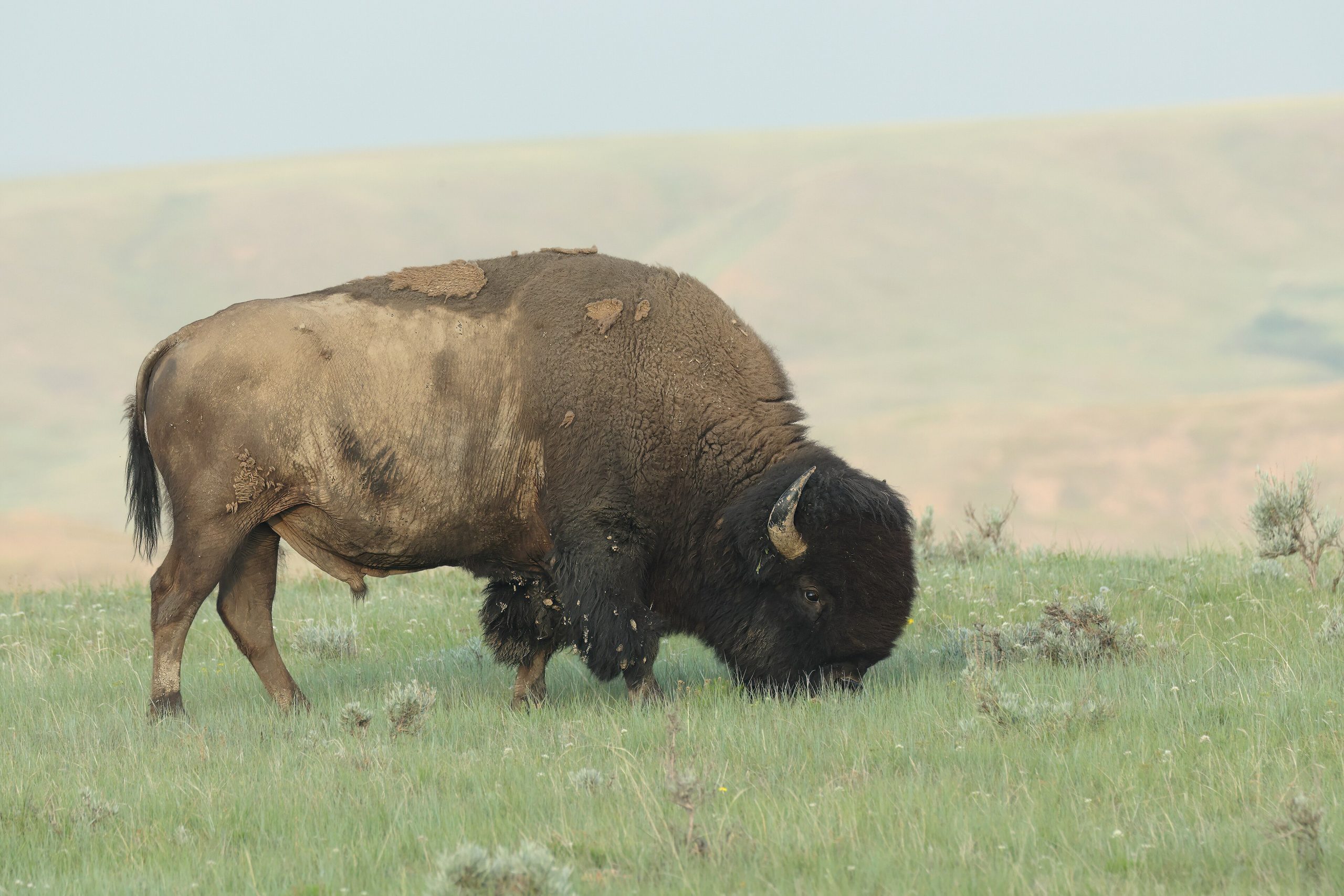
Grasslands National Park preserves one of the last untouched fragments of the North American mixed-grass prairie, a vast, rolling sea of grass, badlands and coulees under enormous skies in southern Saskatchewan. Reintroduced plains bison once again roam here, black-tailed prairie dogs chatter from their towns, and the park’s Dark Sky Preserve status makes for some of the darkest nights on the continent.
Fast facts
- Established: 2001 (agreement 1988)
- Size: about 350 square miles (907 km²) in two blocks in southern Saskatchewan
- Wildlife: reintroduced plains bison, prairie dogs, pronghorn and burrowing owls
- Dark sky: a Dark Sky Preserve with exceptional stargazing
- Gateways: Val Marie (West Block) and Wood Mountain (East Block)
- Managed by: Parks Canada
The landscape
The park protects native mixed-grass prairie rolling to the horizon, broken by the badlands and coulees of the Frenchman and Rock Creek valleys. It is Canada’s only home for the black-tailed prairie dog, whose colonies anchor a whole prairie ecosystem, and it shelters bison, pronghorn, rattlesnakes and rare grassland birds in a landscape most people never imagine still exists intact.
Best time to go
Late spring through early fall is the accessible season, with wildflowers and active wildlife; spring and fall are cooler and more comfortable than the hot, exposed summer. Winter is bitterly cold and windswept, and the dirt roads become impassable when wet any time of year, so time your visit with the weather.
Getting there and around
The park’s two blocks lie near the Montana border, with the West Block reached from Val Marie and the East Block from Wood Mountain. Access is by gravel and dirt roads. A vehicle is essential, ideally with good clearance, and you should never drive the dirt roads when they are wet.
Things to do
Drive the Ecotour scenic route among bison and prairie-dog towns, hike open-prairie and badlands trails like the 70 Mile (110 km) Butte, and simply walk out into the grass for solitude. Wildlife and bird watching, camping under brilliant dark skies, and stargazing are the park’s quiet, profound rewards.
Staying safe
The prairie offers no shade and little water, so carry plenty and guard against heat and lightning on the exposed ground. Give bison a very wide berth, watch for prairie rattlesnakes, and treat the dirt roads with respect. They turn to impassable gumbo when wet, stranding the unprepared.
Know before you go
A Parks Canada pass is required, backcountry camping needs registration, and services are minimal, so come self-sufficient with water and fuel. This page is a general overview, not a live conditions report; always confirm current road conditions, closures and requirements with Parks Canada before your trip.
- Coordinates
- 49.1089, -107.1200
- Magnetic declination
- 9.7° E (2026)
Set this declination on your compass, then align it to the map's north lines; it is the angle between true north and magnetic north, refreshed each year.
A spread of the park’s main places shows straight away, and the rest appear as you zoom in. You can also search above, or pick any place from the lists below, and the map will go to it.
On the trail 17
Trailheads
Campgrounds
Picnic sites
Sights 8
Viewpoints
Heritage site
Peak
Map data comes from third-party sources and may be incomplete or out of date, so carry a current official map (terms).
- Best seasons
- Late spring, Summer, Early fall
- Difficulty
- Easy to strenuous
- Access / trailheads
- In southern Saskatchewan near the Montana border, in two blocks (West near Val Marie, East near Wood Mountain). Access is by gravel and dirt roads.
- Water
- Carry all your water; the prairie has little to no reliable drinking water.
- Cell / satellite coverage
- Little to no cell service. Carry a map and share your plans.
- Nearest ranger / SAR / emergency
- Parks Canada dispatch: 1-877-852-3100; life-threatening emergencies: 911.
- Permits & regulations
- A Parks Canada pass is required; backcountry camping is allowed with registration. Facilities are minimal, so self-sufficiency is essential.
- Leave No Trace
- Stay on trails and durable ground, keep well back from bison, pack out all waste, and follow Leave No Trace.
January
- Below freezing all day
February
- Below freezing all day
March
- Below-freezing nights
April
- Below-freezing nights
May
June
July
- Day-to-night swing of 30°F (17°C)
August
- Day-to-night swing of 32°F (18°C)
September This month
- Day-to-night swing of 30°F (17°C)
October
- Below-freezing nights
November
- Below-freezing nights
December
- Below freezing all day
What to bring depends on your trip: how long you’re out, where you sleep, and how far you go from the road. The planner builds the list for yours.
Plan a trip here →Averages for 1981–2010 from Environment Canada climate normals, measured at the Mankota station, 22 miles (36 km) away at 2,723 feet (830 m).