

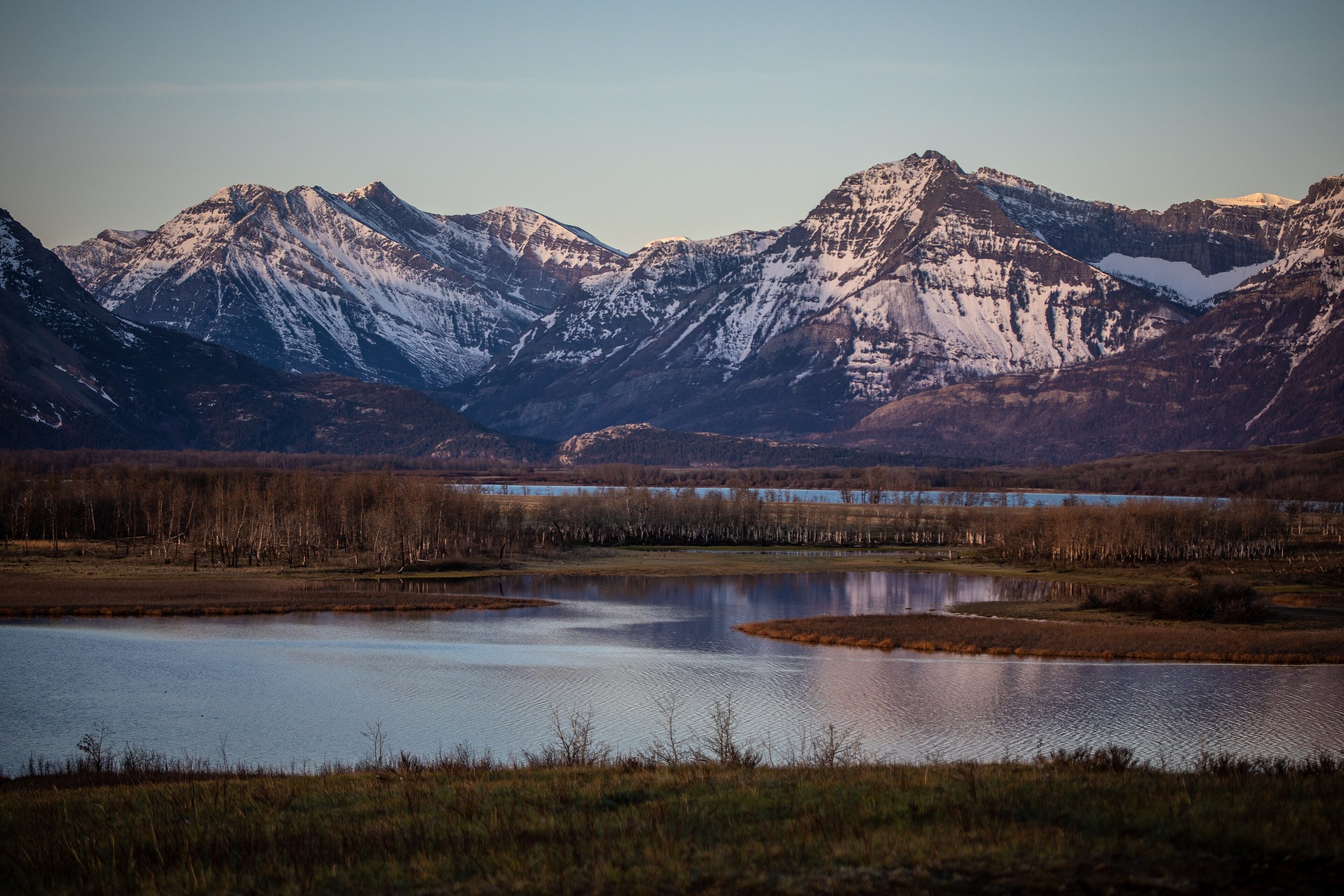
Waterton Lakes National Park
Waterton is where the prairie stops and the mountains start, with almost nothing in between. There are no foothills here: grassland runs flat to the base of thousand-metre limestone peaks, and that abrupt collision is what makes the park look like nowhere else in the Canadian Rockies. It is also half of the world’s first International Peace Park, joined across the border to Glacier in Montana.
Fast facts
- Established: 1895, Canada’s fourth national park
- Size: about 195 square miles (505 km²) in southwest Alberta
- Designations: UNESCO World Heritage Site and Biosphere Reserve
- Shared with: Glacier National Park, Montana, as the Waterton-Glacier International Peace Park
- Gateway: Waterton townsite, on Upper Waterton Lake
- Managed by: Parks Canada
The landscape
Upper Waterton Lake is the deepest lake in the Canadian Rockies, filling a trough gouged by glaciers and running south across the international boundary. Red Rock Canyon exposes bright argillite laid down more than a billion years ago, and Cameron Lake sits in a cirque at the end of the Akamina Parkway with mountains on three sides.
The 2017 Kenow wildfire burned through a large share of the park’s forest. What you see now is an unusually clear view of the terrain underneath, and a landscape regenerating in real time, with fireweed and aspen returning fast among the standing snags.
Best time to go
July through September is the reliable window, when the shuttle boats run and the high trails are clear of snow. Wildflowers peak in late June and July. Waterton is one of the windiest places in Alberta and the wind is not seasonal, so plan for it whenever you come. Services in the townsite shrink dramatically after Thanksgiving, and in winter the nearest fuel is at Pincher Creek or Mountain View.
Getting there and around
The park is reached on Highway 5 from Cardston or Highway 6 from Pincher Creek, and everything in the front country is within a short drive of the townsite. The Akamina and Red Rock parkways branch off to the two main valleys. If you plan to cross into Glacier on the Chief Mountain highway, check the crossing’s seasonal hours and carry your passport.
Things to do
Crypt Lake is the signature day hike, reached by shuttle boat and finishing with a ladder, a natural tunnel and a cabled ledge. The Carthew-Alderson traverse crosses the park from Cameron Lake back to the townsite. Bear’s Hump is a short, steep climb to the classic view over the lake. Paddlers have Cameron Lake and Upper Waterton, both cold and both prone to afternoon wind.
Staying safe
This is grizzly country and the park sits at the meeting point of prairie, montane and alpine habitat, so bears use it heavily. Carry spray where you can reach it and know how to use it. The wind can knock you off balance on exposed ridges and makes lake crossings hazardous for small craft. Burned areas still shed standing trees, particularly in wind. Crypt Lake’s final section is genuinely exposed and is not the place to discover you dislike heights.
Know before you go
Buy a day pass or Discovery Pass on arrival, and reserve backcountry sites in advance for overnight trips. Any boat, paddleboard or float tube must be inspected for aquatic invasive species before it touches the water. Recreational drones are prohibited, with substantial fines. Check park bulletins for closures and fire restrictions before you drive out.
- Coordinates
- 49.1012, -113.9100
- Magnetic declination
- 12.9° E (2026)
Set this declination on your compass, then align it to the map's north lines; it is the angle between true north and magnetic north, refreshed each year.
A spread of the park’s main places shows straight away, and the rest appear as you zoom in. You can also search above, or pick any place from the lists below, and the map will go to it.
Getting there 1
Park entrance
On the trail 10
Trailheads
Campgrounds
Hut or shelters
Sights 38
Viewpoints
Waterfalls
Heritage site
Peaks 30
Map data comes from third-party sources and may be incomplete or out of date, so carry a current official map (terms).
- Best seasons
- Summer, Fall
- Difficulty
- Easy to strenuous
- Access / trailheads
- Southwest corner of Alberta on highways 5 and 6, about 168 miles (271 km) south of Calgary and 82 miles (132 km) southwest of Lethbridge. Nearest airport is Lethbridge. The Chief Mountain crossing into Montana is seasonal; Carway is open year round.
- Water
- Treated water in the Waterton townsite and at serviced campgrounds. Treat all surface water in the backcountry.
- Cell / satellite coverage
- Cell service in the townsite and along the main road. Patchy to none in the backcountry and on the far side of the lake.
- Nearest ranger / SAR / emergency
- Call 911. Parks Canada 24-hour emergency dispatch for the mountain parks: 1-888-927-3367. Park information: 403-859-5133.
- Permits & regulations
- Park entry fee or a Parks Canada Discovery Pass. Backcountry camping requires a wilderness permit and reservation. Watercraft must pass a mandatory aquatic invasive species inspection before launching. Drones are prohibited.
- Leave No Trace
- Stay on established trails, keep 330 feet (100 m) from bears and 100 feet (30 m) from all other wildlife, store food in provided lockers or a hard-sided vehicle, and pack out everything you carry in.
January
- Below-freezing nights
February
- Below-freezing nights
March
- Below-freezing nights
April
- Below-freezing nights
May
June
July
August
September This month
October
- Below-freezing nights
November
- Below-freezing nights
December
- Below-freezing nights
What to bring depends on your trip: how long you’re out, where you sleep, and how far you go from the road. The planner builds the list for yours.
Plan a trip here →Averages for 1981–2010 from Environment Canada climate normals, measured at the Carway station, 25 miles (40 km) away at 4,442 feet (1,354 m). Conditions change with elevation: expect it colder higher up.