

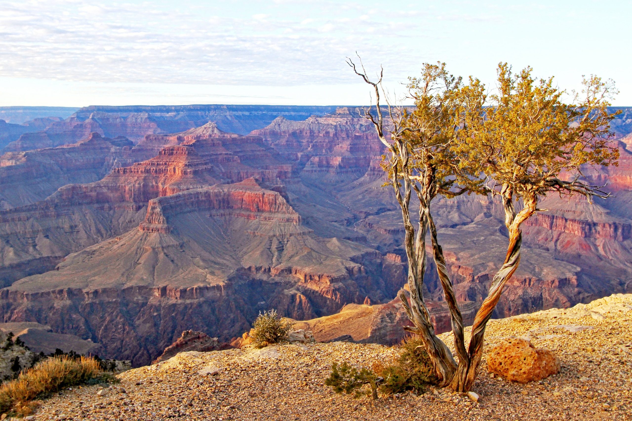
Grand Canyon National Park
The Grand Canyon is one of the world’s great landscapes, a mile-deep, 277-river-mile gorge that the Colorado River has carved through nearly two billion years of rock. It is also deceptively demanding: the same rim views that draw more than four million visitors a year sit above an inner canyon where summer temperatures top 100°F (38°C) and a casual day hike down can become a genuine emergency on the climb back out.
Fast facts
- Established: 1919
- Size: about 1.2 million acres (5,000 km²); the canyon runs 277 river miles
- Depth: roughly a mile from rim to river
- Rims: the South Rim (open year-round) and the higher, cooler North Rim (seasonal)
- World Heritage: a UNESCO World Heritage Site (1979)
- Managed by: National Park Service
The landscape
The canyon exposes a stacked record of desert rock, banded in ochre, rust and grey, dropping from forested rims to the desert floor. The South Rim sits near 7,000 feet (2,100 m) in ponderosa pine and piñon-juniper; the North Rim rises above 8,000 feet (2,400 m) into spruce-fir forest and meadow. Between them the Colorado River threads the bottom, and side canyons hide creeks, waterfalls and slot drainages. It is home to elk, bighorn sheep, condors and, near the river, desert reptiles.
Best time to go
Spring and fall are ideal, milder temperatures for hiking and thinner crowds than summer. Summer brings intense inner-canyon heat and afternoon monsoon thunderstorms, so rim viewing and very early starts are the rule. Winter transforms the snowy South Rim into a quiet, beautiful destination, while the North Rim closes to vehicles for the season.
Getting there and around
Most visitors reach the South Rim from Flagstaff or Williams and use the free seasonal shuttle system to reach viewpoints and trailheads, since parking fills early. The North Rim is a longer drive and open roughly mid-May to mid-October. Rim-to-rim by road is a 4–5 hour trip around the canyon, not across it.
Things to do
Rim walks like the Rim Trail deliver the classic views with little effort. Corridor trails, Bright Angel and South Kaibab, descend toward the river, but the Park Service warns against hiking to the river and back in a single day. Multi-day backpackers aim for Phantom Ranch and Bright Angel Campground; rafters run the Colorado on permitted or commercial trips; and rangers offer talks, walks and stargazing in this certified Dark Sky park.
Staying safe
Heat is the number-one hazard: hike early, rest in shade during midday, eat salty snacks, and drink to match your effort, heat illness and dehydration send hikers to rescue every summer. Respect the exposed drop-offs and stay back from unfenced edges. Watch the sky for flash floods in narrow drainages, carry more water than you expect to need, and remember the hard truth of canyon hiking: down is optional, up is mandatory.
Know before you go
Everyone needs a park pass, and backcountry camping and Colorado River trips require permits that are limited and competitive, so plan well ahead. Summer parking and lodging fill fast. This page is a general overview, not a live conditions report; always confirm current conditions, closures and permits with the National Park Service before your trip.
- Coordinates
- 36.3079, -112.7835
- Magnetic declination
- 10.3° E (2026)
Set this declination on your compass, then align it to the map's north lines; it is the angle between true north and magnetic north, refreshed each year.
A spread of the park’s main places shows straight away, and the rest appear as you zoom in. You can also search above, or pick any place from the lists below, and the map will go to it.
Getting there 10
Park entrances
Ranger stations
On the trail 80
Trailheads
Campgrounds
Hut or shelters
Picnic sites
Sights 99
Viewpoints
Waterfalls
Beachs
Heritage sites
Point of interests
Peaks 30
Map data comes from third-party sources and may be incomplete or out of date, so carry a current official map (terms).
- Best seasons
- Spring, Fall (shoulder)
- Difficulty
- Moderate to strenuous
- Access / trailheads
- South Rim (open year-round) via US-180/AZ-64 from Flagstaff or Williams; North Rim (higher, seasonal) via AZ-67. Free shuttles serve the South Rim in season.
- Water
- Water at rim developed areas and some inner-canyon points, but treat all creek water and never rely on a single source. Carry more than you think.
- Cell / satellite coverage
- Spotty cell service on the rims and essentially none below. Carry a map and a satellite messenger for inner-canyon trips.
- Nearest ranger / SAR / emergency
- Grand Canyon Regional Communications Center; life-threatening emergencies: 911.
- Permits & regulations
- Per-vehicle entry fee (America the Beautiful pass accepted); backcountry camping requires a permit from the Backcountry Information Center, and the Colorado River requires a river permit.
- Leave No Trace
- Pack out all waste (including on river trips), stay on established trails, and follow Leave No Trace; do not feed wildlife.
January
- Below-freezing nights
February
- Below-freezing nights
March
- Below-freezing nights
April
- Below-freezing nights
- Day-to-night swing of 32°F (18°C)
May
- Day-to-night swing of 34°F (19°C)
June
- Day-to-night swing of 39°F (22°C)
July
- Day-to-night swing of 35°F (19°C)
August
- Day-to-night swing of 32°F (18°C)
September This month
- Day-to-night swing of 32°F (18°C)
October
- Day-to-night swing of 32°F (18°C)
November
- Below-freezing nights
December
- Below-freezing nights
What to bring depends on your trip: how long you’re out, where you sleep, and how far you go from the road. The planner builds the list for yours.
Plan a trip here →Averages for 1991–2020 from NOAA U.S. Climate Normals, measured at the Grand Canyon National Park station, 12 miles (19 km) away at 6,785 feet (2,068 m). Conditions change with elevation: expect it colder higher up.