

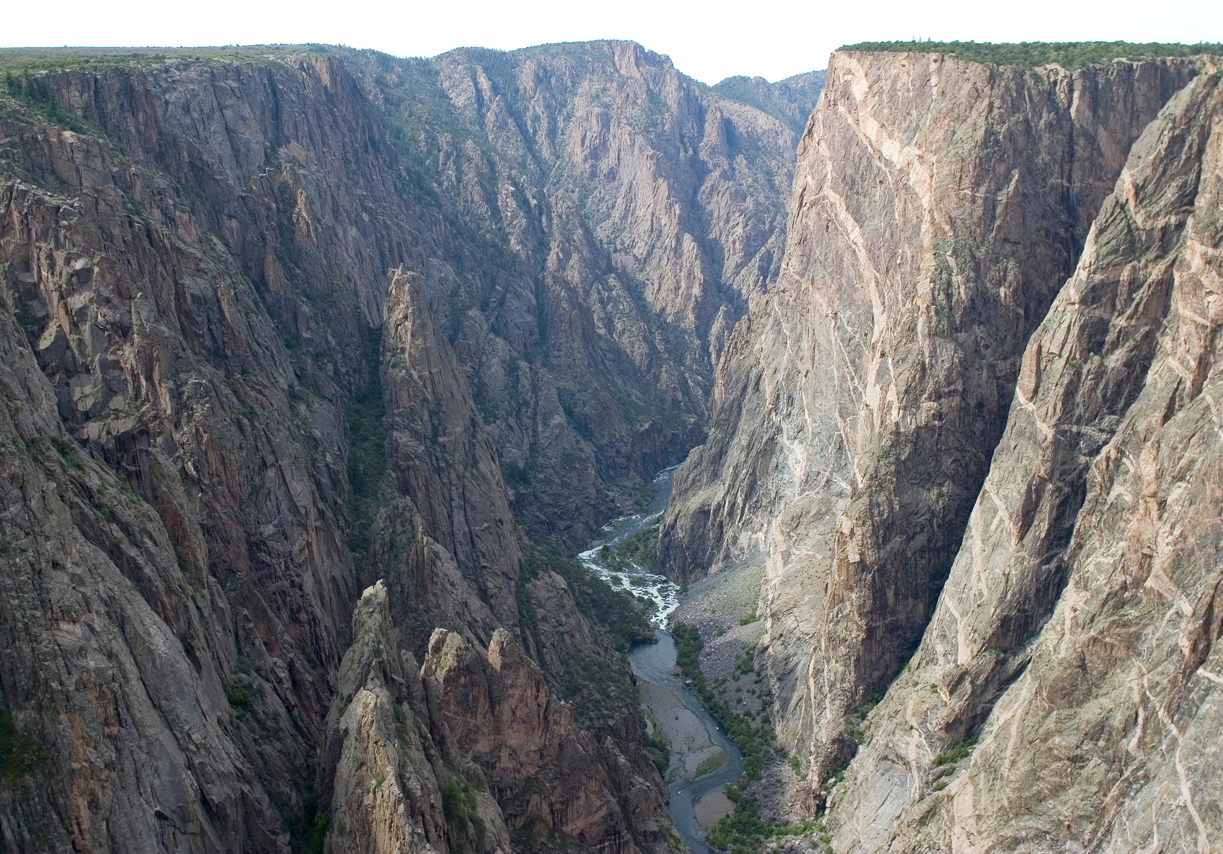
Black Canyon of the Gunnison National Park
The Black Canyon of the Gunnison is one of the steepest, deepest and most dramatic gorges in North America, a narrow chasm so sheer and shadowed that parts of its floor see barely half an hour of sunlight a day. In places the walls plunge over 2,000 feet (600 m) to the roaring Gunnison River, close enough across the top to feel almost within reach, making for some of the most vertigo-inducing overlooks in the national park system.
Fast facts
- Established: national monument 1933; national park in 1999
- Size: about 30,700 acres (124 km²) in western Colorado
- Depth: up to roughly 2,700 feet (800 m), with walls narrowing to about 40 feet (12 m) apart at the Narrows
- The river: the Gunnison drops more steeply here than almost any river in North America
- Gateway: Montrose, Colorado
- Managed by: National Park Service
The landscape
The canyon is cut into ancient, dark metamorphic rock, the “black” gneiss and schist streaked with pale pegmatite, by the relentless Gunnison River. The rims are cloaked in piñon-juniper and Gambel oak at around 8,000 feet (2,400 m), while the sheer inner walls and boulder-choked gorge stay cool and shadowed. Mule deer, peregrine falcons and golden eagles frequent the rims and cliffs.
Best time to go
Late spring through fall is the accessible season, with pleasant rim temperatures and open roads; fall adds golden oak color. The North Rim road and some facilities close in winter, when snow blankets the rims and the park turns quiet and cold. Summer days are warm on the rims but the shaded canyon floor stays cool.
Getting there and around
The developed South Rim, reached via Highway 347 off US-50 near Montrose, has the visitor center, campground and a rim drive linking a string of overlooks. The North Rim is far more remote, reached by gravel roads near Crawford and open seasonally. There is no bridge or road connecting the two rims within the park, so choose your side; a vehicle is essential.
Things to do
Drive the South Rim Road and walk the short paths to overlooks like Gunnison Point, Chasm View and Painted Wall, Colorado’s tallest cliff. Rim trails offer easy hikes, while experienced, self-reliant hikers descend the steep, unmaintained inner-canyon routes to the river with a permit. The canyon is also a serious destination for expert rock climbers and, below, for gold-medal trout fishing.
Staying safe
The overlooks are genuinely dangerous. Edges are crumbly and often unfenced, with sheer drops, so keep well back and hold onto children. Inner-canyon routes are steep, loose and unmarked, demanding scrambling, route-finding and a permit; poison ivy grows thick in the gorge. The Gunnison River is cold and powerful, and at altitude you should hydrate and pace yourself.
Know before you go
A park pass is required, and descending into the inner canyon needs a free wilderness permit. There are no maintained trails to the bottom, so it is for experienced hikers only. The North Rim is seasonal. This page is a general overview, not a live conditions report; always confirm current conditions, road status and permits with the National Park Service before your trip.
- Coordinates
- 38.5721, -107.7240
- Magnetic declination
- 8.7° E (2026)
Set this declination on your compass, then align it to the map's north lines; it is the angle between true north and magnetic north, refreshed each year.
A spread of the park’s main places shows straight away, and the rest appear as you zoom in. You can also search above, or pick any place from the lists below, and the map will go to it.
Getting there 2
Park entrance
Ranger station
On the trail 6
Trailheads
Campgrounds
Sights 27
Viewpoints
Peaks
Map data comes from third-party sources and may be incomplete or out of date, so carry a current official map (terms).
- Best seasons
- Late spring, Summer, Fall
- Difficulty
- Easy to very strenuous
- Access / trailheads
- The South Rim (Hwy 347 off US-50 near Montrose) is the main developed area; the North Rim is remote and seasonal via gravel roads near Crawford.
- Water
- Carry all your water on the rims and into the canyon; the only reliable water is the river far below.
- Cell / satellite coverage
- Little to no cell service. Carry a map and tell someone your route, especially for inner-canyon descents.
- Nearest ranger / SAR / emergency
- Contact park rangers; life-threatening emergencies: 911.
- Permits & regulations
- Per-vehicle entry fee (America the Beautiful pass accepted); a free wilderness permit is required to descend into the inner canyon, which has no maintained trails.
- Leave No Trace
- Stay back from crumbling edges, pack out all waste, avoid poison ivy, and follow Leave No Trace.
January
- Below-freezing nights
February
- Below-freezing nights
March
- Below-freezing nights
April
- Below-freezing nights
May
June
- Day-to-night swing of 30°F (17°C)
July
August
September This month
October
November
- Below-freezing nights
December
- Below-freezing nights
What to bring depends on your trip: how long you’re out, where you sleep, and how far you go from the road. The planner builds the list for yours.
Plan a trip here →Averages for 1991–2020 from NOAA U.S. Climate Normals, measured at the Black Canyon Of The Gunnison station, 2 miles (3 km) away at 8,151 feet (2,484 m). Conditions change with elevation: expect it colder higher up.