

Top 9 things to do in Black Canyon of the Gunnison National Park
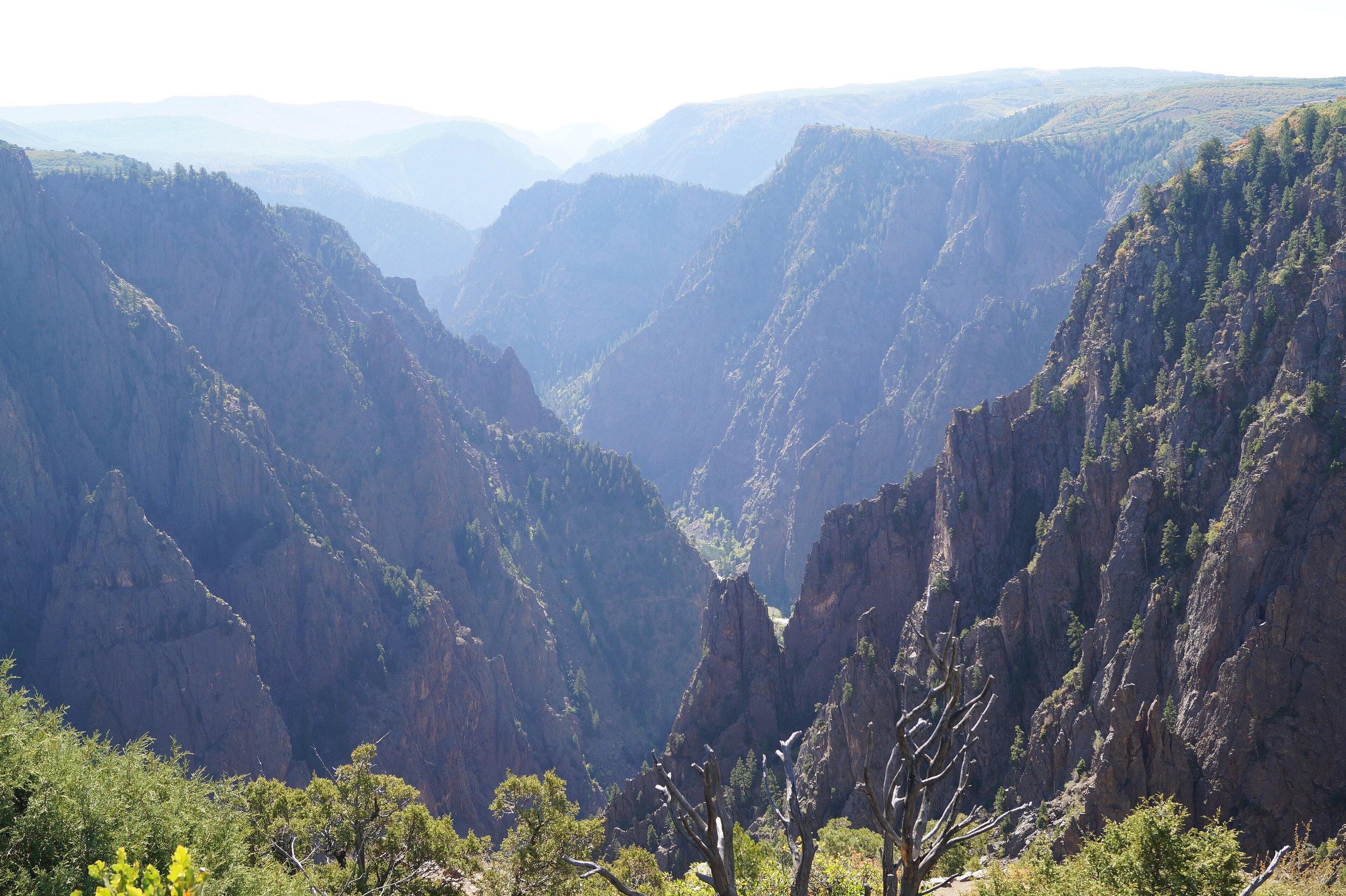
Black Canyon of the Gunnison National Park, in western Colorado near Montrose, protects the deepest and most dramatic part of a gorge that the Gunnison River has cut through some of the oldest rock in North America. The canyon is so deep and so narrow that parts of its floor see only a few minutes of sunlight a day, which is how it got its name, and its walls of dark gneiss and schist, streaked with pale bands of granite, drop more than 2,000 feet (600 m) almost straight down. The South Rim has the road, the visitor center and most visitors; the North Rim is quieter, and the bottom is for the bold. These are the nine outings we would put first. The order starts with what the park is known for, then goes by what an outing gives back for the time and effort it takes. Distances are approximate; times are our estimates and do not include stops.
Many overlooks have low walls or none at all, and the drop is sheer: keep children close and stay on the paths. The rims sit at about 8,000 feet (2,400 m), so the sun is strong and summer storms bring lightning. Going down into the canyon is a serious undertaking on steep, unmaintained routes, with poison ivy, loose rock and a hard climb out, and it needs a free wilderness permit.
1. Drive the South Rim Road
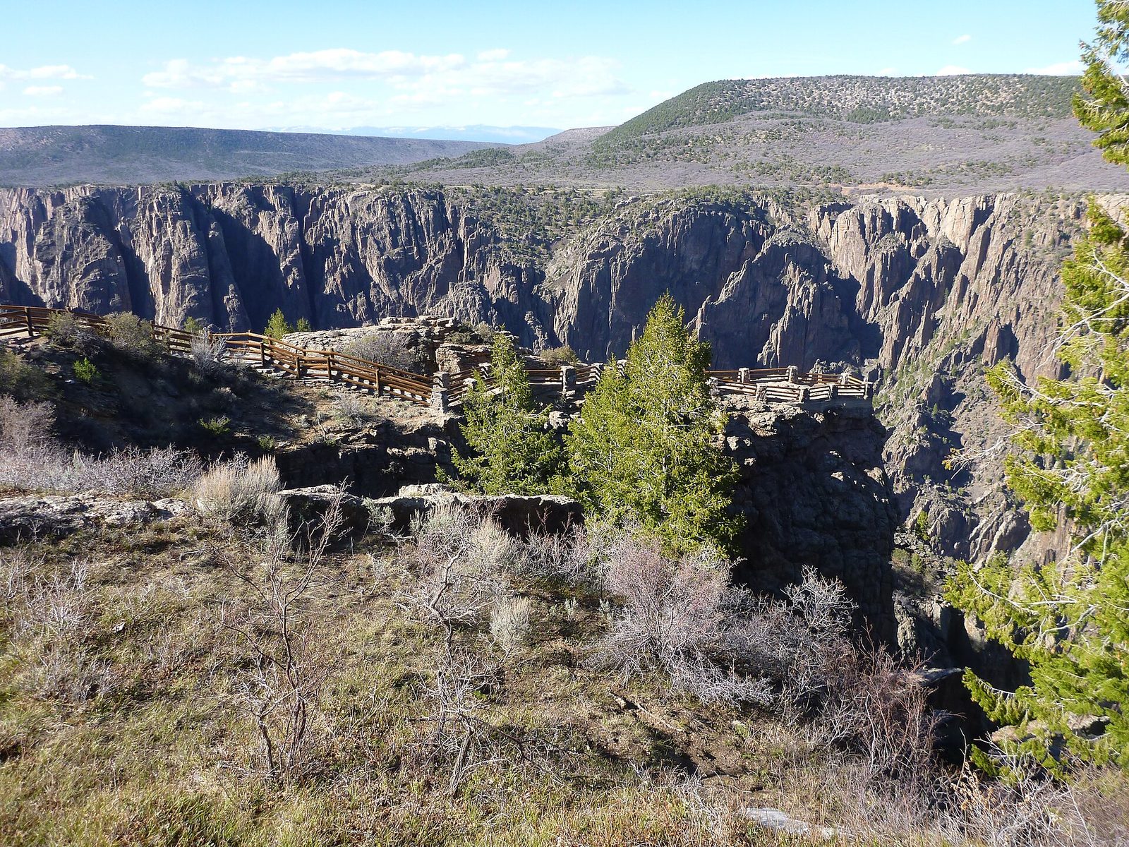
This paved road follows the South Rim from the visitor center to High Point, with a dozen overlooks along the way, each a short walk from the car. Each shows a different face of the canyon: Gunnison Point, behind the visitor center, Pulpit Rock, Chasm View, the Painted Wall, Sunset View and more. Drive it slowly, stop often, and come back for the late afternoon light, when the walls glow and the shadows deepen.
- Distance: 7 miles (11 km) each way
- Allow: 2 to 3 hours
- Start: South Rim Visitor Center
- When: spring to fall; in winter the road is closed beyond the visitor center
- Suits: everyone
2. Stand in front of the Painted Wall
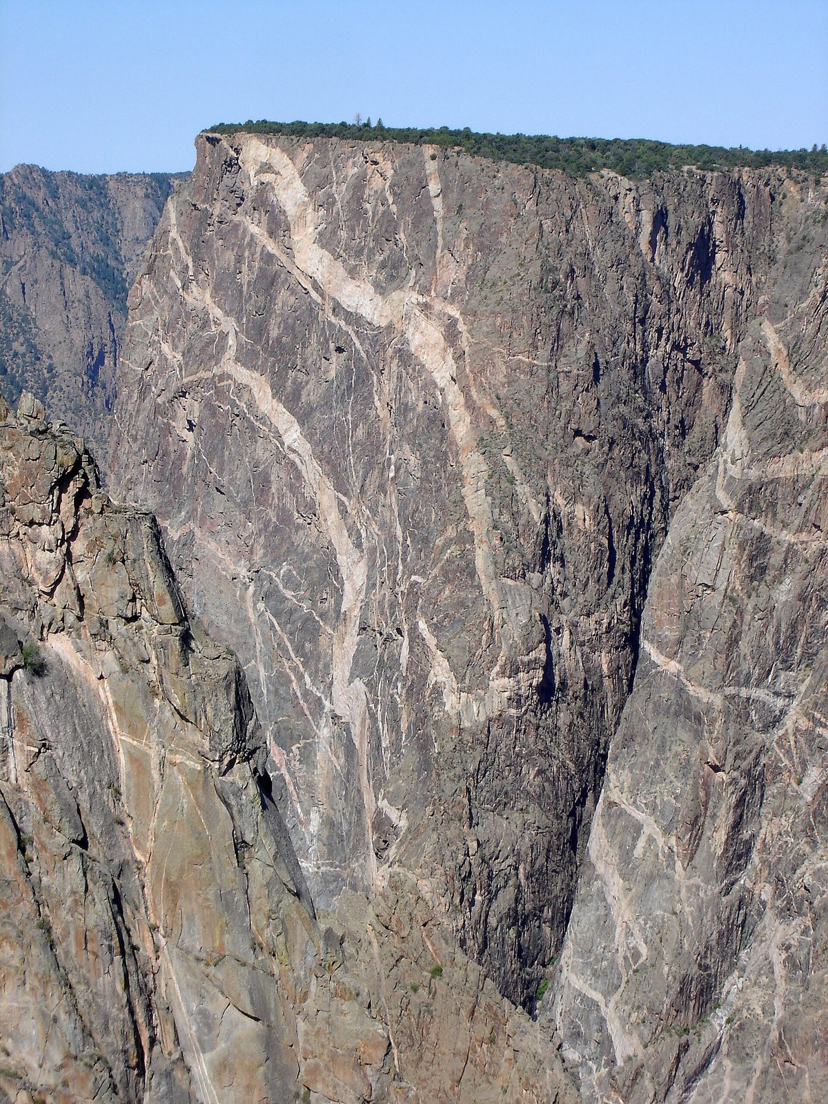
At 2,250 feet (686 m) from river to rim, the Painted Wall is the tallest cliff in Colorado, almost twice the height of the Empire State Building. Its dark face is laced with pale bands of pegmatite, rock that squeezed molten into cracks in the older rock long ago and cooled, giving the wall its marbled look. The overlook faces it across the canyon, and from it you can also see the river far below.
- Allow: 20 minutes
- Start: Painted Wall View, on the South Rim Road
- When: spring to fall; afternoon light is best
- Suits: everyone
3. Look straight down at Chasm View
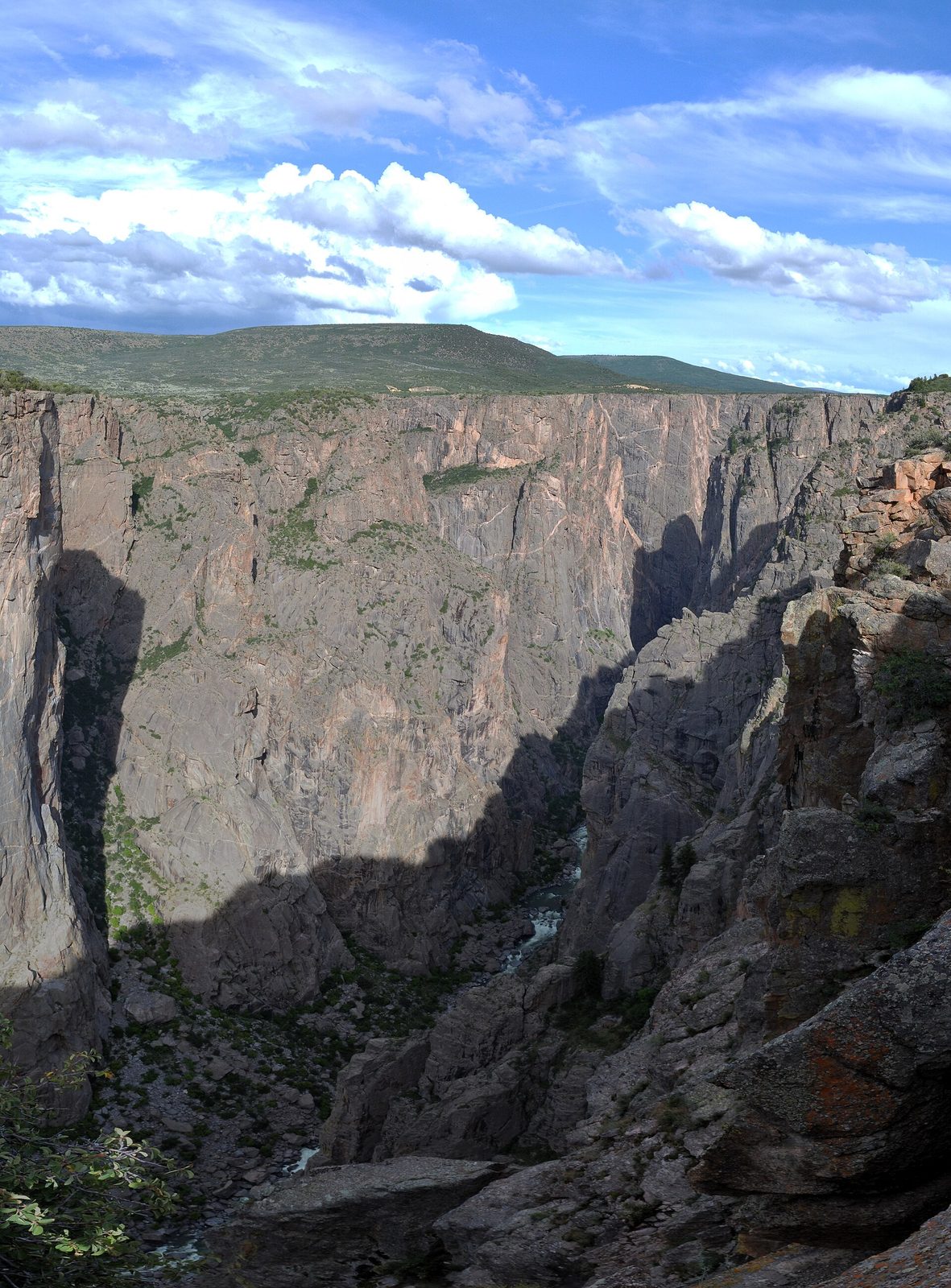
At Chasm View the canyon is at its narrowest and steepest, and you look straight down to the roaring river, with the North Rim only about 1,100 feet (340 m) away across the gap. Here the Gunnison drops as much as 240 feet per mile (45 m per km), one of the steepest descents of any major river in North America, which is why it cut so deep so fast. Swallows and swifts dart along the walls below you.
- Allow: 20 minutes
- Start: Chasm View, on the South Rim Road
- When: spring to fall
- Suits: everyone
4. Walk the Warner Point Nature Trail
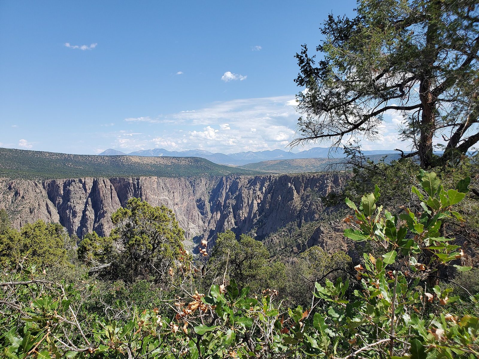
At the end of the South Rim Road, this trail follows a ridge through pinyon pine and juniper, some of the trees hundreds of years old, to Warner Point, with views not only into the canyon but out over the mountains and valleys around it: the San Juans, the West Elks and the Uncompahgre Plateau. Signs along the way explain the plants and the geology.
- Distance: about 1.5 miles (2.4 km) round trip
- Allow: 1 hour
- Start: High Point, at the end of the South Rim Road
- When: spring to fall
- Suits: most walkers
5. Visit the quieter North Rim
The North Rim, reached by a gravel road from the town of Crawford, gets a fraction of the visitors of the South Rim, and its overlooks look down into the canyon at its narrowest. Stop at the Narrows View and Chasm View on this side, then walk the North Vista Trail to Exclamation Point, a rocky perch with one of the finest views into the inner canyon anywhere in the park.
- Distance: about 3 miles (4.8 km) round trip to Exclamation Point
- Allow: half a day, plus the drive
- Start: North Rim Ranger Station, at the end of the North Rim Road from Crawford
- When: spring to fall; the road is closed in winter
- Suits: most walkers
6. Walk the Oak Flat Loop below the rim
For a taste of the canyon below the rim without the commitment of going to the bottom, this loop from the visitor center drops steeply through Gambel oak and aspen and Douglas fir to a view down to the river, then climbs back up. It is short but strenuous, and it gives a sense of how steep the canyon walls really are.
- Distance: about 2 miles (3.2 km) loop
- Climb: about 400 feet (120 m)
- Allow: 1.5 hours
- Start: South Rim Visitor Center
- When: spring to fall
- Suits: fit walkers
7. Drive down the East Portal Road to the river
The only road to the bottom of the canyon drops steeply in tight switchbacks from the South Rim Road to the Gunnison River at the East Portal, where the river emerges from the deep gorge upstream. At the bottom are a campground, picnic sites and a place to fish or sit beside the fast, clear river among cottonwoods. Vehicles over 22 feet (6.7 m) long are not allowed on the road.
- Allow: 1 to 2 hours
- Start: East Portal Road, off the South Rim Road near the park entrance
- When: spring to fall; closed to vehicles in winter
- Suits: everyone, in a suitable vehicle
8. Descend to the river on an inner-canyon route
For fit, experienced hikers, several unmaintained routes drop from the rims to the river, down steep gullies of loose rock, sometimes with a chain to hold on to, through poison ivy at the bottom. The Gunnison Route from the South Rim is the most used. At the bottom, the river roars between towering walls in a world few visitors see. Allow far more time and water for the climb out than you think you need, and get a wilderness permit first.
- Climb: about 1,800 feet (550 m) down and back up on the Gunnison Route
- Allow: 4 to 6 hours, or an overnight with a permit
- Start: South Rim Visitor Center, for the Gunnison Route
- When: spring and fall; summer heat in the canyon is punishing
- Suits: experienced, fit hikers only
9. Stay for the stars
Black Canyon is an International Dark Sky Park, and on a clear, moonless night the sky above the canyon is crowded with stars, with the Milky Way stretched across it. The overlooks along the South Rim Road and the campgrounds on both rims are good places to watch, and rangers hold astronomy programs in summer.
- Allow: an hour or two after dark
- Start: the South Rim overlooks or campground
- When: all year, near the new moon
- Suits: everyone
Before you go
This list covers what stays the same from year to year. Closures, road status and wilderness permit rules change, and the National Park Service posts them on its own site. The link is on our Black Canyon of the Gunnison National Park guide, with the map and how to get there.