

Wind Cave National Park
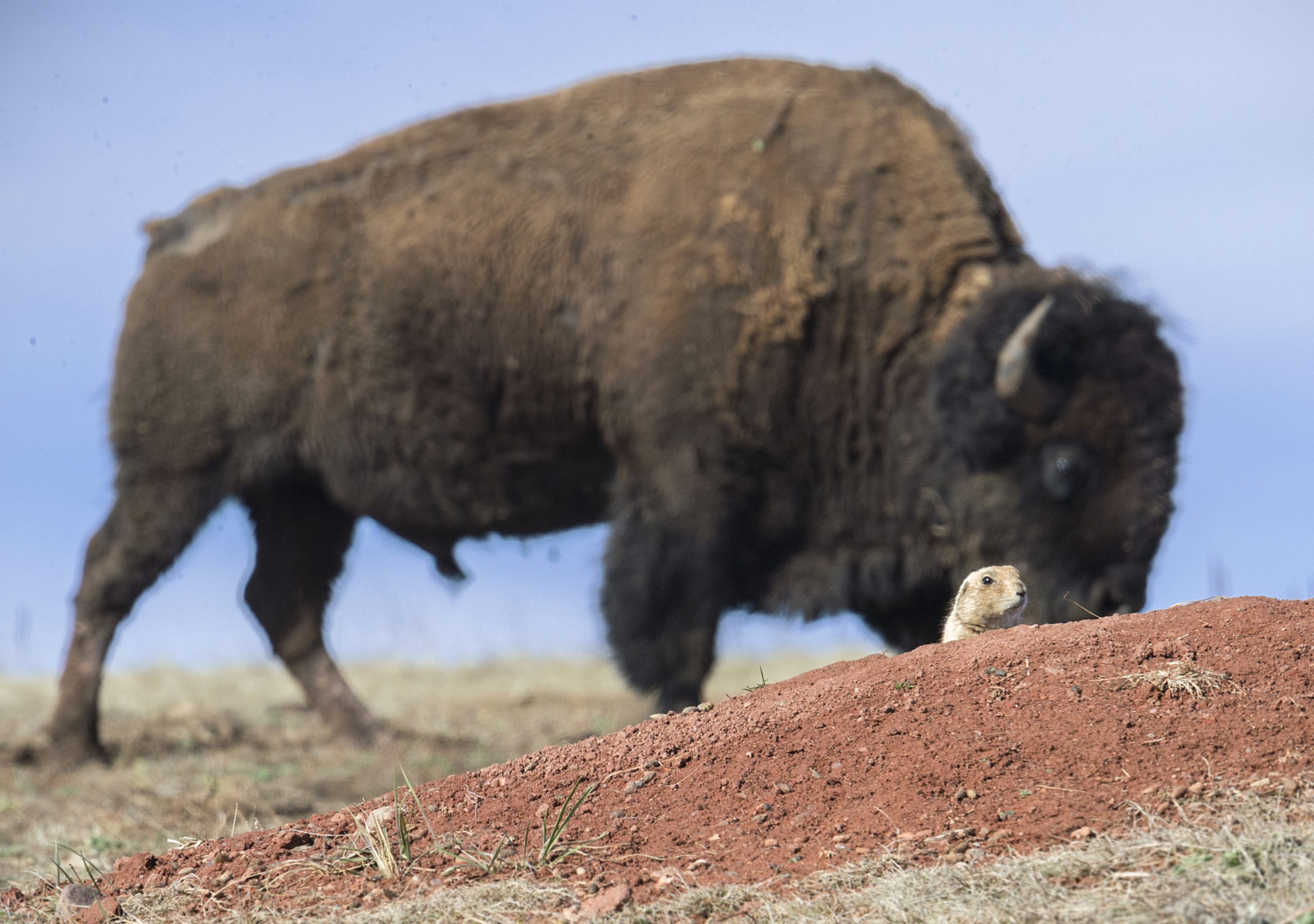
Wind Cave is two parks in one, below ground, one of the longest and most complex caves in the world, famous for its rare, honeycomb-like “boxwork” formations; above ground, a rolling expanse of mixed-grass prairie and ponderosa forest in the Black Hills, roamed by bison, elk and prairie dogs. Named for the wind that rushes through its natural entrance, it protects a whole ecosystem, top to bottom.
Fast facts
- Established: 1903, the first cave to be designated a national park
- Size: about 33,900 acres (137 km²) in the southern Black Hills
- The cave: among the longest in the world, with world-renowned boxwork
- Above ground: mixed-grass prairie and ponderosa forest with bison and elk
- Gateway: Hot Springs, South Dakota
- Managed by: National Park Service
The landscape
Beneath the prairie lies a vast, dense maze of passages adorned with delicate boxwork. Thin calcite fins that form a honeycomb found in few other places on Earth. On the surface, the park protects a rare intact blend of prairie and Black Hills forest, where bison and elk graze, prairie dogs build their towns, and the transition between grassland and ponderosa pine plays out across rolling hills.
Best time to go
Late spring through early fall is prime for both the surface and the cave-tour schedule, with green prairie and active wildlife; the cave stays a cool, constant temperature year-round. Summer is warm with afternoon storms, and winter is cold and quiet, with a reduced tour schedule and a stark beauty above ground.
Getting there and around
The park sits on US-385 in the southern Black Hills between Hot Springs and Custer, an easy add-on to nearby Custer State Park and the Black Hills attractions. A vehicle is needed to reach the visitor center, the launch point for all cave tours, and to drive the scenic roads where wildlife is often seen.
Things to do
Take a ranger-guided cave tour to see the boxwork and passages, from gentle walks to more strenuous routes and introductory caving. On the surface, hike the prairie and forest trails, watch bison, elk and prairie dogs along the roads and in the backcountry, camp at the campground, and enjoy the quiet Black Hills scenery.
Staying safe
Give bison a very wide berth. They are large, fast and unpredictable. Cave tours involve stairs, uneven footing and some tight spots, so choose one matching your fitness. On the surface, guard against summer heat and lightning, watch for rattlesnakes and ticks, and carry water on the trails.
Know before you go
There is no entrance fee, but cave tours are ticketed and sell out in summer, reserve ahead, and backcountry camping needs a free permit. This page is a general overview, not a live conditions report; always confirm current tour availability, conditions and closures with the National Park Service before your trip.
- Coordinates
- 43.5789, -103.4437
- Magnetic declination
- 7.0° E (2026)
Set this declination on your compass, then align it to the map's north lines; it is the angle between true north and magnetic north, refreshed each year.
A spread of the park’s main places shows straight away, and the rest appear as you zoom in. You can also search above, or pick any place from the lists below, and the map will go to it.
On the trail 1
Campground
Sights 3
Point of interest
Peaks
Map data comes from third-party sources and may be incomplete or out of date, so carry a current official map (terms).
- Best seasons
- Late spring, Summer, Early fall
- Difficulty
- Easy to moderate
- Access / trailheads
- In the southern Black Hills of South Dakota on US-385, between Hot Springs and Custer. The visitor center is the hub for cave tours.
- Water
- Water at the visitor center and campground; carry water on surface trails.
- Cell / satellite coverage
- Patchy cell service. Carry a map.
- Nearest ranger / SAR / emergency
- Contact park rangers; life-threatening emergencies: 911.
- Permits & regulations
- No entrance fee; cave tours are ticketed and sell out in summer, and backcountry camping needs a free permit.
- Leave No Trace
- Keep well back from bison, do not touch cave formations, pack out all waste, and follow Leave No Trace.
January
- Below-freezing nights
February
- Below-freezing nights
March
- Below-freezing nights
April
- Below-freezing nights
May
June
July
August
September This month
- Day-to-night swing of 30°F (17°C)
October
November
- Below-freezing nights
December
- Below-freezing nights
What to bring depends on your trip: how long you’re out, where you sleep, and how far you go from the road. The planner builds the list for yours.
Plan a trip here →Averages for 1991–2020 from NOAA U.S. Climate Normals, measured at the Wind Cave station, 2 miles (4 km) away at 4,155 feet (1,266 m). Conditions change with elevation: expect it colder higher up.