

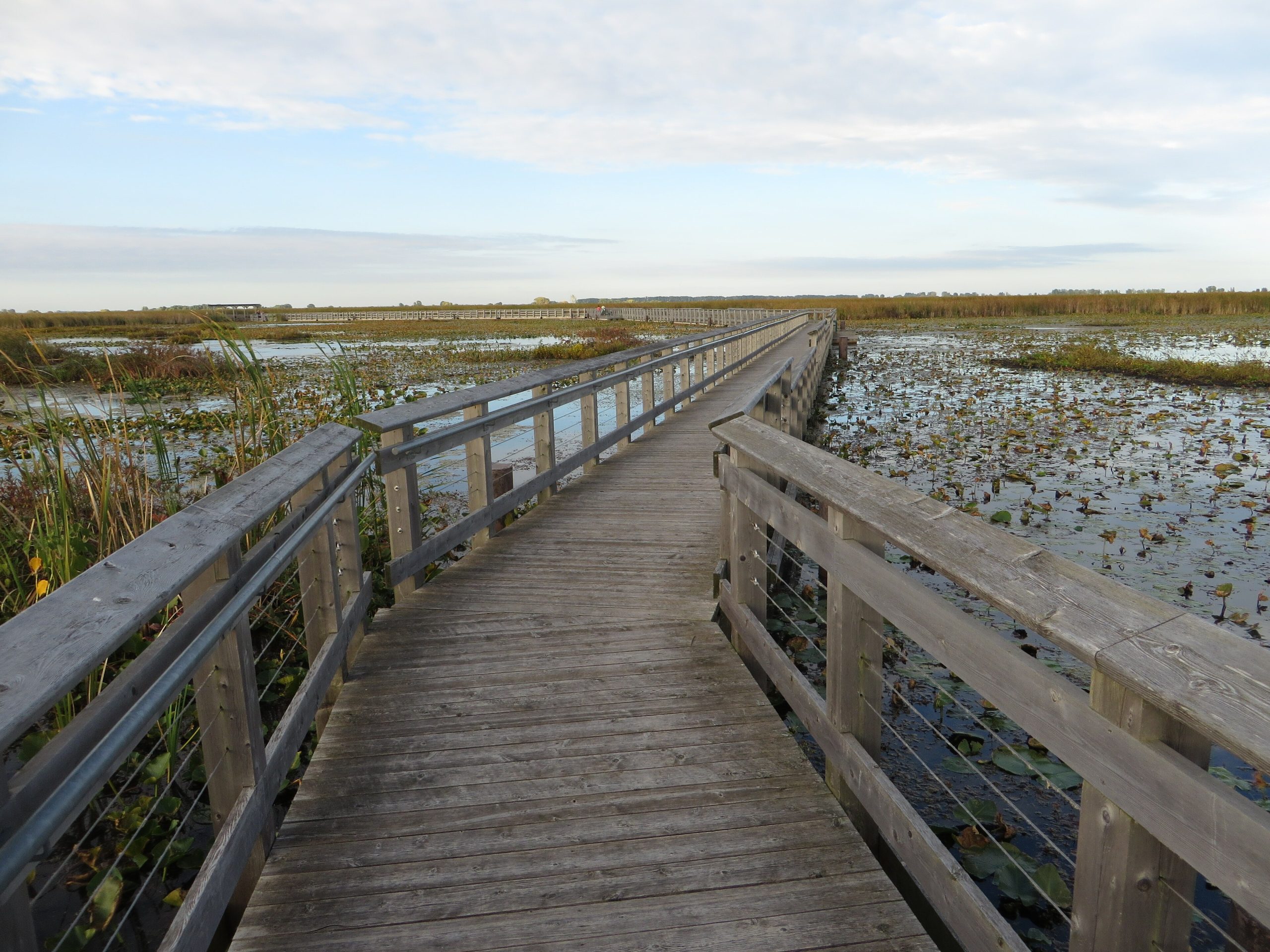
Point Pelee National Park
Point Pelee is a slender sandspit reaching into Lake Erie at the southernmost tip of mainland Canada, a tiny park with an outsized reputation. Its position on a major migratory flyway makes it one of the great birding destinations in North America, where each spring thousands of warblers and, in fall, clouds of monarch butterflies funnel through on their journeys.
Fast facts
- Established: 1918, one of Canada’s oldest national parks
- Size: about 5.8 square miles (15 km²) at the southern tip of mainland Canada
- Famous for: spring warbler migration and fall monarch butterfly migration
- Habitat: rare Carolinian forest and a large freshwater marsh
- Gateway: Leamington, Ontario
- Managed by: Parks Canada
The landscape
The park is a narrow peninsula of sand tapering to a point, cloaked in rare Carolinian forest, a northern outpost of species usually found much farther south, and fringed by a vast cattail marsh and Lake Erie beaches. This concentration of habitat at a continental crossroads packs in extraordinary biodiversity, from turtles and rare plants to hundreds of bird species.
Best time to go
Spring, especially May, is the legendary season, when the “Festival of Birds” brings warblers and birders alike; fall draws the monarch migration and quieter birding. Summer offers warm beach days and marsh paddling. Winter is quiet and cold, with the marsh boardwalk and trails open to bundled-up walkers.
Getting there and around
The park sits near Leamington off Highway 33, an easy drive from Windsor. A vehicle brings you to the visitor centre, from which a shuttle runs out to the tip during busy periods to manage the fragile point. Inside, you get around by foot, bike, boardwalk and canoe through the marsh.
Things to do
Bird the trails and boardwalks in migration, walk out to the very tip of mainland Canada, and paddle the marsh boardwalk and channels by canoe or kayak. Watch monarchs staging in fall, cycle the level paths, swim the beaches in summer, and take in the interpretive programs on this globally important flyway stop.
Staying safe
The waters converging at the tip create dangerous currents, so swimming there is prohibited. Stick to designated beaches and heed the cold-water and current warnings. Storms can blow up over the lake, ticks are common in the warm months, and the sun on the open point is strong, so carry water and protection.
Know before you go
A Parks Canada pass is required, a shuttle serves the tip in busy periods, and some spring birding events need reservations. This page is a general overview, not a live conditions report; always confirm current conditions, shuttle and event details with Parks Canada before your trip.
- Coordinates
- 41.8345, -82.5948
- Magnetic declination
- 7.8° W (2026)
Set this declination on your compass, then align it to the map's north lines; it is the angle between true north and magnetic north, refreshed each year.
A spread of the park’s main places shows straight away, and the rest appear as you zoom in. You can also search above, or pick any place from the lists below, and the map will go to it.
Getting there 1
Park entrance
On the trail 4
Campground
Picnic sites
Sights 10
Viewpoints
Beachs
Map data comes from third-party sources and may be incomplete or out of date, so carry a current official map (terms).
- Best seasons
- Spring (migration), Fall
- Difficulty
- Easy
- Access / trailheads
- At the southern tip of mainland Canada near Leamington, Ontario, off Highway 33; the visitor centre and a shuttle serve the point.
- Water
- Potable water at the visitor centre; carry water on trails.
- Cell / satellite coverage
- Good cell coverage given the setting.
- Nearest ranger / SAR / emergency
- Parks Canada dispatch: 1-877-852-3100; life-threatening emergencies: 911.
- Permits & regulations
- A Parks Canada pass is required; a shuttle runs to the tip in busy periods, and some spring birding events require reservations.
- Leave No Trace
- Stay on boardwalks to protect the fragile marsh and point, pack out all waste, and follow Leave No Trace.
January
- Below freezing all day
February
- Below-freezing nights
March
- Below-freezing nights
April
May
June
July
August
September This month
October
November
December
- Below-freezing nights
What to bring depends on your trip: how long you’re out, where you sleep, and how far you go from the road. The planner builds the list for yours.
Plan a trip here →Averages for 1981–2010 from Environment Canada climate normals, measured at the Kingsville station, 10 miles (16 km) away at 656 feet (200 m).