

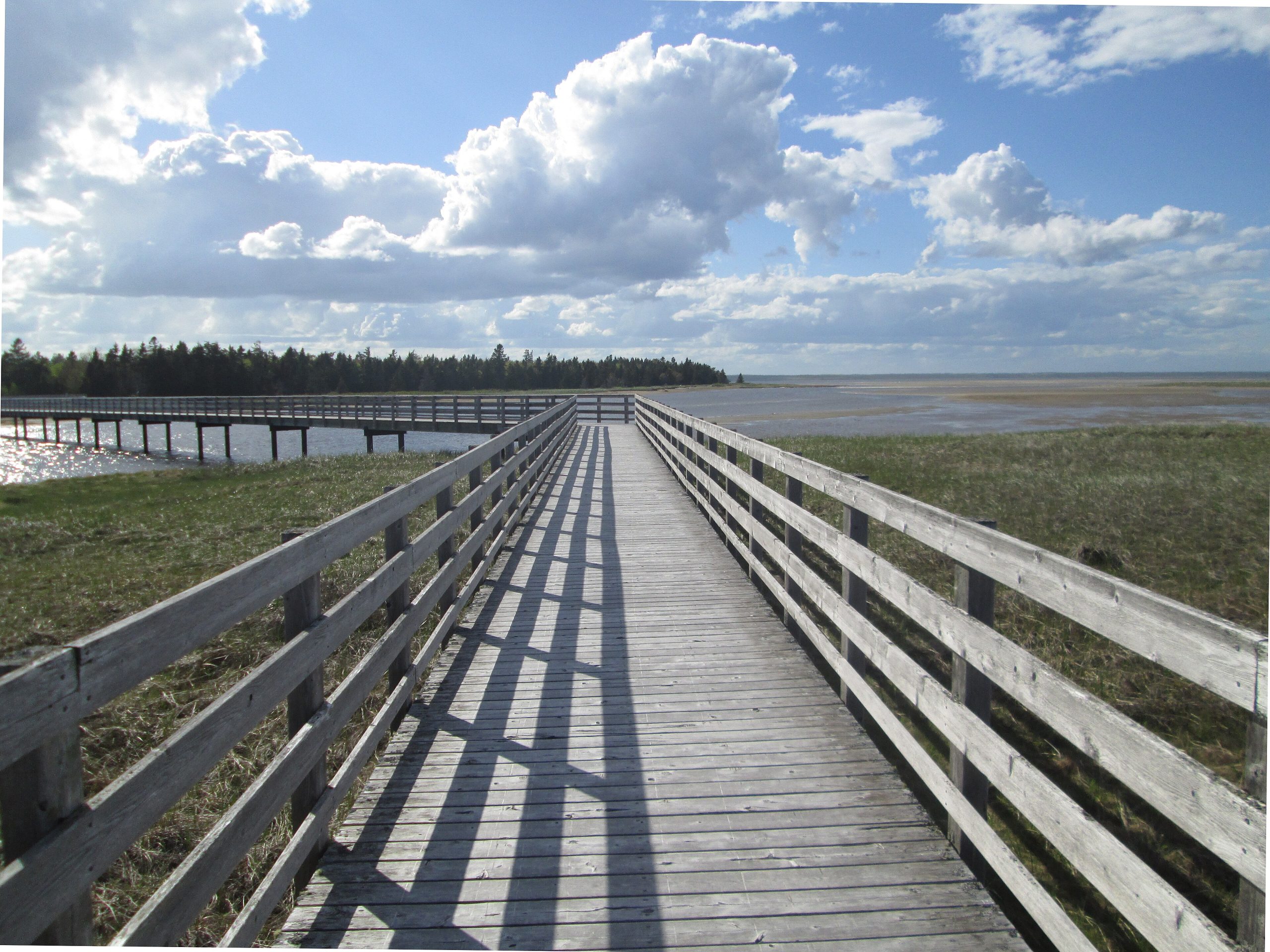
Kouchibouguac National Park
Kouchibouguac protects a gentle, sun-warmed slice of Acadian coast in eastern New Brunswick, barrier islands and golden dunes, warm lagoons, salt marshes and quiet forest along the Gulf of St. Lawrence. Famous for having some of the warmest saltwater north of Virginia, its long sandspits, tern colonies and easy biking and paddling make it a beloved family and nature retreat.
Fast facts
- Established: 1969
- Size: about 92 square miles (238 km²) on the New Brunswick coast
- Coast: barrier islands, dunes and warm lagoons on the Gulf of St. Lawrence
- Wildlife: one of the largest tern colonies in North America, plus seals and shorebirds
- Name: Mi’kmaw for “river of the long tides”
- Managed by: Parks Canada
The landscape
The park is a soft coastal mosaic, long barrier-island dunes sheltering warm lagoons and salt marshes, backed by Acadian forest, bogs and slow tidal rivers. This rich edge between land and sea supports piping plovers, huge tern colonies, grey and harbour seals, and a nursery of marine life, all reached by boardwalk, bike path and paddle.
Best time to go
Summer is the prime season, when the lagoon water warms up for swimming and the full network of trails, beaches and rentals is open. Early fall is quieter and pleasant. Winter turns the park over to cross-country skiing and fat biking, with reduced services and a stark, beautiful coast.
Getting there and around
The park lies on the eastern New Brunswick coast via Highway 11 and Route 117, between Miramichi and Moncton. A vehicle brings you to the entrance and campgrounds, but inside, the park shines for cycling, a scenic bikeway network links the beaches and forest, and for paddling the lagoons and rivers.
Things to do
Bike or walk the trails and the long boardwalk out to Kellys Beach across the dunes, swim in the warm lagoon water, and sea kayak or canoe the sheltered waterways. Watch for seals and terns, join interpretive programs on the Acadian and Mi’kmaw heritage, and camp from serviced sites to canoe-in wilderness spots.
Staying safe
Even the “warm” sea can turn cold and develop rip currents, so heed beach guidance and supervise swimmers. Coastal storms can blow up quickly for paddlers, sun on the open dunes is strong, and ticks and mosquitoes are present. Use repellent, carry water and stay on the boardwalks to protect the fragile dunes and nesting birds.
Know before you go
A Parks Canada pass is required and camping should be reserved, especially in summer. This page is a general overview, not a live conditions report; always confirm current conditions, reservations and closures with Parks Canada before your trip.
- Coordinates
- 46.8311, -64.9605
- Magnetic declination
- 16.5° W (2026)
Set this declination on your compass, then align it to the map's north lines; it is the angle between true north and magnetic north, refreshed each year.
A spread of the park’s main places shows straight away, and the rest appear as you zoom in. You can also search above, or pick any place from the lists below, and the map will go to it.
Getting there 1
Ranger station
On the trail 8
Campgrounds
Picnic site
Sights 8
Viewpoint
Beachs
Point of interest
Map data comes from third-party sources and may be incomplete or out of date, so carry a current official map (terms).
- Best seasons
- Summer, Early fall
- Difficulty
- Easy to moderate
- Access / trailheads
- On the eastern coast of New Brunswick via Highway 11 and Route 117, between Miramichi and Moncton; the main entrance is near the visitor centre.
- Water
- Potable water at campgrounds; carry water on trails.
- Cell / satellite coverage
- Patchy cell service. Carry a map.
- Nearest ranger / SAR / emergency
- Parks Canada dispatch: 1-877-852-3100; life-threatening emergencies: 911.
- Permits & regulations
- A Parks Canada pass is required; camping (including canoe-in and rustic sites) needs a reservation.
- Leave No Trace
- Protect the fragile dunes and tern colonies, stay on boardwalks, pack out all waste, and follow Leave No Trace.
January
- Below freezing all day
February
- Below freezing all day
March
- Below-freezing nights
April
- Below-freezing nights
May
June
July
August
September This month
October
November
- Below-freezing nights
December
- Below freezing all day
What to bring depends on your trip: how long you’re out, where you sleep, and how far you go from the road. The planner builds the list for yours.
Plan a trip here →Averages for 1981–2010 from Environment Canada climate normals, measured at the Rexton station, 10 miles (17 km) away at 15 feet (5 m).