

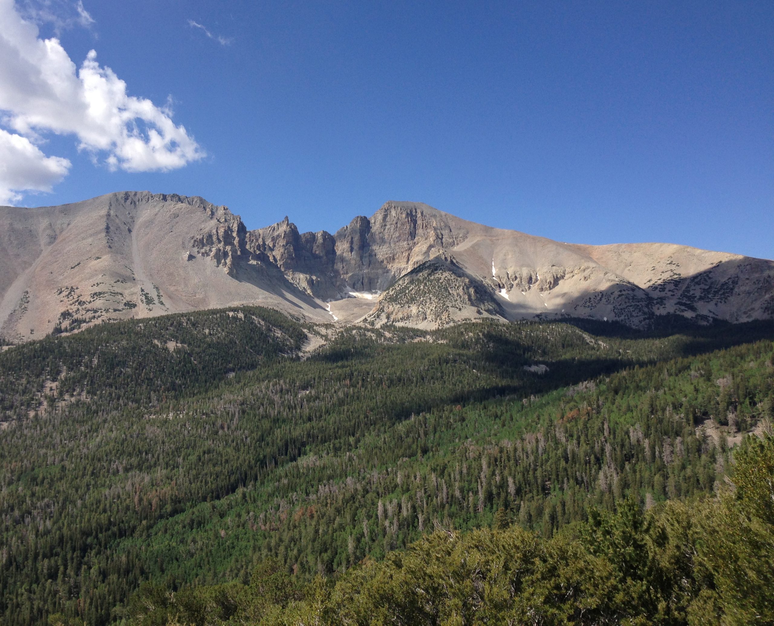
Great Basin National Park
Great Basin is one of America’s quietest and most surprising parks, a lonely mountain island rising from the Nevada desert, crowned by 13,000-foot (4,000 m) Wheeler Peak and ancient bristlecone pines, honeycombed below by the ornate Lehman Caves, and roofed by some of the darkest skies on the continent. Far from any city, it rewards the long drive with solitude and startling variety.
Fast facts
- Established: 1986
- Size: about 77,000 acres (310 km²) in east-central Nevada
- High point: Wheeler Peak, 13,065 feet (3,982 m)
- Living history: bristlecone pines among the oldest trees on Earth
- Dark sky: a certified International Dark Sky Park
- Managed by: National Park Service
The landscape
The park climbs from sagebrush desert through pinyon-juniper and aspen to subalpine forest and a small glacier below Wheeler Peak, compressing many life zones into one mountain. Ancient bristlecone pines cling to the heights, alpine lakes hide in glacial cirques, and beneath the surface the marble Lehman Caves are draped in rare shield and helictite formations.
Best time to go
Summer and early fall are prime, when the Wheeler Peak Scenic Drive is open and the high trails are clear of snow; fall adds golden aspen. Snow lingers at elevation into summer and closes the high road much of the year. Winter is cold and quiet, with the caves open year-round at their constant temperature.
Getting there and around
The park sits near the Utah border via US-50, “the loneliest road in America”, and NV-488, with tiny Baker as the gateway. A vehicle is essential; the Wheeler Peak Scenic Drive climbs to trailheads near 10,000 feet (3,000 m) in season, and services in the area are minimal, so fuel and supply up first.
Things to do
Tour the Lehman Caves on a ranger-led walk, hike to the bristlecone grove and the glacier or up Wheeler Peak, and stroll to the alpine lakes. Drive the scenic road for the views, camp at high elevation, and stay for the ranger astronomy programs under exceptionally dark skies.
Staying safe
Altitude affects visitors quickly here. Pace yourself, hydrate, and watch for afternoon lightning on the exposed peak. Snow can linger on high trails into summer, the caves demand care and warm layers, and the remote desert setting means you should carry water, fuel and supplies and be ready to self-rescue.
Know before you go
There is no entrance fee, but Lehman Caves tours are ticketed and sell out, so reserve ahead. Check the scenic drive’s seasonal status. This page is a general overview, not a live conditions report; always confirm current conditions, tour availability and road status with the National Park Service before your trip.
- Coordinates
- 38.9416, -114.2443
- Magnetic declination
- 11.2° E (2026)
Set this declination on your compass, then align it to the map's north lines; it is the angle between true north and magnetic north, refreshed each year.
A spread of the park’s main places shows straight away, and the rest appear as you zoom in. You can also search above, or pick any place from the lists below, and the map will go to it.
On the trail 22
Trailheads
Campgrounds
Picnic site
Sights 17
Viewpoints
Point of interests
Peaks 10
Map data comes from third-party sources and may be incomplete or out of date, so carry a current official map (terms).
- Best seasons
- Summer, Early fall
- Difficulty
- Easy to strenuous
- Access / trailheads
- In east-central Nevada near the Utah line via US-50 and NV-488; Baker is the tiny gateway town. The Wheeler Peak Scenic Drive climbs high into the range (seasonal).
- Water
- Streams and developed areas have water; carry water and treat backcountry sources.
- Cell / satellite coverage
- Little to no cell service. Carry a map and share your plans.
- Nearest ranger / SAR / emergency
- Contact park rangers; life-threatening emergencies: 911.
- Permits & regulations
- No entrance fee; Lehman Caves tours are ticketed and sell out, and backcountry camping is free but requires self-sufficiency.
- Leave No Trace
- Do not touch cave formations or bristlecones, stay on trails, pack out all waste, and follow Leave No Trace.
January
- Below-freezing nights
February
- Below-freezing nights
March
- Below-freezing nights
April
- Below-freezing nights
May
June
July
August
September This month
October
November
- Below-freezing nights
December
- Below-freezing nights
What to bring depends on your trip: how long you’re out, where you sleep, and how far you go from the road. The planner builds the list for yours.
Plan a trip here →Averages for 1991–2020 from NOAA U.S. Climate Normals, measured at the Great Basin National Park station, 2 miles (3 km) away at 6,850 feet (2,088 m). Conditions change with elevation: expect it colder higher up.