

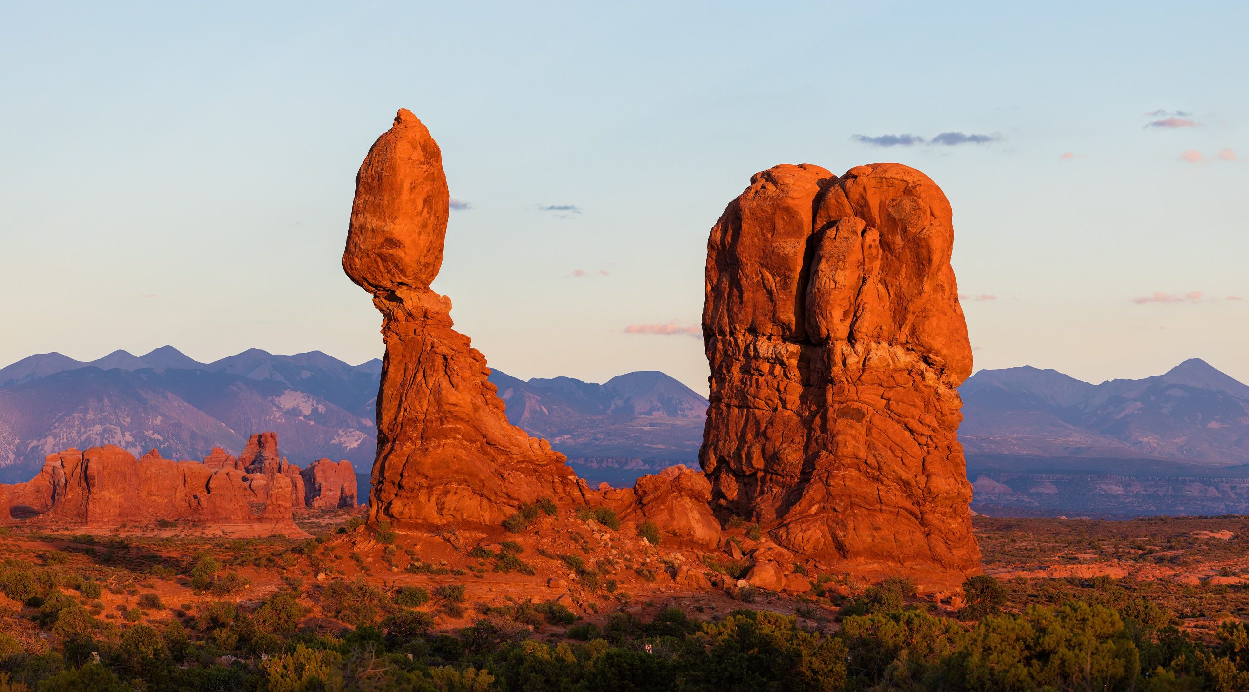
Arches National Park
Arches holds the greatest concentration of natural stone arches on Earth, more than 2,000 of them, from delicate ribbons of rock to the soaring span of Delicate Arch, all set in a surreal red-rock desert above Moab. Compact and easily toured by car, it packs an astonishing density of arches, balanced rocks and slickrock fins into a landscape that glows at sunrise and sunset.
Fast facts
- Established: national monument 1929; national park in 1971
- Size: about 76,500 acres (310 km²) of high desert
- Arches: more than 2,000 documented stone arches
- Icon: Delicate Arch, on Utah’s license plate
- Gateway: Moab, Utah
- Managed by: National Park Service
The landscape
The park sits on a salt bed whose slow movement cracked the overlying sandstone into long fins, which weathering then hollowed into arches. The result is a maze of red rock, arches, pinnacles, balanced rocks and slickrock, framed by the snow-capped La Sal Mountains beyond. Desert wildlife like bighorn sheep, kangaroo rats and lizards make a living in the sparse terrain.
Best time to go
Spring and fall are ideal, with comfortable temperatures for hiking and warm, low light for photography. Summer is intensely hot, so any warm-season visit means early starts and midday shade. Winter is cold and quiet, with occasional snow dusting the red rock for a striking scene.
Getting there and around
The entrance is just north of Moab off US-191, and a paved scenic road runs through the park to the major trailheads, Delicate Arch, Devils Garden, the Windows and Fiery Furnace. In the busy season a timed-entry reservation is required, so plan ahead; a vehicle is needed to move between the widely spaced sites.
Things to do
Hike the moderate slickrock route to Delicate Arch, walk the Devils Garden trail past a string of arches, and stroll the easy paths at the Windows and Landscape Arch. The Fiery Furnace maze is explored by permit or ranger-guided tour, and the dark skies make Arches a superb stargazing destination.
Staying safe
Heat and dehydration are the main dangers. Carry far more water than you expect to need, hike early, and avoid strenuous routes in summer heat. Slickrock has steep, unfenced drop-offs, so watch your footing, keep back from edges, and avoid washes when storms threaten flash floods.
Know before you go
A park pass and, in the busy season, a timed-entry reservation are required. Check the current system and book ahead. Carry all your water. This page is a general overview, not a live conditions report; always confirm current conditions, reservations and permits with the National Park Service before your trip.
- Coordinates
- 38.7259, -109.5954
- Magnetic declination
- 9.5° E (2026)
Set this declination on your compass, then align it to the map's north lines; it is the angle between true north and magnetic north, refreshed each year.
A spread of the park’s main places shows straight away, and the rest appear as you zoom in. You can also search above, or pick any place from the lists below, and the map will go to it.
Getting there 1
Park entrance
On the trail 23
Trailheads
Campgrounds
Picnic sites
Sights 58
Viewpoints
Heritage site
Point of interests
Peaks
Map data comes from third-party sources and may be incomplete or out of date, so carry a current official map (terms).
- Best seasons
- Spring, Fall
- Difficulty
- Easy to moderate
- Access / trailheads
- Just north of Moab, Utah, off US-191; a paved scenic road climbs into the park to the main trailheads and viewpoints.
- Water
- Fill up at the visitor center; there is essentially no water in the park, so carry plenty.
- Cell / satellite coverage
- Limited cell service. Download maps and share your plans.
- Nearest ranger / SAR / emergency
- Contact park rangers or Grand County dispatch; life-threatening emergencies: 911.
- Permits & regulations
- Per-vehicle entry fee (America the Beautiful pass accepted); a timed-entry reservation is required in the busy season, and the Fiery Furnace needs a permit or guided tour.
- Leave No Trace
- Stay on trails and slickrock, never walk on cryptobiotic soil, pack out all waste, and follow Leave No Trace.
January
- Below-freezing nights
February
- Below-freezing nights
March
April
May
June
- Hot days
- Day-to-night swing of 30°F (17°C)
July
- Hot days
August
- Hot days
September This month
October
November
December
- Below-freezing nights
What to bring depends on your trip: how long you’re out, where you sleep, and how far you go from the road. The planner builds the list for yours.
Plan a trip here →Averages for 1991–2020 from NOAA U.S. Climate Normals, measured at the Arches National Park HQ station, 9 miles (14 km) away at 4,093 feet (1,248 m).