

Top 9 things to do in Arches National Park
Arches holds more than 2,000 natural stone arches, the densest collection on Earth, in a park small enough to cross in under an hour. One paved road runs 18 miles (29 km) from the entrance near Moab to Devils Garden, with two short spurs, and nearly everything on this list starts beside it. These are the nine outings we would put first. The order starts with what the park is known for, then goes by what an outing gives back for the time and effort it takes. Distances and heights are National Park Service figures; times are our estimates and do not include stops.
This is desert. From June to August the afternoons pass 100°F (38°C), there is almost no shade, and water is available at only a couple of places. Hike early or late, and carry at least 2 quarts (2 litres) of water each for any trail longer than a mile (1.6 km). In the busy months you need a timed-entry reservation to drive in during the day.
1. Hike to Delicate Arch for sunset
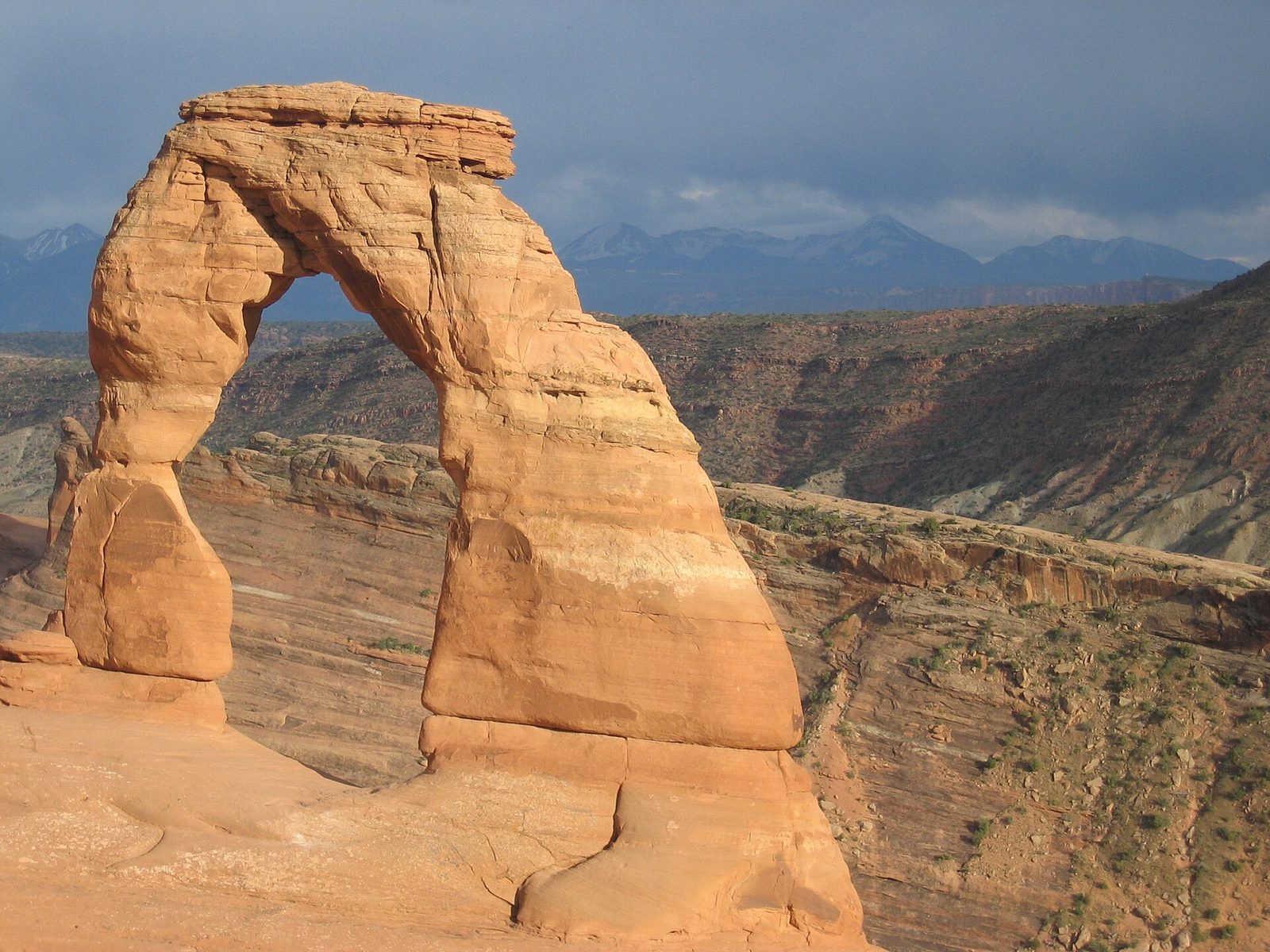
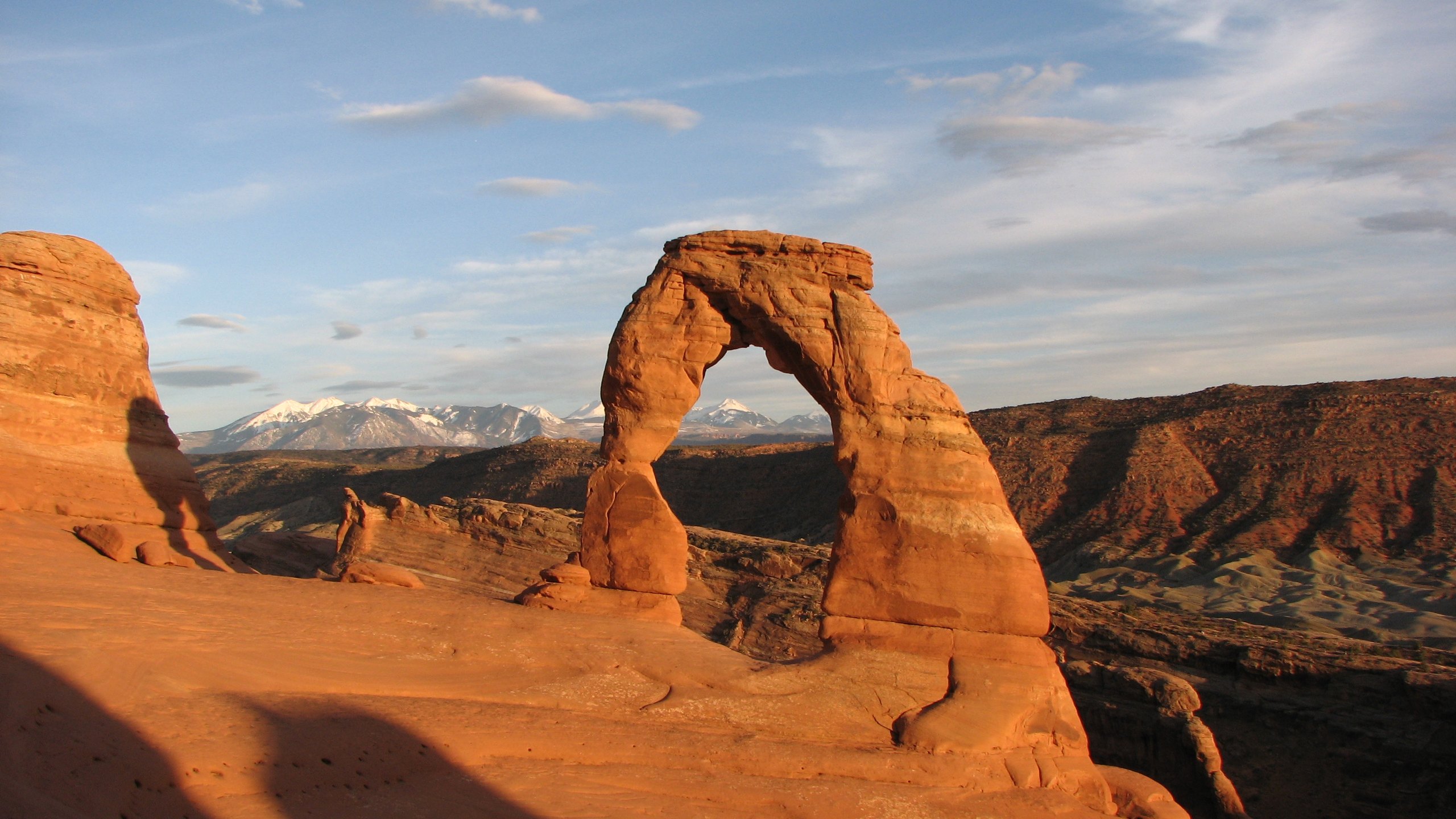
Delicate Arch is the one on Utah’s licence plates: a freestanding arch 52 feet (16 m) high on the rim of a slickrock bowl, with the La Sal Mountains behind it. You cannot see it from the trail until the last few steps. The route passes the cabin at Wolfe Ranch and a panel of Ute rock carvings, climbs a long, open slope of bare sandstone marked by cairns, and finishes along a ledge cut into a cliff, about 200 yards (180 m) long, before the arch appears all at once.
The trail has no shade and no water, and heat illness is common on it in summer. In the warm months go at sunrise or for sunset, not at midday, and bring a headlamp for the walk down. The parking area fills, so arrive well ahead.
- Distance: 3 miles (4.8 km) round trip
- Climb: 480 feet (146 m)
- Allow: 2 to 3 hours
- Start: Wolfe Ranch, on the Delicate Arch road, 13 miles (21 km) from the entrance
- When: March to May and September to November for comfortable temperatures. The ledge is dangerous with ice on it.
- Suits: most walkers in cool weather. The ledge has a drop on one side.
2. Walk through the Windows and under Double Arch
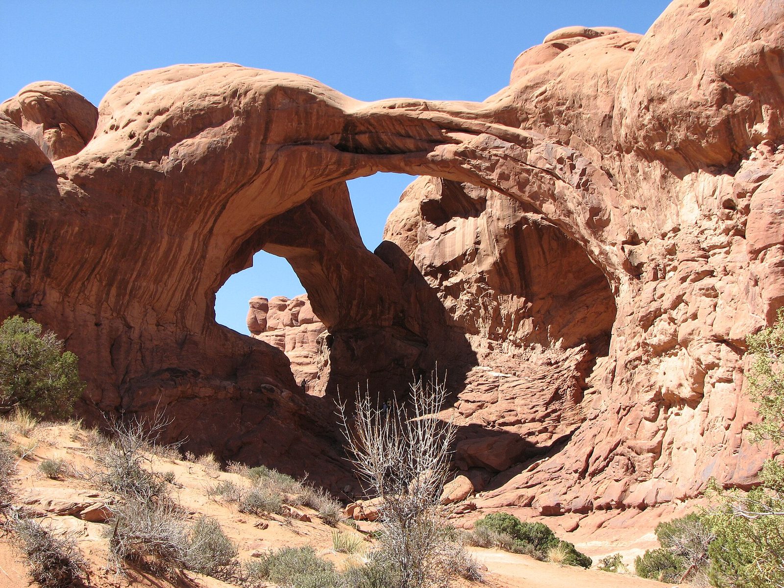
The Windows Section packs more large arches into a short walk than anywhere else in the park. A gravel loop climbs gently to the North and South Windows, two openings side by side in one fin, and to Turret Arch opposite. Across the parking area, a level sandy path leads to Double Arch, two giant spans that share one footing, the taller rising 112 feet (34 m). You can scramble up the slickrock underneath and look out through both. If you have two hours in the park, spend them here.
- Distance: a loop of 1 mile (1.6 km) for the Windows; 0.6 miles (1 km) round trip to Double Arch
- Allow: 1 to 1.5 hours for both
- Start: the Windows parking area, at the end of the Windows road, 12 miles (19 km) from the entrance
- When: all year; sunrise at the Windows is quiet and well lit
- Suits: everyone. The first stretch toward the Windows takes wheelchairs with help.
3. Walk Devils Garden to Landscape Arch
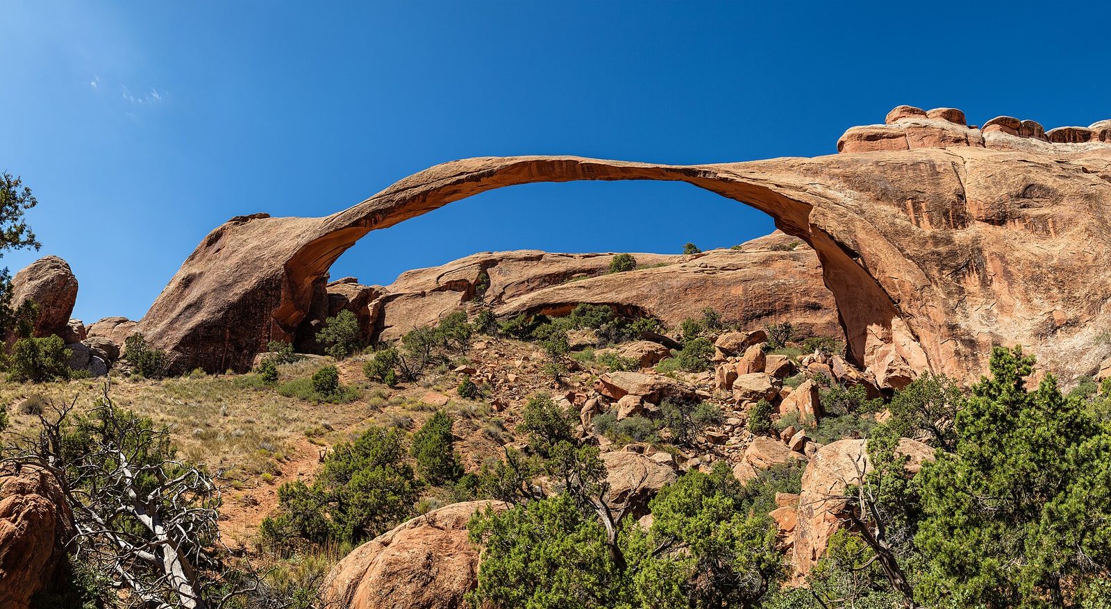
Landscape Arch spans 306 feet (93 m), the longest arch in North America, and is in places only a few feet thick. In 1991 a slab 60 feet (18 m) long fell from its underside, and the trail that used to pass beneath it has been closed ever since. The walk to it is on a wide, firm path between sandstone fins, with short spurs to Tunnel Arch and Pine Tree Arch on the way.
Beyond Landscape Arch the trail changes. It climbs a steep fin and continues along narrow rock ridges to Double O Arch, and a primitive loop returns through sand and slickrock where you follow cairns. That full circuit is the longest maintained hike in the park and needs sure feet and a head for heights.
- Distance: 1.9 miles (3.1 km) round trip to Landscape Arch; 7.9 miles (12.7 km) for the full loop with every spur
- Allow: 1 hour to Landscape Arch; 4 to 5 hours for the loop
- Start: Devils Garden Trailhead, at the end of the park road
- When: all year to Landscape Arch; the loop is hazardous when wet or icy
- Suits: everyone to Landscape Arch; experienced hikers beyond it
4. Drive the park road and stop at Balanced Rock
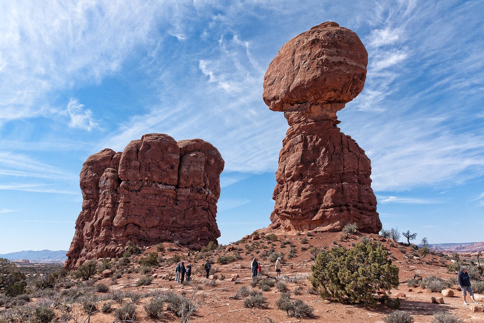
The road itself is the park’s best introduction. It climbs from the visitor center in switchbacks, passes the Courthouse Towers and the petrified dunes, and runs out across open desert with the La Sal Mountains on the horizon. Balanced Rock stands beside it: a boulder the size of three school buses on a narrowing pedestal, 128 feet (39 m) high in all. A short paved loop circles its base. Come back at sunset, when the rock turns deep red.
- Distance: 18 miles (29 km) one way to Devils Garden; a loop of 0.3 miles (0.5 km) at Balanced Rock
- Allow: half a day with the spur roads and short stops
- Start: the park entrance, 5 miles (8 km) north of Moab on US 191
- When: all year
- Suits: everyone
5. Walk down Park Avenue
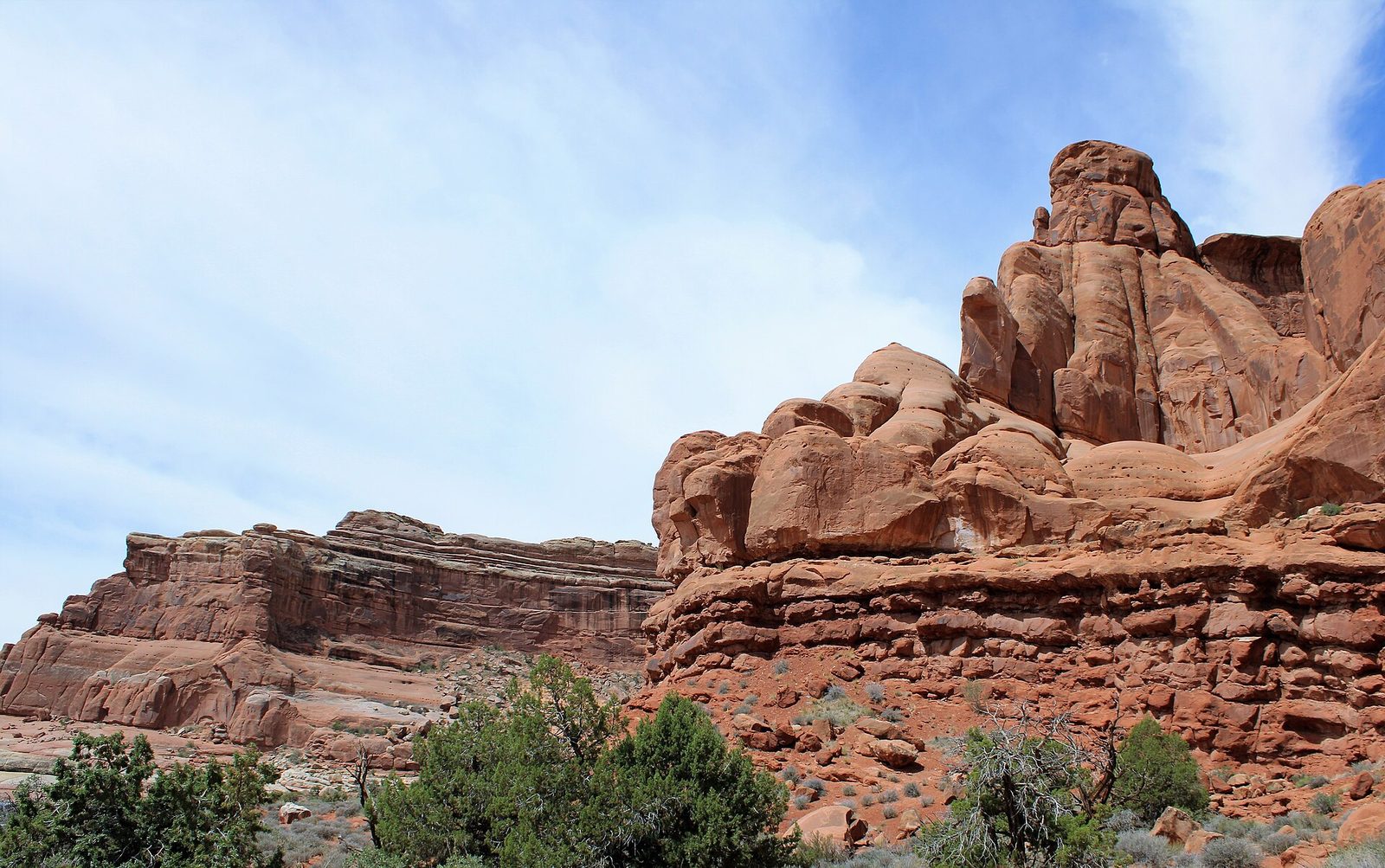
Park Avenue is a wide, flat-floored canyon between sheer sandstone walls that early visitors compared to a street of skyscrapers. From the viewpoint, steps lead down to the canyon floor, and the trail follows a dry wash past balanced slabs and towers to the Courthouse Towers at the far end. It is one of the first stops on the road and one of the least crowded good walks in the park. Have someone drive round to collect you, or turn back when you have seen enough.
- Distance: 1 mile (1.6 km) one way
- Climb: about 320 feet (98 m) back up to the viewpoint
- Allow: 45 minutes one way; 1.5 hours out and back
- Start: Park Avenue viewpoint, 2 miles (3.2 km) from the entrance
- When: all year; shaded early and late in the day
- Suits: most walkers
6. Follow a ranger through the Fiery Furnace
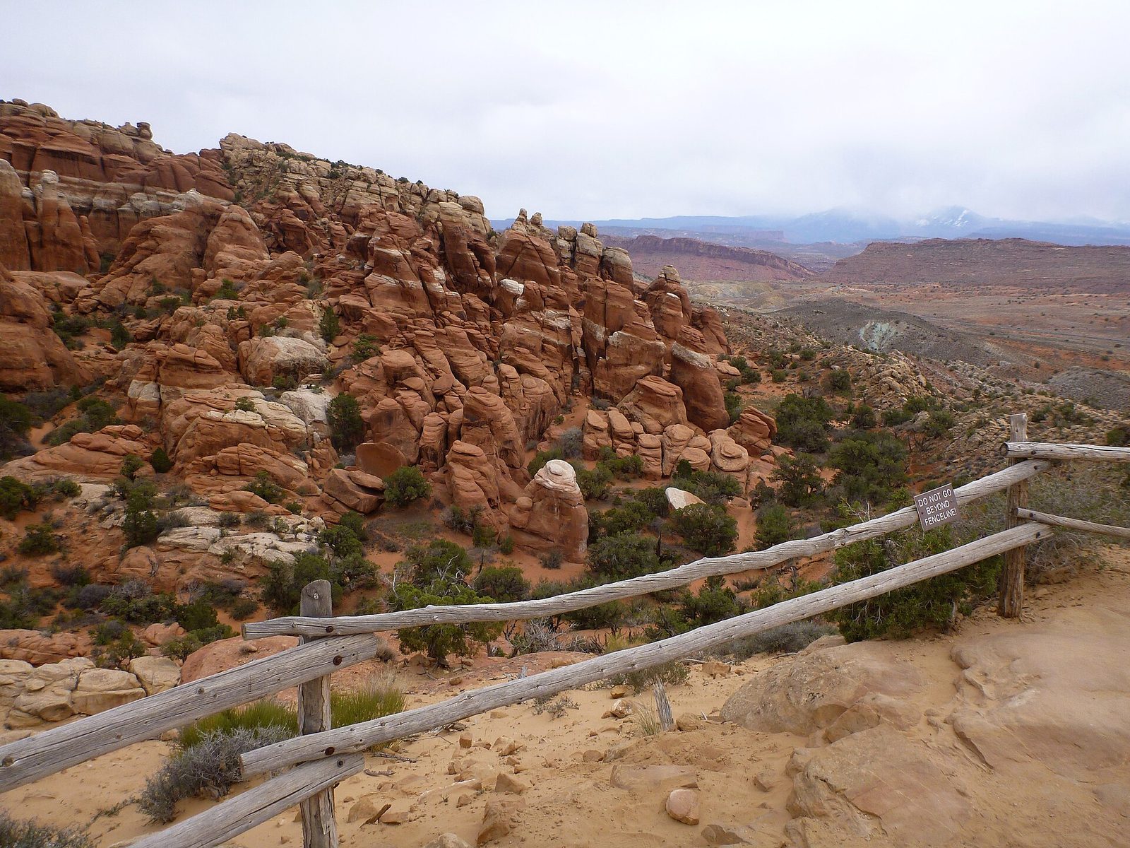
The Fiery Furnace is a maze of narrow slots between tall sandstone fins, with no trail, no signs and many dead ends. A ranger-led hike is the way most people see it: about three hours of squeezing through cracks, stepping across gaps and walking ledges, with a guide who knows the route and explains the rock and the plants. Tickets go on sale a week ahead and sell out quickly. Experienced parties can go in on their own with a permit, after a briefing.
The hike needs both hands and good balance. Children under five are not allowed. Despite the name it is cooler than the open desert, because the fins shade the slots.
- Distance: about 2 miles (3.2 km)
- Allow: 3 hours
- Start: Fiery Furnace parking area, 14 miles (23 km) from the entrance
- When: ranger hikes run from spring to fall
- Needs: a ticket for the ranger hike, or a permit to enter alone
- Suits: agile walkers who are comfortable in tight spaces
7. Cool off at Sand Dune Arch
Sand Dune Arch is hidden in a slot between two fins, a few minutes from the road, and the floor of the slot is deep, fine sand that stays shaded and cool. It is the best stop in the park for young children and the one comfortable place to be at noon in July. From the same trailhead a level path crosses a grassy flat to Broken Arch, and can be continued as a loop through the Devils Garden Campground.
- Distance: 0.3 miles (0.5 km) round trip to Sand Dune Arch; a loop of about 2 miles (3.2 km) with Broken Arch
- Allow: 30 minutes, or 1.5 hours with the loop
- Start: Sand Dune Arch parking area, 16 miles (26 km) from the entrance
- When: all year
- Suits: families. Do not climb on the arch.
8. See the park after dark
Arches is a certified International Dark Sky Park, and the timed-entry system does not apply at night, so the evening is both the darkest and the easiest time to be there. On a moonless night the Milky Way arcs over the fins, and the arches make dark frames against it. Balanced Rock, the Windows and Panorama Point are the usual places to watch from, all a few steps from a parking area. Under a full moon the rock is bright enough to walk the short trails without a light.
- Allow: an evening
- Start: Panorama Point or the Windows parking area
- When: all year; around the new moon for stars. The park is open 24 hours.
- Suits: everyone. Use a red light, and do not shine lights on the arches.
9. Find Tower Arch in the Klondike Bluffs
Tower Arch is for the second day, or for anyone who wants an arch without a crowd. It stands in the Klondike Bluffs, in the park’s northwest corner, at the end of a dirt road. The trail climbs a rocky ridge, crosses open desert with views of the fins called the Marching Men, and works through sand to a broad arch with a tall spire beside it. Cairns mark the way and are easy to miss.
- Distance: 2.6 miles (4.2 km) round trip
- Allow: 2 to 3 hours, plus about 40 minutes’ drive each way from the main road
- Start: Klondike Bluffs parking area, at the end of the unpaved Salt Valley Road
- When: March to May and September to November, in dry weather. The road is impassable when wet.
- Suits: hikers used to following cairns
Before you go
This list covers what stays the same from year to year. Timed-entry dates, Fiery Furnace ticket rules and road conditions change, and the National Park Service posts them on its own site. The link is on our Arches National Park guide, with the map, reservations and how to get there.