

Hawaii Volcanoes National Park
Hawaiʻi Volcanoes National Park is a front-row seat to the raw creation of the Earth, home to Kīlauea, one of the most active volcanoes on the planet, and Mauna Loa, the largest. Here you can walk across still-warm lava, peer into a glowing summit caldera, and watch new land being born, all within a park that also protects rainforest, sea cliffs and a living Hawaiian cultural landscape.
Fast facts
- Established: 1916
- Size: about 335,000 acres (1,360 km²) on the Big Island of Hawaiʻi
- Volcanoes: Kīlauea (among the world’s most active) and Mauna Loa (the largest)
- World Heritage: a UNESCO World Heritage Site (1987)
- Gateway: Hilo, Hawaiʻi (about 45 minutes)
- Managed by: National Park Service
The landscape
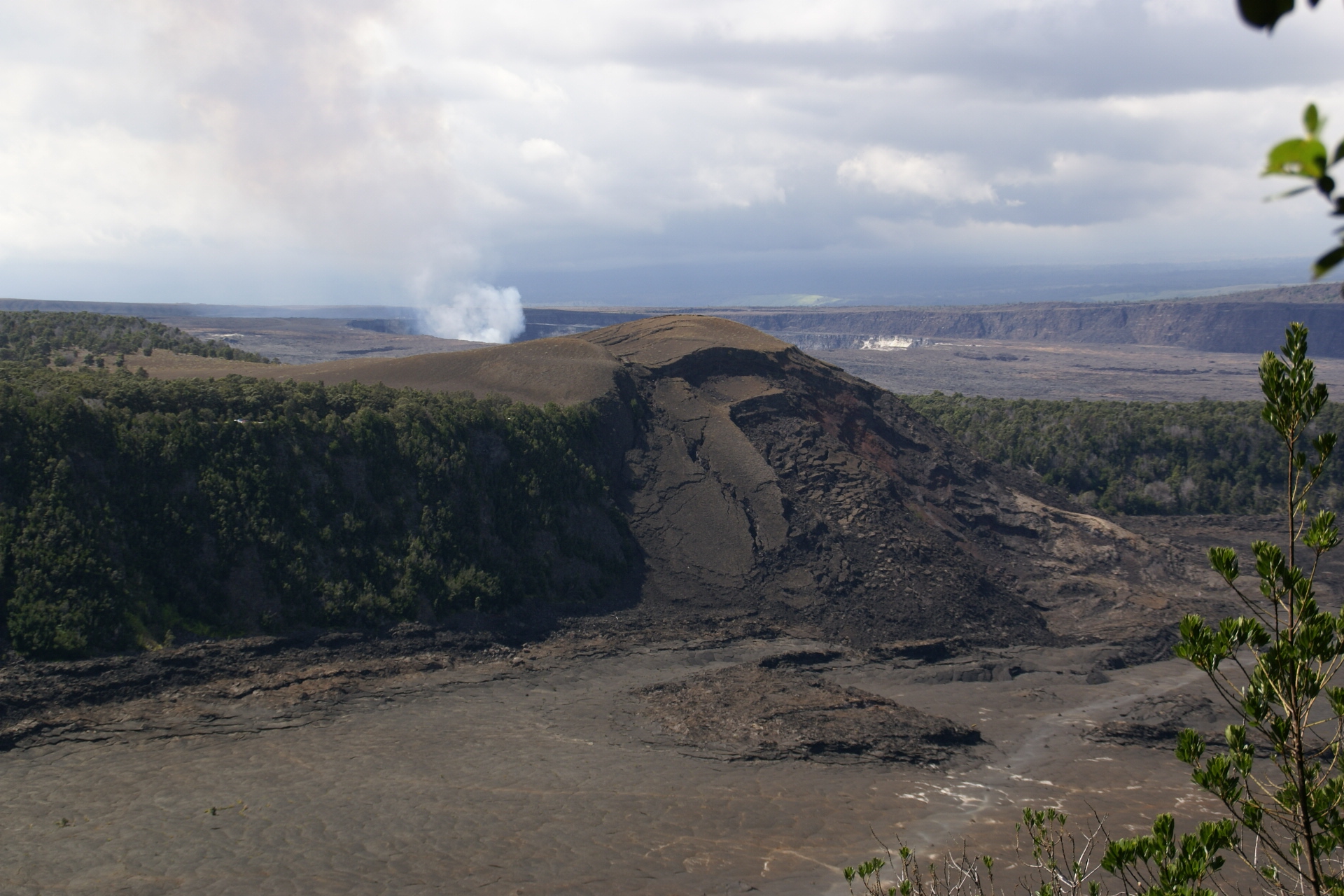
The park descends from the 13,000-foot (4,000 m) heights of Mauna Loa across the summit of Kīlauea and its steaming caldera, through fern and ʻōhiʻa rainforest, over vast hardened lava flows, and down the Chain of Craters Road to sea cliffs where lava meets the ocean. It is a landscape in constant change, dotted with craters, lava tubes, steam vents and, at times, active eruption, and it holds sites of deep meaning in Hawaiian tradition.
Best time to go
The park is open year-round, and its weather varies more by elevation than by season, warm and often rainy in the rainforest, cooler and clearer up high. Volcanic activity, not the calendar, shapes a visit: an active eruption draws crowds (and possible closures), while quieter periods still offer craters, lava fields and glow after dark. Nights are excellent for stargazing.
Getting there and around
The park sits on the Big Island via Highway 11, about 45 minutes from Hilo. Crater Rim Drive loops key overlooks and trailheads around the Kīlauea summit, and the Chain of Craters Road descends nearly 4,000 feet (1,200 m) to the coast and its lava fields. A vehicle is essential; conditions and closures shift with volcanic activity, so check current status first.
Things to do
Peer into the Kīlauea caldera from overlooks, walk through the Nāhuku (Thurston) lava tube, and hike across the crater floor of Kīlauea Iki or over the vast Chain of Craters lava flows to sea arches and petroglyphs. Ambitious, permitted backpackers climb toward the Mauna Loa summit, and after dark the caldera’s glow (when active) and the star-filled sky are unforgettable.
Staying safe
Volcanic gas, vog and sulfur dioxide, can be hazardous, especially for those with heart or breathing conditions, so heed air-quality warnings and closures. The ground can hide unstable crust, earth cracks and cliff edges near lava and the coast, so stay strictly on marked trails and behind barriers. Lava terrain is sharp and sun-baked, so wear sturdy shoes, carry water, and check eruption updates before you go.
Know before you go
A park pass is required, backcountry and Mauna Loa trips need permits, and eruption activity can close areas with little notice. Always check current volcanic and air-quality conditions before and during your visit. This page is a general overview, not a live conditions report; confirm current conditions, closures and permits with the National Park Service before your trip.
- Coordinates
- 19.2608, -155.4154
- Magnetic declination
- 9.3° E (2026)
Set this declination on your compass, then align it to the map's north lines; it is the angle between true north and magnetic north, refreshed each year.
A spread of the park’s main places shows straight away, and the rest appear as you zoom in. You can also search above, or pick any place from the lists below, and the map will go to it.
Getting there 6
Park entrance
Airstrips
Visitor centre
On the trail 20
Trailheads
Campgrounds
Hut or shelters
Picnic site
Sights 62
Viewpoints
Beachs
Heritage site
Point of interest
Islands
Peaks 30
Map data comes from third-party sources and may be incomplete or out of date, so carry a current official map (terms).
- Best seasons
- Year-round
- Difficulty
- Easy to strenuous
- Access / trailheads
- On the Big Island of Hawaiʻi via Highway 11, about 45 minutes from Hilo. Crater Rim Drive and Chain of Craters Road access the main sights; the latter descends to the coast.
- Water
- Carry all your water; there is little to none along the trails and lava flows.
- Cell / satellite coverage
- Patchy cell service. Carry a map and check eruption and air-quality updates before you go.
- Nearest ranger / SAR / emergency
- Contact park rangers; life-threatening emergencies: 911.
- Permits & regulations
- Per-vehicle entry fee (America the Beautiful pass accepted); backcountry and Mauna Loa summit trips require permits, and active-eruption areas may close on short notice.
- Leave No Trace
- Stay on marked trails and away from closures and cliff edges, respect Hawaiian cultural sites, pack out all waste, and follow Leave No Trace.
January
February
March
April
May
June
July
August
September This month
October
November
December
What to bring depends on your trip: how long you’re out, where you sleep, and how far you go from the road. The planner builds the list for yours.
Plan a trip here →Averages for 1991–2020 from NOAA U.S. Climate Normals, measured at the Hawaii Volcanoes National Park HQ station, 6 miles (10 km) away at 3,971 feet (1,210 m). Conditions change with elevation: expect it colder higher up.