

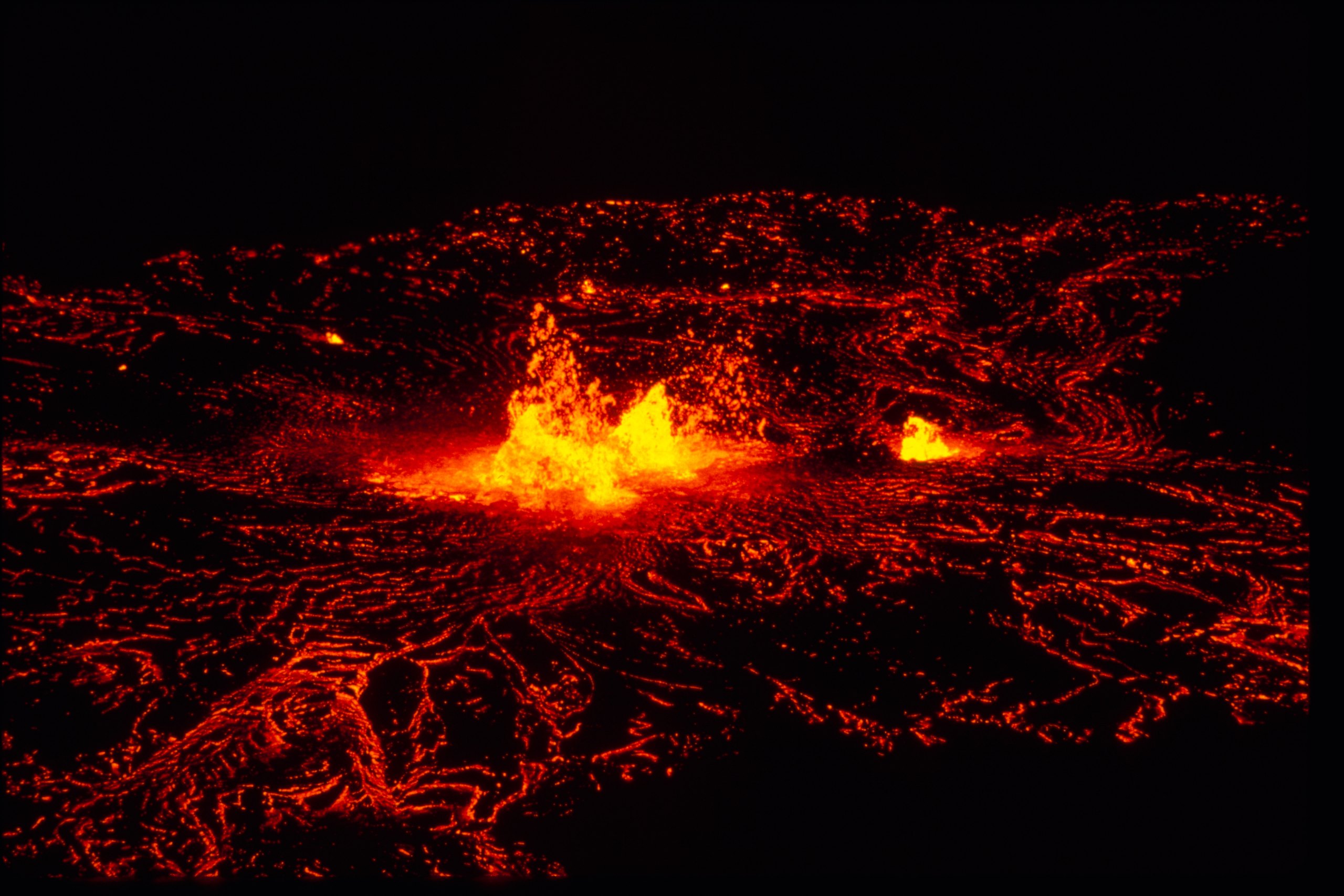
Top 10 things to do in Hawaiʻi Volcanoes National Park
Hawaiʻi Volcanoes National Park covers the summits of two of the most active volcanoes on Earth, Kīlauea and Mauna Loa, and runs from rainforest at 4,000 feet (1,200 m) down across bare lava to the sea. Kīlauea has erupted on and off for most of the last 40 years, at times in short, spectacular episodes of lava fountaining inside its summit crater separated by quiet days or weeks, at times not at all. No two visits are the same. These are the ten outings we would put first. The order starts with what the park is known for, then goes by what an outing gives back for the time and effort it takes. Distances are approximate; times are our estimates and do not include stops.
This is a live volcano, and the park closes areas at short notice when the ground shakes, cracks open or the gas rises. Stay on marked trails and behind barriers: crater rims and cracks give way without warning. Volcanic gas and the haze it makes, called vog, are a hazard for anyone with heart or breathing problems, for pregnant women and for infants and young children. The summit is often cool, wet and windy, while the coast is hot, sunny and dry, so bring layers, rain gear, sun protection and water for both.
1. Look into Halemaʻumaʻu, and come back after dark
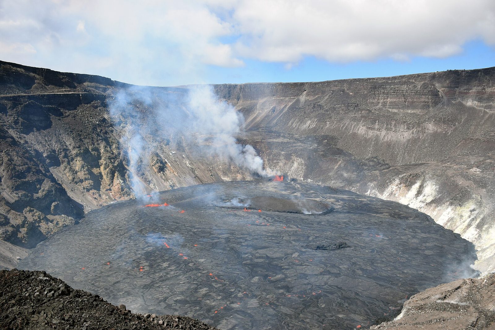
Halemaʻumaʻu, the crater within Kīlauea’s summit caldera, is in Hawaiian tradition the home of Pele, goddess of volcanoes. Its floor collapsed in 2018 and has been refilling with lava in eruptions ever since. Several overlooks on the caldera rim, Kīlauea Overlook and Uēkahuna among them, look across the caldera to it. When the volcano is erupting, the summit is the park’s great show: by day a plume of steam and gas, by night a red glow on the clouds and, during fountaining, lava jetting into the air. Go back after dark, or before dawn when it is quieter.
- Allow: 1 hour by day; 1 to 2 hours after dark
- Start: the overlooks on Crater Rim Drive, west of the Kīlauea Visitor Center
- When: all year; the glow depends on what the volcano is doing
- Suits: everyone; bring a warm layer and a flashlight at night
2. Hike across the floor of Kīlauea Iki
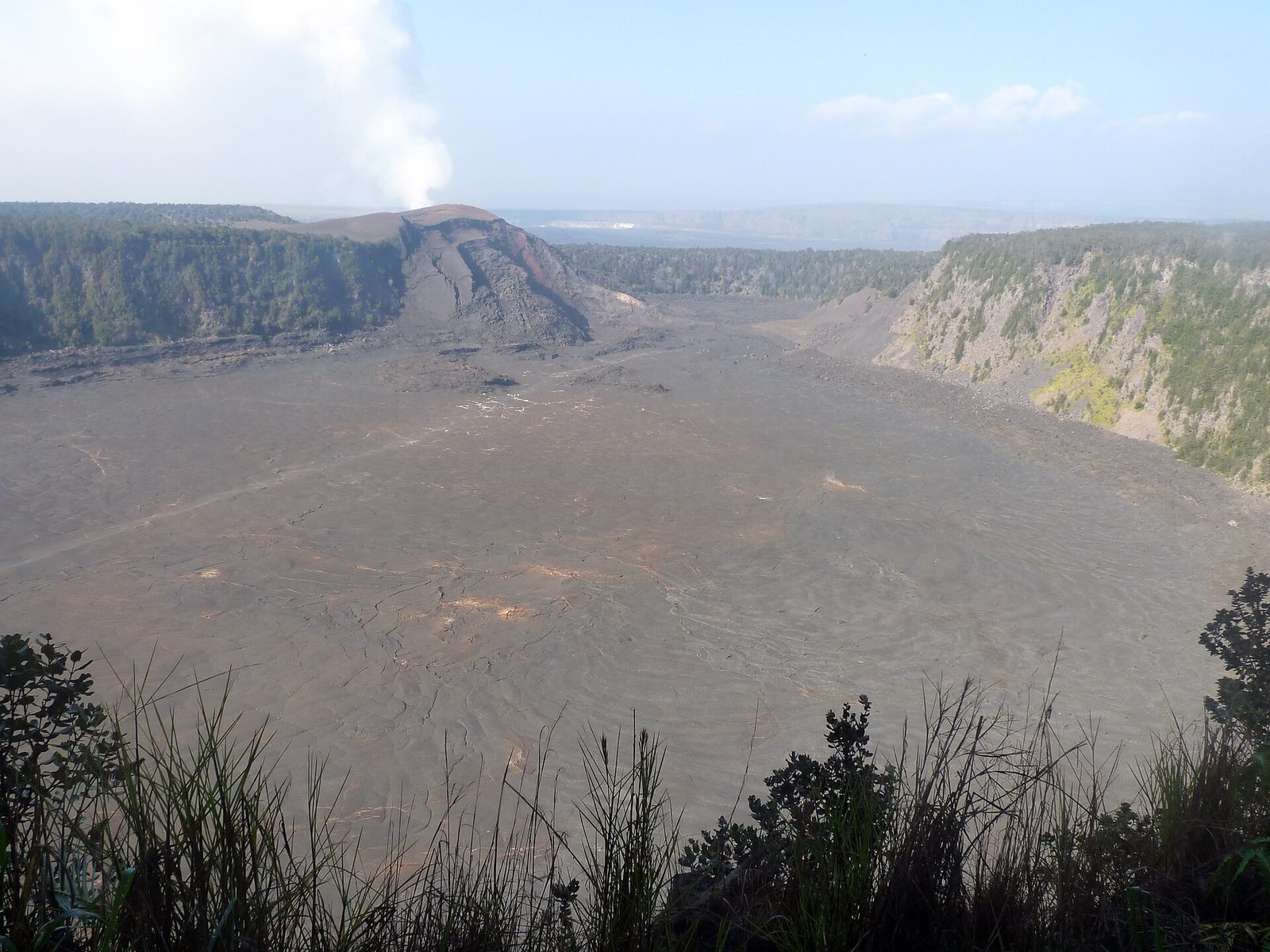
In 1959, Kīlauea Iki, a crater beside the main caldera, filled with a lake of lava while fountains as high as 1,900 feet (580 m) roared above it. The lake has cooled to a hard, cracked floor, still steaming in places, and the trail drops through rainforest full of birdsong, crosses the crater floor past the vent that fed it and climbs back out. It is the park’s best day hike, and the contrast between the green rim and the black floor is unforgettable.
- Distance: about 3.3 miles (5.3 km) loop
- Climb: about 400 feet (120 m) down to the floor and back up
- Allow: 2 to 3 hours
- Start: Kīlauea Iki Overlook, on Crater Rim Drive
- When: all year; early morning for cool air and empty parking
- Suits: most walkers in steady shoes; the crater floor has no shade
3. Drive the Chain of Craters Road to the sea
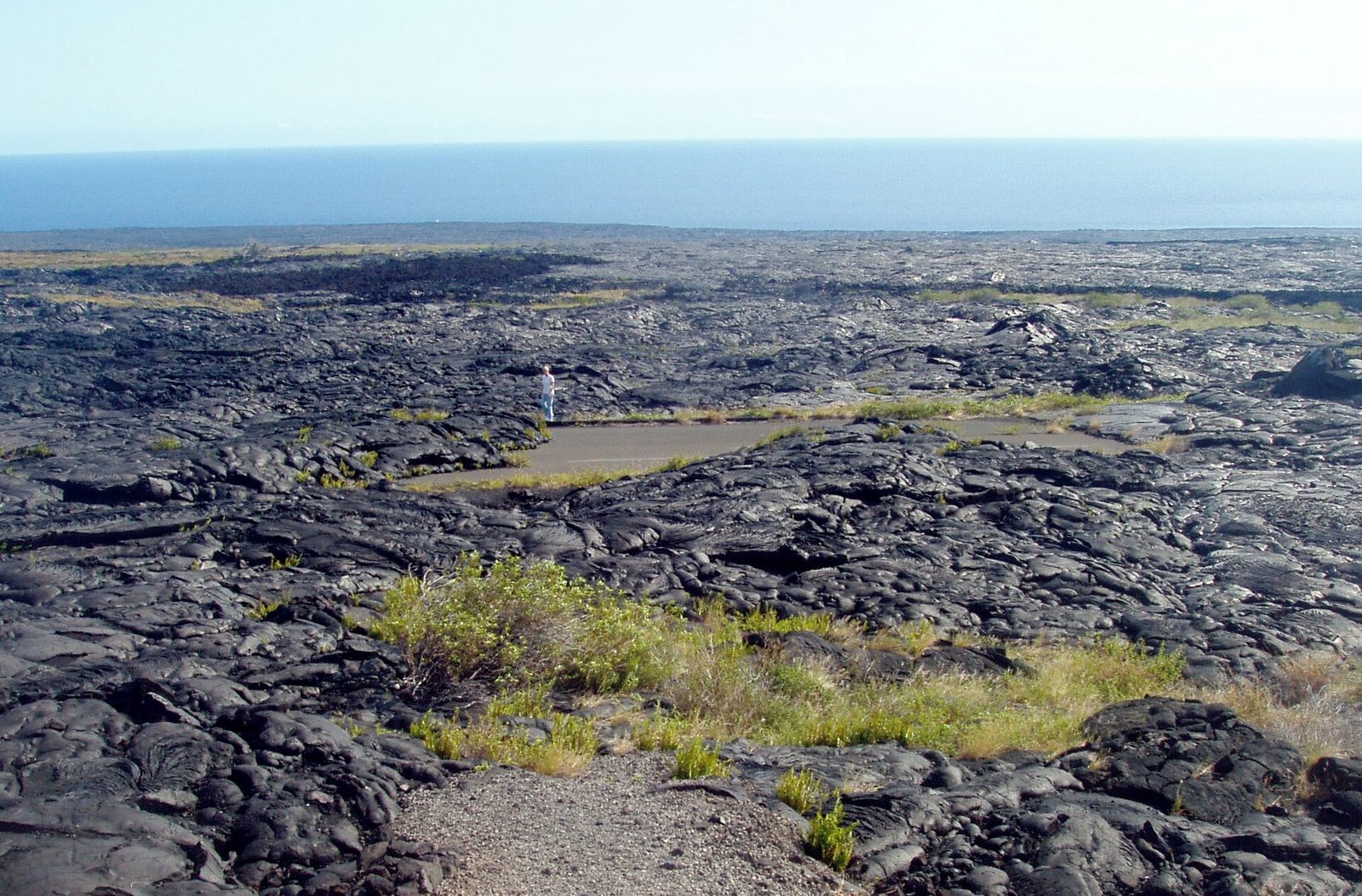
The road drops 3,700 feet (1,100 m) in 19 miles (31 km) from the summit to the coast, past a string of pit craters and across lava flows of many ages, from forested old flows to the black lava of the 1970s that buried the road in places. Pull-offs show where each flow came down. Near the bottom, the coastal cliffs fall to the Pacific, and the road ends where lava from 1986 to 2018 covered it. There is no fuel, food or water below the summit.
- Distance: 19 miles (31 km) each way
- Allow: half a day, with stops
- Start: the junction with Crater Rim Drive, near the Kīlauea Iki Overlook
- When: all year
- Suits: everyone
4. Walk through Nāhuku, the Thurston Lava Tube
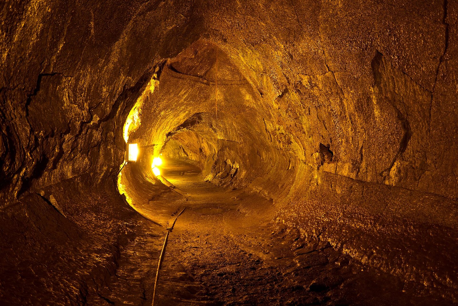
About 500 years ago a river of lava flowed through here under a hardened crust, then drained away and left a tunnel big enough to walk through upright. The path to it winds down through a fern forest of tree ferns and ʻōhiʻa trees, where you may hear native birds, then enters the tube, lit for its whole length. It is the park’s most popular stop, so come early in the morning or late in the day.
- Distance: about 0.4 miles (650 m) loop
- Allow: 30 minutes
- Start: Nāhuku parking area, on Crater Rim Drive east of Kīlauea Iki. The lot is small and fills by mid-morning.
- When: all year
- Suits: everyone who can manage some steps
5. Walk past the Steam Vents and Sulphur Banks
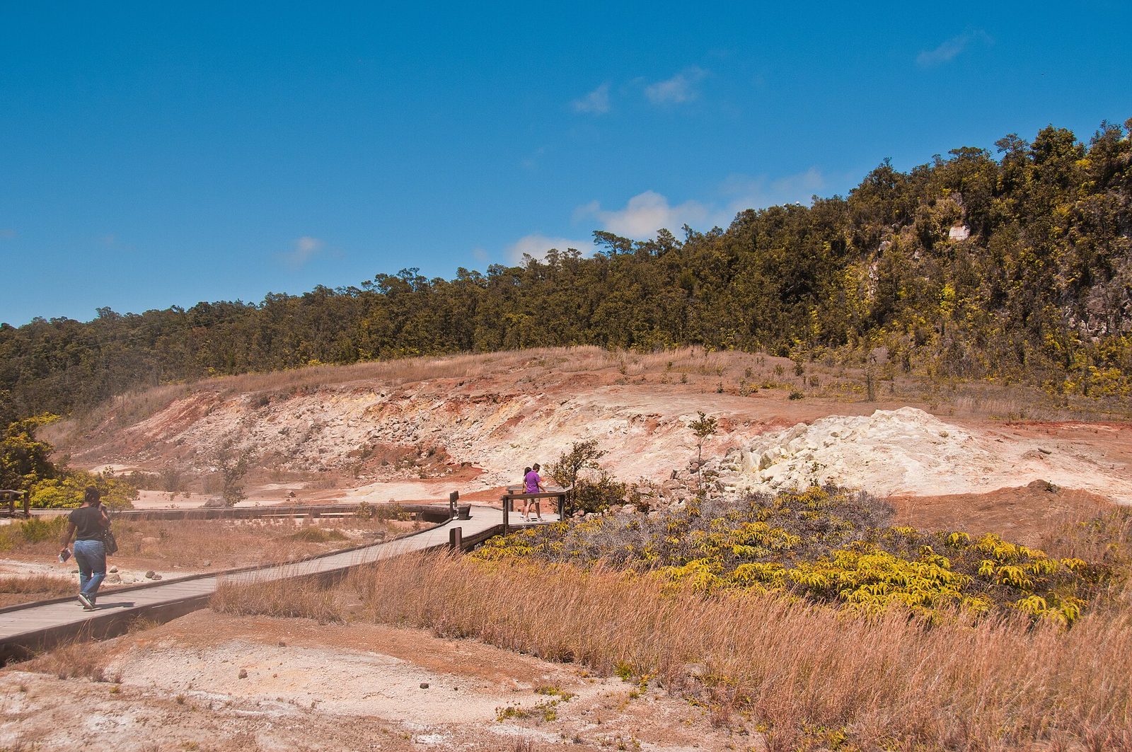
Rain that soaks into the ground near the caldera meets hot rock and comes back up as steam. A short walk from the visitor center leads along the caldera rim past the Steam Vents, where clouds of it drift out of the cracks, and then along a boardwalk at Sulphur Banks, known in Hawaiian as Haʻakulamanu, where the gas has coated the rocks in yellow crystals of sulfur and stained the ground orange and white. The smell of rotten eggs is the hydrogen sulfide.
- Distance: about 1.2 miles (1.9 km) round trip from the visitor center
- Allow: 45 minutes
- Start: Kīlauea Visitor Center, or the Steam Vents parking area on Crater Rim Drive
- When: all year; the steam shows best on a cool morning
- Suits: everyone; the Sulphur Banks boardwalk is accessible. Those sensitive to volcanic gas should keep it short.
6. See the 1959 eruption’s aftermath on the Devastation Trail
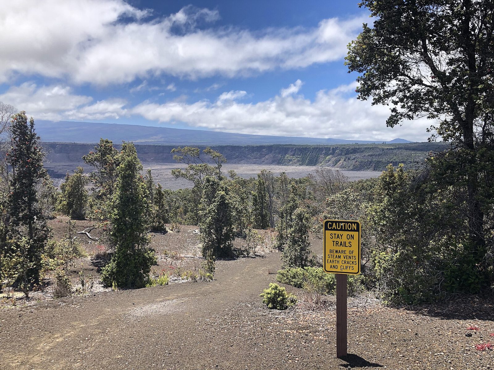
Wind carried the cinders from the 1959 fountains over this part of the rim and buried the forest in them. The paved trail crosses the cinder field, where a few bleached snags of dead trees still stand and new plants are slowly taking hold, to a view over Puʻu Puaʻi, the cinder cone the fountains built beside Kīlauea Iki. It is a short, easy walk that shows how a forest dies and begins to come back.
- Distance: about 1 mile (1.6 km) round trip
- Allow: 30 minutes
- Start: Devastation Trail parking area, on Crater Rim Drive
- When: all year
- Suits: everyone; the trail is paved and accessible
7. See the Puʻuloa Petroglyphs
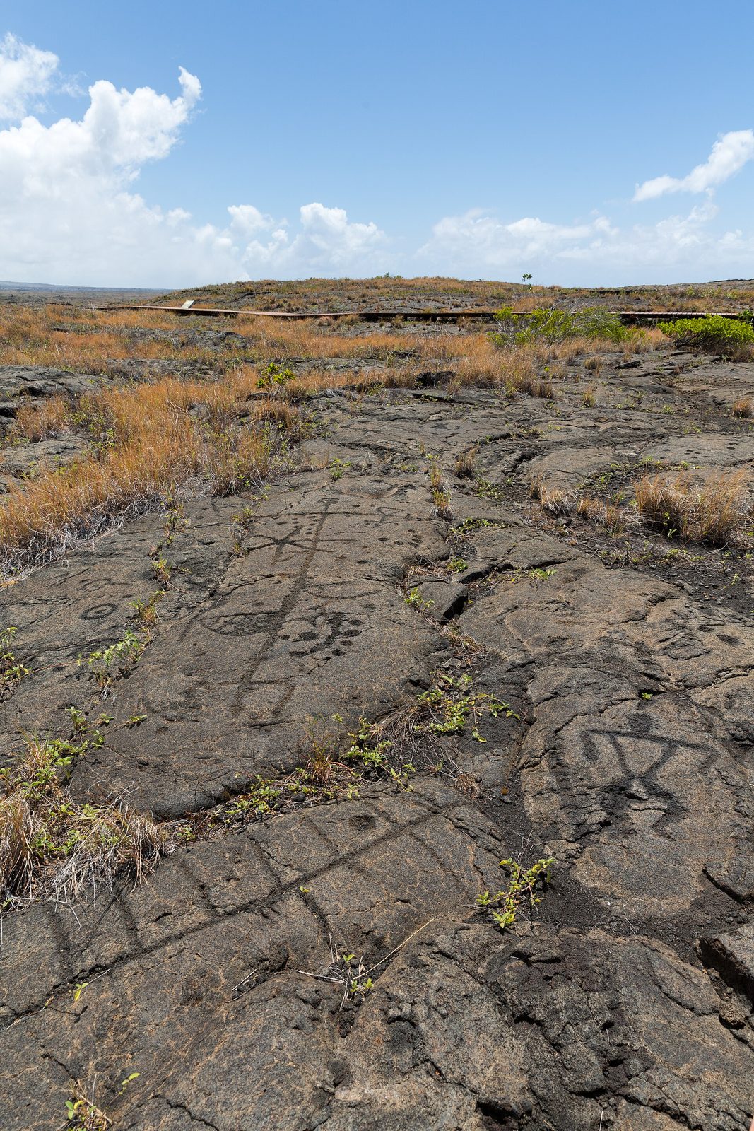
Near the bottom of the Chain of Craters Road, a boardwalk crosses old lava to Puʻuloa, a low mound covered with more than 23,000 images carved into the rock: circles, dots, human figures and canoes. Many are holes where Hawaiian families placed the umbilical cords of newborn children, for a long life. It is one of the largest groups of petroglyphs in Hawaiʻi. Stay on the boardwalk: walking on the carvings wears them away.
- Distance: about 1.4 miles (2.3 km) round trip
- Allow: 1 hour
- Start: Puʻuloa Petroglyphs trailhead, on the Chain of Craters Road near its lower end
- When: all year; mornings are cooler on the open lava
- Suits: most walkers; the trail is uneven lava with no shade
8. Watch the waves at the Hōlei Sea Arch
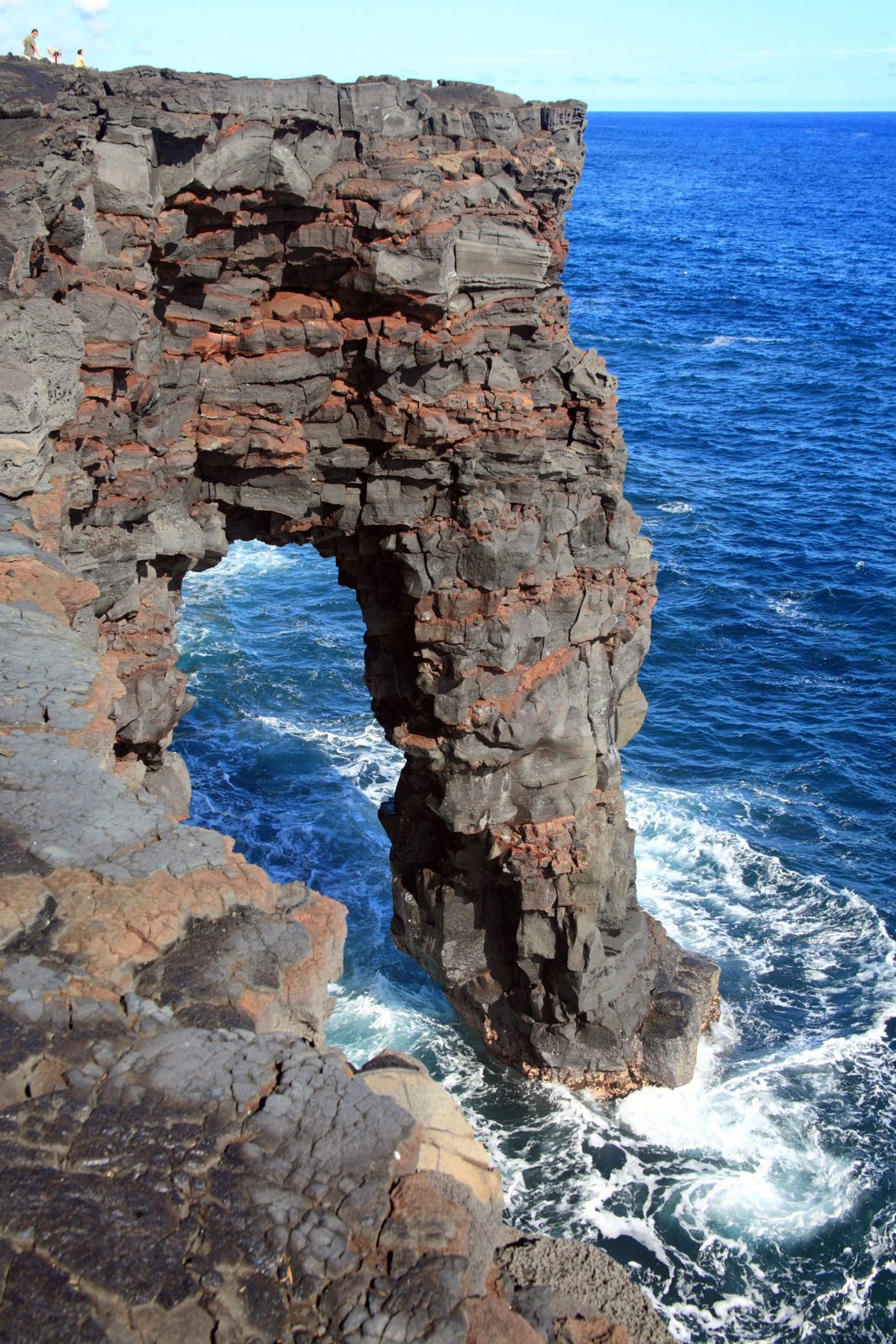
Where the Chain of Craters Road ends, the lava coast drops in sheer black cliffs to the Pacific, and the waves have carved a 90-foot (27 m) arch through one of them. It is a short walk from the end of the road to the viewpoint. The arch, like the coast around it, is young and wearing away fast, and one day it will fall. Stay well back from the cliff edges, which are undercut and can collapse.
- Allow: 30 minutes, at the end of the Chain of Craters drive
- Start: the end of the Chain of Craters Road
- When: all year
- Suits: everyone
9. Drive up Mauna Loa Road and walk Kīpukapuaulu
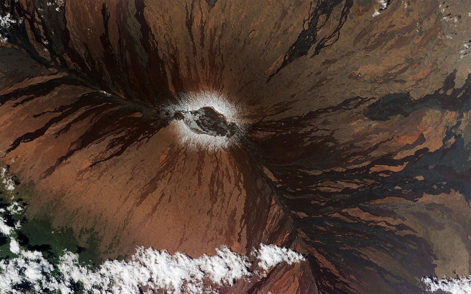
Mauna Loa is the largest active volcano on Earth, rising 13,679 feet (4,169 m) above the sea and some 31,000 feet (9,400 m) from its base on the ocean floor. A narrow road climbs its flank from Highway 11 to a lookout at 6,662 feet (2,031 m), with wide views over Kīlauea and the coast, and the trail to the summit, a multi-day trip for experienced hikers with a permit, starts there. On the way up, stop at Kīpukapuaulu, an island of old forest that lava flows passed around, where a short loop trail leads among koa trees and native birds such as the ʻelepaio and ʻapapane.
- Distance: about 13.5 miles (22 km) each way to the lookout; about 1.2 miles (1.9 km) for the Kīpukapuaulu loop
- Allow: 2 to 3 hours
- Start: Mauna Loa Road, off Highway 11 just west of the park entrance
- When: all year; early morning for birds and clear views
- Suits: everyone; the upper road is one lane, with pull-outs
10. Explore the Kahuku unit
Far to the southwest, on the slopes of Mauna Loa, the park’s Kahuku unit is a former cattle ranch of grassland, forest and lava flows, including the great flow of 1868. It feels nothing like the summit: green, quiet and wide open, with few visitors. Trails lead up Puʻu o Lokuana, a grassy cinder cone with views to the ocean, and through the old ranch lands. Kahuku keeps its own opening days, so check before you drive out.
- Distance: a short, steep climb up Puʻu o Lokuana; loops of a few miles (several km) on the ranch trails
- Allow: 2 hours, plus about an hour’s drive from the summit
- Start: Kahuku entrance, on Highway 11 between Naʻālehu and Ocean View
- When: on the unit’s set opening days
- Suits: everyone
Before you go
This list covers what stays the same from year to year. Eruption status, closures and air quality change daily, sometimes by the hour, and the National Park Service posts them on its own site. The link is on our Hawaiʻi Volcanoes National Park guide, with the map and how to get there.