

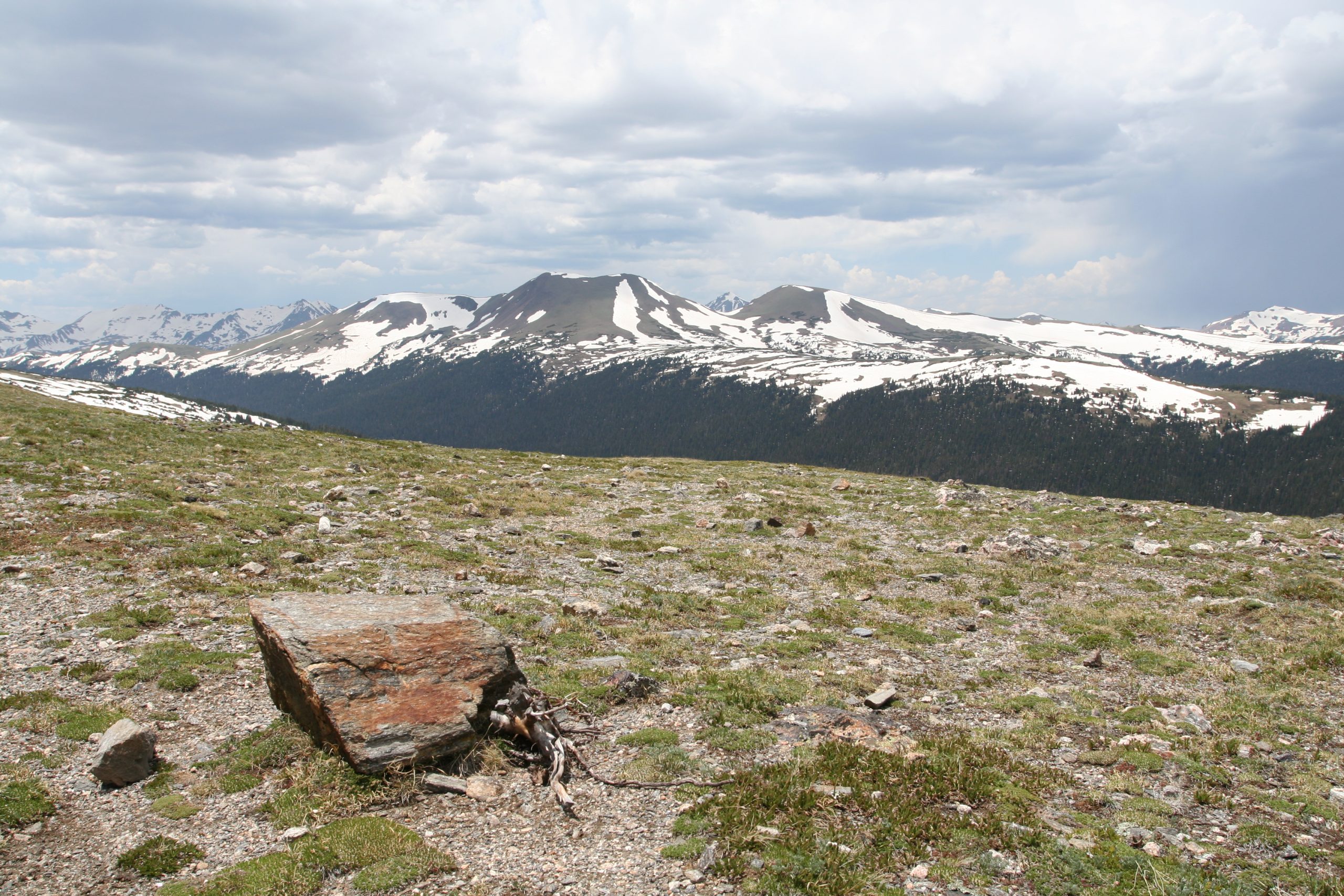
Rocky Mountain National Park
Rocky Mountain National Park is the Colorado high country at its most accessible and its most sublime, a realm of glacier-carved peaks, alpine lakes and vast tundra where more than a third of the park sits above treeline. Trail Ridge Road climbs past 12,000 feet (3,700 m), letting almost anyone stand in the alpine world, while a lifetime of trails and summits waits for those who want to walk into it.
Fast facts
- Established: 1915
- Size: about 265,000 acres (1,070 km²) of the Front Range
- High point: Longs Peak, 14,259 feet (4,346 m)
- Trail Ridge Road: the highest continuous paved road in the U.S., topping 12,000 feet (3,700 m)
- Gateways: Estes Park (east) and Grand Lake (west), Colorado
- Managed by: National Park Service
The landscape
The park spans montane forest and meadows, subalpine lakes ringed by spruce and fir, and a huge expanse of alpine tundra above the trees, all crowned by the Continental Divide and Longs Peak. Glaciers hung these valleys with cirques and moraines, and the wildlife is a highlight, elk bugling in the meadows, moose in the willows near Grand Lake, bighorn sheep on the crags, and black bears in the forest.
Best time to go
Summer through early fall is prime, when Trail Ridge Road is open, the high trails are clear, and the September elk rut fills the meadows with sound. Snow closes Trail Ridge Road much of the year and lingers on high routes into summer. Winter brings snowshoeing, quiet valleys and a very different, colder park at the lower elevations.
Getting there and around
Estes Park is the main east gateway and Grand Lake the west, linked over the crest by Trail Ridge Road in season. A timed-entry reservation is required in the busy months, and a free shuttle serves the popular Bear Lake corridor to ease parking, but a vehicle is needed to reach the park and move between areas.
Things to do
Drive Trail Ridge Road into the tundra, hike to jewel-like lakes such as Emerald, Dream and Sky Pond, and watch wildlife in Moraine Park and the Kawuneeche Valley. Strong, acclimatized hikers tackle the long, exposed route up Longs Peak, backpackers head into the wilderness, and winter visitors snowshoe and ski the lower trails.
Staying safe
Altitude is the great equalizer here, ascend gradually, hydrate, and watch for altitude sickness. Afternoon thunderstorms build fast, so be below treeline by early afternoon to avoid lightning on the exposed tundra. Weather can turn cold and snowy any month, rivers run cold and fast, and this is bear and moose country. Store food and keep your distance.
Know before you go
A park pass and, in the busy season, a timed-entry reservation are required. Check the current system and book ahead. Wilderness camping needs a permit, and popular trailheads fill before dawn. This page is a general overview, not a live conditions report; always confirm current conditions, reservations and road status with the National Park Service before your trip.
- Coordinates
- 40.3558, -105.7036
- Magnetic declination
- 7.9° E (2026)
Set this declination on your compass, then align it to the map's north lines; it is the angle between true north and magnetic north, refreshed each year.
A spread of the park’s main places shows straight away, and the rest appear as you zoom in. You can also search above, or pick any place from the lists below, and the map will go to it.
Getting there 11
Park entrances
Visitor centres
Ranger stations
On the trail 88
Trailheads
Campgrounds
Hut or shelter
Picnic sites
Sights 87
Viewpoints
Waterfalls
Heritage sites
Point of interests
Peaks 30
Map data comes from third-party sources and may be incomplete or out of date, so carry a current official map (terms).
- Best seasons
- Summer, Early fall
- Difficulty
- Easy to strenuous
- Access / trailheads
- Estes Park is the east gateway (US-36/US-34); Grand Lake the west. Trail Ridge Road links them over the crest and is closed by snow much of the year.
- Water
- Abundant lakes, streams and rivers; filter or treat all backcountry water.
- Cell / satellite coverage
- Little to no cell service in much of the park. Carry a map and a satellite messenger for the backcountry.
- Nearest ranger / SAR / emergency
- Contact park rangers or Estes Park dispatch; life-threatening emergencies: 911.
- Permits & regulations
- Per-vehicle entry fee (America the Beautiful pass accepted); a timed-entry reservation is required in the busy season, and wilderness camping needs a permit.
- Leave No Trace
- Use bear-proof storage, stay on trail to protect fragile tundra, pack out all waste, and follow Leave No Trace.
January
- Below-freezing nights
February
- Below-freezing nights
March
- Below-freezing nights
April
- Below-freezing nights
May
June
- Day-to-night swing of 31°F (17°C)
July
- Day-to-night swing of 32°F (18°C)
August
- Day-to-night swing of 32°F (18°C)
September This month
- Day-to-night swing of 31°F (17°C)
October
- Below-freezing nights
November
- Below-freezing nights
December
- Below-freezing nights
What to bring depends on your trip: how long you’re out, where you sleep, and how far you go from the road. The planner builds the list for yours.
Plan a trip here →Averages for 1991–2020 from NOAA U.S. Climate Normals, measured at the Estes Park station, 5 miles (8 km) away at 7,812 feet (2,381 m). Conditions change with elevation: expect it colder higher up.