

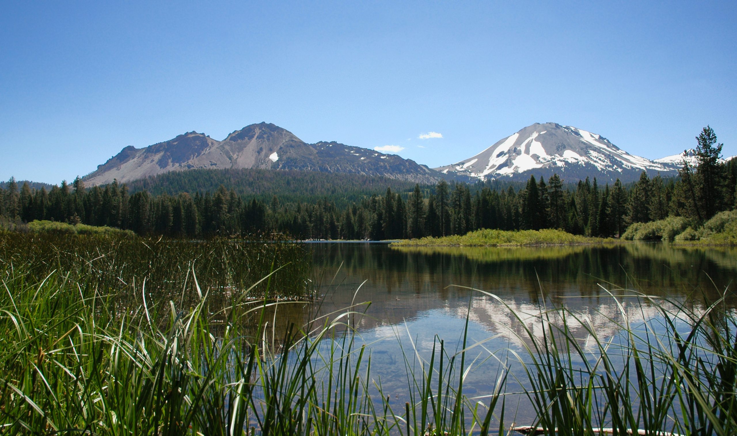
Lassen Volcanic National Park
Lassen Volcanic is a compact showcase of a living volcanic landscape, the only place on Earth where all four types of volcano stand together, crowned by Lassen Peak, which last erupted just over a century ago. Boiling mud pots, roaring fumaroles and steaming ground share the park with clear alpine lakes and quiet conifer forest, all a world away from California’s crowds.
Fast facts
- Established: 1916
- Size: about 106,000 acres (429 km²) in the southern Cascade Range
- Lassen Peak: 10,457 feet (3,187 m); last erupted 1914–1917
- Distinction: all four volcano types (shield, composite, cinder cone, plug dome)
- Gateways: Redding and Chester, California
- Managed by: National Park Service
The landscape
The park is the southernmost of the Cascade volcanoes, and it wears its geology openly, the hydrothermal basins of Bumpass Hell and Sulphur Works hiss and bubble with superheated water, while Lassen Peak rises over forests, meadows and glacially carved lakes. Cinder cones and lava flows record recent eruptions, and the wildlife includes black bears, mule deer and a rich subalpine birdlife.
Best time to go
Summer and early fall are effectively the season: the Lassen Park Highway is buried in heavy snow much of the year and typically opens fully only from around July into October. Once clear, the high country offers wildflowers, swimmable lakes and cool forest. Winter transforms the park into a snowbound destination for snowshoeing and ski touring at the entrances.
Getting there and around
The Lassen Park Highway threads the park between the northwest entrance at Manzanita Lake and the southwest entrance, passing the major trailheads and hydrothermal areas, but only when it is snow-free. Redding and Chester are the nearest service towns. There is no shuttle, so a vehicle is needed, and the road’s seasonal status shapes any trip.
Things to do
Hike the boardwalks into Bumpass Hell to see the park’s largest hydrothermal basin, climb the strenuous switchbacks up Lassen Peak, and walk to Kings Creek Falls or around Manzanita Lake. Backpackers explore a quiet wilderness of lakes and cinder cones, and the dark skies and clear mountain air make for excellent stargazing.
Staying safe
The hydrothermal areas are genuinely dangerous. The ground can be thin crust over boiling water, so stay strictly on the boardwalks and trails and keep children and pets close. At altitude, pace yourself and carry water, expect lingering snow on high trails into summer, and be ready for fast-changing mountain weather. Store food from black bears, using canisters where required.
Know before you go
A park pass is required, overnight backpacking needs a wilderness permit, and the main road’s opening date varies year to year with the snowpack. Always check before you go. This page is a general overview, not a live conditions report; always confirm current road status, conditions and permits with the National Park Service before your trip.
- Coordinates
- 40.4971, -121.4121
- Magnetic declination
- 13.2° E (2026)
Set this declination on your compass, then align it to the map's north lines; it is the angle between true north and magnetic north, refreshed each year.
A spread of the park’s main places shows straight away, and the rest appear as you zoom in. You can also search above, or pick any place from the lists below, and the map will go to it.
Getting there 7
Park entrances
Visitor centre
Ranger stations
On the trail 43
Trailheads
Campgrounds
Picnic site
Sights 46
Viewpoints
Waterfalls
Heritage site
Point of interests
Peaks 30
Map data comes from third-party sources and may be incomplete or out of date, so carry a current official map (terms).
- Best seasons
- Summer, Early fall
- Difficulty
- Easy to strenuous
- Access / trailheads
- The Lassen Park Highway (Hwy 89) links the northwest (Manzanita Lake) and southwest entrances; it is fully open only in summer and fall. Nearest hubs are Redding and Chester.
- Water
- Lakes and streams in season; filter or treat all backcountry water.
- Cell / satellite coverage
- Little to no cell service in the park. Carry a map and share your plans.
- Nearest ranger / SAR / emergency
- Contact park rangers; life-threatening emergencies: 911.
- Permits & regulations
- Per-vehicle entry fee (America the Beautiful pass accepted); wilderness permits are required for overnight backpacking. The main park road is closed by snow much of the year.
- Leave No Trace
- Stay on boardwalks and trails in hydrothermal areas, use bear canisters where required, pack out all waste, and follow Leave No Trace.
January
- Below-freezing nights
February
- Below-freezing nights
March
- Below-freezing nights
April
- Below-freezing nights
May
June
July
- Day-to-night swing of 33°F (18°C)
August
- Day-to-night swing of 33°F (18°C)
September This month
- Day-to-night swing of 31°F (17°C)
October
November
- Below-freezing nights
December
- Below-freezing nights
What to bring depends on your trip: how long you’re out, where you sleep, and how far you go from the road. The planner builds the list for yours.
Plan a trip here →Averages for 1991–2020 from NOAA U.S. Climate Normals, measured at the Manzanita Lake station, 7 miles (11 km) away at 5,750 feet (1,753 m). Conditions change with elevation: expect it colder higher up.