

Yoho National Park
Yoho packs an outsized share of the Canadian Rockies’ drama into a compact park on the west slope of the Continental Divide. Its Cree name means “awe.” Towering rock walls, the thundering Takakkaw Falls, the glacial jewel of Emerald Lake and the fiercely protected alpine of Lake O’Hara sit side by side, all within an easy drive of neighbouring Banff and Lake Louise.
Fast facts
- Established: 1886, one of Canada’s oldest national parks
- Size: about 507 square miles (1,313 km²) of the Canadian Rockies
- Highlights: Takakkaw Falls, Emerald Lake, Lake O’Hara, the Burgess Shale fossils
- World Heritage: part of the Canadian Rocky Mountain Parks UNESCO site
- Service town: Field, British Columbia
- Managed by: Parks Canada
The landscape
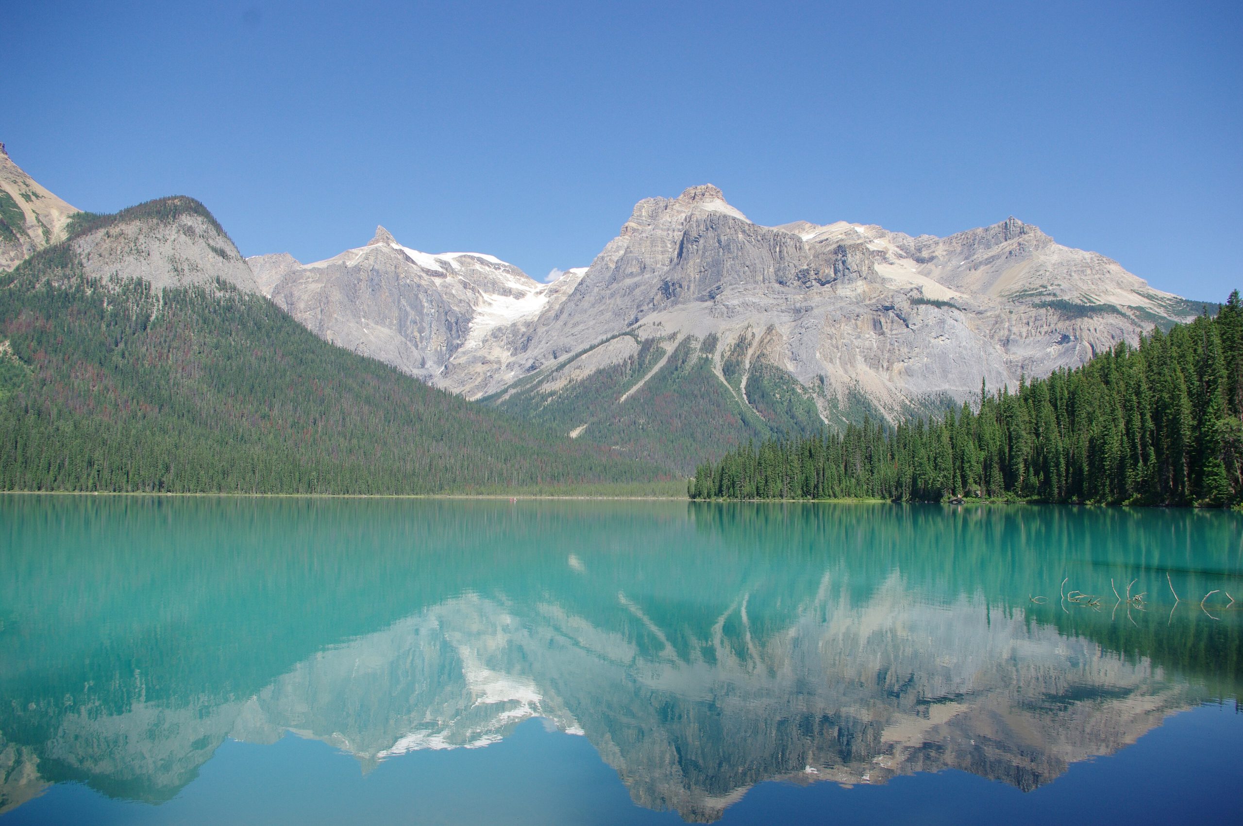
Yoho climbs from the forested Kicking Horse River valley to a crest of glaciers and 9,800-foot (3,000 m) peaks along the Divide. Takakkaw Falls, one of Canada’s highest, plunges from the Daly Glacier; Emerald Lake and Lake O’Hara glow with glacial silt. The park also protects the world-famous Burgess Shale, a UNESCO fossil site preserving soft-bodied Cambrian creatures. Grizzly and black bears, moose, mountain goats and pikas live across the range.
Best time to go
Summer (July to September) is the hiking season, when snow clears the high passes and the larches and meadows come alive. Early fall brings golden larch and stable, quiet weather. Winter turns the park into a backcountry ski and ice-climbing destination, with the Trans-Canada kept open but the high country given over to snow and avalanche terrain.
Getting there and around
The Trans-Canada Highway runs through the park, so most visitors arrive by car from Lake Louise or Golden. Emerald Lake and the seasonal Takakkaw Falls road are reached directly, but Lake O’Hara, the crown jewel of the backcountry, is accessible only by a quota-limited, reservation-only bus, so plan far ahead. There is no general public transit within the park.
Things to do
Walk to the base of Takakkaw Falls, canoe or circle Emerald Lake, and, if you win a booking, hike the legendary Lake O’Hara alpine circuits and the Iceline Trail. Guided Burgess Shale hikes reveal one of the most important fossil finds on Earth. Backpackers link high routes, and winter visitors ski, snowshoe and ice-climb around Field.
Staying safe
This is bear country. Carry bear spray, make noise, travel in groups and store food properly. Mountain weather turns quickly, so pack insulation and a shell even in summer, and start alpine days early. Glacial rivers run cold and fast, winter and shoulder seasons bring avalanche terrain, and many trails involve steep exposure. Know your limits and carry a satellite messenger where cell service fails.
Know before you go
A Parks Canada pass is required, backcountry permits are needed for overnight trips, and the Lake O’Hara bus is a competitive, reservation-only system that sells out fast. Book the moment it opens. This page is a general overview, not a live conditions report; always confirm current conditions, closures and permits with Parks Canada before your trip.
- Coordinates
- 51.3744, -116.5238
- Magnetic declination
- 14.3° E (2026)
Set this declination on your compass, then align it to the map's north lines; it is the angle between true north and magnetic north, refreshed each year.
A spread of the park’s main places shows straight away, and the rest appear as you zoom in. You can also search above, or pick any place from the lists below, and the map will go to it.
Getting there 2
Park entrance
Ranger station
On the trail 18
Campgrounds
Hut or shelters
Picnic sites
Sights 72
Viewpoints
Waterfalls
Point of interests
Peaks 30
Map data comes from third-party sources and may be incomplete or out of date, so carry a current official map (terms).
- Best seasons
- Summer, Early fall (shoulder)
- Difficulty
- Easy to strenuous
- Access / trailheads
- Bisected by the Trans-Canada Highway (Hwy 1) between Lake Louise and Golden, BC, west of the Continental Divide. Field is the main service town.
- Water
- Abundant glacial rivers, streams and lakes; filter or treat all backcountry water.
- Cell / satellite coverage
- Limited to no cell service outside Field. Carry a map and a satellite messenger.
- Nearest ranger / SAR / emergency
- Parks Canada dispatch: 1-877-852-3100; life-threatening emergencies: 911.
- Permits & regulations
- A Parks Canada pass is required; backcountry camping needs a permit, and access to Lake O’Hara is by a reservation-only shuttle bus with a strict quota.
- Leave No Trace
- Use bear-proof storage, pack out all waste, stay on trail, and follow Leave No Trace.
January
- Below freezing all day
- Avalanche terrain
February
- Below freezing all day
- Avalanche terrain
March
- Below-freezing nights
- Avalanche terrain
April
- Below-freezing nights
- Avalanche terrain
May
June
July
August
September This month
October
- Below-freezing nights
- Avalanche terrain
November
- Below-freezing nights
- Avalanche terrain
December
- Below freezing all day
- Avalanche terrain
What to bring depends on your trip: how long you’re out, where you sleep, and how far you go from the road. The planner builds the list for yours.
Plan a trip here →Averages for 1981–2010 from Environment Canada climate normals, measured at the Golden Airport station, 23 miles (36 km) away at 2,575 feet (785 m). Conditions change with elevation: expect it colder higher up.