

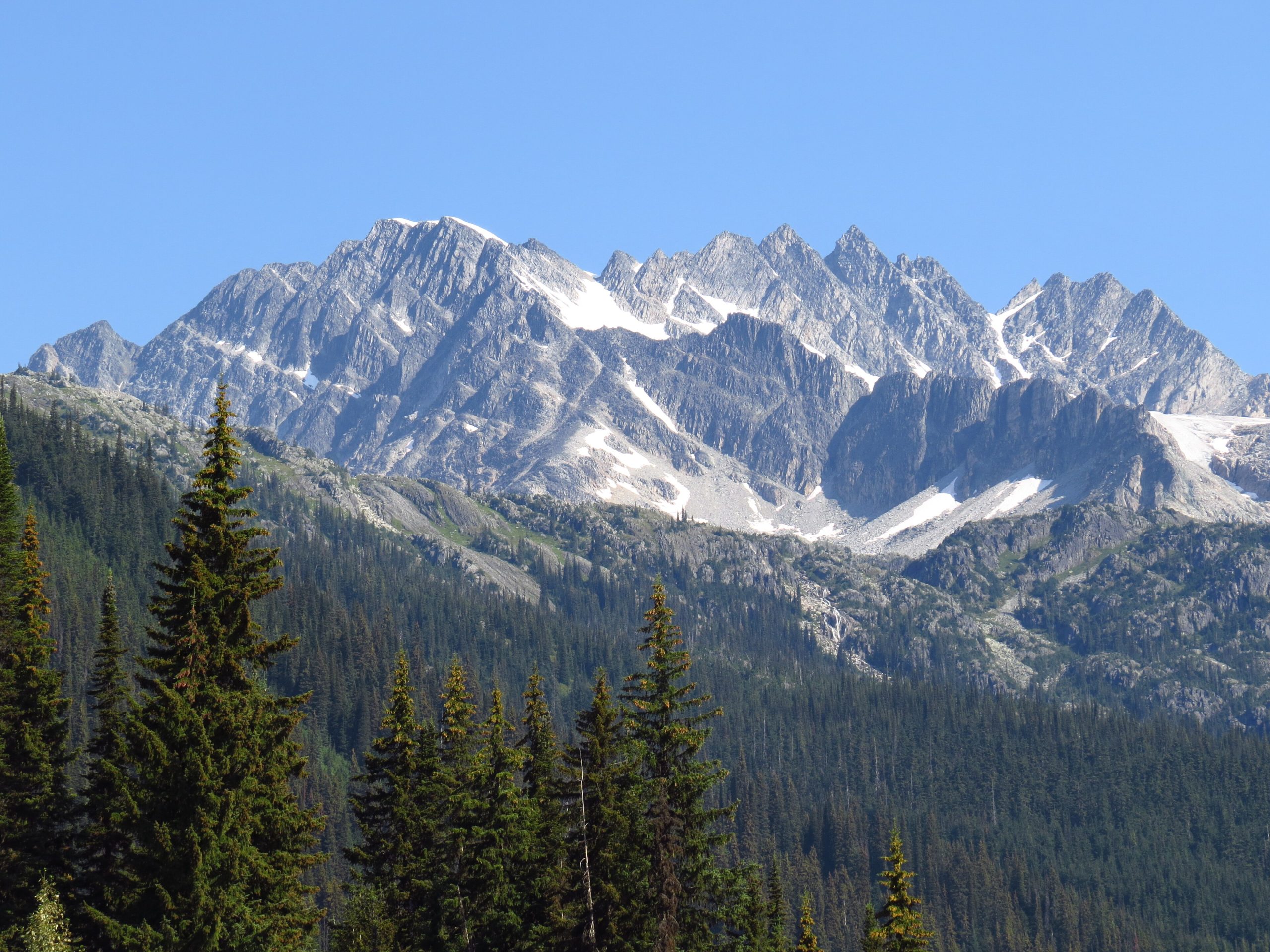
Glacier National Park (Canada)
Glacier National Park in British Columbia is the wild, snowy heart of the Columbia Mountains, straddling the Trans-Canada Highway at Rogers Pass. It is a park of deep rainforest valleys, more than 130 glaciers and some of the most active avalanche terrain in North America, a place of serious mountain beauty that demands equally serious respect, whether you are hiking in summer or ski touring in winter.
Fast facts
- Established: 1886, one of Canada’s oldest national parks
- Size: about 521 square miles (1,349 km²) of the Columbia Mountains
- Glaciers: more than 130, including the Illecillewaet
- Rogers Pass: a National Historic Site and a legendary avalanche zone
- Location: between Revelstoke and Golden, British Columbia
- Managed by: Parks Canada
The landscape
The park rises abruptly from wet, mossy interior rainforest of cedar and hemlock into steep subalpine forest, flowered alpine meadows and a crest of glaciers and rock. Precipitous peaks funnel enormous snowfall into avalanche paths that reach valley bottom, and creeks run cold and fast with meltwater. Grizzly and black bears, mountain goats, hoary marmots and caribou range across it.
Best time to go
Summer (July to September) is the hiking season, when the snow finally clears the high trails and the meadows bloom. Early fall adds colour and stable weather before the snow returns. Winter turns the park into a renowned but hazardous backcountry ski-touring destination, the avalanche control over Rogers Pass is among the largest mobile programs in the world, and travel is tightly managed.
Getting there and around
The Trans-Canada Highway runs straight through the park over Rogers Pass, so most visitors arrive by car from Revelstoke or Golden. The Rogers Pass Discovery Centre is the hub for information and permits, and the main trailheads, including the historic Illecillewaet area, sit just off the highway. There is no public transit within the park.
Things to do
Summer hiking is the draw, from the forest-and-history walks near the Illecillewaet campground to strenuous climbs like the Avalanche Crest and Abbott Ridge trails, with their glacier views. The park is a mountaineering cradle (North American alpinism has deep roots here), and in winter it is a magnet for experienced, avalanche-trained ski tourers and splitboarders.
Staying safe
Avalanche terrain defines this park: winter and shoulder-season backcountry travel demands avalanche training, the right rescue gear, current bulletins, and respect for closures and controlled areas. In summer, this is real bear country (carry bear spray, make noise and store food properly), and creek crossings run cold and swift. Weather changes fast at elevation, so pack insulation and a shell, and carry a satellite messenger where cell service fails.
Know before you go
A Parks Canada pass is required, backcountry camping needs a permit, and winter travel over Rogers Pass is governed by a strict Winter Permit System in controlled zones. Check before you go. This page is a general overview, not a live conditions report; always confirm current conditions, avalanche bulletins and permits with Parks Canada before your trip.
- Coordinates
- 51.2615, -117.5621
- Magnetic declination
- 14.6° E (2026)
Set this declination on your compass, then align it to the map's north lines; it is the angle between true north and magnetic north, refreshed each year.
A spread of the park’s main places shows straight away, and the rest appear as you zoom in. You can also search above, or pick any place from the lists below, and the map will go to it.
On the trail 12
Trailhead
Campgrounds
Hut or shelters
Picnic site
Sights 59
Waterfall
Heritage site
Point of interests
Peaks 30
Map data comes from third-party sources and may be incomplete or out of date, so carry a current official map (terms).
- Best seasons
- Summer, Early fall (shoulder)
- Difficulty
- Moderate to strenuous
- Access / trailheads
- Bisected by the Trans-Canada Highway (Hwy 1) over Rogers Pass, between Revelstoke and Golden, BC. Trailheads and the Rogers Pass Discovery Centre line the highway.
- Water
- Abundant creeks and streams; filter or treat all backcountry water.
- Cell / satellite coverage
- Little to no cell service over Rogers Pass. Carry a map and a satellite messenger.
- Nearest ranger / SAR / emergency
- Parks Canada dispatch: 1-877-852-3100; life-threatening emergencies: 911.
- Permits & regulations
- A Parks Canada pass is required; backcountry camping needs a permit, and winter travel in avalanche terrain requires registration and, in controlled areas, restrictions.
- Leave No Trace
- Use bear-proof storage, pack out all waste, stay on trail, and follow Leave No Trace.
January
- Below freezing all day
February
- Below freezing all day
March
- Below-freezing nights
April
- Below-freezing nights
May
June
July
August
September This month
October
- Below-freezing nights
November
- Below freezing all day
December
- Below freezing all day
What to bring depends on your trip: how long you’re out, where you sleep, and how far you go from the road. The planner builds the list for yours.
Plan a trip here →Averages for 1981–2010 from Environment Canada climate normals, measured at the Glacier National Park Rogers Pass station, 3 miles (6 km) away at 4,364 feet (1,330 m). Conditions change with elevation: expect it colder higher up.