Your phone as a backcountry GPS: offline maps done right
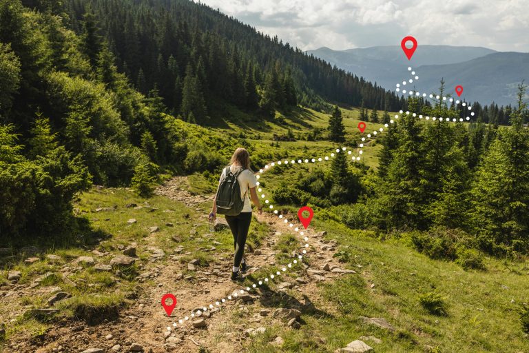
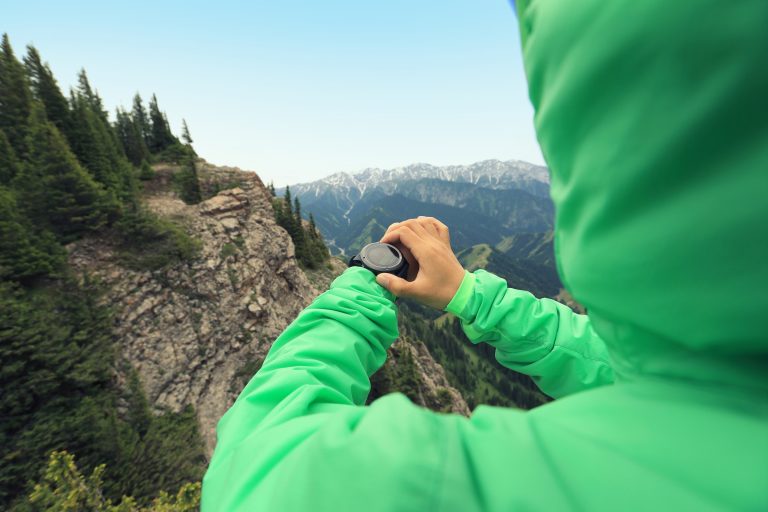
The phone in your pocket is a more capable navigation device than the best dedicated GPS units of a decade ago. It is also a glass-fronted, battery-powered computer that was designed for coffee shops, not ridgelines. Used well, it is one of the best navigation tools most hikers will ever own. Used casually, it dies at the trail junction where you needed it most. The difference between those two outcomes is almost entirely preparation: maps downloaded before you leave, a battery routine that treats charge as a finite resource, and a backup that does not share the phone’s failure modes. This guide covers all three, plus the field habits that make the blue dot genuinely useful instead of merely reassuring.
One principle runs through everything below. The phone is allowed to be your primary navigation tool, but never your only one. A paper map and a baseplate compass weigh almost nothing, work at any temperature, and do not care how you treated your battery. Carry them, know the basics of using them, and then enjoy everything the phone does better, because it does do most of it better.
How a phone finds you with no signal
Understanding this one point clears up most of the confusion about phone navigation. Your phone’s position comes from satellites, not cell towers. The GNSS chip inside it (GPS, and usually Galileo, GLONASS, and BeiDou alongside) listens directly to satellite signals and works anywhere with a view of the sky. No bars required. This is why a phone with no cell service, or a phone in airplane mode, can still put a blue dot on the map.
What needs a data connection is the map underneath that dot. The satellite imagery, the topo contours, the trail lines: those are files, and if you have not downloaded them, the phone has nothing to draw. That is the entire problem with phone navigation in the backcountry, and it is completely solvable at home, on wifi, for free or nearly so. Position works out there. Maps only work out there if you bring them with you.
In open sky, a modern phone typically fixes your position within about 16 feet (5 m), which is as good as dedicated handhelds from a few years back. Accuracy degrades in deep valleys, narrow canyons, and dense forest, where signals bounce off rock and foliage before reaching the antenna. Expect the dot to wander there, and read the section on distrusting it before you need it.
Run the ten-minute driveway test
Tonight, download an offline map of your neighbourhood in your chosen app, switch the phone to airplane mode, and walk around the block. The blue dot should track you on the downloaded map with zero connectivity. That is exactly the state your phone will be in on the trail, and confirming it works at home, where failure costs nothing, is the cheapest confidence you will ever buy.
Set it up before you leave
Everything that matters about phone navigation happens before the trailhead. Once you lose signal, the phone can no longer fetch anything: not map tiles, not app updates, not a login token, not the route someone texted you. Work through this list at home, on wifi, the day before.
- Download offline maps for the whole area, not just the trail. Your map needs to cover the route, every bailout and side trail, the road back to the trailhead, and a generous margin beyond all of it. Routes change. If you have to exit a drainage early, the map has to be there when you do.
- Download at the detail level you will actually use. Most apps let you choose the zoom range for offline maps. Include the close-in zoom levels with contour lines and trail names, not just the overview. Storage is cheap; a contour line you cannot see is not helpful.
- Load your route and mark the waypoints that matter. Import the GPX track if you have one, then mark the trailhead, your intended camps, water sources, tricky junctions, and bail-out points by hand. Named waypoints are findable in the dark and in a hurry; a bare line is not.
- Update and log in while you still can. Update the app, then open it once while connected. Some apps re-verify your account or subscription when they have a connection, and you do not want to learn about an expired login at the trailhead.
- Screenshot the essentials. A handful of screenshots (the route overview, the key junctions, the trailhead approach) live in your photo library, which opens faster and uses less power than a mapping app and survives an app crash.
- Leave the plan with a person. The phone navigates for you; it does not tell anyone where you went. A written trip plan left with a trusted contact is what turns an overdue hiker into a findable one. Our guide to building a pre-trip safety plan covers the whole system, and the Trip Planner builds the plan and emails it, with a reminder, through Leave Word.
Choosing a mapping app
The established options for North American trails include Gaia GPS, CalTopo, onX Backcountry, and AllTrails, and any of them can do the job. We are not going to rank them here, because the right choice depends on how you hike and the apps change faster than this article should. What does not change is the checklist. A backcountry mapping app must have:
- True offline maps. Not caching, not “recently viewed,” but explicitly downloaded regions that work with the radios off. This is the feature that separates a backcountry tool from a toy.
- A real topo layer. Contour lines, water features, and named trails. Satellite imagery is a pleasant extra; the topo layer is the tool.
- Track recording. The app should draw a breadcrumb line of where you have actually walked. That line is your way back in fog or whiteout, and it is the single most underrated feature on this list.
- Waypoints and GPX import and export. You need to load routes built elsewhere and share yours with partners.
- Units you think in. Confirm it will display distances and elevations in your preferred units before you are standing at a junction doing arithmetic.
- A readable screen in sunlight. Some apps are far better than others at high-contrast display. Test it outdoors, not on the couch.
Free tiers usually limit offline downloads or lock the better map layers behind a subscription. For anything beyond an occasional day hike on a signed trail, the paid tier of a good app is a modest annual cost that earns its keep the first time you navigate off a downloaded map in bad weather. Whatever you choose, learn it at home. The trail is a bad classroom, and a cold, tired, late-in-the-day trail is the worst one.
Battery discipline
A phone navigating with the screen on is doing nearly the most power-hungry work it can do: GPS receiver running, screen lit, processor drawing maps. Left unmanaged, a full battery can be gone by mid-afternoon. Managed well, the same battery lasts a long weekend. The routine that gets you there is simple enough to become habit.
- Airplane mode, on the trail, always. Searching for a cell signal that does not exist is one of the largest drains on the battery, and it buys you nothing. GNSS still works. If you pair the phone to a satellite messenger, re-enable Bluetooth only.
- Screen off between checks. The screen is the single biggest drain. Navigate at decision points, then put the phone away. If you want continuous awareness, record a track in the background and check it at junctions instead of watching the dot walk.
- Brightness down. Auto-brightness cranks the screen up in daylight. Set it manually to the lowest level you can read.
- Close what you are not using. Camera, social apps, and anything refreshing in the background all spend charge you will want at 6 p.m.
- Charge on a schedule, not in a panic. Top up from your power bank at lunch and at camp, while the battery is still healthy. Letting the phone run to near zero in the cold invites a shutdown at the worst moment.
- Carry a real power bank and a short cable. A 10,000 mAh bank refills a typical phone roughly one and a half to two times, which extends a phone from a day-hike tool into a multi-day one. Pack the cable where you can reach it without unpacking.
Do the arithmetic before a long trip: days out, minus phone endurance, equals the capacity you need to carry. If the number looks marginal, it is, and the answer is a bigger bank or a dedicated GPS, not optimism.
Cold, heat, water, and drops
Lithium batteries and weather do not get along, and the failures are predictable enough to plan around.
Cold is the big one. Battery capacity falls as temperature drops, and below freezing (32°F / 0°C) a phone can shut down while still showing a healthy charge, because the battery cannot deliver current fast enough when cold. In winter or on cold nights, carry the phone in an inside pocket against your body, not in the top of your pack. Take it out to navigate, put it back to warm. A phone that “dies” in the cold is often not dead at all: warm it against your skin or inside your sleeping bag for twenty minutes and it will frequently come back with charge to spare. Sleep with it and the power bank in cold weather, because a frozen bank is nearly as useless as a frozen phone.
Cold drains and cold lies
Below freezing (32°F / 0°C), treat your phone’s battery meter as optimistic. Carry the phone warm against your body, navigate in short checks, and never let a cold phone run to zero. A dead-cold phone is often recoverable once warmed; a cold phone driven to empty may not wake until it sees a charger.
Heat and sun are the quieter problem. A dark phone in direct sun on a hot day can overheat and throttle or shut down, and hours of high-brightness screen time in summer sun is a battery drain all its own. Navigate in short checks, shade the phone when you stop, and do not leave it on the dash of the shuttle car baking at the trailhead.
Water and drops end phone navigation permanently, and both are common. A waterproof case or a simple zip-top bag handles rain, spray, and the dropped-in-a-creek moment; modern water-resistance ratings help against rain but are not a promise about immersion. Around water, and especially in a boat, tether the phone to something. A lanyard from the case to your life jacket or pack costs nothing and converts a capsize from a lost-navigation emergency into a wet afternoon. A padded case and the habit of putting the phone in the same pocket every time handle most drops.
Field technique: when to look at it
The difference between a navigator and a person watching a blue dot is when the screen comes out.
Check at decision points, not continuously. Trail junctions, stream crossings, ridge crests, the point where the trail fades into a meadow: that is when the phone earns its battery use. Between decision points, put it away and walk. Constant checking drains the battery, erodes your own sense of where you are, and keeps your eyes off the terrain that actually matters.
Record your track from the trailhead. Start the breadcrumb line when you start walking. If fog rolls in, if you have to retreat off a ridge in a whiteout, if you simply lose the thread of a faint trail, that recorded line is the way back to ground you know. Our guide to navigating in fog, whiteout, and darkness covers the full toolkit for those days; a recorded track is the phone’s unique contribution to it.
Mark waypoints as you go. Drop a named pin at the car, the camp, the reliable water, and every junction where you hesitated. The return journey reads the terrain from the opposite direction, and the junction that was obvious at 9 a.m. looks genuinely different at 5 p.m. from downhill.
Match the screen to the ground. Before you trust any position, look up. Does the terrain do what the map says it should: the creek on your left, the slope falling away to the north, the junction arriving about when expected? If the ground and the screen disagree, believe the ground and figure out why. Terrain association is the skill underneath every navigation tool, and it is the one thing the phone cannot do for you.
Stop walking before you look down
Never read the screen while moving near cliff edges, riverbanks, talus, or any ground that punishes a misstep. Phones have walked more than a few hikers straight into falls that a standing glance would have avoided. The habit is absolute: stop first, get stable, then look at the map.
When to distrust the blue dot
The dot is usually right, and the skill is knowing the situations where it is not.
- Watch it settle. A fresh fix in canyon or forest country can start 100 feet (30 m) or more off and tighten as the phone gathers more satellite data. Stand still for half a minute before making a decision on a marginal fix.
- The compass arrow is the weakest instrument in the phone. The magnetometer is noisy, confused by power lines, car bodies, and some phone cases, and it often points somewhere approximate when you are standing still. Direction of travel from a moving GPS track is far more trustworthy than the arrow. For a standing-still bearing, use a real compass.
- The basemap can be wrong. Trails get rerouted, decommissioned, and washed out, and crowdsourced map layers accumulate social trails that are not routes at all. A confident line on the screen is not permission, and it is not currency. Check the date and source of your map layer, and treat any line that does not match the ground as false.
- Low battery changes the plan, not just the settings. A phone at 15 percent mid-afternoon is telling you something about the rest of the day. That is the moment for the conservative call: the shorter loop, the known trail, the early camp. Battery state is a navigation input, and ignoring it is how a dead phone and dusk arrive together.
None of this argues against the phone. It argues for the cross-check. The same skepticism applies to every navigation tool ever made, and the phone’s great virtue is that it makes the cross-check easy, because you can afford to look at it often enough to catch a drift early.
When it fails: the backup plan
Phones get dropped on rock, dropped in creeks, frozen, and drained. Plan for the failure before it happens, because a dead phone should downgrade your navigation, never end it.
The irreducible backup is a paper map and a baseplate compass. Print or buy the topo for your area, carry it in a waterproof bag, and carry a compass you actually know how to use. That pair has no battery, works at any temperature you will survive, and weighs a few ounces. Our guide to map and compass navigation covers the skills, and finding direction without a compass covers the deeper emergency. If you carry the phone and nothing else, you are one slippery rock away from navigating by memory.
For remote or multi-day trips, consider a dedicated handheld GPS. Units like the Garmin eTrex and GPSMAP lines run on AA batteries or long-life internal cells, work with gloves on, shrug off cold and rain, and keep working in conditions that sideline a phone. The eTrex 32x sits as the in the middle of the road for regular hikers; the eTrex SE covers the budget end and the GPSMAP 67 the demanding end. Many experienced parties carry both phone and handheld: the phone for its screen and maps, the handheld as the instrument that doesn’t need to be babied.
Separate navigation from rescue. If the phone dies and you are genuinely lost, the job changes from wayfinding to being found. Stop, think, and stay put; our guide to what to do when you are lost describes the decision, and signaling for rescue covers how to be seen and heard. A satellite communicator such as the Garmin inReach Mini 2 or a beacon like the ACR ResQLink 400 works independently of the phone entirely, which is exactly the point: your lifeline should not share a battery with your camera.
What to carry
The kit below turns a phone into a navigation system. Nothing on it is exotic, and most of it lives in the pack full time.
- A 10,000 mAh power bank and a short cable, carried warm in cold weather. Our pick is the Nitecore NB10000 Gen 3. For winter day trips, the Karecel rechargeable hand warmer doubles as a small power bank, which means the thing keeping your hands functional also keeps your phone alive.
- A paper topo map in a waterproof bag, covering the route and every plausible bailout.
- A baseplate compass. The Suunto M-3 is our pick for regular navigators, and the Suunto A-10 covers the occasional hiker for very little money.
- A dedicated handheld GPS for remote, multi-day, or winter travel: check out the eTrex SE, eTrex 32x, or GPSMAP 67, depending on how much the trip demands.
- A satellite messenger or PLB. See the inReach Mini 2 for two-way messaging, or the ResQLink 400 for a subscription-free SOS.
- A waterproof case or zip-top bag, plus a tether anywhere near water.
- A real headlamp. The phone’s flashlight works, and it spends the same battery your maps live on. A dedicated headlamp with fresh batteries keeps those jobs separate.
Build your route and trip plan
Key takeaways
Your phone’s position comes from satellites and works with no signal at all; it is the maps that need downloading, so download them at home, for the whole area and every bailout, and confirm it all works in airplane mode before you leave. Treat the battery as a finite resource: airplane mode on the trail, screen off between checks, brightness down, charge from a 10,000 mAh bank on a schedule, and in the cold carry the phone against your body because lithium batteries lie below freezing (32°F / 0°C). Navigate at decision points, record your track from the trailhead so you always have a way back, mark waypoints as you go, and stop walking before you look at the screen. Distrust fresh fixes in canyons and forests, never trust the compass arrow while standing still, and treat any map line that disagrees with the ground as false. The phone may be your primary tool, but never your only one: a paper map, a baseplate compass, and the skills to use them ride along every trip, a dedicated handheld earns its place on remote and winter travel, and a satellite messenger keeps the rescue plan independent of the device most likely to fail.
Compiled from our field practice, land-management guidance on carrying map-and-compass backup, and manufacturer documentation on smartphone GNSS accuracy and lithium battery behaviour in cold conditions. App features and map layers change often; verify the offline-map workflow in your chosen app before depending on it.
Wilderness Experts is reader-supported. As an Amazon Associate we earn from qualifying purchases; when you buy through links on our site we may earn a commission at no extra cost to you. It never changes what we recommend.