

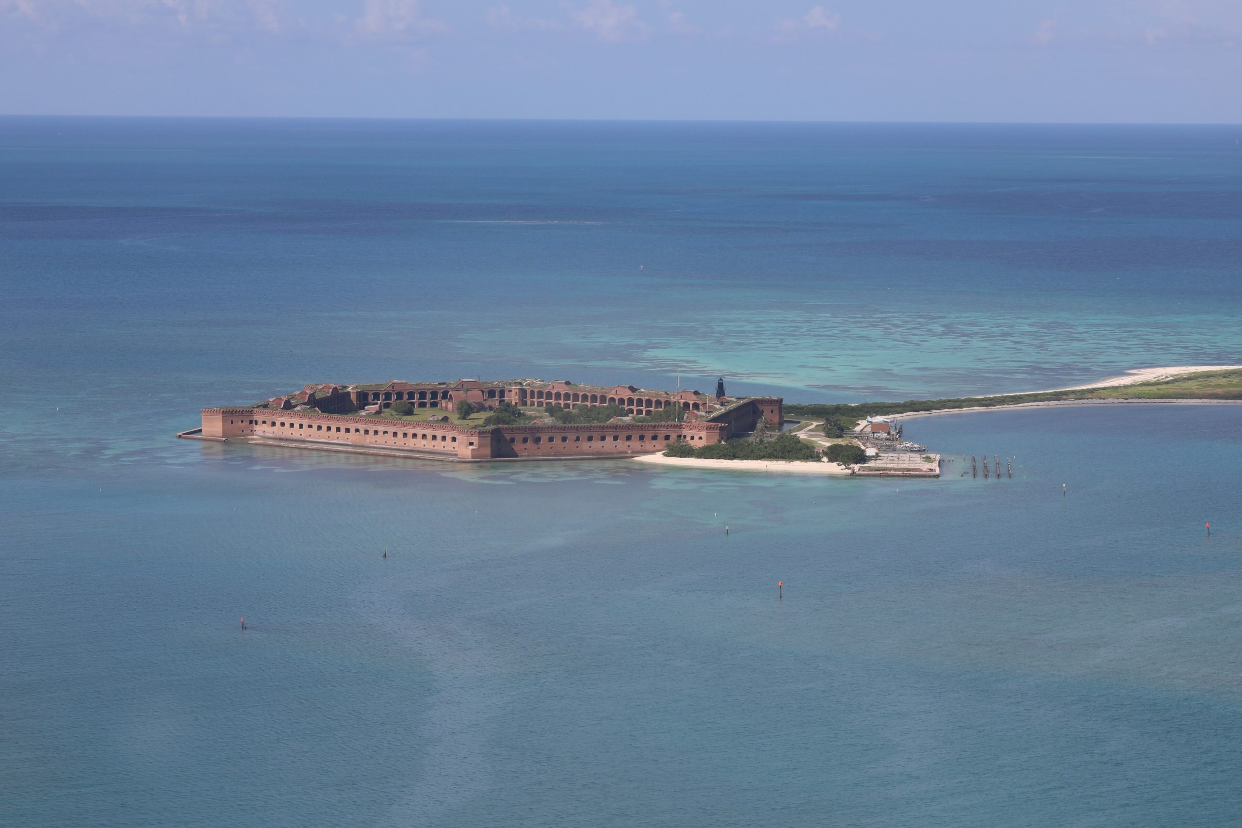
Dry Tortugas National Park
Almost 70 miles (110 km) west of Key West, past the last of the road and most of the boat traffic, seven small islands of coral and sand sit in open water. Dry Tortugas National Park is about 99 percent ocean, and its centrepiece is Fort Jefferson, one of the largest masonry forts ever built in the United States, standing on a key barely bigger than the fort itself. Around it are some of the healthiest reefs in the region and a bird list that draws people across the country each spring.
Fast facts
- Established: national monument in 1935, national park in 1992
- Size: about 100 square miles (260 km²), nearly all of it water
- Islands: seven, including Garden Key, Loggerhead Key and Bush Key
- Fort Jefferson: among the largest 19th-century masonry forts in the country
- Access: ferry, seaplane or private boat only
- Managed by: National Park Service
The landscape
The keys are low, bright and small, ringed by shallow reef that drops away into deep blue water. Garden Key holds the fort and the campground. Loggerhead Key, the largest, carries a lighthouse. Bush Key is a nesting ground and closes seasonally to protect sooty terns and brown noddies. Ponce de Leon named the group for the sea turtles; the “dry” was added to warn mariners there was no fresh water.
Best time to go
Winter and spring bring the calmest crossings and the best conditions overall, and spring migration in April and May is exceptional for birds. December through March is the windy season, with rougher seas that can cancel the ferry. June through November is hurricane season, hot and humid, with a real chance of isolated storms and closures.
Getting there and around
The daily concession ferry from Key West takes about two and a half hours each way and includes the entrance fee, breakfast, lunch and snorkelling gear. Seaplanes make the trip in about 40 minutes and offer half or full day options. Private and charter vessels can anchor near Garden Key. Book well ahead in the busy months, particularly if you intend to camp.
Things to do
Snorkelling the moat wall and the coral heads off Garden Key needs no boat and is superb. Tour the fort and walk its upper terreplein for the view across the reef. Watch birds in spring, when migrants drop in exhausted and the tern colony is in full voice. Camping on Garden Key gives you the islands after the day boats leave, along with some of the darkest night skies in Florida.
Staying safe
Bring everything. There is no fresh water, no shop and virtually no shade beyond the fort, and campers must carry all water and food for the entire stay plus a margin for a delayed ferry. Sun and heat are the most common problems here. Currents run strong between the keys and can carry a snorkeller away from the island quickly. Medical help is hours away by boat or air, so treat minor injuries seriously and plan conservatively.
Know before you go
Reserve the ferry or seaplane well in advance, especially for camping, and understand that weather cancels trips with little notice. Everything you bring must leave with you. Check current conditions and Bush Key closures before travelling, and carry a VHF radio if you are arriving on your own vessel.
- Coordinates
- 24.6287, -82.8732
- Magnetic declination
- 5.6° W (2026)
Set this declination on your compass, then align it to the map's north lines; it is the angle between true north and magnetic north, refreshed each year.
A spread of the park’s main places shows straight away, and the rest appear as you zoom in. You can also search above, or pick any place from the lists below, and the map will go to it.
On the trail 1
Campground
Sights 26
Viewpoints
Beachs
Heritage sites
Point of interests
Islands
Peak
Map data comes from third-party sources and may be incomplete or out of date, so carry a current official map (terms).
- Best seasons
- Winter, Spring
- Difficulty
- Easy on land, Moderate on the water
- Access / trailheads
- Roughly 70 miles (110 km) west of Key West and reachable only by the daily concession ferry, by seaplane, or by private and charter boat. There is no road or scheduled air service to the park.
- Water
- None. There is no potable water anywhere in the park. Carry every litre you will need, and campers must bring all water for the length of their stay.
- Cell / satellite coverage
- Little to no cell coverage. VHF marine radio is the reliable means of communication.
- Nearest ranger / SAR / emergency
- Emergencies go to the US Coast Guard on VHF channel 16. Park headquarters: 305-242-7700. Response times are measured in hours.
- Permits & regulations
- Per-person entrance fee, included in the concession ferry and seaplane fares. Primitive camping on Garden Key is first come first served with a limited number of sites, and the ferry carries only a set number of campers per day. Private vessels must obtain a permit on arrival.
- Leave No Trace
- Pack out everything including all rubbish, do not touch or stand on coral, keep clear of nesting birds on Bush Key, and leave the fort and every shipwreck exactly as you found it.
January
February
March
April
May
June
July
- Hot days
August
- Hot days
September This month
October
November
December
What to bring depends on your trip: how long you’re out, where you sleep, and how far you go from the road. The planner builds the list for yours.
Plan a trip here →Averages for 1991–2020 from NOAA U.S. Climate Normals, measured at the Dry Tortugas station at 3 feet (1 m).