

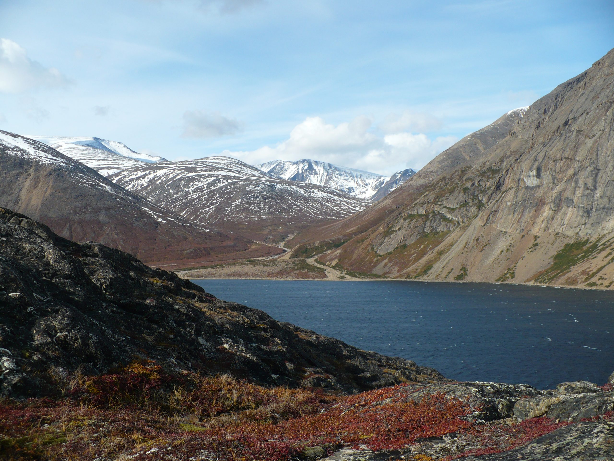
Torngat Mountains National Park
Torngat comes from the Inuktitut Torngait, the place of spirits, and the park protects 3,700 square miles (9,700 km²) of Inuit homeland at the northern tip of Labrador. There are no roads, no trails, no campgrounds and no cell coverage. There are fjords running deep into mountains that rise straight from the sea, small glaciers surviving in the high cirques, and polar bears on the land and the ice. Almost everyone who comes here arrives by charter aircraft and stays at a single base camp.
Fast facts
- Established: 2005
- Size: about 3,700 square miles (9,700 km²) of northern Labrador
- Highest point: Mount Caubvick, 5,420 feet (1,652 m), the highest in mainland Canada east of the Rockies
- Managed: cooperatively with Inuit of Nunatsiavut and Nunavik
- Base: Torngat Mountains Base Camp, St. John’s Harbour, Saglek Bay
- Roads: none
The landscape
Glacier-cut fjords reach inland for tens of kilometres between walls of ancient rock, some of the oldest exposed on the planet. Above them sits a high arctic plateau of tundra, boulder field and permanent snow. The park has no treeline to speak of at its northern end, and the scale is deceptive: what looks like an afternoon’s walk across a valley is often a full day of boulder-hopping and river crossings.
Best time to go
The season is short and firm: roughly late July to early September, when Base Camp operates and the fjords are reliably ice-free. Outside that window there is no infrastructure, no support and no realistic way in or out for a visitor.
Getting there and around
The standard route is a charter flight from Goose Bay to the Saglek airstrip, then a boat or helicopter transfer to Base Camp. Packages include the flights, transfers, meals, tented accommodation and guided excursions. Independent parties can charter air or boat access from Nain, Goose Bay or Kuujjuaq, and should speak to Parks Canada and the Nunatsiavut Government well in advance.
Things to do
Guided day hikes onto the tundra and up into the valleys, boat trips into fjords such as Saglek and Nachvak, visits to archaeological sites in the company of Inuit guides, and wildlife viewing that regularly includes polar bears from the safety of a boat. Mountaineers come for Mount Caubvick, which is a serious undertaking with no rescue backup.
Staying safe
Polar bears are present throughout the park and are the single most important planning factor. Trips travel with armed Inuit bear guards, and this is the accepted standard rather than an optional extra. Weather changes fast and can ground aircraft for days, so build slack into your plans and carry supplies for longer than your itinerary. Rivers run high with meltwater and there are no bridges. There is no cell signal anywhere, and help is hours away at best.
Know before you go
Register with Parks Canada before you enter the park. Book Base Camp well ahead, as the season is short and capacity is small. Bring genuine cold and wet weather clothing regardless of the calendar date, along with a satellite communicator. Treat the archaeology and the cultural landscape with the seriousness it deserves; this is a lived-in homeland, not empty wilderness.
- Coordinates
- 59.3803, -63.7855
- Magnetic declination
- 21.8° W (2026)
Set this declination on your compass, then align it to the map's north lines; it is the angle between true north and magnetic north, refreshed each year.
A spread of the park’s main places shows straight away, and the rest appear as you zoom in. You can also search above, or pick any place from the lists below, and the map will go to it.
Sights 34
Beach
Heritage sites
Island
Peaks 30
Map data comes from third-party sources and may be incomplete or out of date, so carry a current official map (terms).
- Best seasons
- Summer
- Difficulty
- Expert only
- Access / trailheads
- No road access. Charter flights run from Goose Bay to Saglek, then boat or helicopter to Base Camp at St. John’s Harbour in Saglek Bay. Air and boat charters can also be arranged from Nain, Goose Bay or Kuujjuaq. PAL Airlines serves Goose Bay.
- Water
- No treated supply anywhere in the park. Base Camp provides water to its guests. Independent parties must treat all water.
- Cell / satellite coverage
- No cellular coverage anywhere in the park. A satellite phone or satellite messenger is essential, not optional.
- Nearest ranger / SAR / emergency
- No local search and rescue. Response comes from Goose Bay and can take a long time. Parks Canada: 709-922-1290 or 1-888-922-1290. Base Camp: 1-709-635-4336.
- Permits & regulations
- Register with Parks Canada before entering. Travelling with an Inuit guide and bear monitor is the strongly recommended standard, and is included in Base Camp packages. Most visitors book through the Torngat Mountains Base Camp and Research Station.
- Leave No Trace
- This is Inuit homeland with archaeological sites throughout. Disturb nothing, camp on durable ground, pack out everything including human waste where directed, and follow your guide’s direction on which places are appropriate to visit.
January
- Below freezing all day
February
- Below freezing all day
March
- Below freezing all day
April
- Below freezing all day
May
- Below-freezing nights
June
July
August
September This month
October
- Below-freezing nights
November
- Below freezing all day
December
- Below freezing all day
What to bring depends on your trip: how long you’re out, where you sleep, and how far you go from the road. The planner builds the list for yours.
Plan a trip here →Averages for 1981–2010 from Environment Canada climate normals, measured at the Nain Airport station, 210 miles (338 km) away at 21 feet (6 m). That is the nearest station with long-term records, so treat these as a regional guide. Conditions change with elevation: expect it colder higher up.