

Forillon National Park
Forillon sits at the very tip of the Gaspe Peninsula, where the Appalachian chain finally runs out of land and drops into the Gulf of St. Lawrence. The park calls it land’s end, and standing at the Cap-Gaspe lighthouse with water on three sides, it is hard to argue. Limestone cliffs, pebble beaches, seals hauled out on the rocks and whales working the current offshore make this one of the most concentrated coastal experiences in eastern Canada.
Fast facts
- Established: 1970, Quebec’s first national park
- Size: about 95 square miles (245 km²) at the tip of the Gaspe
- Cliffs: limestone walls rising to roughly 660 feet (200 m)
- Trail note: northern terminus of the International Appalachian Trail
- Gateway: Gaspe, Quebec
- Managed by: Parks Canada
The landscape
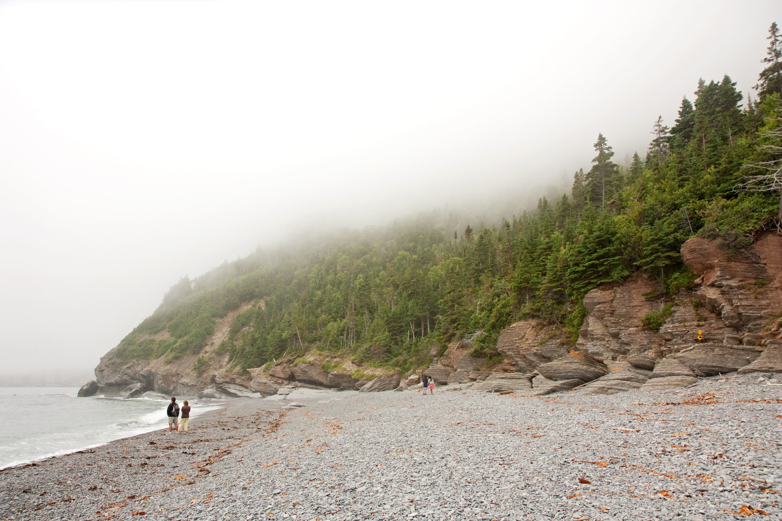
A spine of forested mountain runs down the peninsula and ends in sheer sea cliffs. Below them, narrow cobble beaches and the remains of fishing settlements mark where people worked this coast for generations. The Penouille sector is completely different in character: a long sand spit reaching into the bay, warm shallow water, and salt marsh behind it.
Best time to go
Late June through September is the practical season, with services and shuttles running and the trails dry. Whales are offshore from roughly June into October, with humpback, minke and fin whales the most commonly seen. Seals are present year round. Autumn brings colour to the forested interior and a much quieter coast.
Getting there and around
Route 132 circles the Gaspe Peninsula and runs through the park, dividing it into a north sector, a south sector and Penouille. Gaspe has the nearest airport and full services. The drive from Montreal or Quebec City is long, so most people arrive as part of a wider tour of the peninsula rather than as a single destination.
Things to do
Les Graves is the walk everyone comes for, following the shore to the lighthouse at Cap-Gaspe past the old settlement sites. Mont-Saint-Alban’s observation tower gives the widest view in the park. Whale-watching cruises leave from Grande-Grave, sea kayaking runs along the cliffs in settled weather, and Fort-Peninsule preserves a coastal battery built to guard the Gulf during the Second World War.
Staying safe
The cliff edges are the obvious risk and the ground near them is not always solid, so keep back and keep children and dogs close. Gulf water stays cold through the summer and cold-water shock is a genuine danger for swimmers and paddlers who capsize. Black bears and moose both use the park. Coastal fog can arrive within minutes and turn a straightforward walk disorienting. Paddlers should treat the water off the cape with respect, where currents run hard around the point.
Know before you go
You need a park pass, and campsites should be booked ahead for July and August. Some sectors and services operate seasonally, so check what is open before you commit to a route. Ticks are increasingly present in the region, so check after walking through long grass.
- Coordinates
- 48.8668, -64.3394
- Magnetic declination
- 17.1° W (2026)
Set this declination on your compass, then align it to the map's north lines; it is the angle between true north and magnetic north, refreshed each year.
A spread of the park’s main places shows straight away, and the rest appear as you zoom in. You can also search above, or pick any place from the lists below, and the map will go to it.
Getting there 6
Park entrances
Airstrips
Visitor centre
On the trail 17
Campgrounds
Hut or shelters
Sights 19
Viewpoints
Beachs
Heritage site
Point of interests
Island
Peaks
Map data comes from third-party sources and may be incomplete or out of date, so carry a current official map (terms).
- Best seasons
- Summer, Fall
- Difficulty
- Easy to moderate
- Access / trailheads
- At the eastern tip of the Gaspe Peninsula on Route 132, which loops the peninsula. About an hour from Gaspe and its regional airport, and roughly a ten-hour drive from Montreal.
- Water
- Treated water at campgrounds and day-use areas. Treat any surface water you collect on the trail.
- Cell / satellite coverage
- Reasonable cell coverage near Route 132 and the main sectors. Expect gaps along the coastal trails and at Cap-Gaspe.
- Nearest ranger / SAR / emergency
- Call 911. Marine emergencies go to the Canadian Coast Guard on VHF channel 16. Park information: 418-368-5505.
- Permits & regulations
- Park entry fee or a Parks Canada Discovery Pass. Camping is by reservation. Fires only in provided facilities, and pets must be leashed.
- Leave No Trace
- Stay back from cliff edges and on marked trails, give seals and whales distance from shore and from a boat, and pack out all waste including food scraps.
January
- Below freezing all day
February
- Below freezing all day
March
- Below freezing all day
April
- Below-freezing nights
May
June
July
August
September This month
October
November
- Below-freezing nights
December
- Below freezing all day
What to bring depends on your trip: how long you’re out, where you sleep, and how far you go from the road. The planner builds the list for yours.
Plan a trip here →Averages for 1981–2010 from Environment Canada climate normals, measured at the Cap des Rosiers station, 5 miles (8 km) away at 49 feet (15 m).