

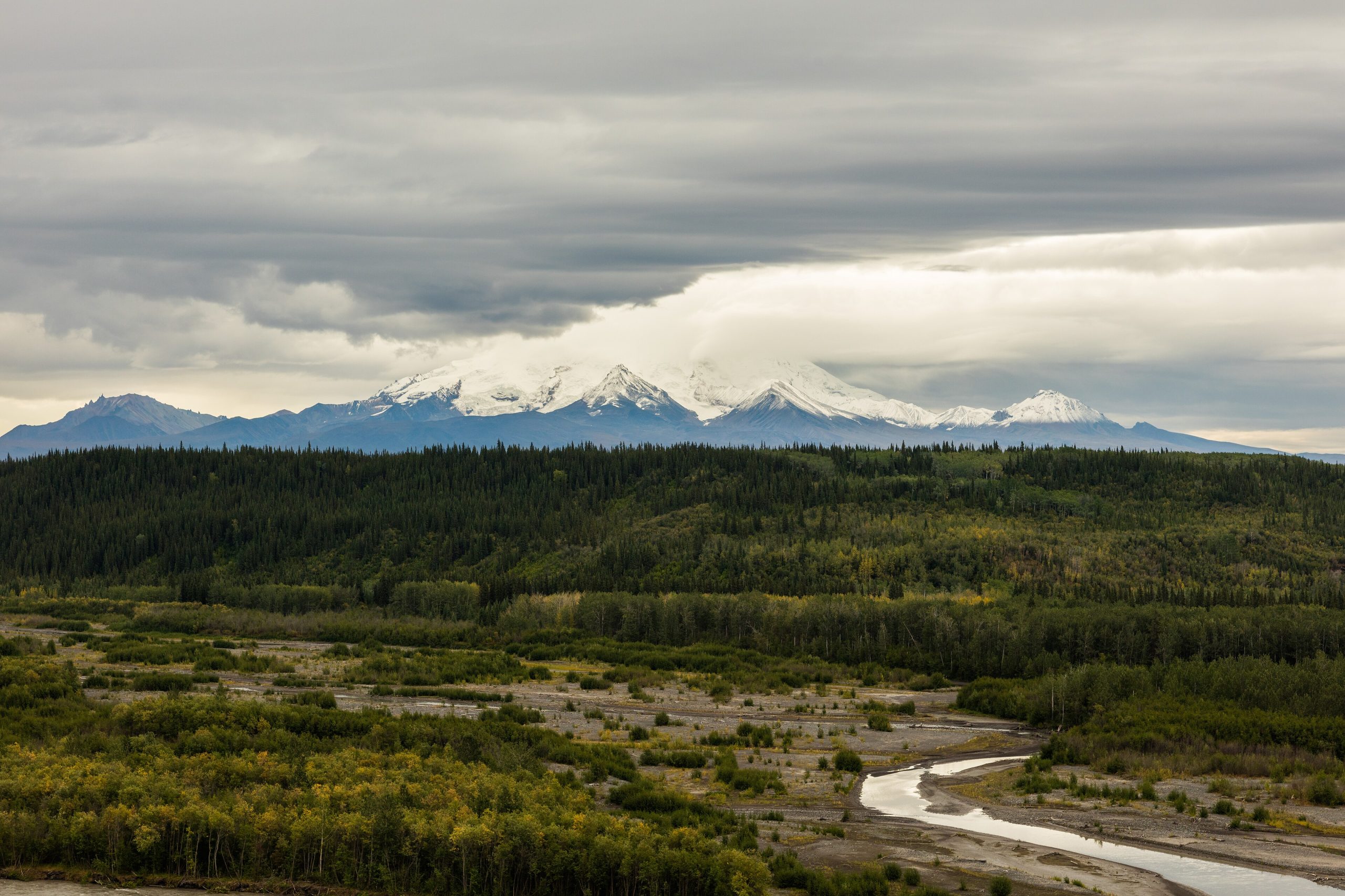
Wrangell-St. Elias National Park
Wrangell-St. Elias is the largest national park in the United States, more than 8.3 million acres (34,000 km²), twice the size of Switzerland, and one of its least visited. It stacks six of Alaska’s ten highest peaks against the world’s largest non-polar icefields, then folds in gold-rush history at the Kennecott Mines and the frontier town of McCarthy. This is Alaska at its fullest scale, reached by one long gravel road or a bush plane.
Fast facts
- Established: 1980, under the Alaska National Interest Lands Conservation Act
- Size: 8,323,145 acres (33,683 km²), the largest U.S. national park
- High points: Mount St. Elias (18,009 ft / 5,489 m) and Mount Wrangell (14,163 ft), an active shield volcano
- Ice: the Bering Icefield and more than 1,500 glaciers, including the Malaspina
- Location: southeastern Alaska, bordering Canada’s Kluane National Park
- Managed by: National Park Service
The landscape
The topography is staggering. The park holds the largest non-polar icefield on Earth alongside more than 1,500 glaciers, including the Malaspina, which spreads across 1,500 square miles (4,000 km²) like a frozen sea. Above the ice rise the Wrangell, St. Elias and Chugach ranges, while the Copper, Chitina and Tanana rivers carve fertile floodplains below. Active volcanoes and the haunting ruins of the Kennecott copper mines add geological and human drama.
Best time to go
The short summer runs late May through early September, with July and August offering the warmest weather, longest days and most reliable road access, prime time for hiking, rafting and exploring Kennecott. Spring brings melting snow and wildflowers with lingering snow up high; September delivers fall color, fewer insects and the first northern lights before temperatures drop and daylight shrinks fast.
Getting there and around
Wrangell-St. Elias has no through roads. Most visitors either fly in by bush plane or drive the roughly 60-mile (97 km) gravel McCarthy Road, which branches off near Chitina and ends near McCarthy and Kennecott; the Nabesna Road accesses the northern park. Both roads are rough, expect potholes and slow going, and beyond them, travel is by bush plane, helicopter, boat or on foot. Come self-reliant, because help can be hours or days away.
Things to do
Hiking ranges from easy walks around the Kennecott Mines to multi-day backcountry treks, and the glaciers are best reached by guided tour, flightseeing or ice-trekking. Wildlife viewing is excellent, grizzlies, black bears, Dall sheep, moose, caribou and wolves, and history buffs can tour the remarkably preserved Kennecott Copper Mines National Historic Landmark. River rafting on the Chitina and Copper delivers whitewater thrills, and the dark, unpolluted skies are unforgettable.
Staying safe
This wilderness demands respect. Bears are common, so carry bear spray, store food properly and understand bear behavior. Weather turns fast, bringing fog, rain or even summer snow, so pack layers and waterproofs. Cell service is unreliable to absent, so carry a satellite communicator. Rivers run cold and powerful, wear a life jacket and never cross a swollen river alone, and always leave your itinerary and expected return time before heading into the backcountry.
Know before you go
This is not a park with amenities at every turn: no developed hookup campgrounds, no in-park restaurants, and limited cell service. Book flights, lodging and guided tours well ahead for July and August, bring cash for the many cash-only services in McCarthy and Chitina, and pack all your own food, water treatment and first aid. This page is a general overview, not a live conditions report; confirm current road and conditions with the National Park Service before your trip.
- Coordinates
- 61.1810, -142.1324
- Magnetic declination
- 16.5° E (2026)
Set this declination on your compass, then align it to the map's north lines; it is the angle between true north and magnetic north, refreshed each year.
A spread of the park’s main places shows straight away, and the rest appear as you zoom in. You can also search above, or pick any place from the lists below, and the map will go to it.
Getting there 10
Airstrips
On the trail 36
Trailheads
Campgrounds
Hut or shelters
Picnic sites
Sights 90
Viewpoints
Waterfalls
Heritage sites
Point of interests
Islands
Peaks 30
Map data comes from third-party sources and may be incomplete or out of date, so carry a current official map (terms).
- Best seasons
- Summer (late May to early September)
- Difficulty
- Easy to strenuous
- Access / trailheads
- The gravel McCarthy Road (about 60 miles / 97 km) and the Nabesna Road are the only roads in; most of the park is reached by bush plane. Fly regional routes to McCarthy via Copper Center.
- Water
- Abundant rivers and streams; filter or treat all water.
- Cell / satellite coverage
- Cell service is virtually nonexistent. Carry a satellite messenger or PLB and leave a trip plan.
- Nearest ranger / SAR / emergency
- Contact the Copper Center visitor center; life-threatening emergencies: 911 (help may be hours or days away).
- Permits & regulations
- No entrance fee. Backcountry travel is self-registered; glacier and summit trips are best done with a permitted guide. The preserve allows regulated hunting.
- Leave No Trace
- Pack out all waste, store food away from bears, and follow strict Leave No Trace across this vast wilderness.
January
- Below freezing all day
February
- Below freezing all day
March
- Below-freezing nights
April
- Below-freezing nights
May
- Below-freezing nights
- Day-to-night swing of 31°F (17°C)
June
- Day-to-night swing of 31°F (17°C)
July
August
September This month
October
- Below-freezing nights
November
- Below freezing all day
December
- Below freezing all day
What to bring depends on your trip: how long you’re out, where you sleep, and how far you go from the road. The planner builds the list for yours.
Plan a trip here →Averages for 1991–2020 from NOAA U.S. Climate Normals, measured at the McCarthy station, 29 miles (47 km) away at 1,250 feet (381 m). Conditions change with elevation: expect it colder higher up.